The Great Plains, sometimes simply "the Plains", is a broad expanse of flatland in North America. It is located just to the east of the Rocky Mountains, much of it covered in prairie, steppe, and grassland. It is the western part of the Interior Plains, which also include the mixed grass prairie, the tallgrass prairie between the Great Lakes and Appalachian Plateau, and the Taiga Plains and Boreal Plains ecozones in Northern Canada. Great Plains or Western Plains is also used to describe the ecoregion of the Great Plains, or alternatively the western portion of the Great Plains.

Douglas County is a county located in the U.S. state of Colorado. As of the 2020 Census, the population was 357,978. The county is named in honor of U.S. Senator Stephen A. Douglas. The county seat is Castle Rock.

Adams County is a county located in the U.S. state of Colorado. As of the 2020 census, the population was 519,572. The county seat is Brighton, and the largest city is Thornton. The county is named for Alva Adams, an early Governor of the State of Colorado in 1887–1889. Adams County is part of the Denver–Aurora–Lakewood, CO Metropolitan Statistical Area.

Denver is the central city of a conurbation region in the U.S. state of Colorado. The conurbation includes one continuous region consisting of the six central counties of Adams, Arapahoe, Broomfield, Denver, Douglas, and Jefferson. The Denver region is part of the Front Range Urban Corridor.

Jefferson County is a county located in the U.S. state of Colorado. As of the 2020 census, the population was 582,910, making it the fourth-most populous county in Colorado. The county seat is Golden, and the most populous city's Lakewood.

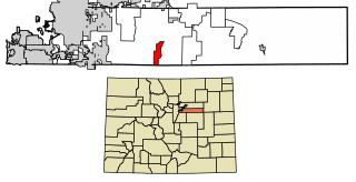
Arapahoe County is a county located in the U.S. state of Colorado. As of the 2020 census, its population was 655,070, making it the third-most populous county in Colorado. The county seat is Littleton, and the most populous city is Aurora. The county was named for the Arapaho Native American tribe, who once lived in the region.
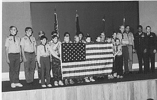
Scouting in Colorado has a long history, from the 1910s to the present day.

Aurora is a home rule municipality located in Arapahoe, Adams, and Douglas counties, Colorado, United States. The city's population was 386,261 at the 2020 United States Census with 336,035 residing in Arapahoe County, 47,720 residing in Adams County, and 2,506 residing in Douglas County. Aurora is the third-most-populous city in the State of Colorado and the 52nd-most-populous city in the United States. Aurora is a principal city of the Denver–Aurora–Lakewood Metropolitan Statistical Area (MSA) and a major city of the Front Range Urban Corridor.

Strasburg is an unincorporated town located just 30 minutes east of downtown Denver along the I-70 corridor. It is home to Strasburg School District 31-J, and there are several small businesses, medical clinics, and a post office. Strasburg is a census-designated place (CDP) located in and governed by Adams and Arapahoe counties, Colorado, United States. The CDP is a part of the Denver–Aurora–Lakewood, CO Metropolitan Statistical Area. The Strasburg post office has the ZIP Code 80136. At the United States Census 2020, the population of the Strasburg CDP was 3,307.

The City of Sheridan is a home rule municipality located in Arapahoe County, Colorado, United States. Sheridan is a part of the Denver–Aurora–Lakewood, CO Metropolitan Statistical Area. The population was 6,105 at the 2020 census.
The Denver Pacific Railway was a historic railroad that operated in the western United States during the late 19th century. Formed in 1867 in the Colorado Territory, the company operated lines in Colorado and present-day southeastern Wyoming in the 1870s until merging with the Kansas Pacific and Union Pacific railroads in 1880. The railroad was formed primarily to create a link between Denver and the transcontinental railroad at Cheyenne, an achievement that was widely credited at the time with making Denver the dominant metropolis of the region.
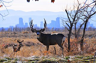
The Rocky Mountain Arsenal National Wildlife Refuge is a 15,988-acre (24.981 sq mi) National Wildlife Refuge located adjacent to Denver and Commerce City, Colorado, in the United States. It is approximately 8 miles (13 km) northeast of downtown Denver. The refuge is on the grounds of the former Rocky Mountain Arsenal, a United States Army chemical weapons manufacturing facility. The site was designated a national wildlife refuge in 1992 by the United States Congress, and underwent a costly environmental cleanup in order to remove pollutants. The refuge is managed by the United States Fish and Wildlife Service. More than 330 species of wildlife inhabit the refuge, including raptors, deer, raccoons, coyotes, white pelicans, black-footed ferrets, black-tailed prairie dogs, and bison.

Littleton is a home rule municipality city located in Arapahoe, Douglas, and Jefferson counties, Colorado, United States. Littleton is the county seat of Arapahoe County, the suburb of both Aurora and Denver and is part of the Denver–Aurora–Lakewood, CO Metropolitan Statistical Area. The city population was 45,652 at the 2020 United States Census, ranking as the 20th most populous municipality in the State of Colorado.
The Cherry Creek School District 5, also known as Cherry Creek Public Schools, is a school district located in western Arapahoe County, Colorado. The current superintendent is Christopher Smith. Former superintendent Scott Siegfried, Ph.D. announced his retirement on January 22, 2021. It consists of elementary, middle, and high schools. The district headquarters are in Greenwood Village.
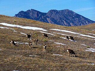
The Rocky Flats National Wildlife Refuge is 5,237-acre (21.19 km2) National Wildlife Refuge in the United States, located approximately 16 miles (26 km) northwest of Denver, Colorado. The refuge is situated west of the cities of Broomfield and Westminster and situated north of the city of Arvada.
Brick Center is an unincorporated community and a census-designated place (CDP) located in and governed by Arapahoe County, Colorado, United States. The CDP is a part of the Denver–Aurora–Lakewood, CO Metropolitan Statistical Area. The population of the Brick Center CDP was 105 at the United States Census 2020. The Bennett post office serves the area.

Comanche Creek is an unincorporated community and a census-designated place (CDP) located in and governed by Arapahoe County, Colorado, United States. The CDP is a part of the Denver–Aurora–Lakewood, CO Metropolitan Statistical Area. The population of the Comanche Creek CDP was 442 at the United States Census 2020. The Strasburg post office serves the area.
Dove Valley is an unincorporated community and a census-designated place (CDP) located in and governed by Arapahoe County, Colorado, United States. The CDP is a part of the Denver–Aurora–Lakewood, CO Metropolitan Statistical Area. The population of the Dove Valley CDP was 5,640 at the United States Census 2020. The Dove Valley Metropolitan District provides services to the area, which lies in ZIP code 80112.
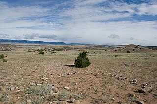
Tipi rings are circular patterns of stones left from an encampment of Post-Archaic, protohistoric and historic Native Americans. They are found primarily throughout the Plains of the United States and Canada, and also in the foothills and parks of the Rocky Mountains.

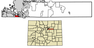
Four Square Mile is an unincorporated community and a census-designated place (CDP) located in and governed by Arapahoe County, Colorado, United States. The population was 22,872 at the 2020 census. The CDP is a part of the Denver–Aurora–Lakewood, CO Metropolitan Statistical Area. The CDP is surrounded by Denver on the north, west, and south and by Aurora on the east. The name is derived from the four square miles bounded by Quebec Street, Mississippi Avenue, Havana Street and Yale Avenue. Annexation of the Arapahoe County enclave was contested between Denver and Aurora in the early 1970s, with Denver annexing east from Quebec Street and Aurora west from Havana Street. Denver’s annexations were ultimately stopped by the Poundstone Amendment; Aurora is not similarly limited but made its most recent annexation to Dayton Street in 1984, leaving nearly three of the four square miles unincorporated. The Four Square Mile CDP includes Sullivan, a previous unincorporated community designation. The area lies in ZIP codes 80231 and 80247.