History
This historic district developed in the late 1890s when the San Francisco and San Joaquin Valley Railway occupied 57 acres (230,000 m2) of land in the area that is now the neighborhood downtown of Point Richmond. [2] The acres were bought by the Santa Fe Railroad upon completion and at the same time the Pacific Coast Oil Company (later Standard Oil, today Chevron) acquired adjacent lands and built an oil refinery. [2] The completion of these projects attracted the first residents to this area. [2]
Point Richmond served as the downtown district of Richmond until the city expanded along the central flatlands of western Contra Costa County during the beginning of the 20th century. This city's expansion led to a larger downtown to the northeast which was exacerbated by tens of thousands of World War II shipbuilding workers. Point Richmond was the terminal of the East Shore & Suburban Railway's Refinery-County Line route; [2] that rail system was a predecessor of the Key System.
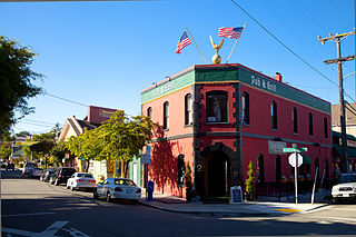
Today maps are provided by the city of Richmond's Convention and Visitors Bureau for individuals to take walking tours of the historic zone. [2] The historic area is now only a small portion of the larger neighborhood but still serves as the center for neighborhood businesses and civic affairs. There was much controversy regarding the inclusion of a Starbucks café in 2004 as the area had up until that point not had any chain stores. Although many residents opposed the coffee shop, it opened in that same year, and the residents have calmed regarding the subject. The location was later closed in November 2020 due to a sustained decline in business as a result of the 2020 coronavirus pandemic. [3]
The Historic District is accessible from Interstate 580, Richmond Parkway, Macdonald Avenue, Cutting Boulevard. AC Transit bus route 72M MacDonald connects with the Richmond BART and Amtrak Station. Golden Gate Transit routes 40 and 42 connect with the station and Marin County; the former serves del Norte Station. [4]

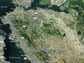
Richmond is a city in western Contra Costa County, California, United States. The city was incorporated on August 7, 1905, and has a city council. Located in the San Francisco Bay Area's East Bay region, Richmond borders San Pablo, Albany, El Cerrito and Pinole in addition to the unincorporated communities of North Richmond, Hasford Heights, Kensington, El Sobrante, Bayview-Montalvin Manor, Tara Hills, and East Richmond Heights, and for a short distance San Francisco on Red Rock Island in the San Francisco Bay. Richmond is one of two cities, the other being San Rafael, that sits on the shores of both San Francisco Bay and San Pablo Bay.

Contra Costa County is a county located in the U.S. state of California, in the East Bay of the San Francisco Bay Area. As of the 2020 United States Census, the population was 1,165,927. The county seat is Martinez. It occupies the northern portion of the East Bay region of the San Francisco Bay Area and is primarily suburban. The county's name refers to its position on the other side of the bay from San Francisco. Contra Costa County is included in the San Francisco–Oakland–Berkeley, CA Metropolitan Statistical Area.

Hercules is a city in western Contra Costa County, California. Situated along the coast of San Pablo Bay, it is located in the eastern region of the San Francisco Bay Area, about 10 miles (16 km) north of Berkeley, California. As of the 2020 census, its population was 26,016, according to the United States Census Bureau. The site of Hercules was first developed in 1881 as a manufacturing facility of the California Powder Works for the production of its patented dynamite formulation, Hercules powder. In 1882, the Hercules Powder Company was incorporated and assumed responsibility for the Hercules site. It was one of several explosive manufacturers that were active along the Pinole shoreline in the late 19th to the mid-20th century. The small company town that grew up near the facility subsequently became known as "Hercules", and was incorporated at the end of 1900. Starting in the 1970s, Hercules was heavily redeveloped as suburban bedroom community that lies along the I-80 corridor in Western Contra Costa County. It has a very ethnically diverse population.

Martinez is a city and the county seat of Contra Costa County, California, United States, in the East Bay region of the San Francisco Bay Area. Located on the southern shore of the Carquinez Strait, the city's population was 37,287 at the 2020 census. The city is named after Californio ranchero Ygnacio Martínez, having been founded on his Rancho El Pinole. Martinez is known for its historic center and its waterfront.

AC Transit is an Oakland-based public transit agency serving the western portions of Alameda and Contra Costa counties in the East Bay of the San Francisco Bay Area. AC Transit also operates "Transbay" routes across San Francisco Bay to San Francisco and selected areas in San Mateo and Santa Clara counties. AC Transit is constituted as a special district under California law. It is governed by seven elected members. It is not a part of or under the control of Alameda or Contra Costa counties or any local jurisdictions.
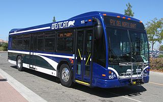
WestCAT is a public transportation service in western Contra Costa County. It is a service of the Western Contra Costa Transit Authority.
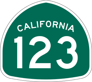
State Route 123 is a 7.39-mile (11.89 km) state highway in the U.S. state of California in the San Francisco Bay Area. Named San Pablo Avenue for almost its entire length except for its northernmost 0.10 miles (0.16 km), SR 123 is a major north–south state highway along the flats of the urban East Bay. Route 123 runs between Interstate 580 in Oakland in the south and Interstate 80 at Cutting Boulevard in Richmond in the north. San Pablo Avenue itself, a portion of Historic US 40, continues well past the SR 123 designation south to Downtown Oakland and north to Crockett.
North Richmond is an unincorporated area in Contra Costa County, California, a census-designated place (CDP) with a population of 3,717 adjacent to and nearly surrounded by the city of Richmond.
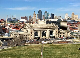
Downtown Kansas City is the central business district (CBD) of Kansas City, Missouri and the Kansas City metropolitan area which contains 3.8% of the areas employment. It is between the Missouri River in the north, to 31st Street in the south; and from the Kansas–Missouri state line eastward to Bruce R. Watkins Drive as defined by the Downtown Council of Kansas City; the 2010 Greater Downtown Area Plan formulated by the City of Kansas City defines the Greater Downtown Area to be the city limits of North Kansas City and Missouri to the north, the Kansas–Missouri state line to the west, 31st Street to the south and Woodland Avenue to the east. However, the definition used by the Downtown Council is the most commonly accepted.

Richmond station is an Amtrak intercity rail and Bay Area Rapid Transit (BART) station located in downtown Richmond, California. Richmond is the north terminus of BART service on the Orange Line and Red Line; it is a stop for Amtrak's Capitol Corridor, San Joaquins, and California Zephyr routes. The accessible station has one island platform for the two BART tracks, with a second island platform serving two of the three tracks of the Union Pacific Railroad Martinez Subdivision for Amtrak trains. It is one of two transfer points between BART and Amtrak, along with Oakland Coliseum station.
San Quentin is a small unincorporated community in Marin County, California, United States. It is located west of Point San Quentin, at an elevation of 30 feet.

The station complex of Amtrak's Oakland Coliseum station and Bay Area Rapid Transit (BART)'s Coliseum station is located in the East Oakland area of Oakland, California, United States. The two stations, located about 600 feet (180 m) apart, are connected to each other and to the Oakland Coliseum/Oakland Arena sports complex with an accessible pedestrian bridge.

Atchison Village is a community in Richmond, California which was originally built as housing for defense workers from the Kaiser Shipyards. It lies at an elevation of 13 feet. Constructed by the Richmond Housing Authority in 1941 as Richmond's first public defense housing project, it is one of the only projects funded by the Community Facilities Act of 1940 that still exists in Richmond and one of the few in the nation not destroyed after the war. It is one of 20 public housing projects built in Richmond before and during World War II. The Village was sold by the government to its residents for $1,512,00.00 February 28, 1957, remaining mutual housing to this day under the ownership of the Atchison Village Mutual Homes Corporation. Many think it would be covered under Proposition 13 as a single unsold parcel, thus limiting tax increases to 2%, but the Tax Assessor does not treat it that way.

Richmond Heights, formerly East Richmond and also known as Mira Vista, is a district of eastern Richmond, California in the San Francisco Bay Area.
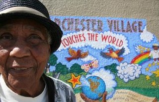
Parchester Village is a planned majority African-American village in northwestern Richmond, California that was the first in the state to sell to blacks.

Downtown Oakland is the central business district of Oakland, California, United States. It is located roughly bounded by both the Oakland Estuary and Interstate 880 on the southwest, Interstate 980 on the northwest, Grand Avenue on the northeast, and Lake Merritt on the east.

Richmond Ferry Terminal is a ferry terminal located in the Marina Bay neighborhood of Richmond, California. It provides daily commuter service to San Francisco.

Hercules station is a proposed intermodal infill train station and ferry terminal in Hercules, California in Contra Costa County. It is to be the first direct Amtrak-to-ferry transit hub in the San Francisco Bay Area and will be constructed in between the existing Richmond and Martinez stations. By July 2018, three of the station's six construction phases had been complete, including street at Bay Trail approaches.