
Barima-Waini is a region of Guyana. Venezuela claims the territory as part of Guayana Esequiba.

Port Kaituma is a small town within the Barima-Waini administrative region of Guyana.
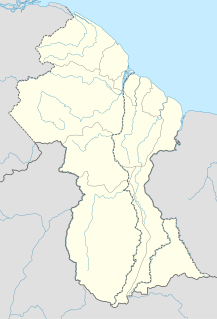
Matthews Ridge is a small town within the Barima-Waini administrative region of Guyana.
Kamwatta Hill is a community in the Barima-Waini Region, in northern Guyana. Kamwatta is an Amerindian village inhabited by Warao and Arawak people.

President's College is a senior secondary school located in Golden Grove, East Coast Demerara, Guyana. Students can enter the school through the National Grade Six Assessment and the lower sixth form in the academic performance of the student at the Caribbean Secondary Education Certificate.
Achiwib is a village in the Upper Takutu-Upper Essequibo Region of Guyana.

Pathlight School is a special school for high-functioning children with autism, located in Ang Mo Kio, Singapore. Founded in 2004, it is run by the non-profit Autism Resource Centre, and comprises one half of the national educational provision for autistic children. The school coaches students in social and life skills, teaches them mainstream curriculum subjects and prepares them for employment, in an autism friendly environment. With more than 1000 pupils enrolled, the school has been noted for its achievements in special education in Singapore.

Mahaicony is a community that is made up several villages on the East Coast of Demerara -- Region 5 in Guyana, located at 06°33′N57°48′W. Mahaicony's physical boundaries on the coast is from De Hoop village in the west to Calcutta village in the east.

Paramakatoi is an Amerindian community in the Potaro-Siparuni Region of Guyana, located in the Pacaraima Mountains. With an altitude of 970 metres, it is 11 miles east of Kurukabaru.

Education in Guyana is provided largely by the government of Guyana, through the Ministry of Education and its arms in the ten different regions of the country. Guyana's education system is a legacy from its time as British Guiana, and is similar to that of the other anglophone member states of the Caribbean Community, which are affiliated to the Caribbean Examinations Council (CXC). School curricula, funding, standards and other policies are set by the central government and implemented through the Ministry of Education and related agencies. The Education System is divided into eleven districts, ten of which correspond to the national administrative and geographical regions of the country, while the capital, Georgetown, is treated as a separate education district. With 8.3% of its GDP spent on education, Guyana sits with Cuba, Iceland, Denmark and Botswana as among the few countries with top spending on education.
Teaching in Victoria, Australia is regulated by the Victorian Institute of Teaching, through the Department of Education and Training (DET), which is part of the State Government. The DEECD is biggest operator of schools in the state, and along with the independent and Catholic school systems have an interest in teaching as the operator of schools and employer of teachers.

The Haitian Educational System yields the lowest total rate in the education realm of the Western Hemisphere. Haiti's literacy rate of about 61% is below the 90% average literacy rate for Latin American and Caribbean countries. The country faces shortages in educational supplies and qualified teachers. The rural population is less educated than the urban. The 2010 Haiti earthquake exacerbated the already constrained parameters on Haiti's educational system by destroying infrastructure and displacing 50–90% of the students, depending on locale.
Education in Belize is governed by the Education Act.
School of the Nations in Georgetown, Guyana is one of the few private parochial schools in Guyana.
Mount Bethany English Medium Higher Secondary School or Kerala, India. The school began providing education to lower primary level classes in the late 1970s. Later the school added further classes and now serves classes from Kindergarten to 10+2 in accordance with the Kerala Syllabus.
English for Integrated Studies (EIS) is a new model of bilingual education first introduced in the Kingdom of Thailand.
In Guyana, the areas outside of the coastal plain are referred to as hinterland. Approximately twenty percent of the Guyanese population live in the hinterland. The population mostly consists of Amerindian communities who have little access to modern energy services such as electricity, light and modern fuels for cooking and transportation. This situation contrasts with the coastal plain, where there is access to the electricity grid. Several initiatives are in place to improve energy services in the hinterland.
In March 2020, schools, nurseries and colleges in the United Kingdom were shut down in response to the ongoing COVID-19 pandemic. By 20 March, all schools in the UK had closed for all in-person teaching, except for children of key workers and children considered vulnerable. With children at home, teaching took place online. The emergence of a new variant of COVID-19 in December 2020 led to cancellation of face-to-face teaching across England, Northern Ireland, Scotland, and Wales the following month.
Morawhanna is a small Atlantic coast village in Guyana, on the left side of the Barima River and in close proximity to Venezuela.
