Port Wakefield, South Australia

Last updated

Port Wakefield
South Australia
PortWakefieldUnitingChurch.JPG
The Uniting Church at Port Wakefield
Australia South Australia location map.svg
Red pog.svg
Port Wakefield
Coordinates 34°11′17″S138°08′54″E / 34.18819°S 138.148325°E / -34.18819; 138.148325 [1]
Population560 (2016 census) [2]
Postcode(s) 5550 [3]
Time zone ACST (UTC+9:30)
 • Summer (DST) ACST (UTC+10:30)
Location99 km (62 mi) North West of Adelaide city centre via Australian National Route A1.svg
LGA(s) Wakefield Regional Council [4]
State electorate(s) Narungga [5]
Federal division(s) Grey
Localities around Port Wakefield:
Port Arthur Port Arthur
Beaufort
Beaufort
Gulf St Vincent Port Wakefield Bowmans
Kallora
Gulf St Vincent Proof Range
Inkerman
Inkerman
FootnotesAdjoining localities [6]

Port Wakefield (formerly Port Henry) is a town at the mouth of the River Wakefield, at the head of the Gulf St Vincent in South Australia. It was the first government town to be established north of the state capital, Adelaide. Port Wakefield is situated 98.7 kilometres (61.3 miles) from the Adelaide city centre on the Port Wakefield Highway section of the A1 National Highway.

Contents

Port Wakefield is a major stop on the Adelaide – Yorke Peninsula and Adelaide – Port Augusta road routes. Travellers between Adelaide and any of the Flinders Ranges, Yorke Peninsula, Eyre Peninsula or the Nullarbor Plain will likely travel through Port Wakefield. Due to its strategic location, Port Wakefield is known for its roadhouses and trucking stops.

Just north of the township there is a major forked intersection where the Yorke Peninsula traffic diverges west onto the Copper Coast Highway from the main Augusta Highway. The intersection is notorious for road accidents and traffic delays, especially at the end of holidays and long weekends. [7] [8]

History

The town was originally named Port Henry by William Hill. [9] The name of the town was changed to Port Wakefield around 1849, after the Wakefield River. [10]

In 1848, the Patent Copper Company agreed to build and operate a smelter at Burra. Seeking to reduce cartage costs, a track was surveyed to its port, established at the mouth of the River Wakefield. By securing leases of the appropriate Crown Land, the company obtained a monopoly of the port. The Government declared the track the Great Western Road. A wharf was constructed along the bank of the river and cargo was transferred between the wharf and ships at anchor in the Gulf on lighters.

With the opening of the railway from Adelaide to Gawler in 1857, the Copper Company's traffic came to a sudden end, leaving only pastoral produce to flow to the port. Mixed farming was established on lands opening up by the Government along the River in the mid-1860s, and this called for improvement in transport to the Port.

William Hanson, Manager for Railways, selected a route for a horse-drawn tramway terminating at Hoyles Plains, later renamed Hoyleton. The enabling Act provided for a tramway of 28 miles 41 chains (45.9 km) in length to a gauge of 1,067 mm (3 ft 6 in), the first line in South Australia built to that gauge. The Government agreed that the line should be operated by a private body. The successful tenderer was Paul Badcock who opened the line to traffic in January 1870. Horses were worked in three relays between the stations on the route.

The choice of gauge was influenced by the argument that costs varied with the cube of the gauge. [11] As this railway had its own port, it was not expected to link up with any broad gauge railways which avoided any break of gauge problems. Following a surrender of the lease, the line was taken over by the Government at the end of 1870.

In March 1876 the line was extended from Hoyleton to Blyth. Steam locomotives were obtained and by August 1876, the entire line was being worked by steam power. The line was extended at the other end from Port Wakefield to Kadina in October 1878.

In 1927, these railways, and the remainder of the Western system that grew from them, were converted to the broad 1,600 mm (5 ft 3 in) gauge. [12]

A Wesleyan Methodist chapel was built in 1868 by a local stonemason and carpenter. It continues in use as a Uniting Church. [13]

The 1955 Australian Grand Prix was held at the Port Wakefield Circuit east of the township. The circuit opened in 1953 when public road racing was banned. It closed in 1961, when some of its facilities were moved to the longer Mallala Race Circuit.

2020 highway upgrade

A proposal by the Liberal Party before the 2018 state election was that if it was elected, it would build a single lane overpass at the Augusta Highway end of the Copper Coast Highway to reduce traffic conflicts. [14] The party won the election and upgraded the planning to completely grade-separate the intersection and duplicate the highway through Port Wakefield. [15]

The contract for detailed design and construction of duplication of Port Wakefield Road through Port Wakefield and grade-separate the intersection with the Copper Coast Highway was let in March 2020 to the "Port Wakefield to Port Augusta Alliance", a consortium of CPB Contractors, Aurecon and GHD Group. This consortium is also responsible for the duplication of Joy Baluch AM Bridge in Port Augusta. Both projects are expected to be completed in 2022. [16]

Local government

In November 1878 the District Council of Port Wakefield was established, on the same day as the District Council of Clinton and the District Council of Kulpara, bringing local government to the area. [17]

Media

In 1876, a short lived newspaper was printed in the town, called the Port Wakefield Times and Balaclava, Hoyleton, Blyth and Lochiel Advertiser (July – August 1876), [18] published by Edward Richardson. [19] A later newspaper was the Wakefield Sun (15 July 1910 – 31 May 1912). [20] Another publication, the Port Wakefield Monitor (7 January 1915 – 26 June 1941), was published locally. [21] [22]

Related Research Articles

<span class="mw-page-title-main">Port Augusta</span> City in South Australia

Port Augusta is a small city in South Australia.

<span class="mw-page-title-main">Central Australia Railway</span> Former narrow-gauge railway line in the north of South Australia and in the Northern Territory

The former Central Australia Railway, which was built between 1878 and 1929 and closed in 1980, was a 1,241 km (771 mi) 1067 mm narrow gauge railway between Port Augusta and Alice Springs. A standard gauge line duplicated the southern section from Port Augusta to Maree in 1957 on a new nearby alignment. The entire Central Australia Railway was superseded in 1980 after the standard gauge Tarcoola–Alice Springs Railway was opened, using a new route up to 200 km to the west. A small southern section of the original line between Port Augusta and Quorn has been preserved as the Pichi Richi Tourist Railway.

<span class="mw-page-title-main">Snowtown, South Australia</span> Town in South Australia

Snowtown is a town located in the Mid North of South Australia 145 km north of Adelaide and lies on the main road and rail routes between Adelaide and Perth – the Augusta Highway and Adelaide-Port Augusta railway line. The town's elevation is 103 metres and on average the town receives 389 mm of rainfall per annum.

Australians generally assumed in the 1850s that railways would be built by the private sector. Private companies built railways in the then colonies of Victoria, opened in 1854, and New South Wales, where the company was taken over by the government before completion in 1855, due to bankruptcy. South Australia's railways were government owned from the beginning, including a horse-drawn line opened in 1854 and a steam-powered line opened in 1856. In Victoria, the private railways were soon found not to be financially viable, and existing rail networks and their expansion were taken over by the colony. Government ownership also enabled railways to be built to promote development, even if not apparently viable in strictly financial terms. The railway systems spread from the colonial capitals, except in cases where geography dictated a choice of an alternate port.

Port Wakefield Highway is an important South Australian highway, connecting Adelaide to the Yorke Peninsula, Port Augusta, northern and western South Australia, the Northern Territory and Western Australia. It is designated National Highway A1 and a part of the National Highway. It is named after Port Wakefield, the first government town north of Adelaide.

<span class="mw-page-title-main">Wakefield Regional Council</span> Local government area in South Australia

Wakefield Regional Council is a local government area in the Yorke and Mid North region of South Australia. The council seat is at Balaklava.

<span class="mw-page-title-main">Wallaroo, South Australia</span> Town in South Australia

Wallaroo is a port town on the western side of Yorke Peninsula in South Australia, 160 kilometres (100 mi) northwest of Adelaide. It is one of the three Copper Triangle towns famed for their historic shared copper mining industry, and known together as "Little Cornwall", the other two being Kadina, about 8 kilometres (5 mi) to the east, and Moonta, about 18 kilometres (11 mi) south. In 2016, Wallaroo had a population of 3,988 according to the census held.

<span class="mw-page-title-main">Rail transport in South Australia</span> Rail transport in South Australia

The first railway in colonial South Australia was a line from the port of Goolwa on the River Murray to an ocean harbour at Port Elliot, which first operated in December 1853, before its completion in May 1854.

<span class="mw-page-title-main">Hoyleton, South Australia</span> Town in South Australia

Hoyleton is a former railway town in South Australia, west of the Clare Valley, halfway between Leasingham and Halbury. At the 2006 census, Hoyleton had a population of 283.

<span class="mw-page-title-main">Balaklava, South Australia</span> Town in South Australia

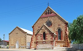
The town of Balaklava is located in South Australia, 92 kilometres north of Adelaide in the Mid North region. It is on the south bank of the Wakefield River, 25 kilometres east of Port Wakefield.

<span class="mw-page-title-main">Blyth, South Australia</span> Town in South Australia

Blyth is a small town in the Mid North of South Australia, located 13 kilometres (8.1 mi) west of the renowned Clare Valley. The town is located on the lands of the Kaurna people, the indigenous people who lived there before European settlement. It has a population of 306, the farming community spanning the plains between the Clare Hills and the Barunga/Hummocks ranges. Altitude is 189 metres (620 ft), and rainfall is approximately 400 millimetres (16 in) per annum.

Bowmans is a locality in South Australia's Mid North. At the 2006 census, Bowmans had a population of 203. It is named after R and C Bowman who were "pastoralists in area."

<span class="mw-page-title-main">Halbury, South Australia</span> Town in South Australia

Halbury is a former railway town in South Australia, west of the Clare Valley, halfway between Balaklava and Auburn. At the 2006 census, Halbury had a population of 363.

<span class="mw-page-title-main">Augusta Highway</span> Highway in South Australia

Augusta Highway is the part of Australia's ring route located in South Australia between Port Wakefield and Port Augusta.

Copper Coast Highway is a highway in South Australia which branches off from the Augusta and Port Wakefield Highways 2 km north of Port Wakefield, and heads northwest across the top of Yorke Peninsula to Kadina, ending at the Spencer Gulf town of Wallaroo.

Yorke Highway is the main road from Adelaide to the southern parts of the Yorke Peninsula in South Australia. It runs from the northeast to the southwest of the peninsula. It branches off Copper Coast Highway after rounding the top of Gulf St Vincent, runs down the coast to Ardrossan then inland through Maitland to the Spencer Gulf coast at Hardwicke Bay then through Warooka to the south coast at Marion Bay and Stenhouse Bay on Investigator Strait.

Transport in South Australia is provided by a mix of road, rail, sea and air transport. The capital city of Adelaide is the centre to transport in the state. With its population of 1.4 million people, it has the majority of the state's 1.7 million inhabitants. Adelaide has the state's major airport and sea port.

<span class="mw-page-title-main">Balaklava-Moonta railway line</span> Former railway line in South Australia

The Balaklava-Moonta railway line was a railway line on the South Australian Railways network. It ran across the top of the Yorke Peninsula.

<span class="mw-page-title-main">South Australian Railways U class</span> Class of Australian 2–6-0 locomotives

The eight members of the South Australian Railways U class were the first narrow-gauge 1067 mm locomotives on the South Australian Railways and the first of many steam locomotives built by Beyer, Peacock and Company for the railway. They entered service in 1876: four on the Port Wakefield to Hoyleton line and four on the Port Pirie to Crystal Brook line. Subsequently they operated on the Port Wakefield, Port Pirie and Port Augusta lines.

The Joy Baluch AM Bridge is a bridge across Spencer Gulf between Port Augusta and Port Augusta West in South Australia. It carries Highway 1 and is a key road link on both east–west and north–south road routes in Australia. The western end leads to Eyre Peninsula, the Eyre Highway and the Stuart Highway. The eastern end leads to the Augusta Highway towards Adelaide, Victoria and New South Wales.

References

  1. "Search results for 'Port Wakefield, LOCB' with the following datasets being selected – 'Suburbs and Localities', 'Counties', 'Government Towns', 'Local Government Areas', 'SA Government Regions', 'Gazetteer' and 'Roads'". Location SA Map Viewer. Government of South Australia. Retrieved 3 February 2019.
  2. Australian Bureau of Statistics (27 June 2017). "Port Wakefield (Urban centre)". 2016 Census QuickStats. Retrieved 25 July 2019. OOjs UI icon edit-ltr-progressive.svg
  3. Port Wakefield Postcode. Australia Post. Retrieved on 2008-05-29
  4. "Development Plan – Wakefield Council". Department of Planning Transport and Infrastructure. pp. 196, 239 & 248. Retrieved 24 July 2015.
  5. Narungga (Map). Electoral District Boundaries Commission. 2016. Retrieved 1 March 2018.
  6. "Search result for "Port Wakefield (Locality Bounded)" (Record no. SA0040720) with the following layers selected – "Suburbs and Localities" and " Place names (gazetteer)"". Property Location Browser. Government of South Australia. Archived from the original on 12 October 2016. Retrieved 16 November 2016.
  7. Kelton, Sam (21 April 2014). "Two separate crashes, involving five cars, at Port Wakefield Rd intersection cause traffic pain for Easter drivers". The Advertiser . News Corp. Retrieved 11 August 2015.
  8. Bishop, Ian (14 October 2014). "RAA Regional Roads Assessment – Yorke Peninsula". Royal Automobile Association. p. 6 (PDF page 11). Retrieved 11 August 2015. The Copper Coast Highway is notorious for the extensive delays occurring at the intersection with the Augusta Highway and RAA recommends this intersection be addressed in the medium term.
  9. "Search results for "Placename Details: Port Henry" (Record Number SA0007442)". Government of South Australia. Archived from the original on 12 October 2016. Retrieved 29 July 2015.
  10. "Wakefield, Port; Nomenclature". State Library of South Australia. Retrieved 29 July 2015.
  11. "RAILWAY GAUGES". South Australian Register . Adelaide. 9 January 1867. p. 2. Retrieved 14 August 2011.
  12. Callaghan, W.H. (2002). "Horse and Steam, Wheat and Copper". Australian Railway Historical Society Bulletin (January, February, 2002): 9–27, 46–63.
  13. "Port Wakefield Uniting Church is turning 150". Yorke Peninsula Country Times . 7 August 2018. Retrieved 8 August 2018.
  14. "Cutting out crash corner at Port Wakefield". Liberal Party of Australia (South Australian Division). 29 January 2018. Retrieved 27 March 2018.
  15. "Port Wakefield Overpass and Highway Duplication". Department of Planning, Transport & Infrastructure . Retrieved 9 May 2020.
  16. McCormack, Michael (1 March 2020). "PORT WAKEFIELD AND JOY BALUCH UPGRADES ARE SIGNED, SEALED AND SOON TO BE DELIVERED" (PDF) (Press release). Retrieved 9 May 2020 via Department of Planning, Transport & Infrastructure.
  17. "Proclamations" (PDF). South Australian Government Gazette (55 ed.). Government of South Australia. 1878: 1568. 28 November 1878. Retrieved 3 July 2017.
  18. Port Wakefield times and Balaclava, Hoyleton, Blyth and Lochiel advertiser. Port Wakefield [S. Aust.] : Edward Richardson. 1876.
  19. Laube, Anthony. "LibGuides: SA Newspapers: O-R". guides.slsa.sa.gov.au. Retrieved 5 March 2018.
  20. The Wakefield sun [newspaper: microform]. Port Wakefield, S. Aust: James Barclay. 1910.
  21. "Newspapers in the Northern and Yorke Peninsula region South Australia". jaunay.com. Retrieved 5 March 2018.
  22. The Port Wakefield monitor [newspaper: microform]. Snowtown, S. Aust: L. F. Henstridge. 1915.