Portal, North Dakota

Last updated

Portal
Portal North Dakota 5-21-2008.jpg
Building in Portal
ND Burke County Portal.svg
Location of Portal, North Dakota
Coordinates: 48°59′41″N102°32′52″W / 48.99472°N 102.54778°W / 48.99472; -102.54778
CountryUnited States
State North Dakota
County Burke
Founded1893
Area
[1]
  Total0.68 sq mi (1.75 km2)
  Land0.67 sq mi (1.73 km2)
  Water0.01 sq mi (0.02 km2)
Elevation
[2]
1,955 ft (596 m)
Population
 (2020) [3]
  Total125
  Estimate 
(2022) [4]
120
  Density187.13/sq mi (72.24/km2)
Time zone UTC-6 (Central (CST))
  Summer (DST) UTC-5 (CDT)
ZIP code
58772
Area code 701
FIPS code 38-63740
GNIS feature ID1036226 [2]

Portal is a city in Burke County, North Dakota, United States. The population was 125 at the 2020 census. [3] Portal was founded in 1893.

Contents

Portal sits along the Canada–United States border and is a major port of entry border crossing for road (connecting US Route 52 and Saskatchewan Highway 39) and rail traffic. North Portal, Saskatchewan is just over the border north of Portal. It is one of three year-round, 24-hour ports in North Dakota (the others being Dunseith and Pembina).

Geography

According to the United States Census Bureau, the city has a total area of 0.56 square miles (1.45 km2), all land. [5]

Economy

Because Portal is in the Bakken Oil Field region, the cost of living has risen considerably in recent years. A 2015 speech by a U.S. Customs and Border Protection official used Portal as an example of an area where the cost of living, combined with limited housing availability, and the distance from medical care and shopping, can make it difficult to attract employees for federal government positions. [6]

The Portal State Bank, built in 1903, is on the National Register of Historic Places. The William E. Metzger House, built in 1904 - 1905, is also on the National Register of Historic Places.

A notable tourist attraction is the Gateway Cities Golf Club. It is one of only two golf courses along the border, the other being the Aroostook Valley Country Club in Maine. Eight of the course's nine holes are located within Canada, but the course's ninth hole, and the clubhouse, are located in the United States. [7]

Demographics

Historical population
CensusPop.Note
1910 491
1920 454−7.5%
1930 51212.8%
1940 499−2.5%
1950 409−18.0%
1960 351−14.2%
1970 251−28.5%
1980 238−5.2%
1990 192−19.3%
2000 131−31.8%
2010 126−3.8%
2020 125−0.8%
2022 (est.)120 [4] −4.0%
U.S. Decennial Census [8]
2020 Census [3]

2010 census

As of the census of 2010, there were 126 people, 61 households, and 38 families residing in the city. The population density was 225.0 inhabitants per square mile (86.9/km2). There were 80 housing units at an average density of 142.9 per square mile (55.2/km2). The racial makeup of the city was 96.0% White, 0.8% African American, 2.4% Native American, and 0.8% from two or more races. Hispanic or Latino of any race were 4.0% of the population.

There were 61 households, of which 23.0% had children under the age of 18 living with them, 49.2% were married couples living together, 9.8% had a female householder with no husband present, 3.3% had a male householder with no wife present, and 37.7% were non-families. 31.1% of all households were made up of individuals, and 8.2% had someone living alone who was 65 years of age or older. The average household size was 2.07 and the average family size was 2.58.

The median age in the city was 46.6 years. 19% of residents were under the age of 18; 8.7% were between the ages of 18 and 24; 18.3% were from 25 to 44; 40.4% were from 45 to 64; and 13.5% were 65 years of age or older. The gender makeup of the city was 54.8% male and 45.2% female.

2000 census

As of the census of 2000, there were 131 people, 63 households, and 43 families residing in the city. The population density was 232.8 inhabitants per square mile (89.9/km2). There were 98 housing units at an average density of 174.1 per square mile (67.2/km2). The racial makeup of the city was 99.24% White and 0.76% Native American.

There were 63 households, out of which 19.0% had children under the age of 18 living with them, 63.5% were married couples living together, 3.2% had a female householder with no husband present, and 31.7% were non-families. 31.7% of all households were made up of individuals, and 14.3% had someone living alone who was 65 years of age or older. The average household size was 2.08 and the average family size was 2.58.

In the city the population was spread out, with 17.6% under the age of 18, 1.5% from 18 to 24, 24.4% from 25 to 44, 38.9% from 45 to 64, and 17.6% who were 65 years of age or older. The median age was 48 years. For every 100 females, there were 101.5 males. For every 100 females age 18 and over, there were 92.9 males.

The median income for a household in the city was $36,406, and the median income for a family was $48,929. Males had a median income of $37,000 versus $20,500 for females. The per capita income for the city was $18,949. There were 7.1% of families and 10.0% of the population living below the poverty line, including no one under the age of 18 and 10.3% of those over 64.

Related Research Articles

<span class="mw-page-title-main">Dakota City, Nebraska</span> City in Dakota County, Nebraska, United States

Dakota City is a city in Dakota County, Nebraska, United States. The population was 1,919 at the 2010 census. It is the county seat of Dakota County. Tyson Foods' largest beef production plant is located in Dakota City.

<span class="mw-page-title-main">Minnewaukan, North Dakota</span> City in North Dakota, United States

Minnewaukan is a city in Benson County, North Dakota, United States. It serves as the county seat and is fourth largest city in the county, after Fort Totten, Leeds, and Maddock. The population was 199 at the 2020 census. Minnewaukan was founded in 1884.

<span class="mw-page-title-main">Kramer, North Dakota</span> City in North Dakota, United States

Kramer is a city in Bottineau County, North Dakota, United States. The population was 24 at the 2020 census. Kramer was founded in 1905.

<span class="mw-page-title-main">Bowman, North Dakota</span> City in North Dakota, United States

Bowman is a city and county seat of Bowman County, North Dakota, United States. The population was 1,470 at the 2020 census.

<span class="mw-page-title-main">Alice, North Dakota</span> City in North Dakota, United States

Alice is a city in Cass County, North Dakota, United States. The population was 41 at the 2020 census.

<span class="mw-page-title-main">Horace, North Dakota</span> City in North Dakota, United States

Horace is a city in Cass County, North Dakota, United States. As of the 2020 census, the population was 3,085.

<span class="mw-page-title-main">North River, North Dakota</span> City in North Dakota, United States

North River is a city in Cass County, North Dakota, United States. The population was 55 at the 2020 census. North River was founded in 1973. It is a suburb/bedroom community directly adjacent to the city of Fargo.

<span class="mw-page-title-main">Ambrose, North Dakota</span> City in North Dakota, United States

Ambrose is a city in Divide County, North Dakota, United States. The population was 24 at the 2020 census. Ambrose was founded in 1906.

<span class="mw-page-title-main">Crosby, North Dakota</span> City in North Dakota

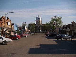
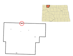
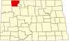
Crosby is a city and the county seat of Divide County, North Dakota, United States. The population was 1,065 at the 2020 census.

<span class="mw-page-title-main">Braddock, North Dakota</span> City in Emmons County, North Dakota, United States

Braddock is a city in Emmons County, North Dakota, United States. The population was 18 at the 2020 census. Braddock was founded in 1898.

<span class="mw-page-title-main">Neche, North Dakota</span> City in North Dakota, United States

Neche is a city in Pembina County, North Dakota, United States. It sits on the banks of the Pembina River. The population was 344 at the 2020 census.

<span class="mw-page-title-main">Hansboro, North Dakota</span> City in North Dakota, United States

Hansboro is a city in Towner County, North Dakota, United States. The population was 15 at the 2020 census.

<span class="mw-page-title-main">Rocklake, North Dakota</span> City in North Dakota, United States

Rocklake is a city in Towner County, North Dakota, United States. The population was 94 at the 2020 census. The city lies a few miles south of the Canada–United States border, near the junction of U.S. Route 281 and North Dakota State Highway 5.

<span class="mw-page-title-main">Hoople, North Dakota</span> City in North Dakota, United States

Hoople is a city in Walsh County, North Dakota, United States. The population was 247 at the 2020 census. Hoople, named for early settler Alan Hoople, was founded in 1889. Hoople's nickname is "Tatertown."

<span class="mw-page-title-main">White, South Dakota</span> City in South Dakota, United States

White is a city in Brookings County, South Dakota, United States. The population was 537 at the 2020 census.

<span class="mw-page-title-main">Corsica, South Dakota</span> City in South Dakota, United States

Corsica is a city in Douglas County, South Dakota, United States. The population was 561 at the 2020 census.

<span class="mw-page-title-main">Parkston, South Dakota</span> City in South Dakota, United States

Parkston is a city in Hutchinson County, South Dakota, United States. The population was 1,567 at the 2020 census.

<span class="mw-page-title-main">Crooks, South Dakota</span> City in South Dakota, United States

Crooks is a city in Minnehaha County, South Dakota, United States and is a suburb of Sioux Falls. The population was 1,362 at the 2020 census. Crooks was named New Hope until 1904. The town's present name honors W. A. Crooks, a local politician.

<span class="mw-page-title-main">Wilmot, South Dakota</span> City in South Dakota, United States

Wilmot is a city in Roberts County, South Dakota, United States. The population was 432 at the 2020 census.

<span class="mw-page-title-main">Iroquois, South Dakota</span> City in South Dakota, United States

Iroquois is a city on the border of Beadle and Kingsbury counties in South Dakota, United States. The population was 292 at the 2020 census. The school building is located in Kingsbury County, while the school parking lot is located in Beadle County. Highway 14 runs directly through Iroquois.

References

  1. "ArcGIS REST Services Directory". United States Census Bureau. Retrieved September 20, 2022.
  2. 1 2 U.S. Geological Survey Geographic Names Information System: Portal, North Dakota
  3. 1 2 3 "Explore Census Data". United States Census Bureau . Retrieved November 23, 2023.
  4. 1 2 "City and Town Population Totals: 2020-2022". United States Census Bureau. November 23, 2023. Retrieved November 23, 2023.
  5. "US Gazetteer files 2010". United States Census Bureau. Archived from the original on July 2, 2012. Retrieved June 14, 2012.
  6. Davidson, Joe (October 22, 2015). "Is the federal pay system flexible enough to recruit and retain the best?". The Washington Post . ISSN   0190-8286 . Retrieved October 24, 2015.
  7. "Championship and Unique Golf Courses in North Dakota". North Dakota Tourism Division. Retrieved December 24, 2020.
  8. United States Census Bureau. "Census of Population and Housing" . Retrieved September 7, 2013.