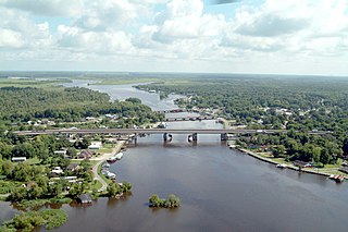
Cameron Parish is a parish in the southwest corner of the U.S. state of Louisiana. As of the 2020 census, the population was 5,617. The parish seat is Cameron. Although it is the largest parish by area in Louisiana, it has the second-smallest population in the state, ahead of only Tensas. Cameron Parish is part of the Lake Charles metropolitan statistical area.

Calcasieu Parish is a parish located on the southwestern border of the U.S. state of Louisiana. As of the 2020 census, the population was 216,785. The parish seat is Lake Charles.
Carlyss is a census-designated place (CDP) in Calcasieu Parish, Louisiana, United States. The population was 5,101 in 2020. It is part of the Lake Charles metropolitan statistical area.

DeQuincy is the northernmost city in Calcasieu Parish, Louisiana, United States. The population was 3,235 at the 2010 census. DeQuincy is part of the Lake Charles metropolitan statistical area.

Iowa is a town in Calcasieu Parish, Louisiana, United States. The population was 3,436 in 2020. It is part of the Lake Charles metropolitan statistical area.

Lake Charles is the fifth-largest incorporated city in the U.S. state of Louisiana, and the parish seat of Calcasieu Parish, located on Lake Charles, Prien Lake, and the Calcasieu River. Founded in 1861 in Calcasieu Parish, it is a major industrial, cultural, and educational center in the southwest region of the state. As of the 2020 U.S. census, Lake Charles's population was 84,872.
Moss Bluff is a census-designated place (CDP) in Calcasieu Parish, Louisiana, United States. The population was 12,522 at the 2020 census. Located just north of the city of Lake Charles, it is considered a suburb of that city. Moss Bluff is a burgeoning community, and is one of the communities in Calcasieu Parish besides Lake Charles and Sulphur experiencing growth. Several efforts have been made to incorporate Moss Bluff, but at the present time the community is unincorporated.

Vinton is a town in Calcasieu Parish, Louisiana, United States. The population was 3,400 in 2020. It is part of the Lake Charles metropolitan statistical area.

Westlake is an industrial city in Calcasieu Parish, in western Louisiana, United States, and is part of the Lake Charles metropolitan statistical area. The population was 4,781 in 2020. Westlake was incorporated in 1945. There are many chemical plants and oil refineries situated around the Westlake area.
Cameron is a census-designated place (CDP) in and the parish seat of Cameron Parish, Louisiana, United States. It is part of the Lake Charles Metropolitan Statistical Area. After sustaining extreme damage from Hurricane Rita in 2005 and Hurricane Ike in 2008, in the 2010 Census Cameron was recorded as having a population of only 406, a 79% drop since 2000.
Hackberry is an unincorporated community and census-designated place (CDP) in Cameron Parish, Louisiana, United States. The population was 1,261 at the 2010 census, down from 1,699 in 2000. The losses were due to extensive damage from hurricanes Rita and Ike in 2005 and 2008, respectively. It is part of the Lake Charles Metropolitan Statistical Area.

Barataria is a census-designated place (CDP) in Jefferson Parish, Louisiana, United States. The population was 1,057 in 2020. It is part of the New Orleans–Metairie–Kenner metropolitan statistical area.
Eden Isle is a census-designated place (CDP) in St. Tammany Parish, Louisiana, United States, on the northeast shore of Lake Pontchartrain. The population was 7,041 at the 2010 census. It is part of the New Orleans–Metairie–Kenner Metropolitan Statistical Area. The area is a residential community with homes built on a system of canals connecting to eastern Lake Pontchartrain, which also includes businesses along the Interstate-10 corridor as well as restaurants and marina services within the residential section.

Heflin is a village in southern Webster Parish, Louisiana, United States. The population was 245 at the 2000 census. It is part of the Minden Micropolitan Statistical Area.

Red Bank is an unincorporated community and census-designated place (CDP) in Lexington County, South Carolina, United States. The population was 9,617 at the 2010 census, up from 8,811 at the 2000 census. It is part of the Columbia, South Carolina Metropolitan Statistical Area.

Des Allemands is an unincorporated community and census-designated place (CDP) in Lafourche and St. Charles parishes in the southeastern part of the U.S. state of Louisiana. The population was 2,179 at the 2020 census. The town, known as the "Catfish Capital of the Universe", is along the Bayou des Allemands, which is the boundary of Lafourche and St. Charles parishes. Lac des Allemands is located northwest of the town. The ZIP code for Des Allemands is 70030.
Gillis is an unincorporated community and census-designated place (CDP) in northern Calcasieu Parish, Louisiana, United States. As of the 2010 census it had a population of 657.
Ossun is an unincorporated community and census-designated place in Lafayette Parish, Louisiana, United States. In 2020, its population was 2,145. The community is named after the area of Ossun, France, near Lourdes.
Starks is an unincorporated community and census-designated place (CDP) in Calcasieu Parish, Louisiana, United States. As of the 2010 census it had a population of 664. It is located approximately 30 miles (48 km) northwest of Lake Charles and about 5 miles (8 km) from the Texas and Louisiana border. Starks is known for its annual Mayhaw Festival to celebrate the fruit that grows in the bayous along the Texas/Louisiana border.
Oretta is a census-designated place in Beauregard Parish, Louisiana, United States. As of the 2010 census, it had a population of 418.


