Westlake, Louisiana

Last updated

Westlake, Louisiana
Motto: 
A Growing Family Community
Calcasieu Parish Louisiana Incorporated and Unincorporated areas Westlake Highlighted.svg
Location of Westlake in Calcasieu Parish, Louisiana.
Louisiana in United States (US48).svg
Location of Louisiana in the United States
Coordinates: 30°14′54″N93°15′33″W / 30.24833°N 93.25917°W / 30.24833; -93.25917
CountryUnited States
StateLouisiana
Parish Calcasieu
Incorporated1945
Government
  MayorDaniel Racca (Interim)
Area
[1]
  Total3.79 sq mi (9.82 km2)
  Land3.79 sq mi (9.82 km2)
  Water0.00 sq mi (0.00 km2)
Elevation
16 ft (5 m)
Population
 (2020)
  Total4,781
  Density1,261.14/sq mi (486.92/km2)
Time zone UTC-6 (CST)
  Summer (DST) UTC-5 (CDT)
ZIP code
70669 [2]
Area code 337
FIPS code 22-80815
Website www.cityofwestlake.com

Westlake is an industrial city in Calcasieu Parish, in western Louisiana, United States, and is part of the Lake Charles metropolitan statistical area. The population was 4,781 in 2020. Westlake was incorporated in 1945. There are many chemical plants and oil refineries situated around the Westlake area.

Contents

Geography

Westlake is located in east-central Calcasieu Parish at 30°14′54″N93°15′33″W / 30.24833°N 93.25917°W / 30.24833; -93.25917 (30.248455, -93.259047), [3] on the west bank of the Calcasieu River, just north of that river's entry into the water body of Lake Charles. The city of Lake Charles borders Westlake across the river, connected via the Interstate 10 bridge.

According to the United States Census Bureau, Westlake has a total area of 3.71 square miles (9.60 km2), of which 3.65 square miles (9.46 km2) is land and 0.05 square miles (0.14 km2), or 1.49%, is water. [4]

Moss Bluff is just to the northeast. Sulphur is to the west, after the small community of Mossville.

Demographics

Historical population
CensusPop.Note
1950 1,871
1960 3,31177.0%
1970 4,08223.3%
1980 5,24628.5%
1990 5,007−4.6%
2000 4,668−6.8%
2010 4,568−2.1%
2020 4,7814.7%
U.S. Decennial Census [5]
Westlake city, Louisiana – Racial and Ethnic Composition
(NH = Non-Hispanic)
Note: the US Census treats Hispanic/Latino as an ethnic category. This table excludes Latinos from the racial categories and assigns them to a separate category. Hispanics/Latinos may be of any race.
Race / EthnicityPop 2000 [6] Pop 2010 [7] Pop 2020 [8] % 2000% 2010% 2020
White alone (NH)3,6883,4253,34079.01%74.98%69.86%
Black or African American alone (NH)83689792517.91%19.64%19.35%
Native American or Alaska Native alone (NH)923130.19%0.50%0.27%
Asian alone (NH)1013420.21%0.28%0.88%
Pacific Islander alone (NH)0310.00%0.07%0.02%
Some Other Race alone (NH)0140.00%0.02%0.08%
Mixed Race/Multi-Racial (NH)42541530.90%1.18%3.20%
Hispanic or Latino (any race)831523031.78%3.33%6.34%
Total4,6684,5684,781100.00%100.00%100.00%

As of the 2020 United States census, there were 4,781 people, 1,935 households, and 1,178 families residing in the city.

Government

Westlake uses a city council consisting of five council members. As of Jan 2023, the current mayor of Westlake is Hal Mcmillin. [9] [10]

Notable people

Education

Public schools in the town are operated by the Calcasieu Parish Public School System.

Elementary schools:

Middle school:

High school:

List of mayors

Related Research Articles

<span class="mw-page-title-main">St. James Parish, Louisiana</span> Parish in Louisiana, United States

St. James Parish is a parish located in the U.S. state of Louisiana. The parish seat is Convent. The parish was created in 1807. St. James Parish is a part of the New Orleans–Metairie, Louisiana metropolitan statistical area, sitting between New Orleans and Baton Rouge on the Mississippi River. According to the 2020 United States census, the population was 20,192.

<span class="mw-page-title-main">Bradley, Arkansas</span> City in Arkansas, United States

Bradley is a city in Lafayette County, Arkansas, United States. The population was 628 at the 2010 census.

<span class="mw-page-title-main">Cary, Illinois</span> Village in Illinois, United States

Cary is a village located in Algonquin Township, McHenry County, Illinois, and Cuba Township, Lake County, Illinois, United States. Per the 2020 census, the population was 17,826.

<span class="mw-page-title-main">Sulphur, Louisiana</span> City in Louisiana, United States

Sulphur is a city in Calcasieu Parish, Louisiana, United States. The population was 21,809 in 2020. Sulphur is part of the Lake Charles metropolitan statistical area.

<span class="mw-page-title-main">Harvey, Louisiana</span> Census-designated place in Louisiana, United States

Harvey is a census-designated place (CDP) in Jefferson Parish, Louisiana, United States. Harvey is on the south side of the Mississippi River, within the New Orleans–Metairie–Kenner metropolitan statistical area. The majority-minority population was 20,348 at the 2010 census, down from 22,226 at the 2000 census. The 2020 census determined 22,236 people lived in the CDP.

<span class="mw-page-title-main">Kenner, Louisiana</span> City in Louisiana, United States

Kenner is a city in Louisiana, United States. It is the most populous city in Jefferson Parish, and is the largest incorporated suburban city of New Orleans. The population was 66,448 at the 2020 census, making it the sixth-most populous city in Louisiana.

Timberlane is a census-designated place (CDP) in Jefferson Parish, Louisiana, United States. The population was 10,364 in 2020. It is part of the New Orleans–Metairie–Kenner metropolitan statistical area.

Woodmere is an unincorporated community and census-designated place (CDP) in Jefferson Parish, Louisiana, United States. The population was 12,080 at the 2010 census, and 11,238 at the 2020 census. It is part of the New Orleans–Metairie–Kenner metropolitan statistical area.

<span class="mw-page-title-main">Bonita, Louisiana</span> Village in Louisiana, United States

Bonita is a village in Morehouse Parish, Louisiana, United States. The population was 170 at the 2020 census, down from 284 in 2010.

Norco is a census-designated place (CDP) in St. Charles Parish, Louisiana, United States. The population was 2,984 at the 2020 census. The community is home to a major Shell/Valero manufacturing complex. The CDP's name is derived from the New Orleans Refining Company.

<span class="mw-page-title-main">Taft, Louisiana</span> Census-designated place in Louisiana, United States

Taft is a census-designated place (CDP) in St. Charles Parish, Louisiana, United States, located on the west bank of the Mississippi River.

<span class="mw-page-title-main">Lutcher, Louisiana</span> Town in Louisiana, United States

Lutcher is a town in St. James Parish, Louisiana, United States, on the east bank of the Mississippi River. It is part of the New Orleans Metropolitan Area. The population was 3,559 at the 2010 U.S. census, and 3,127 at the 2020 population estimates program.

South Vacherie is a census-designated place (CDP) in St. James Parish, Louisiana, United States. The population was 3,543 at the 2000 census. In French, the name defines a cattle range for grazing.

Garyville is a census-designated place (CDP) in St. John the Baptist Parish, Louisiana, United States. The population was 2,775 at the 2000 census and 2,123 in 2020. It is part of the New Orleans–Metairie–Kenner Metropolitan Statistical Area.

Venice is an unincorporated community and census-designated place in Plaquemines Parish, Louisiana, United States. As of the 2020 census, its population was 162. It is 77 miles (124 km) south of New Orleans on the west bank of the Mississippi River at 29°16′37″N89°21′17″W. It is the last community down the Mississippi accessible by automobile, and it is the southern terminus of the Great River Road. This has earned the town the nickname "The end of the world." The ZIP code for Venice is 70091.

Bayou Goula is an unincorporated community and census-designated place (CDP) in Iberville Parish, Louisiana, United States. Its population was 514 in 2020.

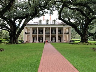
Grand Point is an unincorporated community and census-designated place in St. James Parish, Louisiana, United States. Its population was 2,473 as of the 2010 census.

Hester is an unincorporated community and census-designated place in St. James Parish, Louisiana, United States. It was first listed as a CDP in the 2010 census with a population of 498. The community is located along Louisiana Highway 44 on the east bank of the Mississippi River.

Crescent is an unincorporated community and census-designated place in Iberville Parish, Louisiana, United States. It was first listed as a CDP in the 2010 Census with a population of 959. In 2020, its population was 811.

Moonshine is an unincorporated community and census-designated place in St. James Parish, Louisiana, United States. It was first listed in the 2010 census with a population was 194. The community is located on the west bank of the Mississippi River.

References

  1. "2020 U.S. Gazetteer Files". United States Census Bureau. Retrieved March 20, 2022.
  2. "Westlake LA ZIP Code". zipdatamaps.com. 2023. Retrieved June 16, 2023.
  3. "US Gazetteer files: 2010, 2000, and 1990". United States Census Bureau. February 12, 2011. Retrieved April 23, 2011.
  4. "Geographic Identifiers: 2010 Demographic Profile Data (G001): Westlake city, Louisiana". U.S. Census Bureau, American Factfinder. Archived from the original on February 12, 2020. Retrieved August 14, 2014.
  5. "Census of Population and Housing". Census.gov. Retrieved June 4, 2015.
  6. "P004 HISPANIC OR LATINO, AND NOT HISPANIC OR LATINO BY RACE – 2000: DEC Summary File 1 – Westlake city, Louisiana". United States Census Bureau .
  7. "P2 HISPANIC OR LATINO, AND NOT HISPANIC OR LATINO BY RACE – 2010: DEC Redistricting Data (PL 94-171) – Westlake city, Louisiana". United States Census Bureau .
  8. "P2 HISPANIC OR LATINO, AND NOT HISPANIC OR LATINO BY RACE - 2020: DEC Redistricting Data (PL 94-171) – Westlake city, Louisiana". United States Census Bureau .
  9. "City of Westlake - Council Members". City of Westlake. Retrieved April 8, 2020.
  10. "City of Westlake - Daniel W. Cupit, Mayor". City of Westlake. Retrieved April 8, 2020.