Princess Street (Kingston, Ontario)

Last updated
Smith & Robinson building Day51akingston11.jpg
Smith & Robinson building

Princess Street is a major arterial road in Kingston, Ontario, Canada. As the main retail street of downtown Kingston, it is lined by many historic limestone buildings in the city's downtown core.

Contents

Princess Street begins at Kingston's current western city limits in Westbrook (continuing from Main Street, Odessa) and ends at the downtown waterfront east of Ontario Street. Eastbound traffic is then carried by Ontario Street across the Lasalle Causeway to Barriefield. All of Princess Street and most of Ontario Street formed part of the Provincial Highway (formerly Highway 2), the main highway from Windsor/Toronto to Montréal until the Kingston Bypass segment of Highway 401 was opened in 1958. In the outlying western sections of the city, the road was still simply Highway 2, with the Princess Street name gradually adopted as the urban area expanded west.

Overview

The street was originally called Store Street due to a large government store at the lower end. [1] It was renamed Princess Street in honour of the birth of the Princess Royal in approximately 1840. [2] The portion west of Highway 33, originally well outside the city limits, appears on maps as York Road at least until 1908 [3] and is historically part of the original 1817 Kingston Road from Toronto (which ends in name today in Ajax). An 1839 toll road, one of the first to be macadamized in the region, retained this same path between Kingston and Napanee; some of this road's stone markers remain visible on the western portion of Princess Street today. [4]

A horse-drawn Street Railway had operated on Princess from Concession Street to the foot of downtown from 1877 to 1905; electric streetcars replaced this on an abbreviated route (Princess from Alfred Street to downtown) until 1930, when the streetcars were destroyed and the system converted to buses. [3]

St. Andrew's Presbyterian Church, founded 1820 and rebuilt in 1889 at Princess and Clergy Street, served as first meeting place of the Board of Trustees of Queen's College (which was granted a Royal Charter in 1841). [5]

Princess Street, Kingston Kingston Ontario city hall from Commercial Mart.jpg
Princess Street, Kingston

The Commercial Mart Building (Princess and Ontario streets), designed and built in 1817 by architect George Browne, housed the John C. Fox piano factory [6] in 1862, [7] was sold to John Stevenson in 1864 and continued piano manufacturing under different names (Weber, Wormwith, Stevenson) and owners until 1939. [8] A four-storey Kingston limestone structure with archways on the ground floor and a prominent location at the foot of downtown, it has served as an army barracks, a public works building and a store. It is best known locally as the location of the S & R Department Store (1959–2009) [9] and is now divided into retail and office space.

The Grand Theatre opened on Princess Street in 1879 as Kingston's Opera House and remains in use today, serving as the home of the Kingston Symphony.

From 1942–74, Princess Street intersected with Bath Road and Concession Street at a traffic circle, which was removed and replaced with traffic signals as volumes increased and the circle's capacity was exceeded. The general area is still sometimes referred to as the "traffic circle" by long-time residents. A shopping centre constructed just west of the traffic circle in 1955 served as Kingston's largest indoor mall until 1982. The Kingston Centre (1100 Princess Street) went into decline in 1999 after losing key anchor tenant Sears to rival Cataraqui Town Centre (Princess at Gardiners Road) and was demolished in 2004 to make way for new retail development anchored by Loblaws.

Much of the western growth of the suburban area around Kingston in the 1960s and 1970s followed the more southerly Bath Road (Highway 33) from the traffic circle westward into the former Kingston Township; major retailers were Sears (Kingston Centre, 1100 Princess at Bath), Woolco (Frontenac Mall, Bath Road) and Kmart (Bath at Gardiners Road). Highway 2 west of the old Kingston city limits and east of Westbrook/Odessa was largely rural until the early 1980s, with the exception of Sentry Plaza (established January 1962, chain defunct early 1980s, site demolished 2012) at what is now the corner of Princess and Centennial Streets. [10] New suburbs in the city, such as Polson Park (1957) and Calvin Park (1962), were planned and built on what was once farmland south of Highway 33. Subsequent expansion tended to follow Highway 33 westward into what was then Kingston Township.

By the 1970s and 1980s, west-end development was being pushed northward (into what is now Bayridge) due to lack of vacant land elsewhere; in 1982, the open rural fields at Princess Street and Gardiners Road (then one block east of old Highway 38, now Midland Avenue) were chosen by Cadillac-Fairview as the location for a major shopping mall, the Cataraqui Centre (945 Gardiners at Princess), which would draw away merchants and commercial activity from the then-existing K-Mart Plaza (defunct, now self-storage) and Frontenac Mall (established 1967, semi-dead mall, kept alive by discount anchors).

By the turn of the millennium, the entire length of Princess from Collins Bay Road to downtown Kingston would be filled by commercial development, with only Westbrook village retaining its original rural character. The construction of a stand-alone Walmart at Princess and Midland Avenue (replacing the former Woolco at Frontenac Mall) has only hastened the exodus of merchants from the old Bath Road onto outer Princess Street.

In the downtown core, Princess Street operates one-way eastbound from Division Street to Ontario Street; westbound traffic is diverted to Queen Street.

West of the former traffic circle, Princess Street is a four-lane divided highway until Bayridge Drive, becoming two lanes where it leaves the urban area at Collins Bay Road. A milestone from an 1836 macadam gravel toll road from Kingston to Napanee still stands at the north east corner of Princess and Collins Bay Road.

See also

Related Research Articles

<span class="mw-page-title-main">Kingston, Ontario</span> City in Ontario, Canada

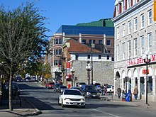
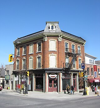
Kingston is a city in Ontario, Canada, on the northeastern end of Lake Ontario. It is at the beginning of the St. Lawrence River and at the mouth of the Cataraqui River, the south end of the Rideau Canal. Kingston is midway between Toronto, Ontario, and Montreal, Quebec, and is also near the Thousand Islands, a tourist region to the east, and the Prince Edward County tourist region to the west. Kingston is nicknamed the "Limestone City" because it has many heritage buildings constructed using local limestone.

<span class="mw-page-title-main">Greater Napanee</span> Town in Ontario, Canada

Greater Napanee is a town in southeastern Ontario, Canada, approximately 45 kilometres (28 mi) west of Kingston and the county seat of Lennox and Addington County. It is located on the eastern end of the Bay of Quinte. Greater Napanee municipality was created by amalgamating the old Town of Napanee with the townships of Adolphustown, North and South Fredericksburg, and Richmond in 1999. Greater Napanee is co-extensive with the original Lennox County.

<span class="mw-page-title-main">Gananoque</span> Town in Ontario, Canada

Gananoque is a town in the Leeds and Grenville area of Ontario, Canada. The town had a population of 5,383 year-round residents in the 2021 Canadian Census, as well as summer residents sometimes referred to as "Islanders" because of the Thousand Islands in the Saint Lawrence River, Gananoque's most important tourist attraction. The Gananoque River flows through the town and the St. Lawrence River serves as the southern boundary of the town.

King's Highway 33, commonly referred to as Highway 33 or Loyalist Parkway, is a provincially maintained highway in the Canadian province of Ontario. The route begins at Highway 62 in Bloomfield and travels east to the Collins Bay Road junction at Collins Bay in the city of Kingston, a distance of 60.9 kilometres (37.8 mi). The highway continues farther east into Kingston as Bath Road, ending at the former Highway 2, now Princess Street. Highway 33 is divided into two sections by the Bay of Quinte. The Glenora Ferry service crosses between the two sections just east of Picton, transporting vehicles and pedestrians for free throughout the year.

<span class="mw-page-title-main">Loyalist, Ontario</span> Township municipality in Ontario, Canada

Loyalist is a lower-tier township municipality in central eastern Ontario, Canada on Lake Ontario. It is in Lennox and Addington County and consists of two parts: the mainland and Amherst Island. It was named for the United Empire Loyalists, who settled in the area after the American Revolution.

<span class="mw-page-title-main">Ontario Highway 2</span> Former Ontario provincial highway

King's Highway 2, commonly referred to as Highway 2, is the lowest-numbered provincially maintained highway in the Canadian province of Ontario, and was originally part of a series of identically numbered highways which started in Windsor, stretched through Quebec and New Brunswick, and ended in Halifax, Nova Scotia. Prior to the 1990s, Highway 2 travelled through many of the major cities in Southern Ontario, including Windsor, Chatham, London, Brantford, Hamilton, Burlington, Mississauga, Toronto, Oshawa, Belleville, Kingston and Cornwall, amongst many other smaller towns and communities.

<span class="mw-page-title-main">Lake Shore Boulevard</span> Street in Toronto

Lake Shore Boulevard is a major arterial road running along more than half of the Lake Ontario waterfront in the city of Toronto, Ontario, Canada. Prior to 1998, two segments of Lake Shore Boulevard were designated as part of Highway 2, with the highway following the Gardiner Expressway between these two sections.

<span class="mw-page-title-main">Napanee station</span> Railway station in Ontario, Canada

Napanee station in Napanee, Ontario, Canada is served by Via Rail trains running from Toronto to Ottawa. The 1856 limestone railway station was an unstaffed but heated shelter with telephones and washrooms, which would open at least half an hour before a train arrives. The platform is wheelchair-accessible. As of February 2023, the shelter was locked.

<span class="mw-page-title-main">Fairview Park Mall</span> Shopping mall in Kitchener, Ontario

CF Fairview Park is a large shopping mall of 120 stores in Kitchener, Ontario, Canada, owned and managed by Cadillac Fairview. Anchor stores are Hudson's Bay and Walmart, with one large anchor space, last occupied by Sears, divided into multiple stores including Winners, Sport Chek, Mark's, and a RBC branch which opened in 2021, with the rest of vacant space planned for redevelopment in the future.

Limestone District School Board is an English public district school board encompassing a region that includes the City of Kingston and the counties of Frontenac and Lennox and Addington in Eastern Ontario, Canada. The board was founded in a 1998 provincial reorganization of all Ontario school boards. It is an amalgamation of the former Frontenac County and Lennox and Addington County Boards of Education. The board's Chair for 2020-2021 is Suzanne Ruttan. The Vice-Chair is Tom Gingrich.

King's Highway 15, commonly referred to as Highway 15, is a provincially maintained highway in the Canadian province of Ontario. It travels north from an interchange with Highway 401 in Kingston to Highway 7 in Carleton Place, a distance of 114.7 kilometres (71.3 mi). In addition to Kingston and Carleton Place, the highway provides access to the Eastern Ontario communities of Joyceville, Seeley's Bay, Morton, Elgin, Crosby, Portland, Lombardy and Franktown. Prior to 1998, Highway 15 continued north from Carleton Place, passed Almonte and through Pakenham, to Highway 17 in Arnprior.

King's Highway 41, commonly referred to as Highway 41, is a provincially maintained highway in the Canadian province of Ontario. The 159.6-kilometre (99.2 mi) highway travels in a predominantly north–south direction across eastern Ontario, from Highway 7 in Kaladar to Highway 148 in Pembroke. The majority of this distance crosses through a rugged forested region known as Mazinaw Country. However, the route enters the agricultural Ottawa Valley near Dacre. A significant portion of Highway 41 follows the historic Addington Colonization Road, built in 1854.

The Kingston Centre was an indoor mall built in Kingston, Ontario in 1955 and demolished in 2004. The Kingston Centre name now belongs to a 223,327 sq ft (20,747.8 m2). campus-style open-air shopping centre on the same site, which replaced the now-demolished indoor mall.

<span class="mw-page-title-main">K&P Rail Trail</span>

The K&P Trail is a recreational trail that runs along the old Kingston and Pembroke Railway (K&P) bed in Ontario, Canada.

King's Highway 38, commonly referred to as Highway 38, was a provincially maintained highway in the Canadian province of Ontario. The 66.9-kilometre (41.6 mi) road connected Highway 2 and Highway 401 in Kingston with Highway 7 west of Perth. It was designated in 1934 and remained relatively unchanged throughout its existence, aside from some minor diversions and a rerouting through Kingston as a result of the construction of Highway 401 in the mid-1950s. At the beginning of 1998, the entire highway was transferred to the municipalities of Frontenac County through which it travelled: Kingston, South Frontenac and Central Frontenac. Today the former highway is named Road 38 and Gardiners Road, but is still referred to as Highway 38 by locals.

<span class="mw-page-title-main">Inner Harbour, Kingston</span> Neighbourhood in Ontario, Canada

Inner Harbour is a neighbourhood located in downtown Kingston, Ontario, Canada. The Inner Harbour district is bounded by Joseph Street to the north, Princess Street to the south, Division Street on the west and the Cataraqui River on the east. The area is within the King's Town District. The District is represented on Kingston City Council by Councillor Rob Hutchison for the 2010-14 term of office.

HMCS Cataraqui is a Canadian Forces Naval Reserve Division (NRD) located in Kingston, Ontario. Dubbed a stone frigate, HMCS Cataraqui is a land-based naval establishment for part-time sailors as well as a local recruitment centre for the Royal Canadian Navy (RCN). It is one of 24 naval reserve divisions located in major cities across Canada.

<span class="mw-page-title-main">Millhaven Creek</span> River in Ontario, Canada

Millhaven Creek is a stream in the municipalities of Loyalist, Lennox and Addington County, and South Frontenac, Frontenac County, and the single-tier municipality of Kingston in eastern Ontario, Canada. It is a tributary of Lake Ontario and is under the auspices of the Cataraqui Region Conservation Authority.

References

  1. The Cloud of War
  2. After The War
  3. 1 2 Illustrated Chronology of the Williamsville Study Area [ permanent dead link ], Jennifer McKendry, City of Kingston, November 2011
  4. Kingston-Napanee Toll Road Milestone, Princess Street near Collins Bay Road - N XVIII K V - Kingston, Ontario
  5. Chronology of the History of Kingston Archived 2012-04-26 at the Wayback Machine , Kingston Historical Society, 2000 (revised)
  6. "John C. Fox". Dictionary of Canadian Biography.
  7. "The Horse & Buggy Era (1880-1900): John Stevenson's Pianos". Lennox and Addington County Museum & Archives. Archived from the original on 2012-03-08. Retrieved 2012-03-17.
  8. "Stevenson House". The Canadian Piano Museum.
  9. Stuart Laidlaw (April 20, 2009). "It all started in the store's old elevator". Toronto Star.
  10. Peter Hendra (March 17, 2012). "Sentry broke new ground". Kingston Whig-Standard. Archived from the original on September 13, 2012.

44°14′18″N76°30′18″W / 44.23831°N 76.50493°W / 44.23831; -76.50493