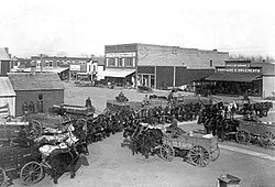
Protection, Kansas

Last updated

Protection, Kansas
Protection, Kansas (1913).jpg
Wheat wagons on Broadway Avenue (1913)
Comanche County Kansas Incorporated and Unincorporated areas Protection Highlighted.svg
Location within Comanche County and Kansas
Map of Comanche Co, Ks, USA.png
Coordinates: 37°12′01″N99°28′51″W / 37.20028°N 99.48083°W / 37.20028; -99.48083 [1]
Country United States
State Kansas
County Comanche
Founded1884
Incorporated 1908
Named for protective tariff
Area
[2]
  Total0.93 sq mi (2.40 km2)
  Land0.93 sq mi (2.40 km2)
  Water0.00 sq mi (0.00 km2)
Elevation
[1]
1,847 ft (563 m)
Population
 (2020) [3]
  Total498
  Density540/sq mi (210/km2)
Time zone UTC-6 (CST)
  Summer (DST) UTC-5 (CDT)
ZIP code
67127
Area code 620
FIPS code 20-57850
GNIS ID 2396289 [1]

Protection is a city in Comanche County, Kansas, United States. [1] As of the 2020 census, the population of the city was 498. [3]

Contents

History

Protection was founded in 1884. [4] Popular support for a protective tariff in the 1884 presidential election caused the name to be selected. [5] The first post office in Protection was established on August 27, 1884. [6]

The town became nationally and internationally known via radio and television in 1957, [7] when the National Polio Foundation chose it as the center for the free distribution of Salk vaccine shots for polio. It then became 100 percent protected. [8]

Geography

According to the United States Census Bureau, the city has a total area of 0.95 square miles (2.46 km2), all land. [9]

Demographics

Historical population
CensusPop.Note
1910 390
1920 1,109184.4%
1930 1,072−3.3%
1940 846−21.1%
1950 814−3.8%
1960 750−7.9%
1970 673−10.3%
1980 6841.6%
1990 625−8.6%
2000 558−10.7%
2010 514−7.9%
2020 498−3.1%
U.S. Decennial Census

2010 census

As of the census [10] of 2010, there were 514 people, 215 households, and 131 families residing in the city. The population density was 541.1 inhabitants per square mile (208.9/km2). There were 277 housing units at an average density of 291.6 per square mile (112.6/km2). The racial makeup of the city was 95.3% White, 0.4% Native American, 0.6% Asian, 2.5% from other races, and 1.2% from two or more races. Hispanic or Latino of any race were 5.1% of the population.

There were 215 households, of which 25.6% had children under the age of 18 living with them, 54.0% were married couples living together, 4.7% had a female householder with no husband present, 2.3% had a male householder with no wife present, and 39.1% were non-families. 36.3% of all households were made up of individuals, and 20.5% had someone living alone who was 65 years of age or older. The average household size was 2.20 and the average family size was 2.86.

The median age in the city was 46.6 years. 21.6% of residents were under the age of 18; 3.5% were between the ages of 18 and 24; 22.1% were from 25 to 44; 25.1% were from 45 to 64; and 27.6% were 65 years of age or older. The gender makeup of the city was 48.4% male and 51.6% female.

2000 census

As of the census [11] of 2000, there were 558 people, 241 households, and 152 families residing in the city. The population density was 586.2 inhabitants per square mile (226.3/km2). There were 297 housing units at an average density of 312.0 per square mile (120.5/km2). The racial makeup of the city was 96.95% White, 0.18% Asian, 1.79% from other races, and 1.08% from two or more races. Hispanic or Latino of any race were 2.69% of the population.

There were 241 households, out of which 23.7% had children under the age of 18 living with them, 51.9% were married couples living together, 7.1% had a female householder with no husband present, and 36.9% were non-families. 35.3% of all households were made up of individuals, and 21.6% had someone living alone who was 65 years of age or older. The average household size was 2.15 and the average family size was 2.67.

In the city, the population was spread out, with 20.1% under the age of 18, 4.3% from 18 to 24, 19.5% from 25 to 44, 26.2% from 45 to 64, and 29.9% who were 65 years of age or older. The median age was 50 years. For every 100 females, there were 103.6 males. For every 100 females age 18 and over, there were 85.1 males.

The median income for a household in the city was $26,917, and the median income for a family was $36,705. Males had a median income of $26,071 versus $15,682 for females. The per capita income for the city was $16,973. About 8.2% of families and 13.5% of the population were below the poverty line, including 13.6% of those under age 18 and 7.0% of those age 65 or over.

The former Protection High School is one of the buildings of South Central Elementary School/South Central Middle School Protection High School west entrance 2007.jpg
The former Protection High School is one of the buildings of South Central Elementary School/South Central Middle School

Education

The community is served by Comanche County USD 300 public school district. South Central Elementary and South Central Middle School are in Protection, with the former Protection High School building on campus, [12] while South Central High School is in Coldwater. The South Central High School mascot is Timberwolves. [13]

Prior to school unification, the Protection Panthers won the Kansas State High School 1A football championship in 1978 and the 8-Man DII football championship in 1983. [14]

Notable people

Related Research Articles

<span class="mw-page-title-main">Comanche County, Kansas</span> County in Kansas, United States

Comanche County is a county located in the U.S. state of Kansas. Its county seat and most populous city is Coldwater. As of the 2020 census, the county population was 1,689. The county was named after the Comanche tribe.

<span class="mw-page-title-main">Kincaid, Kansas</span> City in Anderson County, Kansas

Kincaid is a city in Anderson County, Kansas, United States. As of the 2020 census, the population of the city was 103.

<span class="mw-page-title-main">Ashland, Kansas</span> City in Clark County, Kansas

Ashland is a city in and the county seat of Clark County, Kansas, United States. As of the 2020 census, the population of the city was 783.

<span class="mw-page-title-main">Coldwater, Kansas</span> City in Comanche County, Kansas

Coldwater is a city and county seat of Comanche County, Kansas, United States. As of the 2020 census, the population of the city was 687.

<span class="mw-page-title-main">Wilmore, Kansas</span> City in Comanche County, Kansas

Wilmore is a city in Comanche County, Kansas, United States. As of the 2020 census, the population of the city was 37.

<span class="mw-page-title-main">Cherokee, Kansas</span> City in Crawford County, Kansas

Cherokee is a city in Crawford County, Kansas, United States. As of the 2020 census, the population of the city was 590.

<span class="mw-page-title-main">Richmond, Kansas</span> City in Franklin County, Kansas

Richmond is a city in Franklin County, Kansas, United States. As of the 2020 census, the population of the city was 459.

<span class="mw-page-title-main">Gove City, Kansas</span> City in Gove County, Kansas

Gove City, more commonly known as Gove, is a city in and the county seat of Gove County, Kansas, United States. As of the 2020 census, the population of the city was 80.

<span class="mw-page-title-main">Nortonville, Kansas</span> City in Kansas, United States

Nortonville is a city in Jefferson County, Kansas, United States. As of the 2020 census, the population of the city was 601.

<span class="mw-page-title-main">Perry, Kansas</span> City in Kansas, United States

Perry is a city in Jefferson County, Kansas, United States. As of the 2020 census, the population of the city was 852.

<span class="mw-page-title-main">Altamont, Kansas</span> City in Labette County, Kansas

Altamont is a city in Labette County, Kansas, United States. As of the 2020 census, the population of the city was 1,061.

<span class="mw-page-title-main">Prescott, Kansas</span> City in Kansas, United States

Prescott is a city in Linn County, Kansas, United States. As of the 2020 census, the population of the city was 207.

<span class="mw-page-title-main">Wetmore, Kansas</span> City in Nemaha County, Kansas

Wetmore is a city in Nemaha County, Kansas, United States. As of the 2020 census, the population of the city was 348.

<span class="mw-page-title-main">Brownell, Kansas</span> City in Ness County, Kansas

Brownell is a city in Ness County, Kansas, United States. As of the 2020 census, the population of the city was 23.

<span class="mw-page-title-main">Kirwin, Kansas</span> City in Phillips County, Kansas

Kirwin is a city in Phillips County, Kansas, United States. As of the 2020 census, the population of the city was 139.

<span class="mw-page-title-main">Atwood, Kansas</span> City in Rawlins County, Kansas

Atwood is a city in and the county seat of Rawlins County, Kansas, United States. As of the 2020 census, the population of the city was 1,290.

<span class="mw-page-title-main">McDonald, Kansas</span> City in Rawlins County, Kansas

McDonald is a city in Rawlins County, Kansas, United States. As of the 2020 census, the population of the city was 113.

<span class="mw-page-title-main">Kismet, Kansas</span> City in Seward County, Kansas

Kismet is a city in Seward County, Kansas, United States. As of the 2020 census, the population of the city was 340.

<span class="mw-page-title-main">Benedict, Kansas</span> City in Wilson County, Kansas

Benedict is a city in Wilson County, Kansas, United States, along the Verdigris River. As of the 2020 census, the population of the city was 69.

<span class="mw-page-title-main">Clayton, Kansas</span> City in Decatur and Norton Counties of Kansas

Clayton is a city in Decatur and Norton counties in the U.S. state of Kansas. As of the 2020 census, the population of the city was 44.

References

  1. 1 2 3 4 U.S. Geological Survey Geographic Names Information System: Protection, Kansas
  2. "2019 U.S. Gazetteer Files". United States Census Bureau. Retrieved July 24, 2020.
  3. 1 2 "Profile of Protection, Kansas in 2020". United States Census Bureau. Archived from the original on November 17, 2021. Retrieved November 17, 2021.
  4. Kansas State Historical Society (1916). Biennial Report of the Board of Directors of the Kansas State Historical Society. Kansas State Printing Plant. p. 166.
  5. "Profile for Protection, Kansas". ePodunk . Retrieved June 7, 2014.
  6. "Kansas Post Offices, 1828-1961". Kansas Historical Society. Retrieved June 6, 2014.
  7. "Iron Lung - Kansapedia - Kansas Historical Society".
  8. History of Protection
  9. "US Gazetteer files 2010". United States Census Bureau. Archived from the original on January 25, 2012. Retrieved July 6, 2012.
  10. "U.S. Census website". United States Census Bureau . Retrieved July 6, 2012.
  11. "U.S. Census website". United States Census Bureau . Retrieved January 31, 2008.
  12. "Protection High School" (PDF). National Register of Historic Places . Retrieved October 27, 2020.
  13. "USD 300". USD 300. Retrieved January 6, 2017.
  14. "Football". KSHSAA. Retrieved January 3, 2017.

Further reading