
Kansas is a state in the Midwestern United States. Its capital is Topeka and its largest city is Wichita. Kansas is bordered by Nebraska to the north; Missouri to the east; Oklahoma to the south; and Colorado to the west. Kansas is named after the Kansas River, which in turn was named after the Kansa Native Americans who lived along its banks. The tribe's name is often said to mean "people of the (south) wind" although this was probably not the term's original meaning. For thousands of years, what is now Kansas was home to numerous and diverse Native American tribes. Tribes in the eastern part of the state generally lived in villages along the river valleys. Tribes in the western part of the state were semi-nomadic and hunted large herds of bison.

Comanche County is a county located in the U.S. state of Oklahoma. As of the 2010 census, the population was 124,098, making it the fifth-most populous county in Oklahoma. Its county seat is Lawton. The county was created in 1901 as part of Oklahoma Territory. It was named for the Comanche tribal nation.

Kiowa County is a county located in the U.S. state of Kansas. As of the 2020 census, the county population was 2,460. The largest city and county seat is Greensburg.
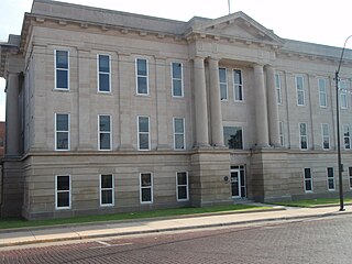
Ford County is a county located in the U.S. state of Kansas. As of the 2020 census, its population was 34,287. Its county seat and most populous city is Dodge City. The county is named in honor of Colonel James Hobart Ford.

Comanche County is a county located in the U.S. state of Kansas. As of the 2020 census, the county population was 1,689. Its county seat and most populous city is Coldwater. The county is named after the Comanche Native Americans.
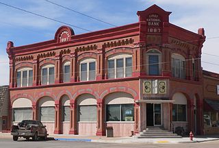
Clark County is a county located in the U.S. state of Kansas. As of the 2020 census, the county population was 1,991. Its county seat and most populous city is Ashland.
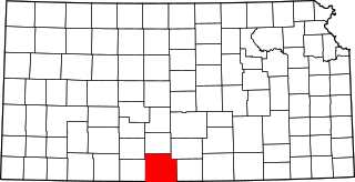
Barber County is a county located in the south-central portion of the U.S. state of Kansas. As of the 2020 census, the county population was 4,228. Its county seat and most populous city is Medicine Lodge. It was named for Thomas Barber, an abolitionist who was killed in Douglas County in 1855 during the Wakarusa War.

Great Bend is a city in and the county seat of Barton County, Kansas, United States. It is named for its location at the point where the course of the Arkansas River bends east then southeast. As of the 2020 census, the population of the city was 14,974.

Dodge City is the county seat of Ford County, Kansas, United States, named after nearby Fort Dodge. The city is famous in American culture for its history as a wild frontier town of the Old West. As of the 2020 census, the population of the city was 27,788.
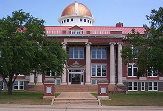
Lawton is a city in, and the county seat of, Comanche County, in the U.S. state of Oklahoma. Located in southwestern Oklahoma, approximately 87 mi (140 km) southwest of Oklahoma City, it is the principal city of the Lawton, Oklahoma, metropolitan statistical area. According to the 2010 census, Lawton's population was 96,867, making it the fifth-largest city in the state, and the largest in Western Oklahoma.

Buffalo is a town and county seat of Harper County, Oklahoma, United States. The population was 1,299 at the 2010 census. It was named after the Buffalo Creek valley, in which it is located.
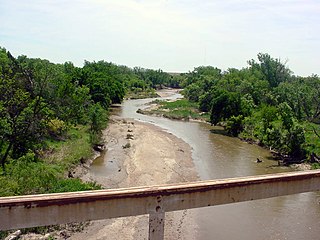
The Smoky Hill River is a 575-mile (925 km) river in the central Great Plains of North America, running through Colorado and Kansas.
Sweetwater Creek is a stream in the Texas Panhandle and western Oklahoma. It is a tributary to the North Fork of the Red River.
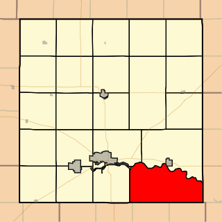
Comanche Township is a township in Barton County, Kansas, USA. As of the 2010 census, its population was 462.
K-14 is a 219.3-mile-long (352.9 km) north–south state highway which runs through the central part of the U.S. state of Kansas. K-14's southern terminus is at U.S. Highway 160 (US-160) and K-2 in the city of Harper, and the northern terminus is a continuation as Nebraska Highway 14 (N-14) at the Nebraska border by Superior, Nebraska. Along the way it intersects several major east–west highways in the larger cities it passes through, including US-54 and US-400 by Kingman; US-50, K-61 and K-96 by South Hutchinson; K-156 and K-140 by South Ellsworth; Interstate 70 (I-70) and US-40 north of Ellsworth; K-18 in Lincoln; US-24 and K-9 in Beloit; and US-36 east of Mankato. The northern and southern halves of the highway differ fairly significantly in terms of terrain and landscape. The southern half of K-14 travels over fairly flat terrain in the valley of the Arkansas River. Just north of the intersection with K-4 in southern Ellsworth County, K-14 passes into the Smoky Hills region, traveling over a series of broad, rolling hills, providing several scenic vistas of the surrounding countryside. The portion of the highway between Lincoln and Beloit is particularly hilly.

Kiowa Rural Township is the sole township in Kiowa County, Kansas, United States. The population was 3,278 at the 2000 census, out of whom 2,346 lived in one of the township's three cities and 813 lived in unincorporated areas of the township. Kiowa Rural Township's boundaries are identical to those of Kiowa County: there are no other townships in the county, and none of the county's cities are governmentally independent.
Kiowa Creek is a watercourse in Texas and Oklahoma that becomes a tributary of the Beaver River. It originates southwest of Huntoon and east of Perryton in northeastern Ochiltree County, Texas. It travels generally east until southwest of Darrouzett in Lipscomb County, then turns northeast and passes just south and east of that town. It continues generally northeasterly into Beaver County, Oklahoma, where it is joined by Camp Creek. The stream enters Harper County west of Laverne, Oklahoma, and continues to its joinder with the Beaver River north-northwest of Laverne.

Mouser is an unincorporated community in Texas County, Oklahoma, United States. Mouser is 13.5 miles (21.7 km) north-northeast of Guymon and 11 miles (18 km) west of Hooker. The community of Straight is two miles to the west. Two grain elevators in Mouser, the Mouser Grain Elevator and the Mouser Woodframe Grain Elevator/Collingwood Elevator, are listed on the National Register of Historic Places listings in Texas County, Oklahoma.
Kiowa Creek is a stream in Comanche County, Kansas. Its watershed includes multiple other streams. West Kiowa Creek forms in northeast Clark County, Kansas and flows generally southeast, passing through the southwestern corner of Kiowa County, Kansas where it is joined by Turkey Creek and Little Turkey Creek. It continues into Comanche County, where it is joined by Middle Kiowa Creek, a southerly-flowing stream originating in Kiowa County to the north. The combined stream flows generally south, and becomes simply Kiowa Creek at some point. It is later joined by East Kiowa Creek, also a southerly-flowing stream originating in Kiowa County to the north, and one having its own tributary, Wiggins Creek. Kiowa Creek continues generally south, and travels along the eastern border of the town of Protection, Kansas, before becoming a tributary of Cavalry Creek to the southeast of Protection. Cavalry Creeks feeds into Bluff Creek, which eventually becomes a tributary of the Cimarron River before that watercourse enters Oklahoma.
Lake Frederick is a reservoir in Tillman County, Oklahoma. It is located about 15 miles northeast of the town of Frederick, which owns it. It was constructed in 1974 for flood control and to provide a water supply. It has a total surface area of 878 acres, and a total volume of 9,663 acre-feet. It has about 18 miles of shoreline.


