Related Research Articles

The Deep Fork National Wildlife Refuge (DFNWR) is part of the United States system of National Wildlife Refuges, and is a critical resource for wildfowl that migrate along the Central Flyway in Spring and Fall. It is located in Eastern Oklahoma, near the city of Okmulgee. The preserve runs along both banks of the Deep Fork River for about 20 miles (32 km). According to TravelOK, DFNWR receives about 45,000 visitors every year.
Catoosa Wildlife Management Area is a large game-management area on the Upper Cumberland Plateau in Morgan, Cumberland and Fentress counties in Tennessee in the United States. It comprises 96,000 acres (332 km2) of wild land administered by the Tennessee Wildlife Resources Agency (TWRA). The Management Area is funded by hunters and fishermen, and is popular with all outdoors enthusiasts, including backpackers, and whitewater rafters. It has many trails for hiking, of which the most notable is the Cumberland Trail. It also has gravel roads and dirt track four-wheel drive roads for motorized exploration. Catoosa ranges from gentle rolling hills to some of the most rugged and extreme terrain in the country. Many rivers and streams have cut deep canyons into the Cumberland Plateau and Cumberland Mountains of the Management area allowing for beautiful vistas.
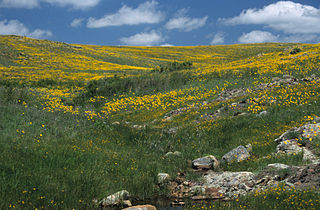
Wichita Mountains Wildlife Refuge, located in southwestern Oklahoma near Lawton, has protected unique wildlife habitats since 1901 and is the oldest managed wildlife facility in the United States Fish and Wildlife Service system. The refuge's location in the geologically unique Wichita Mountains and its areas of undisturbed mixed grass prairie make it an important conservation area. The Wichitas are approximately 500 million years old. Measuring about 59,020 acres (238.8 km2), the refuge hosts a great diversity of species: 806 plant species, 240 species of birds, 36 fish, and 64 reptiles and amphibians are present.
The Fort Mill Ridge Wildlife Management Area is located on 217 acres (0.88 km2) two miles (3 km) southwest of Romney in Hampshire County, West Virginia. Fort Mill Ridge WMA is owned by the West Virginia Division of Natural Resources. The Fort Mill Ridge Civil War Trenches are located at the top of the Fort Mill Ridge access road.
Nathaniel Mountain Wildlife Management Area is located on 10,675 acres (43.20 km2) south of Romney in Hampshire County, West Virginia. The wildlife management area's principle access road is off Grassy Lick Road. Nathaniel Mountain is owned by the West Virginia Division of Natural Resources (WVDNR), and is one of West Virginia's largest wildlife management areas. The WMA was expanded in November 2003 after the WVDNR purchased 1,800 acres (7.3 km2) from the MeadWestvaco Corporation.

The Allegheny Wildlife Management Area is located on 6,202 acres (25.1 km2) on two separate tracts of mixed oak-hickory woodlands in western Mineral County along the Allegheny Front. The large land tract of 5,034 acres (2,037.2 ha) is accessible via Pinnacle Road and Pine Swamp Road four miles (6 km) southwest of Keyser. The smaller tract of 1,168 acres (4.7 km2) is accessed by West Virginia Route 46 and Barnum Road about 6 miles (10 km) north from Elk Garden. The Barnum Road tract consists of old farm fields along the river and the ridgetop, connected by steep slopes.

The Little River is a tributary of the Red River, with a total length of 217 miles (349 km), 130 miles (210 km) within the Choctaw Indian Reservation in southeastern Oklahoma and 87 miles (140 km) in southwestern Arkansas in the United States. Via the Red, it is part of the watershed of the Mississippi River. Six large reservoirs impound the Little River and its tributaries. The drainage basin of the river totals 4,204 square miles (10,890 km2), 2,204 square miles (5,710 km2) in Oklahoma and 2,036 square miles (5,270 km2) in Arkansas. The Little River and its upper tributaries are popular for recreational canoeing and kayaking.

Anawalt Lake Wildlife Management Area is a 1,792-acre (725 ha) protected area located in McDowell County, West Virginia. It is managed by the Wildlife Resources Section of the West Virginia Division of Natural Resources.
James River Wildlife Management Area is a 1,213-acre (4.91 km2) Wildlife Management Area (WMA) in Nelson County, Virginia, near the town of Wingina. It consists of hilly woodland and relatively level bottomland along slightly more than one mile (1.6 km) of the James River. Elevations at the area range from 350 to 500 feet above sea level.

Burches Run Wildlife Management Area, formerly Burches Run Lake WMA, is located on 55 acres (22 ha) near Wheeling in Marshall County, West Virginia. Until 2005 the wildlife management area contained a lake impounded by a dam at risk of failure. The name change occurred after the dam was removed. The terrain climbs gently above Burches Run and is covered by a mature oak-hickory second-growth forest.

Sleepy Creek Wildlife Management Area is located in Morgan and Berkeley Counties in West Virginia's Eastern Panhandle. It encompasses 22,928 acres (92.79 km2), mostly covered with mixed oak and pine forest, although about 3,500 acres (14 km2) are covered with mixed hardwoods. The 205-acre (83 ha) Sleepy Creek Lake is located entirely within the WMA.
The San Luis National Wildlife Refuge Complex is located in the northern San Joaquin Valley, within Merced County and Stanislaus County of California. The complex, with four federal National Wildlife Refuges, is managed by the U.S Fish & Wildlife Service.
Pine Creek Wildlife Management Area is a scientifically managed preserve of natural and native wildlife flora and fauna. It is located in Pushmataha County and McCurtain County, Oklahoma, adjacent to Pine Creek Lake, seven miles north of Valliant, Oklahoma.

The ecology of the Rocky Mountains is diverse due to the effects of a variety of environmental factors. The Rocky Mountains are the major mountain range in western North America, running from the far north of British Columbia in Canada to New Mexico in the southwestern United States, climbing from the Great Plains at or below 1,800 feet (550 m) to peaks of over 14,000 feet (4,300 m). Temperature and rainfall varies greatly also and thus the Rockies are home to a mixture of habitats including the alpine, subalpine and boreal habitats of the Northern Rocky Mountains in British Columbia and Alberta, the coniferous forests of Montana and Idaho, the wetlands and prairie where the Rockies meet the plains, a different mix of conifers on the Yellowstone Plateau in Wyoming and in the high Rockies of Colorado and New Mexico, and finally the alpine tundra of the highest elevations.
Boise River Wildlife Management Area at 34,000 acres (140 km2) is an Idaho wildlife management area in Ada, Boise, and Elmore counties east of Boise. The WMA is located on land around Lucky Peak Lake, a reservoir on formed by the Lucky Peak Dam on the Boise River. The WMA is managed by the Idaho Department of Fish and Game (IDFG) but consists of land owned by IDFG, the Bureau of Land Management, U.S. Forest Service, Army Corps of Engineers, and Idaho Fish and Wildlife Foundation. The first land for the WMA was purchased in 1943, and the mission of the WMA is to conserve mule deer and elk wintering habitat.
Portneuf Wildlife Management Area at 3,104 acres (12.56 km2) is an Idaho Wildlife Management Area (WMA) in Bannock County near the town of McCammon. The first land acquisition for the WMA occurred in 1970 from M.S. Bastian, a local farmer and rancher. Three additional parcels were acquired in 1974.
Frances A. Crane Wildlife Management Area is a wildlife management area (WMA) in Falmouth, Massachusetts, operated by the state Department of Fish and Game.

Big Woods Wildlife Management Area is a 4,173-acre (16.89 km2) Wildlife Management Area (WMA) in Sussex County, Virginia. It comprises two tracts of land; the 2,208-acre (8.94 km2) main tract, located immediately adjacent Big Woods State Forest, and the 1,965-acre (7.95 km2) Parker's Branch tract, located nearby.
West Bay Wildlife Management Area, also known as West Bay WMA, is a 59,189-acre tract of protected area near Elizabeth in Allen Parish, Louisiana. The WMA is managed by the Louisiana Department of Wildlife and Fisheries (LDWF) from land owned by Boise Paper Solutions, Roy O. Martin Lumber Company, Forest Investments Associates, and Weyerhaeuser.
Peason Ridge Wildlife Management Area, also referred to as Peason Ridge WMA, is a 74,309-acre tract of protected area located in the Parishes of Natchitoches, Sabine, and Vernon, in the state of Louisiana. The WMA is managed by the Louisiana Department of Wildlife and Fisheries (LDWF).
References
- ↑ Research report, "Pushmataha Forest Habitat Research Area", Tall Tibers Research Station. n.d.
- ↑ Information courtesy the general profile for Pushmataha WMA written by Jack Waymire of the Oklahoma Department of Wildlife Conservation, available at "Pushmataha". Archived from the original on January 3, 2010. Retrieved October 18, 2009.
- ↑ Steve Burge, "Pushmataha Wildlife Management Area", Outdoor Oklahoma, May-June 2006, pp. 38-41.