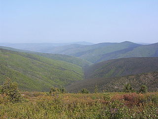
The Klondike is a region of the territory of Yukon, in northwestern Canada. It lies around the Klondike River, a small river that enters the Yukon River from the east at Dawson City.

Yukon is the smallest and westernmost of Canada's three territories. It is the third-least populated province or territory in Canada, with a population of 45,148 as of 2023. However, Whitehorse, the territorial capital, is the largest settlement in any of the three territories.

The Arctic Archipelago, also known as the Canadian Arctic Archipelago, is an archipelago lying to the north of the Canadian continental mainland, excluding Greenland and Iceland.

Northern Canada, colloquially the North or the Territories, is the vast northernmost region of Canada, variously defined by geography and politics. Politically, the term refers to the three territories of Canada: Yukon, Northwest Territories and Nunavut. This area covers about 48 per cent of Canada's total land area, but has less than 0.5 per cent of Canada's population.
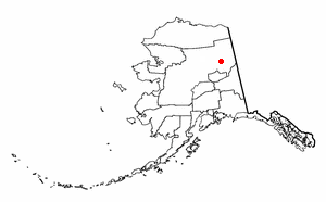
Circle is a census-designated place (CDP) in Yukon-Koyukuk Census Area, Alaska, United States. At the 2010 census the population was 104, up from 100 in 2000.
Herschel or Herschell may refer to:

Herschel Island is an island in the Beaufort Sea, which lies 5 km (3.1 mi) off the coast of Yukon in Canada, of which it is administratively a part. It is Yukon's only offshore island.
Komakuk Beach was the site of a DEW Line station, located on the Arctic coast of Yukon, Canada. The station was closed in 1993 pursuant to the general policy of dismantling such stations that was adopted following the collapse of the Soviet Union, which effectively ended the Cold War and obviated the need to maintain these installations.
Ivvavik National Park is a national park of Canada located in the Yukon. Initially named "Northern Yukon National Park," the park was renamed Ivvavik in 1992 for the Inuvialuktun word meaning "nursery" or "birthplace," in reference to the importance of the area as a calving ground for Porcupine caribou. Created as a result of the Inuvialuit Final Agreement in 1984, negotiated between the Canadian Government and the Inuvialuit of the Northern Yukon, Ivvavik is the first national park in Canada to be established as a result of an aboriginal land claims agreement. About 100 people visit the park each year.
Ovayok Territorial Park is a park situated 15 km (9.3 mi) east of Cambridge Bay, in the Kitikmeot Region, Nunavut, Canada. The park is relatively small and covers an area of approximately 16 km2 (6.2 sq mi). The park can be accessed by vehicle from the community as a gravel road runs directly to it.

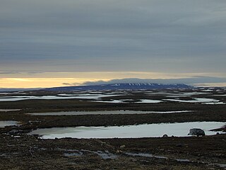
Old Crow Flats is a 6,170 km2 (2,382 sq mi) wetland complex in northern Yukon, Canada along the Old Crow River. It is north of the Arctic Circle and south of the Beaufort Sea, and is nearly surrounded by mountains.
Little Mac Ski Hill, known as Little Mac, is a community-operated ski area adjacent to Mackenzie, British Columbia, Canada in the northern Rocky Mountain Trench. The area has one tow lift and vertical differential of 90 m (295 ft). The longest run is 210 m (689 ft). In addition to downhill skiing, the hill also has areas for tobogganing and snowboarding. The hill itself is connected to John Dahl Regional Park which features groomed cross-country ski trails and eventually connects to the Mackenzie Recreation Centre. In 2021 an outdoor ice rink was opened in the park and was open to members of the public to use. Though not directly part of the ski area, there are an additional 32 km (20 mi) of groomed and lit cross-country ski trails immediately accessible from the town of Mackenzie, with three specially built warming huts.

The Inuvialuit Settlement Region, abbreviated as ISR, located in Canada's western Arctic, was designated in 1984 in the Inuvialuit Final Agreement by the Government of Canada for the Inuvialuit people. It spans 90,650 km2 (35,000 sq mi) of land, mostly above the tree line, and includes several subregions: the Beaufort Sea, the Mackenzie River delta, the northern portion of Yukon, and the northwest portion of the Northwest Territories. The ISR includes both Crown Lands and Inuvialuit Private Lands.

Christian Theodore Pedersen was a Norwegian-American seaman, whaling captain and fur trader active in Alaska, Canada, and the northern Pacific from the 1890s to the 1930s. He was called "one of the canniest old skippers in the western arctic" by a contemporary.
Rock Island Township is a township in Williams County, North Dakota, United States. It has a land area of 34.4 square miles (89 km2). As of the 2010 census it had a population of zero.

The Indigenous peoples of Yukon are ethnic groups who, prior to European contact, occupied the former countries now collectively known as Yukon. While most First Nations in the Canadian territory are a part of the wider Dene Nation, there are Tlingit and Métis nations that blend into the wider spectrum of indigeneity across Canada. Traditionally hunter-gatherers, indigenous peoples and their associated nations retain close connections to the land, the rivers and the seasons of their respective countries or homelands. Their histories are recorded and passed down the generations through oral traditions. European contact and invasion brought many changes to the native cultures of Yukon including land loss and non-traditional governance and education. However, indigenous people in Yukon continue to foster their connections with the land in seasonal wage labour such as fishing and trapping. Today, indigenous groups aim to maintain and develop indigenous languages, traditional or culturally-appropriate forms of education, cultures, spiritualities and indigenous rights.
