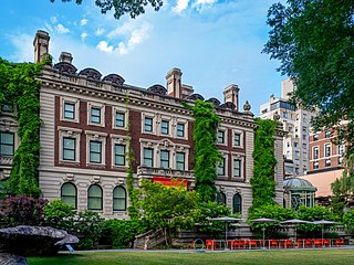
Carnegie Hill is a neighborhood within the Upper East Side, in the borough of Manhattan in New York City. Its boundaries are 86th Street on the south, Fifth Avenue on the west, with a northern boundary at 98th Street that continues just past Park Avenue and turns south to 96th Street and proceeds east up to, but not including, Third Avenue. The neighborhood is part of Manhattan Community District 8.

The Museum of the City of New York (MCNY) is a history and art museum in Manhattan, New York City, New York. It was founded by Henry Collins Brown, in 1923 to preserve and present the history of New York City, and its people. It is located at 1220–1227 Fifth Avenue between East 103rd to 104th Streets, across from Central Park on Manhattan's Upper East Side, at the northern end of the Museum Mile section of Fifth Avenue.

South Brooklyn is a historic term for a section of the former City of Brooklyn – now the New York City borough of Brooklyn – encompassing what are now the Boerum Hill, Carroll Gardens, Cobble Hill, Gowanus, Park Slope, Windsor Terrace, Sunset Park and Red Hook neighborhoods. It was named for its location along the waterfront that was the southern border of the original Village of Brooklyn, and has remained widely used as a colloquialism despite it no longer being the southernmost point of the borough. It should not be confused with the geographic southern region of the modern borough of Brooklyn, which includes the neighborhoods of Gravesend, Seagate, Coney Island, Brighton Beach, Manhattan Beach, Sheepshead Bay, Gerritsen Beach, Marine Park, Mill Basin, and Bergen Beach.

Henry Street is a street in the Lower East Side of the New York City borough of Manhattan that runs one-way eastbound, except for two small two-way segments west of Pike Street and east of Montgomery Street. It spans from Oliver Street in the west, passing underneath the Manhattan Bridge and on to Grand Street in the east ("north"). The street is named for Henry Rutgers, a hero of the American Revolutionary War and prominent philanthropist. Rutgers Street, which intersects with Henry Street, is also named for him.
Historic preservation in New York is activity undertaken to conserve forests, buildings, ships, sacred Indian burial grounds, water purity and other objects of cultural importance in New York in ways that allow them to communicate meaningfully about past practices, events, and people. Governmental programs for historic preservation range from Federal ownership and active operation of sites to grants and subsidies provided by state government, municipal support of museums and interpretative displays. Nonprofit programs include activities of statewide and local historical associations and museums, and activities of historical societies and museums at the national level. Quasi-governmental organizations, such as the New York State Thruway Authority and Thousand Islands Bridge Authority, play a role as well. Private endeavors, such as investment and other choices made by private landowners to conserve historical features of their properties, are significant but less visible and include groups such as the Historic Districts Council, The New York Landmarks Conservancy and the Preservation League of New York State. During the reconstruction of the World Trade Center site in July 2010, a team of archaeologists discovered a 32-foot-long boat. The craft was at least 200 years old, dating from a time when the Hudson River was partly filled with trash and debris because of a rapidly expanding lower Manhattan.

Andrew Scott Dolkart is a professor of Historic Preservation at the Columbia University Graduate School of Architecture, Planning and Preservation (GSAPP) and the former Director of the school's Historic Preservation Program. Professor Dolkart is an authority on the preservation of historically significant architecture and an expert in the architecture and development of New York City. He was described as someone who is "without peer among New York's architectural researchers" by architectural critic Francis Morrone and he has written extensively on this topic. Before joining the faculty at Columbia he held a position at the New York City Landmarks Preservation Commission and worked as a consultant. Dolkart holds a Bachelor of Arts degree from Colgate University (1973) and a Master of Science degree in Historic Preservation from Columbia University (1977); he is a popular lecturer and walking tour guide.

The Lewis H. Latimer House, also called the Latimer House or the Lewis Latimer House, is a historic house located at 34-41 137th Street in Flushing, Queens, New York City. It was constructed in the Queen Anne style of architecture between 1887 and 1889 by the Sexton family. It served as the home of the African-American inventor Lewis Howard Latimer from 1903 to 1928, and is now operated as a museum dedicated to the inventor's work. In addition, this museum-house also illuminated the life and achievements of other black scientists. The house remained property of the Latimer family until 1963. Currently, the Lewis H. Latimer House is owned by the New York City Department of Parks and Recreation, operated by the Lewis H. Latimer Fund, Inc., and is a member of the Historic House Trust.

Mount Hebron is a Jewish cemetery located in Flushing, Queens, New York, United States. It was founded in 1903 as the Jewish section of Cedar Grove Cemetery, and occupies the vast majority of the grounds at Cedar Grove. The cemetery is on the former Spring Hill estate of colonial governor Cadwallader Colden. Mount Hebron is arranged in blocks, which are then split up into sections or society grounds. Sections were originally sold mainly to families or Jewish community groups such as landsmanshaftn, mutual aid societies, and burial societies. For instance, Mount Hebron is known for having a section reserved for people who worked in New York City's Yiddish theater industry. While this type of organization is common for American Jewish cemeteries, Mount Hebron has an especially diverse range of society grounds. About 226,000 people have been buried in Mount Hebron since it opened.

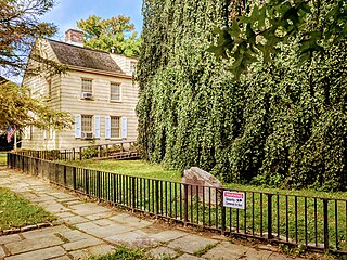
Kingsland Homestead is an 18th-century house located in Flushing, Queens, New York City. It is the home of the remains of The Weeping Beech, a landmark weeping beech tree, believed to have been planted in 1847. The homestead is also close to the 17th-century Bowne House, the location of the first Quaker meeting place in New Amsterdam. The homestead is operated by the Queens Historical Society, whose quarters are inside; the homestead is open to the public as a museum. The Kingsland Homestead is a member of the Historic House Trust, and is both a New York City designated landmark and a National Register of Historic Places listing.
The Rose Museum is a small museum dedicated to the history of Carnegie Hall in Manhattan, New York City. The museum, which opened in 1991, is located at 154 West 57th Street, on the second floor of Carnegie Hall. It was funded by the Susan and Elihu Rose Foundation and includes more than 2,500 feet of archives and more than a century of concert programs. The plan when the museum opened was to supplement its permanent collection with a series of rotating exhibits. The museum also focuses on the Hall's uncertain future following the development of Lincoln Center and the sale of Carnegie Hall in the late 1950s leading to the preservation campaign spearheaded by Isaac Stern. The government purchased the hall in 1960 and the building was declared a National Historic Landmark in 1962.

Wyckoff Heights is an area within the New York City boroughs of Brooklyn and Queens, straddling the border between Bushwick, Brooklyn, and southwest Ridgewood, Queens. Wyckoff Heights was urbanized starting in the late 19th century, and took its name from the Wyckoff family, who owned the land. The area was home first to many German immigrants, later followed by Italian and more recently Latino and Eastern-European residents.

Prospect Cemetery is a historic cemetery located in the Jamaica section of the New York City borough of Queens. It was established in 1668 and known as the "burring plas." The cemetery's original main gate was on Beaver Road which led from Sutphin Boulevard to Jamaica Avenue. The cemetery was generally known as the Presbyterian burial ground and is one of the few remaining Colonial cemeteries in Queens.

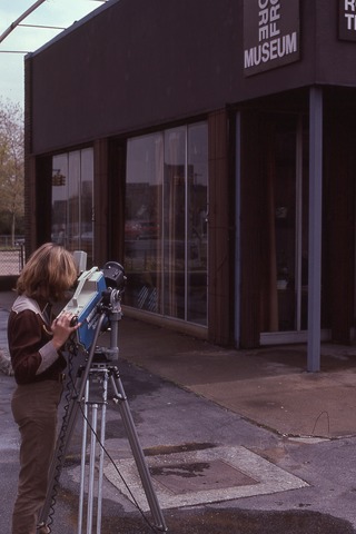
The Store Front Museum was a community museum in Queens, New York that served as a cultural center and exhibition space for the black community of the borough. Established in 1971 by artist Tom Lloyd, it was originally located on Liberty Avenue, in a former retail tire dealer building.

The Moore-Jackson Cemetery is a historic cemetery in the Woodside neighborhood of Queens in New York City, active from 1733 to about 1868. It is one of New York City's few remaining 18th-century cemeteries and is a New York City designated landmark. The burial ground occupies a five-sided site on 51st and 54th Streets between 31st and 32nd Avenues. While the cemetery spans about 20,000 square feet (1,900 m2), all of the surviving tombstones are placed along 54th Street. The cemetery was part of the estate of Samuel and Charity Moore, members of one of Queens's oldest families, and contains approximately 48 corpses.

The Weeping Beech was a historic tree located at Weeping Beech Park in Flushing, Queens, New York City. It was the mother of all European weeping beeches in the United States.

The Jamaica Savings Bank is a building at Jamaica Avenue and Sutphin Boulevard in Jamaica, Queens, New York City. The building was built between 1938 and 1939 in the Art Deco style. It replaced the Queensboro Savings Bank at 90-55 Sutphin Boulevard, which was acquired by the Jamaica Savings Bank in 1934 and demolished in 1938. The address was changed to the current 146-21 Jamaica Avenue and is a New York City designated landmark.

The Lawrence Cemetery is located at the corner of 216th Street and 42nd Avenue in Bayside, Queens, New York. It is one of three family burial grounds owned by the Lawrence family in Queens. It was designated as a New York City Landmark in 1967, and is managed today by the Bayside Historical Society.

The Pepsi-Cola sign is a neon sign at Gantry Plaza State Park in the Long Island City neighborhood of Queens in New York City. The sign, visible from Manhattan and the East River, was built in 1940 and originally installed atop PepsiCo 's bottling factory nearby. It is composed of a 50-foot (15 m) depiction of a Pepsi bottle, as well as lettering that reflected PepsiCo's logo when the sign was commissioned.

The Remsen Cemetery is a private burial ground in at 69-43 Trotting Course Lane, bordering the Middle Village and Rego Park neighborhoods of Queens in New York City. The cemetery is on a 2.5-acre (1.0 ha) triangle just north of Metropolitan Avenue and one block east of Woodhaven Boulevard. The Remsen Cemetery contains the remains of members of the Remsen family who died between 1790 and the early 19th century. The burials in the cemetery include that of American Revolutionary War colonel Jeromus Remsen (1735–1790), as well as his wife, his brother, and four of his children. The remains of an eighth person, Bridget Remsen, are also in the cemetery.


