Related Research Articles
Riverview is a neighbourhood in Ottawa, Ontario, Canada. It is southeast of the downtown adjacent to the Rideau River, its location on which is its namesake. The 2021 Census population of Riverview is 13,113.
Westboro is an area in the west end of Ottawa, Ontario, Canada. Located along the Ottawa River, Island Park Drive defines Westboro's eastern border, while the Ottawa River defines its northern border. Under this definition, the population of the area is 22,725.

Blossom Park is a neighbourhood in Gloucester-Southgate Ward in the south-end of the city of Ottawa, Ontario, Canada. Before the 2001 city of Ottawa amalgamation it was a suburb of the city of Gloucester. The current limits of the neighbourhood are: Hunt Club Road to the north, Airport Parkway to the west, Conroy Road to the east and the Greenbelt to the south.

Vanier, formerly Eastview, is a neighbourhood in the Rideau-Vanier Ward of Ottawa, Ontario, Canada's east end. Historically francophone and working class, the neighbourhood was a separate city until being amalgamated into Ottawa in 2001. It no longer has a majority francophone population. By 2012 its francophone population had shrunk to less than 40% from 63% in the early 1980s. The neighbourhood is located on the east bank of the Rideau River, across from the neighbourhoods of Lowertown and Sandy Hill, and just south of Rockcliffe Park, New Edinburgh, Lindenlea, and Manor Park. To the east of Vanier are the suburbs of Gloucester. Vanier has a relatively small area with a high population density.

The Ottawa City Council is the governing body of the City of Ottawa, Ontario, Canada. It is composed of 24 city councillors and the mayor. The mayor is elected at large, while each councillor represents wards throughout the city. Council members are elected to four-year terms, with the last election being on October 24, 2022. The council meets at Ottawa City Hall in downtown Ottawa. Much of the council's work is done in the standing committees made up of sub-groups of councillors. The decisions made in these committees are presented to the full council and voted upon.
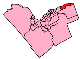
Orléans East-Cumberland Ward is a city ward in the city of Ottawa, Ontario, Canada, represented on Ottawa City Council. It was created before the 2000 Election when the area was amalgamated into the city of Ottawa. The ward covers much of the suburban community of Orleans in the east of the city. Previous to that, the ward existed in the Regional Municipality of Ottawa-Carleton Council. It contains the neighbourhoods of Queenswood Heights, Queenswood Village, Fallingbrook, Cardinal Creek, Cardinal Creek Village, Bella Vista and Cumberland Village.

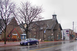
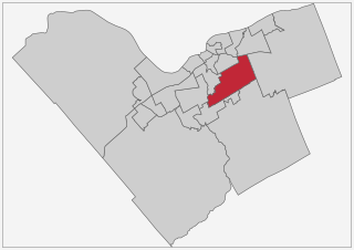
Kitchissippi Ward is a city ward in the city of Ottawa, Ontario, Canada. It gets its name from the Algonquin name for the Ottawa River, meaning Great River. The ward is slightly west of downtown, and covers the neighbourhoods of Champlain Park, Civic Hospital, Hampton Park, Highland Park, Hintonburg, Island Park, McKellar Heights, McKellar Park, Mechanicsville, Westboro Beach, Westboro, Wellington Village, and Wellington Street West.

Ottawa Road 174, formerly Ottawa-Carleton Regional Road 174 and commonly referred to as Highway 174, is a city-maintained road in the City of Ottawa which serves the eastern suburbs of Orléans and Cumberland. The four-lane freeway segment between Highway 417/Aviation Parkway junction to Trim Road is also known as the Queensway, in addition the Queensway name continues to be applied to Highway 417 west of that intersection. Although the road continues through the towns of Rockland and Hawkesbury to the Quebec border, the portion east of the Ottawa city boundary is known as Prescott and Russell County Road 17.
Shawn William Little was a political consultant and Ottawa City Councillor in Ottawa, Ontario, Canada, for the urban Kitchissippi Ward, consisting of neighbourhoods west of the City Centre. He was born in Ottawa and raised in its Westboro neighbourhood, where he attended Woodroffe Avenue and Broadview Public elementary schools followed by Nepean High School. He earned a bachelor's degree in history and political science from Carleton University, and a diploma in health sciences from Humber College. He wrote articles for the Newswest community paper in its early days. He died in November 2012 while vacationing in Cuba.

Carlington is a neighbourhood located in River Ward in the west-end of Ottawa, Ontario, Canada.
Gloucester-Southgate Ward is a city ward located in Ottawa, Ontario. Located in the city's south end, the ward includes Gloucester Glen east of the Rideau River, most of the Ottawa International Airport, CFSU Uplands, Blossom Park, Greenboro, Hunt Club Park, portions of Heron Gate south of Walkley Road, the Ottawa South/Hawthorne Industrial Park and rural areas west of Anderson Road and north of Leitrim. Previously, the ward included the community of Riverside South located south of the airport but in a ward reorganization, the growing community was included in the new ward of Gloucester-South Nepean.
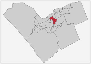
River Ward or Ward 16 is a municipal ward located in Ottawa, Ontario. It is located in the south central portion of the city, and includes the communities of Carlington, Central Park, Carleton Heights, Mooney's Bay, Riverside Park, and Hunt Club/Uplands. The ward spans both sides of the Rideau River between Carling Avenue and Hunt Club Road.
Elmdale Ward was a municipal ward in the city of Ottawa, Ontario, Canada.
Copeland Park is a neighbourhood located in College Ward in the west end of Ottawa, Canada. It is bounded to the west by Agincourt Road, to the south by Baseline Road, to the east by Clyde Avenue and to the north by the Central Experimental Farm Pathway.
Britannia Heights is a neighbourhood in Bay Ward in west end of Ottawa, Ontario, Canada. The neighbourhood is a sub-neighbourhood of Britannia area of the city, but is within the Queensway Terrace North Community Association boundaries. The neighbourhood is away from the Ottawa River on a steep hill. It is bounded to the North by Carling Avenue, east by OC Transpo Transitway, south by Henley Street, and west by Bayshore Drive. The population of the neighbourhood is approximately 1750.
McKellar Heights is a small neighbourhood located in Kitchissippi Ward, in the west end of Ottawa, Ontario, Canada. The neighbourhood is generally triangular in shape, and is generally bounded on the north by Westboro, on the west by Glabar Park, and on the south by Carlington. The population as of the Canada 2016 Census was 575.

Champlain Park is an older urban neighbourhood in Kitchissippi Ward in Ottawa, Ontario, Canada. It was considered in the 1930s as the west end of town. The boundaries of the neighbourhood are the Ottawa River and Scott Street. To the east is Tunney's Pasture and to the west is Island Park Drive. Westboro Beach is also to the west. The population as of the 2016 Census was 1090.
Ernest William Jones was a Canadian politician. He was an alderman on Ottawa City Council from 1950 to 1952, and was a member of the Ottawa Board of Control from 1955 to 1960 and from 1963 to 1974. He unsuccessfully ran for mayor of Ottawa in 1960, and was Deputy Mayor of the city in 1972.
References
- ↑ "Ward". Ottawa Citizen. March 20, 1956. p. 39. Retrieved December 28, 2021.
- ↑ "Alderman wants ward renamed". Ottawa Citizen. June 8, 1989. p. 27. Retrieved July 9, 2023.
- ↑ "Ward redistribution". Ottawa Citizen. January 2, 1991. p. 67. Retrieved July 9, 2023.
- ↑ "Light Vote Recorded In 2 New City Wards". Ottawa Citizen. December 20, 1949. p. 19. Retrieved December 27, 2021.