
Route 27 is a state highway in New Jersey, United States. It runs 38.53 mi (62.01 km) from U.S. Route 206 (US 206) in Princeton, Mercer County northeast to an interchange with Route 21 and Broad Street in Newark, Essex County. The route passes through many communities along the way, including New Brunswick, Highland Park, Edison, Metuchen, Rahway, and Elizabeth. Route 27 is a two- to four-lane undivided highway for most of its length, passing through a variety of urban and suburban environments. It intersects many roads along the way, including Route 18 in New Brunswick, Interstate 287 (I-287) in Edison, the Garden State Parkway in Woodbridge Township, Route 35 in Rahway, Route 28 in Elizabeth, and U.S. Route 22 in Newark. Route 27 crosses the Raritan River on the Albany Street Bridge, which connects Highland Park on the east with New Brunswick on the west.
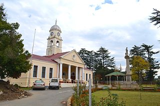
Kokstad is a town in the Harry Gwala District Municipality of KwaZulu-Natal Province, South Africa. Kokstad is named after the Griqua chief Adam Kok III who settled here in 1863. Kokstad is the capital town of the East Griqualand region, as it is also the biggest town in this region. It was built around Mount Currie, a local mountain range, by the city's founder Adam Kok III, for whom the town is named. Stad is the Dutch and Afrikaans word for "city".

The R56 is a provincial route in South Africa that connects Middelburg with Pietermaritzburg via Molteno, Maclear and Kokstad. It is co-signed with the N2 between Kokstad and Stafford's Post for 39 kilometres.
The R103 is a Regional Route in South Africa that is the designation for some of the old sections of roads that were previously the N3, prior to upgrading. It only has 3 sections, from Hillcrest to Ladysmith, from Warden to Villiers and from Heidelberg to Johannesburg.

The N2 is a national route in South Africa that runs from Cape Town through George, Gqeberha, East London, Mthatha, Port Shepstone and Durban to Ermelo. It is the main highway along the Indian Ocean coast of the country. Its current length of 2,255 kilometres (1,401 mi) makes it the longest numbered route in South Africa.

U.S. Route 30 (US 30) is a U.S. Highway that runs east–west across the southern part of Pennsylvania, passing through Pittsburgh and Philadelphia on its way from the West Virginia state line east to the Benjamin Franklin Bridge over the Delaware River into New Jersey.
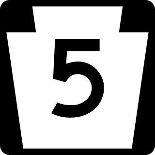
Pennsylvania Route 5 is a westward continuation of New York State Route 5. Located in the Commonwealth of Pennsylvania, in the United States, it runs from North East, Pennsylvania at the New York-Pennsylvania border to Springfield Township in western Erie County, for a total of 44.85 miles (72.18 km).

U.S. Route 13 (US 13) is a north–south United States Numbered Highway established in 1926 that runs for 518 miles (834 km) from Interstate 95 (I-95) just north of Fayetteville, North Carolina, north to US 1 in Morrisville, Pennsylvania, a northeastern suburb of Philadelphia. In the U.S. state of Virginia, US 13 runs north–south through the Hampton Roads and Eastern Shore regions of the state, using the Chesapeake Bay Bridge–Tunnel to get between the two. In the Hampton Roads area, it uses Military Highway to bypass the city centers. It is most usually a four-lane highway, sometimes up to freeway or expressway standards with controlled access.

Pennsylvania Route 16 is a 43-mile-long (69 km) east–west state route located in southern Pennsylvania, United States. The western terminus of the route is at U.S. Route 522 in McConnellsburg. The eastern terminus is at the Mason–Dixon line in Liberty Township, where the road continues into Maryland as Maryland Route 140. PA 16 is a two-lane road that runs through rural areas in Fulton, Franklin, and Adams counties. The route heads east from McConnellsburg and crosses Tuscarora Mountain into Franklin County, where it continues east into the agricultural Cumberland Valley. Here, the passes through Mercersburg, Greencastle, and Waynesboro. PA 16 heads east through the South Mountain range, where it heads into Adams County and passes through Carroll Valley before coming to the Maryland border. PA 16 intersects several roads including PA 456 in Cove Gap, PA 75 and PA 416 in Mercersburg, PA 995 in Upton, US 11 and Interstate 81 (I-81) in Greencastle, PA 316 and PA 997 in Waynesboro, and PA 116 in Carroll Valley. The road's main name is Buchanan Trail in honor of 15th President James Buchanan, who was born near the road in Cove Gap.

Pennsylvania Route 75 is a 71.2-mile-long (114.6 km) north–south state highway located in central Pennsylvania. The southern terminus is at the Mason–Dixon line in Montgomery Township, where the road continues into Maryland as Maryland Route 494. The northern terminus is at an interchange with U.S. Route 22 and US 322 northeast of Port Royal. PA 75 is a two-lane undivided road that passes through the Ridge-and-Valley Appalachians in Franklin and Juniata counties. The route heads north from the Maryland border in Franklin County to Mercersburg, where it runs concurrent with PA 16 and PA 416. From Mercersburg, PA 75 heads north and crosses US 30 in Fort Loudon before it runs northeast through a long valley, where it has an interchange with the Pennsylvania Turnpike in Willow Hill. The route turns north and heads into Juniata County, where it continues through another valley. PA 75 passes through Port Royal and crosses the Juniata River before it comes to its terminus at US 22/US 322.
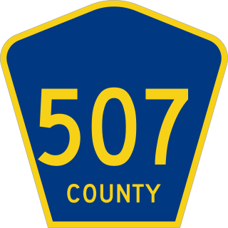
County Route 507 is a county highway in the U.S. state of New Jersey. The highway extends 28.37 mi (45.66 km) from Harrison Avenue on the Kearny-Harrison town line to the New York state line in Mahwah. Between Ho-Ho-Kus and Mahwah, this highway is known as Franklin Turnpike. At its northern terminus, County Route 507 continues north into New York as Orange Avenue, which is a portion of U.S. Route 202 (US 202).

State Route 317 (SR 317) is a north–south state highway in the central portion of the U.S. state of Ohio. Its southern terminus is at U.S. Route 23 approximately 9 miles (14 km) south of Downtown Columbus and just outside the city limits; its northern terminus is at U.S. Route 62 in Gahanna. The route serves as a partial southeastern outbelt for the Columbus metropolitan area, passing through many commercial districts and light industry areas.
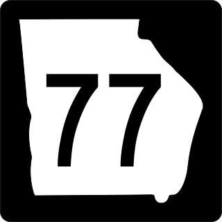
State Route 77 (SR 77) is a 103-mile-long (166 km) state highway that travels south-to-north through portions of Hancock, Greene, Oglethorpe, Elbert, and Hart counties in the eastern part of the U.S. state of Georgia.

U.S. Route 40 in the U.S. state of Maryland runs from Garrett County in Western Maryland to Cecil County in the state's northeastern corner. With a total length of 221 miles (356 km), it is the longest numbered highway in Maryland. Almost half of the road overlaps or parallels with Interstate 68 (I-68) or I-70, while the old alignment is generally known as US 40 Alternate, US 40 Scenic, or Maryland Route 144. West of Baltimore, in the Piedmont and Appalachian Mountains / Blue Ridge region of the Western Maryland panhandle of the small state, the portions where it does not overlap an Interstate highway are mostly two-lane roads. The portion northeast of Baltimore going toward Wilmington in northern Delaware and Philadelphia in southeastern Pennsylvania is a four-lane divided highway, known as the Pulaski Highway. This section crosses the Susquehanna River at the north end of the Chesapeake Bay on the Thomas J. Hatem Memorial Bridge.
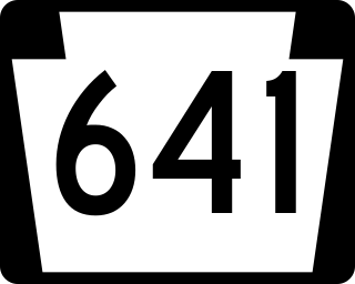
Pennsylvania Route 641 is a state route that is located in Central Pennsylvania in the United States. The route is 57.9 miles (93.2 km) long and runs from U.S. Route 522 near Shade Gap east to US 11/US 15 in Camp Hill.
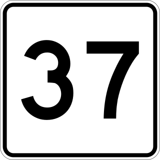
Route 37 is a 9.54-mile-long (15.35 km) north–south state highway in eastern Massachusetts. Its southern terminus is at Route 28 in Brockton and its northern terminus is at Interstate 93 (I-93) and U.S. Route 1 in Braintree.

State Route 96 is an east–west and north–south highway in Middle Tennessee. The road begins in Dickson and ends in Granville. The current length is 126.7 mi (203.9 km). Along its path it goes through 10 counties. Locals mostly refer to it as Highway 96.
Impendle is a town in Umgungundlovu District Municipality in the KwaZulu-Natal province of South Africa.
The R612 is a regional route in KwaZulu-Natal, South Africa that connects Park Rynie with Bulwer via Donnybrook, Ixopo, Highflats and Umzinto.
