RAF Harpur Hill

Last updated

RAF Harpur Hill
Ensign of the Royal Air Force.svg
Harpur Hill, Derbyshire in England
Derbyshire UK location map.svg
Red pog.svg
RAF Harpur Hill
Coordinates 53°13′59″N1°55′08″W / 53.233°N 1.919°W / 53.233; -1.919
Type Royal Air Force station
Site information
Owner Ministry of Defence
Operator Royal Air Force
Site history
Built1938 (1938)
In use1939–1960 (1960)
Airfield information
Elevation400 metres (1,312 ft) AMSL

RAF Harpur Hill is a former Royal Air Force station, situated at Harpur Hill near Buxton, Derbyshire in England. The site was operational from 1938 to 1960 and was mainly used as an underground munitions storage facility. [1] It became the largest ammunitions dump in the country across the 500 acres (200 ha) site. [2]

Contents

RAF site history

During World War I, the Frith artillery range was located on the site. [3]

From December 1939 to December 1960, the RAF Maintenance Unit 28 was based at Harpur Hill. The RAF used Harpur Hill as an underground munitions store. In 1938 the Air Ministry bought Harpur Hill Quarry from ICI. 11 tunnels were built (concrete galleries covered by waste quarry stones) and dug into the hillside from 1938 to 1940 by McAlpine (at a cost of £6,500,000) to house munitions (ammunition and weapons) and ordnance (bombs and explosives) during World War II. The small entrance leads into one main tunnel, which used to have a railway track running along its length, with three side tunnels branching off on each side. These tunnels are 25 feet (7.6 m) wide, 17 feet (5.2 m) high and over half a mile long. The tunnels were constructed 60 feet (18 m) below ground level to withstand enemy bombing raids. There are four slightly smaller tunnels on a lower level, accessed by lifts. War food rations were also stored within the tunnel system. Bombs were transported to the site by road and by the mainline railway through the site (a branch of the Cromford and High Peak Railway). [3] [4] [5]

After the end of the war, a bomb disposal unit was based at the site. The RAF UXO (Unexploded Ordnance) unit, known as an X station, was used to store and disarm captured German ordnance, including V-rocket warheads. The RAF disposed of chemical weapons, including mustard gas and phosgene, by burning them with bleach on the surrounding hills. This generated large volumes of toxic fumes, which killed off much of the surrounding vegetation. [6]

The large bomb store built in 1939 at RAF Llanberis in Wales was modelled on the underground tunnel design at RAF Harpur Hill. [7]

Building from the old RAF camp RAF Camp Building at Harpur Hill.jpg
Building from the old RAF camp

The original wartime RAF camp at Harpur Hill was a top secret facility and was heavily defended. The camp's housing for staff was built nearby on roads named after past RAF war heroes (such as Nettleton, Tedder and Trenchard). A new site was constructed lower down the hill after the war. Bombs continued to be stored underground during the 1950s. The RAF base was closed in 1961. [5]

RAF Mountain Rescue Service

In common with many RAF stations the SMO at RAF Harpur Hill undertook the responsibility for searching for and assisting crews of aircraft that were lost or had crashed in their area. Although the RAF Mountain Rescue Service formed in July 1943 it was not until May 1945 that the MRT at RAF Harpur Hill became a fully integrated and supported part of the RAF Mountain Rescue Service , within RAF Maintenance Unit 28 at Harpur Hill. The team was led by the site's medical officer Flight Lieutenant (later Air Commodore) (Dr)David Crichton and it recovered many wartime aircrew from crashes. The high moors and hills of the Peak District have accounted for over 250 aircraft crashes. On 3 November 1948 the RAF team was called out to locate the US Air Force (USAF) Boeing RB-29A Superfortress which had crashed near Bleaklow moor on the Kinder Scout moorland plateau. All 13 crew perished in the tragedy and the crashed aircraft became known as the Bleaklow Bomber. Much of the wreckage is still visible at the crash site, where a memorial was erected in 1988. [8] [9] [10]

Later uses

Tunnel in use as a mushroom farm in 1974 Tunnel at RAF Harpur Hill in 1974.jpg
Tunnel in use as a mushroom farm in 1974

After the RAF left the tunnels, Somerset-based Wrington Vale Nurseries bought the underground tunnel network in 1964 and used it as a mushroom farm for over 10 years. Rubble from the demolition of Buxton’s Empire Hotel was used to fill in the channel of the railway line in the main tunnel. After the tunnels were closed again, they were sold to a group of local businessmen and used as a cold store for cheese; a warehouse was built for dry and bonded wines and spirits. Several local hauliers provided the transport for these goods. One of the hauliers was Lomas Distribution and Christian Salvesen and was a major employer in the area; it later sold the site to French transport company Norbert Dentressangle. [11] [12]

High Peak College campus in ex-RAF buildings on Burlow Road High Peak College Campus at Harpur Hill.jpg
High Peak College campus in ex-RAF buildings on Burlow Road

Derbyshire College for Further Education moved from its 1950s premises in the Peak Buildings on Terrace Road to the former RAF base at Harpur Hill in 1965. [13] It became known as High Peak College and closed on 1 August 1998. [14]

The site today

Machine gun bunker on High Edge Machine Gun Bunker on High Edge.jpg
Machine gun bunker on High Edge

Many of the defensive bunkers can still be seen in the surrounding hillside. [11] The site is now operated by the Health and Safety Executive Laboratory, which has had a presence on the site since 1924, when it was the Safety in Mines Research Establishment (SMRE). [15]

See also

Related Research Articles

<span class="mw-page-title-main">Buxton</span> Town in Derbyshire, England

Buxton is a spa town in the Borough of High Peak, Derbyshire, in the East Midlands region of England. It is England's highest market town, sited at some 1,000 feet (300 m) above sea level. It lies close to Cheshire to the west and Staffordshire to the south, on the edge of the Peak District National Park. In 1974, the municipal borough merged with other nearby boroughs, including Glossop, to form the local government district and borough of High Peak.

<span class="mw-page-title-main">RAF Lakenheath</span> Royal Air Force station near Eriswell, Suffolk, United Kingdom

Royal Air Force Lakenheath or RAF Lakenheath is a Royal Air Force station near the village of Lakenheath in Suffolk, England, UK, 4.7 miles (7.6 km) north-east of Mildenhall and 8.3 miles (13.4 km) west of Thetford. The installation's perimeter borders Brandon.

<span class="mw-page-title-main">Cromford and High Peak Railway</span> Early British railway company (1833–1871)

The Cromford and High Peak Railway (C&HPR) was a standard-gauge line between the Cromford Canal wharf at High Peak Junction and the Peak Forest Canal at Whaley Bridge. The railway, which was completed in 1831, was built to carry minerals and goods through the hilly rural terrain of the Peak District within Derbyshire, England. The route was marked by a number of roped worked inclines. Due to falling traffic, the entire railway was closed by 1967.
<span class="mw-page-title-main">Bleaklow</span> Gritstone moorland in the Derbyshire High Peak

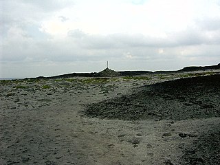
Bleaklow is a high, largely peat-covered, gritstone moorland in the Derbyshire High Peak near the town of Glossop. It is north of Kinder Scout, across the Snake Pass (A57), and south of the A628 Woodhead Pass. Much of it is nearly 2,000 feet (610 m) above sea level and the shallow bowl of Swains Greave on its eastern side is the source of the River Derwent.

ROF Glascoed was built as a UK government-owned, Royal Ordnance Factory (ROF). It was designed as one of 20 munitions filling factories. It was planned as a permanent ROF with the intention that, unlike some other similar facilities, it would remain open for production after the end of World War II. After privatisation of the Royal Ordnance Factories in the 1980s it became part of Royal Ordnance plc and later a production unit of BAE Systems.

<span class="mw-page-title-main">RAF Welford</span> Royal Air Force station in Berkshire

Royal Air Force Welford or more simply RAF Welford is an active Royal Air Force station in Berkshire, England. The station is located approximately 6 miles (10 km) northwest of Newbury; about 50 miles (80 km) west of London
<span class="mw-page-title-main">Harpur Hill</span> Human settlement in England

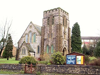
Harpur Hill is a small village on the outskirts of Buxton, Derbyshire, England. It is in the Cote Heath ward of the High Peak Borough Council. It has a primary school, a park, a pub, a working men's club and a Methodist church.

The logistics organisations of the Royal Air Force in World War II were No. 42 Group RAF and RAF Maintenance Command.

Operation Sandcastle was a United Kingdom non-combat military operation conducted between 1955–1956. Its purpose was to dispose of chemical weapons by dumping them in the sea.

Royal Air Force Ashbourne, or more simply RAF Ashbourne, is a former Royal Air Force station located approximately 1.5 miles (2.4 km) south-east of the town of Ashbourne, Derbyshire, England.

Buxton & Leek College is a college of Further and Higher Education operating at their campuses and facilities in Buxton, Derbyshire, Leek, Staffordshire and Derby, Derbyshire. The college is part of the University of Derby.

<span class="mw-page-title-main">Harpur Hill Quarry</span> Disused limestone quarry in Derbyshire, England

Harpur Hill Quarry is a disused limestone quarry on Harpur Hill, Derbyshire, England. Limestone was extracted there from 1835 to 1952 for lime burning at lime kilns to produce quicklime. The quarry was used by the Royal Air Force as a chemical weapons storage depot during the Second World War, the largest such depot in the United Kingdom. Afterwards a number of captured German chemical munitions were disposed of at the site by burning, which was only partially successful. The RAF depot closed in 1960 and the site is now vacant.

<span class="mw-page-title-main">Sywell Aviation Museum</span> Aviation museum in Sywell Aerodrome, Northamptonshire

Sywell Aviation Museum is based at Sywell Aerodrome in Northamptonshire, England. It is sited in the aircraft viewing car park at the aerodrome. It documents the history of flying in Northamptonshire from the early days to the present day with particular emphasis on the Second World War. The museum is run by the Sywell Aviation Museum Trust and is run by volunteers; it is closed during the winter months and reopens each Easter Saturday.

<span class="mw-page-title-main">RAF Bowes Moor</span> Former Royal Air Force munitions site in County Durham, England

RAF Bowes Moor was a chemical warfare agent (CWA) storage site run by the Royal Air Force during and after the Second World War. The site was to the north of the village of Bowes in what is now County Durham, England. The Bowes Moor geographical feature runs from the north to the south west of the village. The Royal Air Force used the site to stock its chemical weapon supply, most of which was disposed of in situ by burning. The site, which closed in 1947, is known for the dangerous chemicals which leached into the soil.
<span class="mw-page-title-main">Lost buildings of Buxton</span> List of former notable buildings in Buxton, Derbyshire

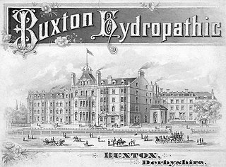
This is a partial list of prominent buildings in Buxton, Derbyshire which have been demolished or ruined.

<span class="mw-page-title-main">Bleaklow Bomber</span> Aircraft crash in the Peak District

The Bleaklow Bomber was a US Air Force (USAF) Boeing RB-29A Superfortress that crashed near Higher Shelf Stones on Bleaklow in the Peak District in 1948. It was modified as a reconnaissance aircraft, rather than a bomber.

<span class="mw-page-title-main">Peak District Mountain Rescue Organisation</span> Charity operating search and rescue missions

The Peak District Mountain Rescue Organisation (PDMRO) is a UK registered charity which was formed in 1964. The purpose of PDMRO is "to save life and alleviate distress, primarily in Upland and Mountain areas". This is achieved by conducting search and rescue missions for walkers, climbers and missing persons in and around the Peak District National Park.

<span class="mw-page-title-main">Buxton Mountain Rescue Team</span> Charity operating search and rescue missions

The Buxton Mountain Rescue Team is a UK registered charity operating search and rescue missions from its base at Dove Holes near Buxton in Derbyshire. The team covers an area of about 400 square miles across Derbyshire, Staffordshire and Cheshire.

<span class="mw-page-title-main">High Edge</span> Hill in the Derbyshire Peak District

High Edge is a limestone hill overlooking Harpur Hill, Buxton in Derbyshire, in the Peak District. The summit is 472 metres (1,549 ft) above sea level. The lower hilltop is marked by a cairn.

<span class="mw-page-title-main">RAF Helperby</span> Former RAF base in Yorkshire, England

RAF Helperby, was a First World War era airfield near to the villages of Brafferton and Helperby in North Yorkshire, England. It was used initially by No. 33 Squadron RAF, and then later by No. 76 Squadron RAF in the home defence (HD) role. During the Second World War, the site was used as an ammunition supply depot, being operated by No. 92 Maintenance Unit RAF, and also by the USAAF. The site was known to have stored mustard gas and other chemical weapons during the period of the Second World War.

References

  1. "R.A.F. Maintenance Unit 28 – Harpur Hill". Buxton Civic Association. 16 June 2015. Retrieved 7 November 2020.
  2. "RAF Harpur Hill – Regiment History, War & Military Records & Archives". www.forces-war-records.co.uk. Retrieved 7 November 2020.
  3. 1 2 "Harpur Hill". Buxton Civic Association. 16 June 2015. Retrieved 7 November 2020.
  4. "Harpur Hill". www.bigginhall.co.uk. Retrieved 7 November 2020.
  5. 1 2 Neville, Lea (2002). Return To Buxton - 28 MU RAF Harpur Hill. Woodcote Press. pp. 2–4, 13, 57, 70–71.
  6. "Tribute by Lancaster". Buxton Advertiser. 13 July 2011. Archived from the original on 23 August 2011. Retrieved 27 February 2020.
  7. "Llanberis Bomb Store – Subterranea Britannica". www.subbrit.org.uk. Retrieved 7 November 2020.
  8. "RB-29A 44-61999, Higher Shelf Stones, The Team was closed in 1960 when it moved to RAF Stafford.Bleaklow". Peak District Air Accident Research. 8 August 2016. Retrieved 19 June 2020.
  9. "Superfortress RB-29 44-61999 'Over-Exposed!' air crash site on Bleaklow – photos, history, directions and grid references". aircrashsites.co.uk. 1 June 2013. Retrieved 19 June 2020.
  10. "RAF Harpur Hill" (PDF). Buxton Mountain Rescue Team. Retrieved 15 November 2020.
  11. 1 2 "Harpur Hill – Buxton Online – Peak District". www.buxtononline.net. Retrieved 7 November 2020.
  12. "Fond memories of Harpur Hill's mushroom farm". www.buxtonadvertiser.co.uk. Retrieved 7 November 2020.
  13. Leach, John (1987). The Book of Buxton. Baracuda Books Limited. p. 106. ISBN   0-86023-286-7.
  14. "High Peak College - GOV.UK". www.get-information-schools.service.gov.uk. Retrieved 25 February 2021.
  15. "HSE: Timeline". www.hse.gov.uk. Retrieved 19 June 2020.