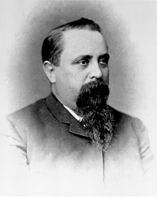
José María de Echeandía (?–1871) was twice Mexican governor of Alta California from 1825 to 1831 and again from 1832 to 1833. He was the only governor of California that lived in San Diego.

Rancho de los Palos Verdes was a 31,629-acre (128.00 km2) Mexican land grant in present-day Los Angeles County, California given in 1846 by Governor Pío Pico to José Loreto and Juan Capistrano Sepulveda. The name means "ranch of the green trees". The grant encompassed the present-day cities of the Palos Verdes Peninsula, as well as portions of San Pedro and Torrance.

Don Manuel Domínguez e Ybáñez (1803–1882) was a Californio ranchero, politician, and a signer of the Californian Constitution in 1849. He served as two terms as Alcalde of Los Angeles (mayor). He was one of the largest landowners in Southern California, having inherited Rancho San Pedro in 1825, one of the largest ranchos in California. He was one of the founders of the cities of Carson and Compton and of the fishing village of San Pedro. Today, California State University, Dominguez Hills and the communities of Rancho Dominguez, East Rancho Dominguez, and West Rancho Dominguez bear his family's name.

Rancho San Pedro was one of the first California land grants and the first to win a patent from the United States. The Spanish Crown granted the 75,000 acres (300 km2) of land to soldier Juan José Domínguez in 1784, with his descendants validating their legal claim with the Mexican government at 48,000 acres (190 km2) in 1828, and later maintaining their legal claim through a United States patent validating 43,119 acres (174.50 km2) in 1858. The original Spanish land grant included what today consists of the Pacific coast cities of Los Angeles harbor, San Pedro, the Palos Verdes peninsula, Torrance, Redondo Beach, Hermosa Beach, and Manhattan Beach, and east to the Los Angeles River, including the cities of Lomita, Gardena, Harbor City, Wilmington, Carson, Compton, and western portions of Long Beach and Paramount.
Jose Manuel Nieto (1734–1804) was a soldier from the Presidio of San Diego who was assigned to the Mission San Gabriel at the time his land was granted by the Spanish Empire in 1784.

Rancho Los Alamitos takes its name from an 1834 Mexican partition of the 1784 Rancho Los Nietos, a Spanish concession, covering an area in present-day California's southwestern Los Angeles County and northwestern Orange County. Los Alamitos means the Little Cottonwoods or Poplars in Spanish, after the native Fremont Cottonwood trees there.
Rancho San Pascual, also known as Rancho el Rincón de San Pascual, was a 14,403-acre (58.29 km2) Mexican land grant in present-day Los Angeles County, California given to Juan Marine in 1834 by Mexican Governor José Figueroa. The former Rancho San Pascual land includes present-day cities of Pasadena, South Pasadena, and portions of San Marino, and the unincorporated communities of Altadena and San Pasqual.

Rancho Cañón de Santa Ana was a 13,328-acre (53.94 km2) land grant in present-day Orange County, California given by Mexican governor José Figueroa in 1834 to Bernardo Yorba. The name means "Canyon of Santa Ana". The grant included present-day Yorba Linda.

Rancho La Puente was a ranch in the southern San Gabriel Valley that measured just under 49,000 acres (200 km2), and remained intact from its establishment in the late 1700s as an outpost of Mission San Gabriel until about 1870. By modern landmarks, the ranch extended from San Gabriel River on the west to just west of the 57 Freeway on the east and from Ramona Boulevard/San Bernardino Road on the north to the Puente Hills on the south. All but 40 acres (160,000 m2), which fall within Orange County, are within Los Angeles County. The present communities of Avocado Heights, Bassett, Baldwin Park, San Dimas, Rowland Heights, Hacienda Heights, City of Industry, La Puente, Walnut, Covina, West Covina, and small sections of South El Monte and Irwindale are contained within the old boundaries of Rancho La Puente.

Rancho Rincón de los Bueyes was a 3,127-acre (12.65 km2) land grant in present-day Los Angeles County, California, given in 1821 to Bernardo Higuera and Cornelio Lopez by Pablo Vicente de Sola, the Spanish Governor of Alta California. In 1843, this Spanish grant was confirmed by Mexican Governor Manuel Micheltorena. Rincón, translated from Spanish, means corner or nook, and Bueyes are oxen or steer.
Rancho Santa Gertrudes was a 21,298-acre (86.19 km2) 1834 Mexican land grant, in present-day Los Angeles County, California, resulting from a partition of Rancho Los Nietos. A former site of Nacaugna, the rancho lands included the present-day cities of Downey, Santa Fe Springs and the northern part of Norwalk.
Rancho Los Coyotes was a 48,806-acre (197.51 km2) 1834 Mexican land grant resulting from the partition of the Rancho Los Nietos grant, in present-day southeastern Los Angeles County and northwestern Orange County, California. The rancho lands include the present-day cities of Cerritos, La Mirada, Artesia, Stanton, and Buena Park.
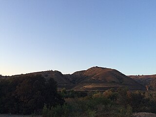
Rancho Los Cerritos was a 27,054-acre (109.48 km2) 1834 land grant in present-day southern Los Angeles County and Orange County, California The grant was the result of a partition of the Rancho Los Nietos grant. "Cerritos" means "little hills" in Spanish. The rancho lands include the present-day cities of Cerritos, Paramount, Bellflower and Long Beach.

Rancho Las Bolsas was a 33,460-acre (135.4 km2) 1834 Mexican land grant resulting from the partition of Rancho Los Nietos, located from the coast on inland within present day northwestern Orange County, California. The Spanish name "las bolsas" means "the pockets", and refers to pockets of land amongst the marsh wetlands of the Santa Ana River estuary. The rancho lands, adjacent to the southeast of Rancho La Bolsa Chica, include the present day cities of Huntington Beach, Garden Grove, Fountain Valley and Westminster.

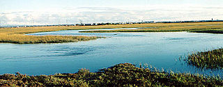
Rancho La Bolsa Chica was an 8,107-acre (32.81 km2) Mexican land grant in present day coastal northwestern Orange County, California given in 1841 by Governor Juan Alvarado to Joaquín Ruiz. The name means "little pocket", and refers to pockets of land amongst the marsh wetlands of the Santa Ana River estuary. The rancho lands include the present day city of Huntington Beach, the community of Sunset Beach, and the significant Bolsa Chica Ecological Reserve.

Rancho Paso de Bartolo also called Rancho Paso de Bartolo Viejo was a 10,075-acre (40.77 km2) Mexican land grant in present-day Los Angeles County, California given in 1835 by Governor Jose Figueroa to Juan Crispin Perez. The name refers to a San Gabriel River ford called Paso de Bartolo Viejo. The rancho includes present-day Montebello, Whittier, and Pico Rivera.

The Mexican Secularization Act of 1833, officially called the Decree for the Secularization of the Missions of California, was an act passed by the Congress of the Union of the First Mexican Republic which secularized the Californian missions. The act nationalized the missions, transferring their ownership from the Franciscan Order of the Catholic Church to the Mexican authorities.

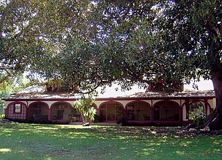
Jose Dolores Sepulveda Adobe is an adobe home built in 1818. It is located at the Rancho de los Palos Verdes in Torrance, California. The Jose Dolores Sepulveda Adobe was designated a California Historic Landmark on Jan. 03, 1944. The Jose Dolores Sepulveda Adobe was built by José Dolores Sepúlveda de Redondo, his son was Mayor of Los Angeles from 1837 to 1848. José Dolores Sepúlveda's father was José Loreto Sepúlveda (1764–1808). The location is now a private residence in Torrance. The original Adobe is gone, but the current homeowner renovated the house to reflect the Rancho history. Rancho de los Palos Verdes means "range of green trees". The Rancho is now the present-day cities of the Palos Verdes Peninsula, as well as portions of San Pedro and Torrance.

The Sepúlveda family is a prominent Californio family of Southern California. Members of the family held extensive rancho grants and numerous important positions, including Alcalde de Los Ángeles, California State Assemblymen, and Los Angeles County Supervisor.

The ranchos of Los Angeles County were large-scale land grants made by the governments of Spain and Mexico between 1784 and July 7, 1846, to private individuals within the current boundary lines of Los Angeles County in California, United States.


