
South Tipperary was a county in Ireland in the province of Munster. It was named after the town of Tipperary and consisted of 52% of the land area of the traditional county of Tipperary. South Tipperary County Council was the local authority for the county. The population of the county was 88,433 according to the 2011 census. It was abolished on 1 June 2014, and amalgamated with North Tipperary to form County Tipperary under a new Tipperary County Council.

Dún Laoghaire–Rathdown is a county in Ireland. It is in the province of Leinster and the Eastern and Midland Region. It is one of three successor counties to County Dublin, which was disestablished in 1994. It is named after the former borough of Dún Laoghaire and the barony of Rathdown. Dún Laoghaire–Rathdown County Council is the local authority for the county. The population of the county was 233,860 at the time of the 2022 census.
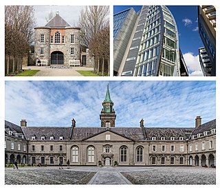
Kilmainham is a south inner suburb of Dublin, Ireland, south of the River Liffey and west of the city centre. It is in the city's Dublin 8 postal district. The area was once known as Kilmanum.

Rathmines is an affluent inner suburb on the Southside of Dublin in Ireland. It begins at the southern side of the Grand Canal and stretches along the Rathmines Road as far as Rathgar to the south, Ranelagh to the east, and Harold's Cross to the west. It is situated in the city's D06 postal district.

Dublin North was a parliamentary constituency represented in Dáil Éireann, the lower house of the Irish parliament or Oireachtas, from 1981 to 2016, representing an area in the north of County Dublin. A previous constituency of the same existed in Dublin City from 1923 to 1937. The method of election was proportional representation by means of the single transferable vote (PR-STV).

Irishtown is an inner suburb of Dublin, Ireland. It is situated on the southside of the River Liffey, between Ringsend to the north and Sandymount to the south, and is to the east of the River Dodder.
Town commissioners were elected local government bodies that existed in urban areas in Ireland from the 19th century until 2002. Larger towns with commissioners were converted to urban districts by the Local Government (Ireland) Act 1898, with the smaller commissions continuing to exist beyond partition in 1922. The idea was a standardisation of the improvement commissioners established in an ad-hoc manner for particular towns in Britain and Ireland in the eighteenth century. The last town commissioners in Northern Ireland were abolished in 1962. In the Republic of Ireland, the remaining commissions became town councils in 2002, and abolished in 2014.
North Dublin, a division of County Dublin, is a former parliamentary constituency which returned one Member of Parliament (MP) to the House of Commons of the United Kingdom from 1885 until 1922. From 1918 to 1921, it was also used as a constituency for Dáil Éireann. From the dissolution of 1922, the area was not represented in the UK Parliament.
Rathmines, a division of County Dublin based on the urban district of Rathmines and Rathgar, was a parliamentary constituency in Ireland. It returned one Member of Parliament (MP) to the House of Commons of the Parliament of the United Kingdom from 1918 to 1922.

Pembroke Township was an area adjoining the city of Dublin, Ireland, formed for local government purposes by private Act of Parliament in 1863. The township took its name from the fact that most of the area was part of the estate of the Earl of Pembroke. It was governed by town commissioners until 1899 when it became an Urban District. In 1930 Pembroke Township was absorbed by the City and County Borough of Dublin.
Dublin County was a parliamentary constituency represented in Dáil Éireann, the lower house of the Irish parliament or Oireachtas from 1921 to 1969. The method of election was proportional representation by means of the single transferable vote (PR-STV).

Dún Laoghaire–Rathdown County Council is the authority responsible for local government in the county of Dún Laoghaire–Rathdown, Ireland. It is one of three local authorities that succeeded the former Dublin County Council on its abolition on 1 January 1994 and one of four councils in the old County Dublin. As a county council, it is governed by the Local Government Act 2001. The council is responsible for housing and community, roads and transportation, urban planning and development, amenity and culture, and environment. The council has 40 elected members. Elections are held every five years and are by single transferable vote. The head of the council has the title of Cathaoirleach (chairperson). The county administration is headed by a Chief Executive, Frank Curran. The county town is Dún Laoghaire. It serves a population of approximately 206,260.
Dublin Townships was a parliamentary constituency represented in Dáil Éireann, the lower house of the Irish parliament or Oireachtas from 1937 to 1948. The constituency elected 3 deputies to the Dáil, using proportional representation by means of the single transferable vote (PR-STV).
Dún Laoghaire and Rathdown was a parliamentary constituency represented in Dáil Éireann, the lower house of the Irish parliament or Oireachtas from 1948 to 1977. The constituency elected 3 deputies to the Dáil, on the system of proportional representation by means of the single transferable vote (PR-STV).

Rathdown is the south-easternmost barony in County Dublin, Ireland. It gives its name to the county of Dún Laoghaire–Rathdown. Before County Wicklow was shired in 1606, Rathdown extended further south: it was named after a medieval settlement which grew up around Rathdown Castle, at a site subsequently deserted and now in County Wicklow in the townland of Rathdown Upper, north of Greystones. The Wicklow barony of Rathdown corresponds to the portion transferred to the new county; although both divisions were originally classed as "half baronies", in the nineteenth century the distinction between a barony and a half barony was obsolete.
The Local Government (Dublin) Act 1930 is an Act of the Oireachtas which altered the administration of County Dublin and Dublin City.
Killiney and Ballybrack is a former second-tier local government area within County Dublin. It was created as a township in 1866. In 1899, it became an urban district. It was abolished in 1900, with its area becoming part of the borough of Dún Laoghaire.
Local government in Dublin, the capital city of Ireland, is currently administered through the local authorities of four local government areas. The historical development of these councils dates back to medieval times.
Urban and rural districts were divisions of administrative counties in Ireland created in 1899. These local government areas elected urban district councils (UDCs) and rural district councils (RDCs) respectively which shared responsibilities with a county council. They were established when all of Ireland was part of the United Kingdom.
