Rentiesville, Oklahoma

Last updated

Rentiesville, Oklahoma
OKMap-doton-Rentiesville.PNG
Location of Rentiesville, Oklahoma
Coordinates: 35°32′01″N95°29′05″W / 35.53361°N 95.48472°W / 35.53361; -95.48472
Country United States
State Oklahoma
County McIntosh
Area
[1]
  Total1.67 sq mi (4.32 km2)
  Land1.67 sq mi (4.32 km2)
  Water0.00 sq mi (0.00 km2)
Elevation
[2]
594 ft (181 m)
Population
 (2020)
  Total103
  Density61.75/sq mi (23.84/km2)
Time zone UTC-6 (Central (CST))
  Summer (DST) UTC-5 (CDT)
ZIP code
74459
Area code(s) 539/918
FIPS code 40-62950 [3]
GNIS feature ID2412543 [2]

Rentiesville is a town in McIntosh County, Oklahoma, United States. It was founded in 1903 and named for William Rentie, a local landowner. It was one of 50 all-black towns in Oklahoma and one of 13 that still survives. [4] The population was 128 at the 2010 census, an increase of 25.5 percent from 102 in 2000. [5]

Contents

History

The Civil War Battle of Honey Springs was fought about a half mile east of present-day Rentiesville and south of Oktaha, near the county line; [6] the Honey Springs Battlefield is on the National Register of Historic Places listings in Muskogee County, Oklahoma. Honey Springs was Oklahoma's largest Civil War engagement. [7]

Rentiesville was founded as an all-black town in 1903 on land owned by William Rentie and Phoebe McIntosh. The post office opened May 11, 1904, and the town became a flag stop on the Missouri-Kansas-Texas Railroad. William Rentie was the town's only lawman until 1908, when he was shot and killed by a man he had arrested for being drunk and disorderly. [4]

In 1990, the population was 69. [8]

Geography

Rentiesville is located five miles north-northeast of Checotah, a short distance east of U.S. Route 69. [4] [9]

The Honey Springs Battlefield is less than a mile north of town, off 11th Street. [9]

According to the United States Census Bureau, the town has a total area of 1.7 square miles (4.4 km2), all land.

Demographics

Historical population
CensusPop.Note
1910 411
1920 255−38.0%
1930 154−39.6%
1940 18016.9%
1950 156−13.3%
1960 122−21.8%
1970 96−21.3%
1980 78−18.7%
1990 66−15.4%
2000 10254.5%
2010 12825.5%
2020 103−19.5%
U.S. Decennial Census [10]

As of the census [3] of 2000,[ needs update ] there were 102 people, 42 households, and 27 families residing in the town. The population density was 59.2 inhabitants per square mile (22.9/km2). There were 51 housing units at an average density of 29.6 per square mile (11.4/km2). The racial makeup of the town was 64.71% African American, 27.45% White, 4.90% Native American, and 2.94% from two or more races.

There were 42 households, out of which 21.4% had children under the age of 18 living with them, 42.9% were married couples living together, 19.0% had a female householder with no husband present, and 35.7% were non-families. 31.0% of all households were made up of individuals, and 14.3% had someone living alone who was 65 years of age or older. The average household size was 2.43 and the average family size was 3.00.

In the town, the population was spread out, with 25.5% under the age of 18, 5.9% from 18 to 24, 23.5% from 25 to 44, 24.5% from 45 to 64, and 20.6% who were 65 years of age or older. The median age was 42 years. For every 100 females, there were 92.5 males. For every 100 females age 18 and over, there were 85.4 males.

The median income for a household in the town was $23,750, and the median income for a family was $31,250. Males had a median income of $6,250 versus $36,250 for females. The per capita income for the town was $21,862. There were 26.9% of families and 24.4% of the population living below the poverty line, including 24.0% of under eighteens and 23.1% of those over 64.

Notable people

D.C. Minner at his Dusk 'til Dawn Blues Festival. DC Minner.jpg
D.C. Minner at his Dusk 'til Dawn Blues Festival.

See also

Related Research Articles

<span class="mw-page-title-main">McIntosh County, Oklahoma</span> County in Oklahoma, United States

McIntosh County is a county located in the U.S. state of Oklahoma. As of the 2020 census, the population was 18,941. Its county seat is Eufaula. The county is named for an influential Muscogee Creek family, whose members led the migration of the Lower Towns to Indian Territory and served as leaders for generations.

<span class="mw-page-title-main">Springer, Oklahoma</span> Town in Oklahoma, United States

Springer is a town in Carter County, Oklahoma, United States. As of the 2020 census, the community had 685 residents. It is part of the Ardmore, Oklahoma Micropolitan Statistical Area.

<span class="mw-page-title-main">Shady Grove, Cherokee County, Oklahoma</span> Census-designated place in Oklahoma, United States

Shady Grove is an unincorporated community and census-designated place (CDP) in Cherokee County, Oklahoma, United States. The population was 556 at the 2010 census. This is not to be confused with the similarly-named Shady Grove in McIntosh County, or the Shady Grove in Pawnee County.

<span class="mw-page-title-main">Hunter, Oklahoma</span> Town in Oklahoma, United States

Hunter is a town in Garfield County, Oklahoma, United States. The population was 165 at the 2010 census, a 4.6 percent decline from the figure of 173 in 2000.

<span class="mw-page-title-main">Erin Springs, Oklahoma</span> Town in Oklahoma, United States

Erin Springs is a town in Garvin County, Oklahoma, United States. The population was 87 at the 2010 census, a decline of 23.7 percent from the figure of 114 in 2000.

<span class="mw-page-title-main">Checotah, Oklahoma</span> Town in Oklahoma, United States

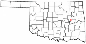
Checotah is a town in McIntosh County, Oklahoma, United States. It was named for Samuel Checote, the first chief of the Creek Nation elected after the Civil War. Its population was 3,481 at the 2000 census. According to Census 2010, the population has decreased to 3,335; a 4.19% loss.

<span class="mw-page-title-main">Hanna, Oklahoma</span> Town in Oklahoma, United States

Hanna is a town in southwestern McIntosh County, Oklahoma, United States. Its population was 102 at the time of the 2020 Census. It was named for Hanna Bullett, the daughter of a prominent early resident.

<span class="mw-page-title-main">Hitchita, Oklahoma</span> Town in Oklahoma, United States

Hitchita is a town in McIntosh County, Oklahoma, United States. The Encyclopedia of Oklahoma History and Culture says that the town was named for a band of Muskhogean Indians that had been absorbed into the Creek tribe. The population was 88 at the 2010 census, a decline of 22.1 percent from 113 in 2000.

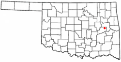
Shady Grove is a census-designated place (CDP) in McIntosh County, Oklahoma, United States. The population was 199 at the 2010 census, a decrease of 14.4 percent from 229 in 2000. This is not to be confused with the similarly-named Shady Grove in Cherokee County, or the Shady Grove in Pawnee County.

<span class="mw-page-title-main">Stidham, Oklahoma</span> Town in Oklahoma, United States

Stidham is a town in McIntosh County, Oklahoma, United States. The population was 16 at the 2010 census, a decline of 21.7 percent from 23 in 2000.

<span class="mw-page-title-main">Council Hill, Oklahoma</span> Town in Oklahoma, United States

Council Hill is a town in Muskogee County, Oklahoma, United States. The population was 158 at the 2010 census, an increase of 28.5 percent over the figure of 129 recorded in 2000.

<span class="mw-page-title-main">Summit, Oklahoma</span> Town in Oklahoma, United States

Summit is a town in Muskogee County, Oklahoma, United States. It was originally called South Muskogee when it was platted in 1910, and is one of thirteen all-black towns still surviving at the beginning of the 21st Century. The population was 139 at the 2010 census, a 38.5 percent decline from the figure of 226 recorded in 2000. Summit, is located in Muskogee County six miles southwest of the city of Muskogee. The community retained a post office as early as 1896. Like many of the other Black towns previously mentioned, was a stopover destination on the Missouri, Kansas and Texas Railway and had a depot in the community. It is said that the town may have been named Summit because it was the highest point on the railroad between Arkansas and the North Canadian rivers.

<span class="mw-page-title-main">Clearview, Oklahoma</span> Town in Oklahoma, United States

Clearview is a town in Okfuskee County, Oklahoma, United States. The population was 41 at the 2020 Census. It was historically an all-black freedmen's town and was platted by the Lincoln Townsite Company and designated as Lincoln.

<span class="mw-page-title-main">Grayson, Oklahoma</span> Town in Oklahoma, United States

Grayson is a town in Okmulgee County, Oklahoma, United States. The population was 127 at the 2020 census.

<span class="mw-page-title-main">Hoffman, Oklahoma</span> Town in Oklahoma, United States

Hoffman is a town in Okmulgee County, Oklahoma, United States. The population was 81 at the 2020 census.

<span class="mw-page-title-main">Shady Grove, Pawnee County, Oklahoma</span> Unincorporated community in Oklahoma, United States

Shady Grove was a town in southeastern Pawnee County, Oklahoma, United States, near Lake Keystone. The population was 44 at the 2000 census. In the 2010 census, its population had dropped to 2, and a 2011 news report stated that one of those two had left since the census, leaving it the smallest town in the state. The report explained that the owner of the seven mobile home lots that made up the town had incorporated it in 1997 to avoid being absorbed into a larger municipality, but had dissolved the town in 2006 and died in 2009, and nearly all the tenants had departed. This is not to be confused with the similarly-named Shady Grove in Cherokee County, or the Shady Grove in McIntosh County.

<span class="mw-page-title-main">Brooksville, Oklahoma</span> Town in Oklahoma, United States

Brooksville is a town in Pottawatomie County, Oklahoma, United States. It is one of the thirteen existing all-black towns in Oklahoma. The population was 63 at the 2010 census, a 30 percent decline from the figure of 90 in 2000.

<span class="mw-page-title-main">Strong City, Oklahoma</span> Town in Oklahoma, United States

Strong City is a town in Roger Mills County, Oklahoma, United States. As of the 2020 census, the town’s population was 33.

<span class="mw-page-title-main">Redbird, Oklahoma</span> Town in Oklahoma, United States

Redbird is a town in Wagoner County, Oklahoma, United States. The population was 137 at the 2010 census, a 10.5 percent decline from the figure of 153 in 2000. Founded at the turn of the 20th century, it was one of more than fifty all-black towns in Oklahoma Territory and Indian Territory and is one of thirteen surviving black communities in Oklahoma.

<span class="mw-page-title-main">Spring Prairie, Wisconsin</span> Town in Wisconsin, United States

Spring Prairie is a town in Walworth County, Wisconsin, United States. The population was 2,123 at the 2020 census. The unincorporated communities of Spring Prairie and Voree are located in the town. The unincorporated communities of Honey Creek and Honey Lake are also located partially in the town.

References

  1. "ArcGIS REST Services Directory". United States Census Bureau. Retrieved September 20, 2022.
  2. 1 2 U.S. Geological Survey Geographic Names Information System: Rentiesville, Oklahoma
  3. 1 2 "U.S. Census website". United States Census Bureau . Retrieved January 31, 2008.
  4. 1 2 3 4 5 O'Dell, Larry. Encyclopedia of Oklahoma History and Culture. Rentiesville. Accessed August 27, 2012.
  5. CensusViewer: Population of the City of Rentiesville, Oklahoma
  6. "Honey Springs, Blue River suddenly on federal radar | Tulsa World". Archived from the original on November 6, 2011.
  7. "Honey Springs, Battle of". Archived from the original on October 18, 2010. Retrieved October 2, 2010.
  8. "Honey Springs Battlefield Park - 1997 Master Plan Report." Hama, Karen and R. Brian Culpepper. Prepared by: The Center for Advanced Spatial Technologies, University of Arkansas, Fayetteville, Arkansas. 1997. Retrieved August 26, 2014.
  9. 1 2 "Honey Springs Battlefield". Google Maps. Retrieved August 12, 2020.
  10. "Census of Population and Housing". Census.gov. Retrieved June 4, 2015.
  11. Scholar Takes On His Toughest Study of Race - New York Times
  12. blues festival Archived September 1, 2010, at the Wayback Machine - accessed Sep 2010