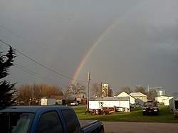
Richland, Nebraska | |
---|---|
Coordinates: 41°26′13″N97°12′54″W / 41.43694°N 97.21500°W | |
Country | United States |
State | Nebraska |
County | Colfax |
Area | |
• Total | 0.21 sq mi (0.55 km2) |
• Land | 0.21 sq mi (0.55 km2) |
• Water | 0.00 sq mi (0.00 km2) |
Elevation | 1,398 ft (426 m) |
Population (2020) | |
• Total | 70 |
• Density | 327.10/sq mi (126.31/km2) |
Time zone | UTC-6 (Central (CST)) |
• Summer (DST) | UTC-5 (CDT) |
FIPS code | 31-41375 [3] |
GNIS feature ID | 2399065 [2] |
Richland is a village in Colfax County, Nebraska, United States. The population was 73 at the 2010 census.
Richland was once known as Benton. It was a shipping point on the Union Pacific Railroad. [4] A post office was established at Richland in 1870. [5]
According to the United States Census Bureau, the village has a total area of 0.21 square miles (0.54 km2), all land. [6]
Census | Pop. | Note | %± |
---|---|---|---|
1910 | 156 | — | |
1920 | 133 | −14.7% | |
1930 | 174 | 30.8% | |
1940 | 160 | −8.0% | |
1950 | 141 | −11.9% | |
1960 | 139 | −1.4% | |
1970 | 123 | −11.5% | |
1980 | 114 | −7.3% | |
1990 | 96 | −15.8% | |
2000 | 89 | −7.3% | |
2010 | 73 | −18.0% | |
2020 | 70 | −4.1% | |
U.S. Decennial Census [7] |
As of the census [8] of 2010, there were 73 people, 36 households, and 22 families residing in the village. The population density was 347.6 inhabitants per square mile (134.2/km2). There were 43 housing units at an average density of 204.8 per square mile (79.1/km2). The racial makeup of the village was 94.5% White, 1.4% African American, 2.7% from other races, and 1.4% from two or more races. Hispanic or Latino of any race were 5.5% of the population.
There were 36 households, of which 16.7% had children under the age of 18 living with them, 52.8% were married couples living together, 5.6% had a female householder with no husband present, 2.8% had a male householder with no wife present, and 38.9% were non-families. 33.3% of all households were made up of individuals, and 13.9% had someone living alone who was 65 years of age or older. The average household size was 2.03 and the average family size was 2.55.
The median age in the village was 51.8 years. 13.7% of residents were under the age of 18; 5.4% were between the ages of 18 and 24; 11% were from 25 to 44; 46.5% were from 45 to 64; and 23.3% were 65 years of age or older. The gender makeup of the village was 57.5% male and 42.5% female.
As of the census [3] of 2000, there were 89 people, 45 households, and 27 families residing in the village. The population density was 407.2 inhabitants per square mile (157.2/km2). There were 50 housing units at an average density of 228.8 per square mile (88.3/km2). The racial makeup of the village was 97.75% White, 1.12% African American and 1.12% Native American. Hispanic or Latino of any race were 1.12% of the population.
There were 45 households, out of which 17.8% had children under the age of 18 living with them, 55.6% were married couples living together, 2.2% had a female householder with no husband present, and 40.0% were non-families. 31.1% of all households were made up of individuals, and 11.1% had someone living alone who was 65 years of age or older. The average household size was 1.98 and the average family size was 2.48.
In the village, the population was spread out, with 12.4% under the age of 18, 7.9% from 18 to 24, 28.1% from 25 to 44, 33.7% from 45 to 64, and 18.0% who were 65 years of age or older. The median age was 46 years. For every 100 females, there were 128.2 males. For every 100 females age 18 and over, there were 122.9 males.
As of 2000 the median income for a household in the village was $26,042, and the median income for a family was $33,125. Males had a median income of $23,750 versus $25,625 for females. The per capita income for the village was $15,822. There were no families and 5.9% of the population living below the poverty line, including no under eighteens and 10.0% of those over 64.
Richland County is a county located in the U.S. state of Ohio. As of the 2020 census, the population was 124,936. Its county seat is Mansfield. The county was created in 1808 and later organized in 1813. It is named for the fertile soil found there.
Colfax County is a county in the U.S. state of Nebraska. As of the 2020 United States Census, the population was 10,582. Its county seat is Schuyler. The county and its seat are named after US Vice President (1869-1873) Schuyler Colfax.
Calhoun is a village in Richland County, Illinois, United States. The population was 222 at the 2000 census.
Parkersburg is a village in Richland County, Illinois, United States. As of the 2000 census, the village population was 234.
Colfax Township is a civil township of Benzie County in the U.S. state of Michigan. The population was 504 at the 2020 census. Colfax Township contains half of the village of Thompsonville, and the entire community of Nessen City
Richland is a village in Kalamazoo County in the U.S. state of Michigan. The population was 751 at the 2010 census, up from 593 at the 2000 census.
Prescott is a village in Ogemaw County of the U.S. state of Michigan. The population was 266 at the 2010 census. The village is located within Richland Township.
New Richland is a city in Waseca County, Minnesota, United States. The city was founded in 1877. The population was 1,203 at the 2010 census.
Rogers is a village in Colfax County, Nebraska, United States. The population was 95 at the 2010 census.
Abercrombie is a city in Richland County, North Dakota, United States. The population was 244 at the 2020 census. Abercrombie was founded in 1884.
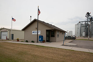
Colfax is a city in Richland County, North Dakota, United States. The population was 172 at the 2020 census. Colfax was founded in 1881. It is part of the Wahpeton, ND–MN Micropolitan Statistical Area. In the mid-1960s it billed itself as the "smallest town in the U.S. with a public swimming pool".
Richland is a city in Baker County, Oregon, United States. The population was 156 at the 2010 census.
Boaz is a village in Richland County, Wisconsin, United States. According to the 2010 census, the population of the village was 156.
Yuba is a village in Richland County, Wisconsin, United States. The population was 74 at the 2010 census. Yuba is 11 miles southwest of Hillsboro and 17 miles north of Richland Center. County Hwy C runs through the village.
Richland is a town in Rusk County, Wisconsin, United States. The population was 206 at the 2000 census. The village of Ingram is located in the town.
Plymouth is a village in Huron and Richland counties in the U.S. state of Ohio. The population was 1,707 at the 2020 census.
Cazenovia is a village in Richland and Sauk Counties in the U.S. state of Wisconsin. The population was 318 at the 2010 census. Of this, 314 were in Richland County, and only 4 were in Sauk County.
Viola is a village in Richland (mostly) and Vernon Counties in the U.S. state of Wisconsin, United States. The population was 699 at the 2010 census. Of this, 477 were in Richland County, and 222 were in Vernon County.
Colfax is a village in Dunn County, Wisconsin, United States. The population was 1,158 at the 2010 census. The village is surrounded by the Town of Colfax.
Richland Township is a civil township of Kalamazoo County in the U.S. state of Michigan. The population was 7,580 at the 2010 census, up from 6,491 at the 2000 census.