This article's lead sectionmay be too short to adequately summarize the key points. Please consider expanding the lead to provide an accessible overview of all important aspects of the article.(September 2021)
Place in Richmond, California, United States of America
The neighborhood is bordered by the North & East neighborhood to the west, the city of San Pablo to the north, the unincorporated community of East Richmond Heights to the east and the city of El Cerrito to the south. The area is also known as Mira Vista (Spanish: Look at the view), an older name for the eastern quarter of the city and unincorporated areas in the sector that is survived by the Mira Vista Post Office across the street in North & East. The portion west of I-80 is referred to as Humboldt Park.
The neighborhood has four small community parks, Mira Vista Park on Mount St, Tiller Park which has a baseball field and tennis courts near Sierra and Ventura, a 0.4 acre (1,618 m2) Humboldt Park and 0.3 acre (1,214 m2) Kern Playlot. Both have play structures and Humboldt also has basketball courts.[1] A brownfield site adjacent to Humboldt Park is being developed[when?] by Urban Tilth as a community farm producing locally grown produce.[2]
Infrastructure
Government
The Mira Vista Post Office provides the community of Richmond Heights with mail services.[3]
The community maintains a neighborhood council that delegates the community's issues with the city council, known as the Richmond Heights Neighborhood Council. The council meets at 6028 Ralston Avenue at the Serra Adult School campus.[4]
The neighborhood is in Richmond Police Department district 3. The entire neighborhood is served by one officer at a time as police beat 7.[5]
Education
The area's schools are Mira Vista Elementary K-8 school, Riverside elementary school of the West Contra Costa Unified School District.[6] The private Catholic Saint David School is located in the northern corner of the neighborhood and this includes Saint David Catholic Church, part of the Diocese of Oakland. Serra Adult School provides education to adults from throughout the area and is the headquarters for the Richmond Heights Neighborhood Council.[7]
Healthcare
According to The Richmond Confidential, the city's eastern quarter had the best access to and most affordable healthcare options of any region in Richmond.[8]
Transportation
Roads
Interstate 80 runs through the middle of the neighborhood and has exits at MacBryde and Solano Aavenues. The main street corridor is San Pablo Avenue. MacBryde and Solano are as major arteries feeding Interstate 80 and Arlington Boulevard in East Richmond Heights. Amador and Humboldt are frontage roads to the highway and Yuba, Garvin and others are feeder streets.
The I-80/Hercules bikeway passes through the neighborhood from the El Cerrito border along Humboldt Street to the northern border with the city of San Pablo. The trail connects the El Cerrito del Norte BART station and Ohlone Greenway to the south with the city of Hercules to the north.
Public transit
AC Transit runs bus services through the community along the San Pablo corridor. This service includes one local, one rapid, one express commuter and two school service lines through the neighborhood. The service has been reduced substantially compared to the 1990s and 2000s, including less frequent service, reduction from four local lines to one and reduction from five express buses to one.
Currently,[when?] route 72 provides local service to Contra Costa College and Hilltop Mall and points in Richmond and San Pablo to the north. The line also travels south to El Cerrito del NorteBay Area Rapid Transit station, a major regional transit hub and then further south into El Cerrito, Berkeley, points in between and finally Oakland.[9] The 72R is a bus rapid transit line that has one rapid stop in Richmond Heights at San Pablo and Garvin that travels from Contra Costa College to Oakland.[9] Line L provides transbay commuter service to or from the San Francisco Transbay Terminal.[10] School lines 683 and 684 connect the community's students with LeVonya DeJean and Portola Middle School and El Cerrito High School.[11]
Zoning and development
The area is mostly residential with detached single family homes with some two-story apartment buildings in between. The majority of the neighborhood is zoned as multifamily residential with areas along Humboldt Street zoned as neighborhood commercial and the San Pablo Avenue corridor and western McBryde Corridor are marked for general commercial. Some small areas are marked community and regional recreational or public and civic uses, such as schools and parks.[12]
There are many small businesses along San Pablo Avenue, including a diverse mix of Indian, Chinese, Vietnamese, Thai, Nicaraguan, Cajun, Mexican, American and fast food restaurants, earning the area a reputation as a low-priced "gourmet ghetto", according to the East Bay Express.[citation needed] There are 30 businesses in the district, mostly small to medium-sized retail shops, in addition to leasing offices for apartments, insurance, banking, grocery and auto dealers.[13]
The city has expanded its business façade improvement project to the area's San Pablo Avenue businesses with US$20,000 grants that need not be paid back if the business remains in place for five years.[14]
Notes
↑ "Kern Playlot". City of Richmond. Retrieved 21 January 2011. - "Humboldt Park". City of Richmond website. Retrieved 21 January 2011.
Richmond is a city in western Contra Costa County, California, United States. The city was incorporated on August 7, 1905, and has a city council. Located in the San Francisco Bay Area's East Bay region, Richmond borders San Pablo, Albany, El Cerrito and Pinole in addition to the unincorporated communities of North Richmond, Hasford Heights, Kensington, El Sobrante, Bayview-Montalvin Manor, Tara Hills, and East Richmond Heights, and for a short distance San Francisco on Red Rock Island in the San Francisco Bay.
Contra Costa County is a county located in the U.S. state of California, in the East Bay of the San Francisco Bay Area. As of the 2020 United States Census, the population was 1,165,927. The county seat is Martinez. It occupies the northern portion of the East Bay region of the San Francisco Bay Area and is primarily suburban. The county's name refers to its position on the other side of the bay from San Francisco. Contra Costa County is included in the San Francisco–Oakland–Berkeley, CA Metropolitan Statistical Area.
East Richmond Heights is an unincorporated community and census-designated place (CDP) in western Contra Costa County, California, United States. Its population was 3,280 at the 2010 census.
El Cerrito is a city in Contra Costa County, California, United States, and forms part of the San Francisco Bay Area. It has a population of 25,962 according to the 2020 census. El Cerrito was founded by refugees from the 1906 San Francisco earthquake. It was incorporated in 1917 as a village with 1,500 residents. As of the census in 2022, there were 25,583 people and 10,637 households in the city.
Kensington is an unincorporated community and census designated place located in the Berkeley Hills, in the East Bay, part of the San Francisco Bay Area, in Contra Costa County, California. In the 20th century it was considered part of Berkeley, although it is across the county line. House numbers follow the pattern used in Berkeley, and Kensington shares two zip codes with the Berkeley Hills area.
San Pablo is an enclave city in Contra Costa County, California, United States. The city of Richmond surrounds nearly the whole city. The population was 32,127 at the 2020 census. The current Mayor is Abel Pineda. Currently, the City Council consists of Abel Pineda, Patricia Ponce, Arturo Cruz, Elizabeth Pabon-Alvarado, and Rita Xavier. Ponce is the Vice Mayor, and Cruz, Pabon-Alvarado, and Xavier are Council Members. Dorothy Gantt is the city Clerk. Viviana Toledo is the city Treasurer.
AC Transit is an Oakland-based public transit agency serving the western portions of Alameda and Contra Costa counties in the East Bay of the San Francisco Bay Area. AC Transit also operates "Transbay" routes across San Francisco Bay to San Francisco and selected areas in San Mateo and Santa Clara counties. AC Transit is constituted as a special district under California law. It is governed by seven elected members. It is not a part of or under the control of Alameda or Contra Costa counties or any local jurisdictions.
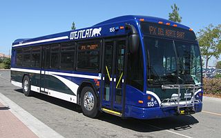
WestCAT is a public transportation service in western Contra Costa County. It is a service of the Western Contra Costa Transit Authority.
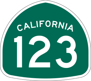
State Route 123 is a 7.39-mile (11.89 km) state highway in the U.S. state of California in the San Francisco Bay Area. Named San Pablo Avenue for almost its entire length except for its northernmost 0.10 miles (0.16 km), SR 123 is a major north–south state highway along the flats of the urban East Bay. Route 123 runs between Interstate 580 in Oakland in the south and Interstate 80 at Cutting Boulevard in Richmond in the north. San Pablo Avenue itself, a portion of Historic US 40, continues well past the SR 123 designation south to Downtown Oakland and north to Crockett.
The West Contra Costa Unified School District is the school district for western Contra Costa County, California. It is based in Richmond, California. In addition to Richmond, the district covers the cities of El Cerrito, San Pablo, Pinole, and Hercules and the unincorporated areas of Bayview-Montalvin Manor, East Richmond Heights, El Sobrante, Kensington, North Richmond, and Tara Hills.
Richmond station is an Amtrak intercity rail and Bay Area Rapid Transit (BART) station located in downtown Richmond, California. Richmond is the north terminus of BART service on the Orange Line and Red Line; it is a stop for Amtrak's Capitol Corridor, San Joaquins, and California Zephyr routes. The accessible station has one island platform for the two BART tracks, with a second island platform serving two of the three tracks of the Union Pacific Railroad Martinez Subdivision for Amtrak trains. It is one of two transfer points between BART and Amtrak, along with Oakland Coliseum station.
El Cerrito del Norte station is a Bay Area Rapid Transit (BART) station located on Cutting Boulevard in El Cerrito, California. The station is served by the Orange and Red lines. Located near San Pablo Avenue and Interstate 80, it serves as a regional transit hub for local AC Transit bus services, and for commuter feeder services from Solano, Napa, and Marin Counties in the North Bay plus western Contra Costa County. Opened in 1973, the station was renovated in 2017–2021 to add additional elevators, stairs, and lobby space.
Hilltop District, more commonly known simply as Hilltop, is a neighborhood located in the northeastern area of Richmond, California.
Richmond Annex or The Annex is a neighborhood in southeastern Richmond, California. It is mostly residential and located between San Pablo Avenue/El Cerrito to the east, San Francisco Bay to the west, Central Avenue/Cerrito Creek/Albany Hill/Albany/Alameda County to the south, and Potrero Avenue/Pullman to the north. Carlson Boulevard is the main thoroughfare through the annex, connecting downtown Richmond with downtown El Cerrito.
Cutting Boulevard is a major east–west arterial trunk road in the city of Richmond, California.
Downtown Oakland is the central business district of Oakland, California, United States. It is located roughly bounded by both the Oakland Estuary and Interstate 880 on the southwest, Interstate 980 on the northwest, Grand Avenue on the northeast, and Lake Merritt on the east.
Hilltop Green or "The Green"is a neighborhood in Richmond, California bordering the city of Pinole, the census-designated place of El Sobrante, the neighborhood of Hilltop, and Hilltop Mall.
Hercules Transit Center is a major commuter hub in the western Contra Costa County city of Hercules, California. It is anchored by WestCAT bus services. The center was originally on San Pablo Avenue. In August 2009, the transit center was relocated to the other side of I-80 with additional paid parking, which is $3/day.
Macdonald 80 Shopping Center, or Macdonald 80, is a 200,000 sq. ft. (18,580m³) regional shopping mall in the North & East neighborhood in Richmond, California, anchored by a Target store. The center was largely demolished and rebuilt after suffering from urban decay and blight. It is the only entirely LEED certified mall. It is anchored by a large Target store.
Abella Center formerly International Marketplace and originally El Portal Shopping Center is a mixed-use city services, business, shopping center and housing village transit-oriented development that was formerly a mall in San Pablo, California.
This page is based on this Wikipedia article Text is available under the CC BY-SA 4.0 license; additional terms may apply. Images, videos and audio are available under their respective licenses.