Rifle Range Nature Park

Last updated
Rifle Range Nature Park
Camino en Rifle Range Nature Park, Singapur.jpg
Trail at Rifle Range Nature Park
Rifle Range Nature Park
Type Nature park
LocationSingapore
Coordinates 1°20′42″N103°46′59″E / 1.345°N 103.783°E / 1.345; 103.783
Area66 hectares (160 acres)
Opened12 November 2022;17 months ago (2022-11-12)
Operated by National Parks Board
StatusOpen
Public transit access DT5  Beauty World
Website www.nparks.gov.sg/gardens-parks-and-nature/parks-and-nature-reserves/rifle-range-nature-park

Rifle Range Nature Park is a nature park in Bukit Timah, Singapore. Rifle Range Nature Park was opened on 12 November 2022 and is located along Rifle Range Road and Bukit Timah Nature Reserve. [1] Rifle Range Nature Park is also Singapore's first net positive energy nature park. [2] Rifle Range Nature Park is the eighth park in the Central Nature Park Network. [1] Rifle Range Nature Park was also built to protect Bukit Timah Nature Reserve. [3]

Contents

History

Rifle Range Nature Park was originally used by the old Bukit Timah Kampong and the former Sin Seng Quarry, the deepest quarry in Singapore. [4] In 1998, the quarry ceased operations and was backfilled and transformed into a freshwater habitat. [2] [5] [6]

Rifle Range Nature Park was first announced in 2017 by Minister for National Development Desmond Lee. [1] [7]

At the park's launch, Deputy Prime Minister Lawrence Wong stated that, "we have expanded our green spaces and green connectors, and we have protected our nature reserves". [2] [8] [9]

The nature park was opened by Lawrence Wong and Desmond Lee. [3]

Description

Trail at Rifle Range Nature Park Camino en Rifle Range Nature Park, Singapur 2.jpg
Trail at Rifle Range Nature Park

Attractions

Rifle Range Nature Park has multiple attractions such as: [10]

Transportation

Rifle Range Nature Park is accessible from Exit A of Beauty World MRT station by going to Beauty World Centre via an overhead bridge. [13] It is also accessible from bus services 41, 52, 61, 77, 157, 174, 184, 852, 961, 970, and 985. [12]

See also

Related Research Articles

<span class="mw-page-title-main">Bukit Batok</span> Planning Area and HDB Town in West Region ----, Singapore

Bukit Batok, often abbreviated as Bt Batok, is a planning area and matured residential town located along the eastern boundary of the West Region of Singapore. Bukit Batok statistically ranks in as the 25th largest, the 12th most populous and the 11th most densely populated planning area in Singapore. It is bordered by six other planning areas - Choa Chu Kang to the North, Northeast and Northwest, Cashew to the northeast and East, Clementi to the South, Bukit Timah to the southeast, Jurong East to the southwest and Tengah to the west.

<span class="mw-page-title-main">Bukit Panjang</span> Planning Area and HDB Town in West Region, Singapore

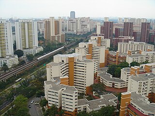
Bukit Panjang is a planning area and residential town located in the West Region of Singapore. A portion of this town is situated on a low-lying elongated hill. The planning area is bounded by Bukit Batok to the west, Choa Chu Kang to the northwest, Sungei Kadut to the north, the Central Water Catchment to the east, and Bukit Timah to the south. Bukit Panjang New Town is located at the northern portion of the planning area. Bukit Panjang has an average elevation of 36m/118 ft.

<span class="mw-page-title-main">Bukit Timah Nature Reserve</span> Protected area in Singapore

The Bukit Timah Nature Reserve is a 1.7-square-kilometre (0.66 sq mi) nature reserve near the geographic centre of Singapore, located on the slopes of Bukit Timah Hill, the country's highest natural peak standing at a height of approximately 165 metres (541 ft), and parts of the surrounding area, located actually in Bukit Panjang. The nature reserve is about 15 kilometres from the Downtown Core, Singapore's central business district (CBD).

<span class="mw-page-title-main">Central Catchment Nature Reserve</span> Largest nature reserve in Singapore

The Central Catchment Nature Reserve is the largest nature reserve in Singapore, occupying 2880 hectares. Forming a large green lung in the geographical centre of the city, it houses several recreational sites, including the Singapore Zoo, the Night Safari and the River Safari, as well as several newer facilities built to encourage public appreciation of the reserve, such as the HSBC TreeTop Walk. The reserve sits within the boundaries of the Central Water Catchment. It is one of the four gazetted nature reserves in Singapore. The other three are the Labrador Nature Reserve which was gazetted since 1 January 2002, Sungei Buloh Wetland Reserve and Bukit Timah Nature Reserve. All four nature reserves along with the parks are protected under the Parks & Trees Act 2005.

<span class="mw-page-title-main">Sungei Buloh Wetland Reserve</span> Nature reserve park in Singapore

Sungei Buloh Wetland Reserve is a nature reserve in the northwest area of Singapore. It is the first wetlands reserve to be gazetted in Singapore (2002), and its global importance as a stop-over point for migratory birds was recognised by the inclusion of the reserve into the East Asian Australasian Shorebird Site Network. The reserve, with an area of 130 hectares, was listed as an ASEAN Heritage Park in 2003.
<span class="mw-page-title-main">Bukit Timah Hill</span> Tallest hill in Singapore

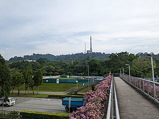
Bukit Timah Hill, is the highest natural peak in Singapore. It is located in Bukit Panjang rather than its namesake and its altitude is 164 metres above sea level.
<span class="mw-page-title-main">Future developments in Singapore</span>

This article shows the notable future developments in Singapore. Most of them are currently under construction with most to be completed within the next five years.

<span class="mw-page-title-main">National Parks Board</span> Statuary board of the Singapore government

The National Parks Board (NParks) is a statutory board under the Ministry of National Development of the Government of Singapore.

<span class="mw-page-title-main">Cashew MRT station</span> Mass Rapid Transit station in Singapore

Cashew MRT station is an underground Mass Rapid Transit (MRT) station on the Downtown line in Singapore, located between Upper Bukit Timah Road and Cashew Road. It is the nearest MRT station to the headquarters of the Ministry of Defence as well as the upcoming National Service (NS) Hub.

<span class="mw-page-title-main">Hillview, Singapore</span> Place in Singapore

Hillview is located in Upper Bukit Timah, Northwest Singapore. The neighbourhood overlooks Bukit Timah Hill, hence its name.

The Bukit Timah Race Course was a venue for Thoroughbred horse racing in the Bukit Timah area of Singapore. Built by the Bukit Timah Turf Club, it was opened on 15 April 1933 by the Sir Cecil Clementi, Governor of Singapore. There was no racing from 1941 through 1946 as a result of World War II.

<span class="mw-page-title-main">Bukit Batok Town Park</span> Nature park in Bukit Batok, Singapore

Bukit Batok Town Park is a nature park located in the precinct of Guilin in the town of Bukit Batok, Singapore. The park was created from a disused granite quarry. As such, it has a resemblance to the granite rock formations in Guilin, China. Hence it is also known as Little Guilin or Xiao Guilin among the Chinese.
<span class="mw-page-title-main">Hindhede Nature Park</span> Park in Singapore

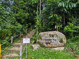
Hindhede Nature Park is a park located next to Bukit Timah Nature Reserve in Singapore.

<span class="mw-page-title-main">Eco-Link@BKE</span> Ecological bridge in Singapore

The Eco-Link@BKE is an ecological bridge in Singapore which connects the Bukit Timah Nature Reserve with the Central Catchment Nature Reserve.

The following lists events that happened during 2022 in the Republic of Singapore.

The following lists events that happened during 2023 in the Republic of Singapore.
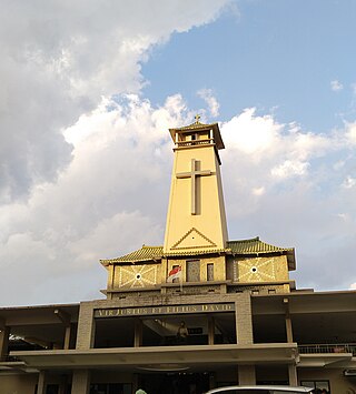
<span class="mw-page-title-main">Saint Joseph's Church, Bukit Timah</span> Catholic church in Singapore

Saint Joseph's Church is a Catholic church in Singapore. It is located at Upper Bukit Timah Road along the boundary of the Bukit Panjang and Bukit Batok planning areas, within the Northern District of Singapore. Saint Joseph's is the second oldest church in Singapore, after the Cathedral of the Good Shepherd. Saint Joseph's is also the last remaining Catholic church to feature a cemetery.

<span class="mw-page-title-main">Pang Sua Pond</span> Wetland in Bukit Panjang, Singapore

Pang Sua Pond is a floating wetland located in Bukit Panjang, Singapore. It is the second-largest man-made wetland in Singapore. The pond has a 480-meter long elevated bridge that connects to the Bukit Panjang Park Connector and the Senja-Cashew Community Club. It also serves as a stormwater collection pond.

<span class="mw-page-title-main">The Rail Mall</span> Strip mall in Bukit Timah, Singapore

The Rail Mall, or just Rail Mall, is a strip mall located at Upper Bukit Timah Road, Singapore. The Rail Mall is located nearby the Rail Corridor and the Bukit Timah Nature Reserve.

<span class="mw-page-title-main">Former Bukit Timah Fire Station</span> Building in Singapore, Singapore

The Former Bukit Timah Fire Station (BTFS), located in Upper Bukit Timah Road, Singapore, was a fire station. It is planned to be redesigned into a community centre for nature. It is nearby the upcoming Hume MRT station. BTFS is also located nearby other heritage sites such as the Former Ford Factory, Bukit Timah Nature Reserve, and the Bukit Timah Memorial.

References

  1. 1 2 3 Wan Ting, Koh (12 November 2022). "Revamped Rifle Range Nature Park opens with 7km trails, 31m lookout point and quarry wetland". CNA. Retrieved 17 October 2023.
  2. 1 2 3 Soh, Gena (12 November 2022). "Newly opened Rifle Range Nature Park offers 7km-long trails, rain garden and a clifftop view". The Straits Times. ISSN   0585-3923 . Retrieved 17 October 2023.
  3. 1 2 3 Zheng, Zhangxin; Pek, Gawain (12 November 2022). "New 66ha Rifle Range Nature Park has over 7km trails & wetland converted from old quarry". mothership.sg. Retrieved 18 October 2023.
  4. Utomo, Delfina; Nurjuwita, Dewi (19 June 2023). "The most beautiful quarries in Singapore". Time Out Singapore. Retrieved 18 October 2023.
  5. Ng, Lester (14 November 2022). "Rifle Range Nature Park: Quarry Wetland, Colugo Lookout & 7KM Of Trails". Little Day Out. Retrieved 17 October 2023.
  6. "A Morning Walk At The Newly Open Rifle Range Nature Park. Nice. Relaxing". patnotebook. 18 April 2023. Retrieved 17 October 2023.
  7. WY, Abigail Ng (22 April 2017). "Windsor Nature Park opens, new park near Rifle Range Road announced". The Straits Times. ISSN   0585-3923 . Retrieved 18 October 2023.
  8. Chen, Katherine (12 November 2022). "PMO | DPM Lawrence Wong at the Opening of Rifle Range Nature Park". Prime Minister's Office Singapore. Retrieved 17 October 2023.
  9. 1 2 Rashid, Amierul (15 November 2022). "From parking advice to route difficulty: Early visitor to newly opened Rifle Range park provides tips for fellow hikers". AsiaOne. Retrieved 17 October 2023.
  10. Nadine, Gabriella (21 November 2022). "8 New Things To Do At Rifle Range Nature Park - Boardwalk Trails, Photo Spots & Lookout Points". TheSmartLocal - Singapore's Leading Travel and Lifestyle Portal. Retrieved 17 October 2023.
  11. "Hello, Mother Nature: 27 best hiking spots, walking trails and nature parks in Singapore". thehoneycombers. 27 September 2023. Retrieved 17 October 2023.
  12. 1 2 "Rifle Range Nature Park – Hiking the Green Isle". hikingthegreenisle.com. 28 April 2023. Retrieved 17 October 2023.
  13. Youjin, Low (16 September 2018). "Wildlife-rich Rifle Range Nature Park could feature bridge crossing when completed in 2020". TODAY. Retrieved 17 October 2023.