Rio Vista Dam

Last updated
Rio Vista Dam
Rio Vista Dam (2005).jpg
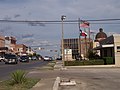
The "old" Rio Vista Dam, prior to its reconstruction in 2006
Coordinates 29°52′43″N97°55′57″W / 29.878689°N 97.932602°W / 29.878689; -97.932602

Rio Vista Dam is a dam on the San Marcos River in San Marcos, Texas. The flood of 1998 badly damaged the dam. [1]

Whitewater slalom in Rio Vista Park Rio Vista Park, San Marcos River, whitewater slalom.jpg
Whitewater slalom in Rio Vista Park
Bodyboarders in Rio Vista Park Bodyboarders in Rio Vista Park, San Marcos River.jpg
Bodyboarders in Rio Vista Park

Following a US$2.1 million project, Recreation Engineering and Planning (REP) was commissioned to reconstruct the failing dam to enhance existing usage for recreational visitors and tourists alike while improving a stimulant of the local economy. REP was capable of providing a design which was tailored to the needs of the Rio Vista Dam which drastically reduced the reconstruction costs from $1.8 million to $500,000. The reconstruction efforts done by KBR, included removing the failing concrete side walls, grading the banks down to the water, and the addition of artificial rapids. REP completed the project in just under four months when the park reopened on May 25, 2006. [2] [3] [4] [5]

Rio Vista Park

The Rio Vista Park is a 13-acre (5.3 ha) park located on the dam, which serves as a local hotspot for swimming, tubing, canoeing, and kayaking. [6] [7] [8]

Notes

  1. "Old dam is on the brink". San Marcos Daily Record . November 20, 2005.
  2. Millecam, Melissa (May 22, 2006). "The Transformation of Rio Vista Dam". City of San Marcos. Archived from the original on 2006-06-01.
  3. Croteau, Roger (May 26, 2006). "Memorial Day pleasure, pain ahead". mySA.com. Archived from the original on 2007-09-29.
  4. "San Marcos Police Department - 2006 Year in Review" (PDF). City of San Marcos. 2006. Archived from the original (PDF) on 2008-05-28.
  5. "Rio Vista Whitewater Park, San Marcos River" (PDF). S2O Design and Engineering. May 2006. Archived from the original (PDF) on 2008-07-18.
  6. "Area Attractions and Events". Texas State University. Archived from the original on 2008-10-11.
  7. Miller, Anita (April 21, 2007). "Just the first?". San Marcos Daily Record. Archived from the original on 2011-05-26.
  8. "Rio Vista Park". Visit San Marcos. Retrieved 2022-10-31.

Related Research Articles

<span class="mw-page-title-main">Sacramento River</span> River in Northern and Central California, United States

The Sacramento River is the principal river of Northern California in the United States and is the largest river in California. Rising in the Klamath Mountains, the river flows south for 400 miles (640 km) before reaching the Sacramento–San Joaquin River Delta and San Francisco Bay. The river drains about 26,500 square miles (69,000 km2) in 19 California counties, mostly within the fertile agricultural region bounded by the Coast Ranges and Sierra Nevada known as the Sacramento Valley, but also extending as far as the volcanic plateaus of Northeastern California. Historically, its watershed has reached as far north as south-central Oregon where the now, primarily, endorheic (closed) Goose Lake rarely experiences southerly outflow into the Pit River, the most northerly tributary of the Sacramento.

<span class="mw-page-title-main">Rio Grande</span> Major river forming part of the US–Mexico border

The Rio Grande, known in Mexico as the Río Bravo del Norte or simply the Río Bravo, is one of the principal rivers in the southwestern United States and in northern Mexico. The length of the Rio Grande is 1,896 miles (3,051 km). It originates in south-central Colorado, in the United States, and flows to the Gulf of Mexico. The Rio Grande drainage basin (watershed) has an area of 182,200 square miles (472,000 km2); however, the endorheic basins that are adjacent to and within the greater drainage basin of the Rio Grande increase the total drainage-basin area to 336,000 square miles (870,000 km2).

<span class="mw-page-title-main">San Marcos, Texas</span> City in Hays County, Texas, USA

San Marcos is a city and the county seat of Hays County, Texas, United States. The city's limits extend into Caldwell and Guadalupe Counties, as well. San Marcos is within the Austin–Round Rock metropolitan area and on the Interstate 35 corridor between Austin and San Antonio. Its population was 44,894 at the 2010 census and 67,553 at the 2020 census. Founded on the banks of the San Marcos River, the area is thought to be among the oldest continuously inhabited sites in the Americas. San Marcos is home to Texas State University and the Meadows Center for Water and the Environment.

<span class="mw-page-title-main">Colorado River</span> Major river in the western United States and Mexico

The Colorado River is one of the principal rivers in the Southwestern United States and northern Mexico. The 1,450-mile-long (2,330 km) river drains an expansive, arid watershed that encompasses parts of seven U.S. states and two Mexican states. The name Colorado derives from the Spanish language for "colored reddish" due to its heavy silt load. Starting in the central Rocky Mountains of Colorado, it flows generally southwest across the Colorado Plateau and through the Grand Canyon before reaching Lake Mead on the Arizona–Nevada border, where it turns south toward the international border. After entering Mexico, the Colorado approaches the mostly dry Colorado River Delta at the tip of the Gulf of California between Baja California and Sonora.

<span class="mw-page-title-main">San Joaquin River</span> Longest river of Central California, United States

The San Joaquin River is the longest river of Central California. The 366-mile (589 km) long river starts in the high Sierra Nevada, and flows through the rich agricultural region of the northern San Joaquin Valley before reaching Suisun Bay, San Francisco Bay, and the Pacific Ocean. An important source of irrigation water as well as a wildlife corridor, the San Joaquin is among the most heavily dammed and diverted of California's rivers.

<span class="mw-page-title-main">Kern River</span> Wild And Scenic River in California, United States

The Kern River, previously Rio de San Felipe, later La Porciuncula, is an Endangered, Wild and Scenic river in the U.S. state of California, approximately 165 miles (270 km) long. It drains an area of the southern Sierra Nevada mountains northeast of Bakersfield. Fed by snowmelt near Mount Whitney, the river passes through scenic canyons in the mountains and is a popular destination for whitewater rafting and kayaking. It is the southernmost major river system in the Sierra Nevada, and is the only major river in the Sierra that drains in a southerly direction.

Rio Vista may refer to:

<span class="mw-page-title-main">Guadalupe River (Texas)</span> River in Texas

The Guadalupe River, runs from Kerr County, Texas, to San Antonio Bay on the Gulf of Mexico, with an average temperature of 17.75 degrees Celsius. It is a popular destination for rafting, fly fishing, and canoeing. Larger cities along it include Kerrville, New Braunfels, Seguin, Gonzales, Cuero, and Victoria. It has several dams along its length, the most notable of which, Canyon Dam, forms Canyon Lake northwest of New Braunfels.

<span class="mw-page-title-main">San Antonio River Walk</span>

The San Antonio River Walk is a city park and special-case pedestrian street in San Antonio, Texas, one level down from the automobile street. The River Walk winds and loops under bridges as two parallel sidewalks lined with restaurants and shops, connecting the major tourist draws such as the Shops at Rivercenter, the Arneson River Theatre, Marriage Island, La Villita, HemisFair Park, the Tower Life Building, the San Antonio Museum of Art, the Pearl, and the city's five Spanish colonial missions, which have been named a World Heritage Site, which includes the Alamo. During the annual springtime Fiesta San Antonio, the River Parade features flowery floats that float down the river.

<span class="mw-page-title-main">Buffalo Bayou</span> Body of water in the U.S. state of Texas

Buffalo Bayou is a slow-moving body of water which flows through Houston in Harris County, Texas. Formed 18,000 years ago, it has its source in the prairie surrounding Katy, Fort Bend County, and flows approximately 53 miles (85 km) east through the Houston Ship Channel into Galveston Bay and the Gulf of Mexico. In addition to drainage water impounded and released by the Addicks and Barker reservoirs, the bayou is fed by natural springs, surface runoff, and several significant tributary bayous, including White Oak Bayou, Greens Bayou, and Brays Bayou. Additionally, Buffalo Bayou is considered a tidal river downstream of a point 440 yards (400 m) west of the Shepherd Drive bridge in west-central Houston.

<span class="mw-page-title-main">Meadows Center for Water and the Environment</span>

The Meadows Center for Water and the Environment, formerly Aquarena Springs and later the Aquarena Center, is an educational center in San Marcos, Texas, that seeks to preserve the unique archeological and biological resources of Spring Lake. Formed from more than 200 artesian springs, this lake is one of the world's largest aquifer fed systems. A state antiquities landmark, this site is also believed to be one of the longest continuously inhabited places in North America.

<span class="mw-page-title-main">San Marcos River</span> River in Texas, United States

The San Marcos River rises from the San Marcos Springs, the location of Aquarena Springs, in San Marcos, Texas. The springs are home to several threatened or endangered species, including the Texas blind salamander, fountain darter, and Texas wild rice. The river is a popular recreational area, and is frequented for tubing, canoeing, swimming, and fishing.

<span class="mw-page-title-main">Rio Grande silvery minnow</span> Species of fish

The Rio Grande silvery minnow or Rio Grande minnow is a small herbivorous North American fish. It is one of the seven North American members of the genus Hybognathus, in the cyprinid family.

<span class="mw-page-title-main">Greater Austin</span> Metropolitan area in Texas, United States

The Austin–Round Rock–San Marcos metropolitan statistical area is a five-county metropolitan area in the U.S. state of Texas, as defined by the Office of Management and Budget. The metropolitan area is situated in Central Texas on the western edge of the American South and on the eastern edge of the American Southwest, and borders Greater San Antonio to the south.

The Flood Control Act of 1965, Title II of Pub.L. 89–298, was enacted on October 27, 1965, by the 89th Congress and authorized the United States Army Corps of Engineers to design and construct numerous flood control projects including the Lake Pontchartrain and Vicinity, Louisiana Hurricane Protection Project in the New Orleans region of south Louisiana.

<span class="mw-page-title-main">U.S. Route 281 in Texas</span> Section of U.S. Highway in Texas, United States

U.S. Route 281 (US 281) is a United States Numbered Highway that runs from the Mexican border in the Rio Grande Valley to the Canadian border near Dunseith, North Dakota. In the state of Texas, the highway is a major south–north corridor, connecting Brownsville to the Oklahoma state line at the Red River in Burkburnett. Several segments of U.S. 281 are concurrent with Interstate routes, including I-69C in the Rio Grande Valley, I-37 in San Antonio, and I-44 north of Wichita Falls.

<span class="mw-page-title-main">Colorado River Storage Project</span> US Bureau of Reclamation project

The Colorado River Storage Project is a United States Bureau of Reclamation project designed to oversee the development of the upper Colorado River basin. The project provides hydroelectric power, flood control and water storage for participating states along the upper portion of the Colorado River and its major tributaries.

Winzler & Kelly was an engineering and environmental services firm based in Santa Rosa, CA, with offices in California, Oregon, Washington, Guam, and Saipan. It was recognized as a "Best Multidiscipline A/E Services Firm to Work For" by CE News in 2010.

<span class="mw-page-title-main">Amistad Dam</span> Dam in Texas / Acuña Municipality, Coahuila

Amistad Dam is a major embankment dam across the Rio Grande between Texas, United States, and Coahuila, Mexico. Built to provide irrigation water storage, flood control, and hydropower generation, it is the largest dam along the international boundary reach of the Rio Grande. The dam is over 6 miles (9.7 km) long, lies mostly on the Mexican side of the border, and forms Amistad Reservoir. It supplies water for irrigation in the Rio Grande Valley, 574 miles (924 km) upstream of the Rio Grande's mouth on the Gulf of Mexico at Brownsville, Texas/Matamoros, Tamaulipas.

<span class="mw-page-title-main">O'Shaughnessy Dam (California)</span> Dam in Tuolumne County, California, United States

O'Shaughnessy Dam is a 430-foot (131 m) high concrete arch-gravity dam in Tuolumne County, California, United States. It impounds the Tuolumne River, forming the Hetch Hetchy Reservoir at the lower end of Hetch Hetchy Valley in Yosemite National Park, about 160 miles (260 km) east of San Francisco. The dam and reservoir are the source for the Hetch Hetchy Aqueduct, which provides water for over two million people in San Francisco and other municipalities of the west Bay Area. The dam is named for engineer Michael O'Shaughnessy, who oversaw its construction.