History
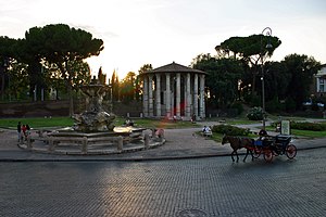
The borough has always been urbanized, although not intensively, since the Ancient Rome: at that time, the area included three regiones, Circus Maximus, Piscina Publica and Aventinus.
As of the 4th century, the bank of the River Tiber in the rione was called Ripa Graeca, after a Greek community that settled there and increased during the following centuries, particularly in the 8th century, when the area was inhabited by Greek and Latin people escaped from the iconoclastic persecutions led by Leo III the Isaurian.
During the Middle Ages, the northern part of the rione remained unpopulated, with the only exceptions of some fortified monastery and a baronial castle, the Rocca Savella.
Geography
Initially the rione was ampler and included other portions of the city, that were detached in 1921 in order to establish two more rioni, San Saba and Testaccio.
Boundaries
Ripa borders northward with Regola (R. VII), whose border is defined by a stretch of the Tiber near the Tiber Island, between Ponte Garibaldi and Ponte Fabricio; as well as with Sant'Angelo (R. XI), from which is separated by Ponte Fabricio itself, by Lungotevere dei Pierleoni and by Via del Foro Olitorio. To the northeast, it also borders with Campitelli (R. X), from which is separated by Vico Jugario, Piazza della Consolazione, Via dei Fienili, Via di San Teodoro, Via dei Cerchi and Piazza di Porta Capena.
Eastward, the rione shares a short border with Celio (R. XIX), from which is separated by Piazza di Porta Capena.
To the south, Ripa borders with San Saba (R. XXI), whose boundary is outlined by Viale Aventino, Piazza Albania, Viale Manlio Gelsomini and Largo Manlio Gelsomini; and with Testaccio (R. XX), from which is separated by Largo Manlio Gelsomini, Via Marmorata and Piazza dell'Emporio.
Westward, Ripa is separated from Trastevere (R. XIII) by the stretch of the Tiber between Ponte Sublicio and Ponte Garibaldi.

Trastevere is the 13th rione of Rome, Italy. It is identified by the initials R. XIII and it is located within Municipio I. Its name comes from Latin trans Tiberim.

A rione of Rome is a traditional administrative division of the city of Rome. Rione is an Italian term used since the 14th century to name a district of a town. The term was born in Rome, originating from the administrative divisions of the city. The word comes from the Latin word regio, meaning "region"; during the Middle Ages the Latin word became rejones, from which rione comes. Currently, all the rioni are located in Municipio I of Rome.

Monti is the 1st rione of Rome, Italy, identified by the initials R. I, located in Municipio I. The name literally means 'mountains' in Italian and comes from the fact that the Esquiline, the Viminal Hills, and parts of the Quirinal and the Caelian Hills belonged to this rione: currently, however, the Esquiline Hill belongs to the rione Esquilino.
Trevi is the 2nd rione of Rome, Italy, identified by the initials R. II, located in Municipio I. The origin of its name is not clear, but the most accepted theory is that it comes from the Latin trivium, because there were three streets all leading to the current Piazza dei Crociferi, a square next to the modern Trevi square. Its coat of arms is made of three swords on a red background.

Ponte is the 5th rione of Rome, Italy, identified by the initials R. V, and is located in Municipio I. Its name comes from Ponte Sant'Angelo, which connects Ponte with the rione of Borgo. This bridge was built by Emperor Hadrian in 134 AD to connect his mausoleum to the rest of the city. Though Pope Sixtus V changed the rione limits, so that the bridge belongs now to Borgo, not to Ponte anymore, the area has kept its name and a bridge as its coat of arms.

Parione is the 6th rione of Rome, Italy, identified by the initials R. VI, and belongs to the Municipio I. Its name comes from the fact that in the area there was a huge ancient wall, maybe belonging to the stadium of Domitianus; the nickname people gave to this wall was Parietone, from which the name Parione.

Regola is the 7th rione of Rome, Italy, identified by the initials R. VII, and belongs to the Municipio I. The name comes from Arenula, which was the name of the soft sand that the river Tiber left after the floods, and that built strands on the left bank.

Campitelli is the 10th rione of Rome, Italy, identified by the initials R. X, and is located in the Municipio I.

Sant'Angelo is the 11th rione of Rome, Italy, located in Municipio I. Often written as rione XI - Sant'Angelo, it has a coat of arms with an angel on a red background, holding a palm branch in its left hand. In another version, the angel holds a sword in its right hand and a scale in its left.

Borgo is the 14th rione of Rome, Italy. It is identified by the initials R. XIV and is included within Municipio I.

Celio is the 19th rione of Rome, Italy, identified by the initials R. XIX, and is located within the Municipio I.
Testaccio is the 20th rione of Rome, Italy, identified by the initials R. XX, deriving its name from Monte Testaccio. It is located within the Municipio I.

San Saba is the 21st rione of Rome, Italy, identified by the initials R. XXI. It is located within the Municipio I, and takes its name from the Basilica of San Saba, which is located there.

Prati is the 22nd rione of Rome, Italy, identified by the initials R. XXII. It belongs to the Municipio I since 2013, while previously, along with Borgo and quartieri Trionfale and Della Vittoria, it was part of the Municipio XVII.

Campo Marzio is the 4th rione of Rome, Italy, identified by the initials R. IV. It belongs to the Municipio I and covers a smaller section of the area of the ancient Campus Martius. The logo of this rione is a silver crescent on a blue background.

Circo Massimo is a station on Line B of the Rome Metro. It was opened on 10 February 1955 and is sited at the east end of the Circus Maximus, after which it is named, near the headquarters of the FAO, originally built as the Ministero delle Colonie. Until 2002, the Obelisk of Axum also stood near the station. It has two separate exits on either side of the viale Aventino.

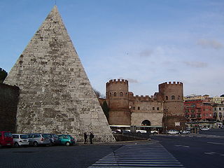
Piramide is a station on Line B of the Rome Metro. It was opened on 10 February 1955 and is sited on Piazzale Ostiense just outside Porta San Paolo, in the Ostiense quarter. Its atrium houses mosaics that have won the Artemetro Roma by Enrico Castellani (Italy) and Beverly Pepper. The station has escalators.

Ostiense is the 10th quartiere of Rome, identified by the initials Q. X.
Portuense is the 11th quartiere of Rome (Italy), identified by the initials Q.XI.

Viale Aventino is a street that links Piazza di Porta Capena and Piazza Albania in Rome (Italy). It marks the boundary between the Rione Ripa and San Saba.