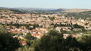
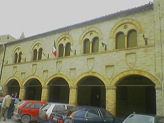
| Ripe San Ginesio | ||
|---|---|---|
| Comune | ||
| Comune di Ripe San Ginesio | ||
 | ||
| ||
 Ripe San Ginesio Location of Ripe San Ginesio in Italy | ||
| Coordinates: 43°9′N13°22′E / 43.150°N 13.367°E | ||
| Country | Italy | |
| Region | Marche | |
| Province | Macerata (MC) | |
| Government | ||
| • Mayor | Paolo Teodori | |
| Area | ||
| • Total | 10.1 km2 (3.9 sq mi) | |
| Elevation | 430 m (1,410 ft) | |
| Population (30 June 2011) [1] | ||
| • Total | 871 | |
| • Density | 86/km2 (220/sq mi) | |
| Demonym(s) | Ripani | |
| Time zone | CET (UTC+1) | |
| • Summer (DST) | CEST (UTC+2) | |
| Postal code | 62020 | |
| Dialing code | 0733 | |
| Patron saint | St. Michael Archangel | |
| Saint day | May 8 | |
| Website | Official website | |

Ripe San Ginesio is a comune (municipality) in the Province of Macerata in the Italian region Marche, located about 50 kilometres (31 mi) south of Ancona and about 20 kilometres (12 mi) southwest of Macerata.

The comune is a basic administrative division in Italy, roughly equivalent to a township or municipality.

The province of Macerata is a province in the Marche region of Italy. Its capital is the city of Macerata. The province includes 55 comunes in the province, see Comunes of the Province of Macerata. Located between the rivers Potenza (Flosis) and Chienti, both of which originate in the province, the city of Macerata is located on a hill.

Italy, officially the Italian Republic, is a country in Europe. Located in the middle of the Mediterranean Sea, Italy shares open land borders with France, Switzerland, Austria, Slovenia and the enclaved microstates San Marino and Vatican City. Italy covers an area of 301,340 km2 (116,350 sq mi) and has a largely temperate seasonal and Mediterranean climate. With around 61 million inhabitants, it is the fourth-most populous EU member state and the most populous country in Southern Europe.
Ripe San Ginesio borders the following municipalities: Colmurano, Loro Piceno, San Ginesio, Sant'Angelo in Pontano.

Colmurano is a comune (municipality) in the Province of Macerata in the Italian region of Marche, located about 50 kilometres (31 mi) southwest of Ancona and about 15 kilometres (9 mi) southwest of Macerata.
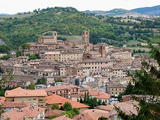
Loro Piceno is a comune (municipality) in the Province of Macerata in the Italian region Marche, located about 50 kilometres (31 mi) south of Ancona and about 15 kilometres (9 mi) south of Macerata on a hill near the Fiastra stream.

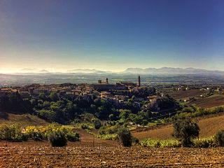
San Ginesio is a comune (municipality) in the Province of Macerata in the Italian region Marche, located about 60 kilometres (37 mi) southwest of Ancona and about 25 kilometres (16 mi) southwest of Macerata. As of 31 December 2004, it had a population of 3,872 and an area of 77.7 square kilometres (30.0 sq mi).