Ripley, New York

Last updated

Ripley, New York
Ripley NY Church.jpg
Church in Ripley
Motto: 
"The Gateway to New York State"
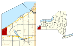
Chautauqua County NY Ripley 61885 highlighted.svg
Location in Chautauqua County and the state of New York.
Coordinates: 42°15′42″N79°41′53″W / 42.26167°N 79.69806°W / 42.26167; -79.69806
Country United States
State New York
County Chautauqua
Government
  Type Town Council
   Town Supervisor Douglas Bowen
   Town Council
Members' List
Area
[1]
  Total48.87 sq mi (126.57 km2)
  Land48.76 sq mi (126.30 km2)
  Water0.10 sq mi (0.27 km2)
Elevation
1,299 ft (396 m)
Population
 (2020) [2]
  Total2,310
  Estimate 
(2021) [2]
2,292
  Density47.60/sq mi (18.38/km2)
Time zone UTC-5 (Eastern (EST))
  Summer (DST) UTC-4 (EDT)
ZIP code
14775
Area code 716
FIPS code 36-013-61885
GNIS feature ID0979424
Website www.ripley-ny.com

Ripley is a town on Lake Erie in the westernmost part of Chautauqua County, New York, United States. The population was 2,310 at the time of the 2020 census. [2] The town was named after Eleazer Wheelock Ripley, a general in the War of 1812. There are no incorporated villages in the town, but there is one census-designated place: the hamlet of Ripley. The town is perhaps best known as being the western terminus of the New York State Thruway.

Contents

History

Ripley was first settled circa 1804 in the vicinity of Ripley village. The town was established in 1817 from part of the town of Portland.

Much of the economy of the town in recent years has been based on growing fruit, especially Concord grapes.

Notable people

Geography

Western terminus of the New York State Thruway in Ripley at the Pennsylvania state line I-90 wb entering Pennsylvania from New York (2), July 2023.jpg
Western terminus of the New York State Thruway in Ripley at the Pennsylvania state line

According to the United States Census Bureau, the town has a total area of 48.9 square miles (126.6 km2), of which 48.8 square miles (126.3 km2) is land and 0.12 square miles (0.3 km2), or 0.21%, is water. [3]

The New York State Thruway (Interstate 90), US 20, NY 5, and NY 76 pass through the town.

Adjacent towns and areas

(Clockwise)

Demographics

Historical population
CensusPop.Note
1820 1,111
1830 1,64748.2%
1840 2,19733.4%
1850 1,732−21.2%
1860 2,01316.2%
1870 1,946−3.3%
1880 1,9902.3%
1890 2,0201.5%
1900 2,25611.7%
1910 2,239−0.8%
1920 2,116−5.5%
1930 2,2546.5%
1940 2,250−0.2%
1950 2,69419.7%
1960 2,8485.7%
1970 2,9343.0%
1980 3,1818.4%
1990 2,967−6.7%
2000 2,636−11.2%
2010 2,415−8.4%
2020 2,310−4.3%
2021 (est.)2,292 [2] −0.8%
U.S. Decennial Census [4]

As of the census of 2000, there were 2,636 people, 1,004 households, and 722 families residing in the town. The population density was 53.9 inhabitants per square mile (20.8/km2). There were 1,211 housing units at an average density of 9.6 persons/km2 (24.7 persons/sq mi). The racial makeup of the town was 98.25% White, 0.19% African American, 0.11% Native American, 0.08% Asian, 0.04% Pacific Islander, 0.34% from other races, and 0.99% from two or more races. 1.44% of the population were Hispanic or Latino of any race.

There were 1,004 households, out of which 33.0% had children under the age of 18 living with them, 57.8% were married couples living together, 7.7% have a woman whose husband does not live with her, and 28.0% were non-families. 23.4% of all households were made up of individuals, and 11.6% had someone living alone who was 65 years of age or older. The average household size was 2.63 and the average family size was 3.08.

In the town, the population was spread out, with 26.5% under the age of 18, 8.6% from 18 to 24, 27.4% from 25 to 44, 22.5% from 45 to 64, and 15.0% who were 65 years of age or older. The median age was 38 years. For every 100 females, there were 103.7 males. For every 100 females age 18 and over, there were 98.1 males.

The median income for a household in the town was $33,237, and the median income for a family was $37,083. Males had a median income of $28,278 versus $23,359 for females. The per capita income for the town was $15,652. 10.3% of the population and 7.8% of families were below the poverty line. Out of the total people living in poverty, 12.1% are under the age of 18 and 9.9% are 65 or older.

Communities and locations in Ripley

Notable people

Related Research Articles

<span class="mw-page-title-main">Brutus, New York</span> Town in New York, United States

Brutus is a town in Cayuga County, New York, United States. The population was 4,311 at the 2020 census. It is the most populous town in the county. The name was assigned by a clerk interested in the classics. The town court is located in the village of Weedsport, the largest settlement in the town.

<span class="mw-page-title-main">Hanover, New York</span> Town in New York, United States

Hanover is a town in Chautauqua County, New York, United States. The population was 6,893 at the 2020 census. The town lies in the northeast corner of Chautauqua County.

<span class="mw-page-title-main">Mina, New York</span> Town in New York, United States

Mina is a town in Chautauqua County, New York, United States. The population was 1,004 at the 2020 census. It is at the western county border and state line. The town is best known as a summer resort area, centered on the hamlet of Findley Lake.

<span class="mw-page-title-main">Pomfret, New York</span> Town in New York, United States

Pomfret is a town in Chautauqua County, New York, United States. The population was 13,236 at the 2020 census. The town lies in the north-central part of the county, south of Dunkirk, and includes the village of Fredonia.

<span class="mw-page-title-main">Portland, New York</span> Town in New York, United States

Portland is a town in Chautauqua County, New York, United States. The population was 4,366 according to the 2020 census. The town is on the shore of Lake Erie southwest of Dunkirk.

<span class="mw-page-title-main">Sheridan, New York</span> Town in New York, United States

Sheridan is a town in Chautauqua County, New York, United States. The population was 2,563 at the 2020 census. The town is on the county's northern border, east of Dunkirk.

<span class="mw-page-title-main">Pembroke, New York</span> Town in New York, United States

Pembroke is a town in Genesee County, Western New York, United States. The population was 4,292 at the 2010 census. The town is named after a town in west Wales. Pembroke lies on the west border of Genesee County, west of Batavia.

<span class="mw-page-title-main">Danube, New York</span> Town in New York, United States

Danube is a town in Herkimer County, New York, United States. The population was 801 at the 2020 census, down from 1,039 in 2010. Early Palatine German immigrants in the eighteenth century named the town after the Danube River in Europe.

<span class="mw-page-title-main">Schuyler, New York</span> Town in Herkimer County, New York, US

Schuyler is a town in Herkimer County, New York, United States. The population was 3,420 at the 2010 census. The town is in the western part of Herkimer County and is east of Utica.

Lenox is a town in Madison County, New York, United States. The population was 8,768 as of the 2020 census.

<span class="mw-page-title-main">Sullivan, New York</span> Town in Madison County, New York, US

Sullivan is a town in Madison County, New York, United States. The population was 15,339 at the 2010 census. The town is named after General John Sullivan.

<span class="mw-page-title-main">Royalton, New York</span> Town in New York, United States

Royalton is a town in Niagara County, New York, United States. The population was 7,660 at the 2010 census.

<span class="mw-page-title-main">Deerfield, New York</span> Town in New York, United States

Deerfield is a town in Oneida County, New York, United States. The population was 4,273 at the 2010 census.

<span class="mw-page-title-main">Verona, New York</span> Town in New York, United States

Verona is a town in southwestern Oneida County, New York, United States. The population was 6,293 at the 2010 census. The town was named after Verona, Italy.

<span class="mw-page-title-main">Westmoreland, New York</span> Town in New York, United States

Westmoreland is a town in Oneida County, New York, United States. The population was 6,138 at the 2010 census.

<span class="mw-page-title-main">Gaines, New York</span> Town in New York, United States

Gaines is a town in Orleans County, New York, United States. The population was 3,378 at the 2010 census. The town is named after General Edmund P. Gaines, who defended the area during the War of 1812.

<span class="mw-page-title-main">Tyre, New York</span> Town in New York, United States

Tyre is a town in Seneca County, New York, United States. The population was 1,002 at the 2020 census. The town is named after the Lebanese city of Tyre.

<span class="mw-page-title-main">Westfield, New York</span> Town in New York, United States

Westfield is a town in the western part of Chautauqua County, New York, United States. The population was 4,513 at the 2020 census. Westfield is also the name of a village within the town, containing 65% of the town's population. This unique town is accompanied by vineyards, gorges and historical buildings.

<span class="mw-page-title-main">Manchester, New York</span> Town in New York, United States

Manchester is a town in Ontario County, New York, United States. The population was 9,406 at the 2020 census. The town was named after one of its villages, which in turn was named after the original Manchester in England. It was formed in 1822 from the town of Farmington.

<span class="mw-page-title-main">Plattekill, New York</span> Place in New York, United States

Plattekill is a town in Ulster County, New York, United States. The population was 10,424 in 2020, a slight decrease from 10,499 at the 2010 census. The name is derived from a stream, the Platte Kill.

References

  1. "2016 U.S. Gazetteer Files". United States Census Bureau. Retrieved July 4, 2017.
  2. 1 2 3 4 Bureau, US Census. "City and Town Population Totals: 2020-2021". Census.gov. US Census Bureau. Retrieved July 4, 2022.
  3. "Geographic Identifiers: 2010 Demographic Profile Data (G001): Ripley town, Chautauqua County, New York". U.S. Census Bureau, American Factfinder. Archived from the original on February 12, 2020. Retrieved October 30, 2014.
  4. "Census of Population and Housing". Census.gov. Retrieved June 4, 2015.

42°16′01″N79°42′38″W / 42.26694°N 79.71056°W / 42.26694; -79.71056