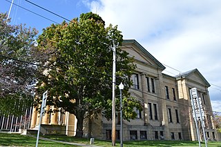
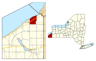
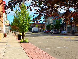
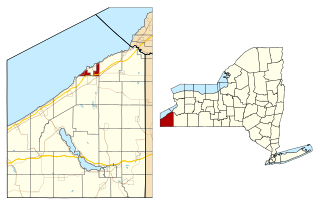
Silver Creek is a village in the town of Hanover in Chautauqua County, New York, United States. As of the 2020 census, the village had a population of 2,637.[2] Silver Creek is named after a small creek which runs through the village. It is on the shore of Lake Erie.
The community was first settled circa 1803, and the first school house was erected in approximately 1823. In 1822 a well-known black walnut tree, measuring about 10 feet (3.0m) in diameter, was blown over in a storm. The village of Silver Creek was incorporated in 1848, and was an important port on Lake Erie until railroads reduced shipping. The village is home to a skew arch railroad bridge, one of the few bridges in the country built on an angle. In September 1886, two trains collided near this location, killing approximately 15 and injuring roughly the same number.
Geography
Silver Creek is located at 42°32'39" North, 79°10'2" West (42.544083, -79.167088).[3] According to the United States Census Bureau, the village has a total area of 1.2square miles (3.0km2); all land. Silver Creek is part of the Lake Erie Basin. The two creeks in the village, Silver Creek and Walnut Creek, drain into the lake. Silver Creek is at the junction of New York State Route 5 (Central Avenue) and US Route 20 (Main Street), north of New York State Thruway (Interstate 90) Exit 58.
The Penn Central's (formerly the Pennsylvania Railroad, or PRR) Buffalo-Corry (PA)-Pittsburgh line formerly operated through Silver Creek. The single-track lines of the NKP and PRR were jointly operated to form a double-track line which was used by the trains of both railroads. The former PRR line was abandoned around 1976 by order of the Interstate Commerce Commission in favor of highway transportation. From approximately 1907 to 1933 Silver Creek was on the Buffalo-to-Erie main line of the Buffalo & Erie Railway (successor to the Buffalo & Lake Erie Traction Company), a high-speed electric interurban railway. It was abandoned by order of the New York Public Service Commission to promote highway transportation.
As of the 2010 census, there were 2,656 people, 1,048 households and 718 families residing in the village. The population density was 2,213.3 inhabitants per square mile (854.6/km2). There were 1,174 housing units, with an average density of 978.3 per square mile (377.7/km2). The racial makeup of the village was 94.2 percent White, 0.9 percent African American, 1.8 percent Native American, 0.5 percent Asian, 0.7 percent from other races, and 1.8 percent from two or more races. 2.8 percent of the population were Hispanic or Latino of any race.
31.8 percent of households had children under the age of 18 living with them, 48.8 percent were married couples living together, 15 percent had a female householder with no husband present, and 31.5 percent were non-families. 26.4 percent of all households were made up of individuals, and 11 percent had someone living alone who was 65 years of age or older. The average household size was 2.51 and the average family size was 2.98.
In the village, the population was spread out, with 28 percent under the age of 20, 7 percent from 20 to 24, 25.5 percent from 25 to 44, 26.7 percent from 45 to 64, and 12.9 percent who were 65 years of age or older. The median age was 37.7 years. For every 100 females, there were 95.9 males. For every 100 females age 18 and over, there were 90.6 males.[6]
The median 2000 income for a household in the village was $32,446, and the median income for a family was $38,617. Males had a median income of $33,889 versus $19,464 for females. The per capita income for the village was $15,904. 12.9% of the population and 9.8% of families were below the poverty line. Out of the total population, 22.8% of those under the age of 18 and 1.9% of those 65 and older were living below the poverty line.
Health care and law enforcement
Silver Creek is served by Brooks Memorial Hospital in Dunkirk, NY.
The village has a volunteer fire department with 50–60 active volunteers and junior firefighters, operating in tandem with the Silver Creek Emergency Squad. They are trained by the New York State Office of Fire Prevention and Control and the New York State Department of Health's Bureau of Emergency Medical Services. On August 9, 2009, the emergency-squad building, the village fire hall and its vehicles sustained extensive damage in a flash flood; the public works department on North Main Street was destroyed (it has since moved to a new building in the former Bentges distributing plant on Routes 5 and 20 in the Town of Hanover. Several homes along Walnut Creek were badly damaged or destroyed, and the Silver Village Trailer Park was leveled by flooding from Silver Creek.[7] Some village streets were badly damaged or washed away by the flood waters. A funeral home, church and school were also badly damaged.
Both Mercy Flight, a nonprofit medivac service based in Buffalo and LifeStar, a medivac service affiliated with UPMC Hamot in Erie, serve the Silver Creek area.
Grape Festival
Every third weekend in September Silver Creek hosts a Festival of Grapes to honor Concord grapes, an important agricultural product. The festival began in 1968[8] and features a parade, live music, a midway, a wine tent, children's and adults' activities and a grape stomping.[9]
In 2008, the Silver Creek Grape Festival was featured on the nationally televised Good Morning America. Diane Sawyer, Robin Roberts, Sam Champion and Chris Cuomo visited a farm to stomp grapes on their trip across America; taken during the 2008 election, they visited 50 states in 50 days learning about the country.[10] Diane Sawyer called it "the first and maybe last annual GMA grape stomping contest in honor of Lucille Ball, who was born 30 minutes from Silver Creek". The four participated in a grape-stomping competition.
The festival concludes every year with the grand parade which features the festival of grapes royalty, local and sometimes county or state political figures, high school marching bands from regional high schools, fire apparatus from Silver Creek, Sunset Bay, Forestville, Hanover Center, Irving, Sheridan, Lake Erie Beach, Angola, and Fredonia. Some years we are lucky to feature local shriners club from Gowanda. Also the Chautauqua County Sheriff's Office mounted unit participates. Also several different youth organizations march in the parade as well as several local fire departments and local veterans.
School
In Silver Creek all three schools (elementary, middle and high school) are physically interconnected, to facilitate the transition to the next stage of learning. The elementary school is attached to the middle school which in turn is attached to the high school.[11] Silver Creek maintains its own transportation department, rather than contracting for school-bus service. Its bus drivers have come from all walks of life; many are retirees. The transportation director is responsible for the district's 30 buses.
There are separate runs for pre-kindergarten to fifth-grade, and sixth- to twelfth-grade students. Four buses are used on a later run for vocational students returning from the LoGuidice Educational Center in Fredonia and students staying late for any reason. The buses are used for school-sponsored sporting events held at other schools, school-sponsored field trips and the annual Class Night party for the graduating class. In the event of a snow day or an unanticipated need for early dismissal, all local television and radio stations are contacted. If the fire-alarm system is activated apart from state-required fire drills Silver Creek Fire and EMS, Sunset Bay Fire, Battalion 1(County Fire Coordinator), County Fire 1(Director of County Emergency Services) are dispatched as 1st Alarm. Fire Chief or Asst. Fire Chief who takes role as Incident Commander at the school determines if 2nd alarm is needed from Fredonia or Dunkirk for their Tower or Ladder truck, County Rescue 71(Fredonia), Hanover Center, Forestville, Irving, and Sheridan.
There is a SADD (Students Against Destructive Decisions) chapter at the high school, counseling students against destructive decisions. It has sponsored movie nights for elementary-school students with movies, food and activities. Once every few years Forestville and/or Silver Creek try to hold a mock DWI Drill just before prom weekend in the spring.
Athletics
The school colors are black and old gold, and its mascot is a black knight. Sports offered are cross-country for boys and girls, football and soccer for boys and soccer, swimming and volleyball for girls.[12] The 2008–2009 boys' varsity football team played at New Era Field in Orchard Park, home of the Buffalo Bills.[13]
Cattaraugus County is a county in Western New York, with one side bordering Pennsylvania. As of the United States 2020 census, the population was 77,042. The county seat is Little Valley. The county was created in 1808 and later organized in 1817. The county is part of the Western New York region of the state.
Chautauqua County is the westernmost county in the U.S. state of New York. As of the 2020 census, the population was 127,657. Its county seat is Mayville, and its largest city is Jamestown. Its name is believed to be the lone surviving remnant of the Erie language, a tongue lost in the 17th century Beaver Wars; its meaning is unknown and a subject of speculation. The county was created in 1808 and organized in 1811. The county is part of the Western New York region of the state.
Erie County is a county along the shore of Lake Erie in western New York State. As of the 2020 census, the population was 954,236. The county seat is Buffalo, which makes up about 28% of the county's population. Both the county and Lake Erie were named for the regional Iroquoian language-speaking Erie tribe of Native Americans, who lived in the area before 1654. They were later pushed out by the more powerful Iroquoian nations tribes. The county is part of the Western New York region of the state.
Cassadaga is a village in Chautauqua County, New York, United States. The village is located within the northeast corner of the town of Stockton, east of the hamlet of Stockton, south of and immediately adjacent to Lily Dale in the town of Pomfret, and north of the village of Sinclairville. As of the 2020 census, the population of Cassadaga was 569.
Forestville is a hamlet in Chautauqua County, New York, United States. The population was 697 at the 2010 census. The hamlet is within the town of Hanover and in the northeast part of the county. It was an incorporated village from 1848 to 2016.
Fredonia is a village in Chautauqua County, New York, United States. The population was 9,871 as of the 2020 census. Fredonia is in the town of Pomfret south of Lake Erie. The village is the home of the State University of New York at Fredonia.
Hanover is a town in Chautauqua County, New York, United States. The population was 6,893 at the 2020 census. The town lies in the northeast corner of Chautauqua County.
Mayville is a village in Chautauqua County, New York, United States. The population was 1,477 at the 2020 census, 13.7% less than in the 2010 census. Mayville is in the town of Chautauqua and is the county seat of Chautauqua County. The village and town offices share a building on Main Street, directly across from the Chautauqua County courthouse.
Sheridan is a town in Chautauqua County, New York, United States. The population was 2,563 at the 2020 census. The town is on the county's northern border, east of Dunkirk.
Angola is a village in the town of Evans in Erie County, New York, United States. Located 2 miles (3 km) east of Lake Erie, the village is 22 miles (35 km) southwest of downtown Buffalo. As of the 2010 Census, Angola had a population of 2,127. An unincorporated community known as Angola on the Lake, with a population of 1,675, lies between Angola village and Lake Erie.
Hornell is a city in Steuben County, New York, United States. The population was 8,259 at the 2020 census. The city is named after the Hornell family, early settlers.
Gowanda is a village in western New York, United States. It lies partly in Erie County and partly in Cattaraugus County. The population was 2,512 at the 2020 census. The name is derived from a local Seneca language term meaning "almost surrounded by hills" or "a valley among the hills". The Erie County portion of Gowanda is part of the Buffalo–Niagara Falls metropolitan statistical area, while the Cattaraugus County portion is part of the Olean micropolitan statistical area.
Dunkirk is a town in Chautauqua County, New York, United States. The population was 1,257 at the 2020 census.
Dunkirk is a city in Chautauqua County, New York, United States. It was settled around 1805 and incorporated in 1880. The population was 12,743 as of the 2020 census. Dunkirk is bordered on the north by Lake Erie. It shares a border with the village of Fredonia to the south, and with the town of Dunkirk to the east and west. Dunkirk is the westernmost city in the state of New York.
Westfield is a town in the western part of Chautauqua County, New York, United States. The population was 4,513 at the 2020 census. Westfield is also the name of a village within the town, containing 65% of the town's population. This unique town is accompanied by vineyards, gorges and historical buildings.
Lancaster is a village in Erie County, New York, United States. As of the 2010 census, the village population was 10,352. It is part of the Buffalo-Niagara Falls metropolitan area.
Lancaster is a town in Erie County, New York, United States, centered 14 miles east of downtown Buffalo. Lancaster is an outer ring suburb of Buffalo. As of the 2020 Census, the town population was 45,106.
Mount Morris is a village in the town of Mount Morris in Livingston County, New York, United States. The village population was 2,986 at the 2010 census, out of 4,465 in the entire town. The village and town are named after Robert Morris.
Addison is a village in Steuben County, New York, United States, in the southeast part of the town of the same name, and southwest of the city of Corning. The population was 1,763 at the 2010 census. The village and the surrounding town are named after the author Joseph Addison.
The Dunkirk, Allegheny Valley and Pittsburgh Railroad is a historic railroad company that operated in Pennsylvania and New York.
This page is based on this Wikipedia article Text is available under the CC BY-SA 4.0 license; additional terms may apply. Images, videos and audio are available under their respective licenses.