Related Research Articles

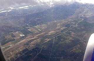
The Santa Clara River Valley is a rural, mainly agricultural, valley in Ventura County, California that has been given the moniker Heritage Valley by the namesake tourism bureau. The valley includes the communities of Santa Paula, Fillmore, Piru and the national historic landmark of Rancho Camulos. Named for the Santa Clara River, which winds through the valley before emptying into the Pacific Ocean between the cities of Ventura and Oxnard, the tourist bureau describes it as ".... Southern California's last pristine agricultural valley nestled along the banks of the free-flowing Santa Clara River."

Officially Good Hope Mountain but commonly known as Mount Good Hope is one of the principal summits of the Pacific Ranges of the southern Coast Mountains in British Columbia, Canada. It stands immediately west of Chilko Lake, with the highest peak on the massif rising between the lake's southern arms.
Chickwolnepy Stream, also called Chickwollopy, is a 14.2-mile-long (22.9 km) river in northern New Hampshire in the United States. It is a tributary of the Androscoggin River, which flows south and east into Maine, joining the Kennebec River near the Atlantic Ocean.
The Whiteface River is a 5.9-mile-long (9.5 km) river rising in the White Mountains of New Hampshire in the United States. Its waters flow by way of the Cold River, Bearcamp River, Ossipee Lake, the Ossipee River and the Saco River into the Gulf of Maine, an arm of the Atlantic Ocean.

Ryer Island is an island in the Sacramento-San Joaquin River Delta surrounded by Miner Slough and Steamboat Slough at their confluence with the Sacramento River, 6.5 miles north-northeast of Rio Vista. It is in Solano County, California, and managed by Reclamation District 501. The 4,750 ha (11,700-acre) island is named in honor of a California pioneer, Dr. Washington M. Ryer, and his family. A map prepared at the time of statehood shows the area divided by the west fork of the Sacramento River, with the western half identified as Priest Island and the eastern half identified as Sutter Island.
Waterman Creek is a 3.0-mile-long (4.8 km) southward-flowing stream in southern San Mateo County, California. Rising near Big Basin Way and the Santa Cruz County line, it empties into Pescadero Creek.

The Bald Mountains are a mountain range rising along the border between Tennessee and North Carolina in the southeastern United States. They are part of the Blue Ridge Mountain Province of the Southern Appalachian Mountains. The Bald Mountains stretch from the Pigeon River in the south to the Nolichucky River in the north, and comprise parts of Cocke County, Greene County, and Unicoi County in Tennessee and parts of Madison County and Yancey County in North Carolina. The Great Smoky Mountains border the range to the south, and the Unakas rise opposite the Nolichucky to the north. The range gets its name from the relatively frequent occurrence of grassy balds atop the more prominent summits.
The Indian Pass Wilderness is 32,418-acre (13,119 ha) wilderness area under the administered by the Bureau of Land Management. The reserve is located in the very southeastern part of the Chocolate Mountains, in the southeastern part of California, just to the west of the Colorado River in the Lower Colorado River Valley. It adjoins the Picacho Peak Wilderness to the south, and the Imperial National Wildlife Refuge to the east.
Dinsmore is an unincorporated community in California. It is located on the Van Duzen River, at an elevation of 2,415 feet (736 m). Dinsmore Airport and the Dinsmore Store are located nearby. Also nearby is the Mad River, Ruth, California and Ruth Reservoir.
Indian Wells is a former settlement in Imperial County, California. It was located 8 miles (13 km) south-southwest of Seeley.

Old River is an unincorporated community in Kern County, California. It is located 9.5 miles (15 km) southwest of Bakersfield, at an elevation of 344 feet (105 m).

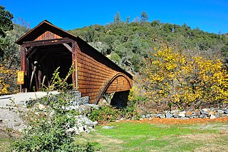
Bridgeport is a former settlement on the Yuba River in Nevada County, California, 2 mi (3.2 km) from the town of French Corral. Its elevation is 567 ft (173 m) above sea level.

Dos Rios is an unincorporated community in Mendocino County, California. It is located 7 miles (11 km) east-northeast of Laytonville, at an elevation of 961 feet (293 m). Dos Rios's ZIP code, 95429, has a population of 70. The Dos Rios AVA is located in the area.

The Cousins River is a 4.7-mile-long (7.6 km), primarily tidal river in southern Maine. Rising in the town of Freeport at the junction of Harvey Brook and Merrill Brook, it flows south and forms, for most of its course, the boundary between Freeport and Yarmouth. It flows into the Royal River just west of its mouth in Casco Bay.
The Littlefield River is a 3.8-mile-long (6.1 km) tributary of the Middle Branch Mousam River in York County, Maine. Via the Middle Branch and the Mousam River, its waters flow to the Atlantic Ocean.
Parker Dam is an unincorporated community in San Bernardino County, California, United States. Parker Dam is located along the Colorado River across from Arizona 24 miles (39 km) east-northeast of Vidal. It is named after Parker Dam, which impounds the Colorado River nearby. Parker Dam has a post office with ZIP code 92267. The post office opened in 1935 and closed briefly between 1939 and 1940.

The Middle Fork Kings River is a 37.2-mile (59.9 km) tributary of the Kings River in Kings Canyon National Park, California, in the southern Sierra Nevada. Draining 318 square miles (820 km2) – almost all of it wilderness – the Middle Fork is one of the largest wholly undeveloped watersheds in the state, with no dams or paved roads within its basin. The entire length of the Middle Fork is designated a National Wild and Scenic River.
References
- ↑ U.S. Geological Survey Geographic Names Information System: Rising River
- ↑ Gudde, Erwin Gustav (1960). California Place Names: The Origin and Etymology of Current Geographical Names. University of California Press. p. 3. GGKEY:403N5Z6QERG.