
The River Trent is the third-longest river in the United Kingdom. Its source is in Staffordshire on the southern edge of Biddulph Moor. It flows through and drains most of the metropolitan central and northern Midlands south and east of its source north of Stoke-on-Trent. The river is known for dramatic flooding after storms and spring snowmelt, which in past times often caused the river to change course.

Hinckley and Bosworth is a local government district with borough status in south-western Leicestershire, England, administered by Hinckley and Bosworth Borough Council. Its only towns are Hinckley, Earl Shilton and Market Bosworth. Villages include Barwell, Burbage, Stoke Golding, Groby, Shackerstone and Twycross. The population of the Borough at the 2011 census was 105,078.

The River Tame is a river in the West Midlands of England, and one of the principal tributaries of the River Trent. The Tame is about 95 km (59 mi) long from the source at Oldbury to its confluence with the Trent near Alrewas, but the main river length of the entire catchment, i.e. the Tame and its main tributaries, is about 285 km (177 mi).

The Walloomsac River from the Native American name, Wal-loom-sac is a 16.8-mile-long (27.0 km) tributary of the Hoosic River in the northeastern United States. It rises in southwestern Vermont, in the Green Mountains east of the town of Bennington in Woodford Hollow at the confluence of Bolles Brook and City Stream where it is labeled Walloomsac Brook on maps but is locally known as "The Roaring Branch". The river then flows west toward Bennington and passes the downtown area to the north. For many years this section was intermittent due to the water having been diverted to power mills in town. This divergence gave the name Walloomsac to a portion of the river flowing through town on the present course of South Stream. The combined Walloomsac / South Stream joins the Roaring Branch northwest of town. From here the river flows westward as the Walloomsac River and joins the Hoosic River below Hoosick Falls, New York.

The River Quaggy is a river, 17 kilometres (11 mi) in length, passing through the south-east London boroughs of Bromley, Greenwich and Lewisham. In its lower reaches it is an urban river, in its upper reaches further from London it is more natural and known as the Kyd Brook. The river rises from two sources near Princess Royal University Hospital (PRUH) at Locksbottom and is a tributary of the River Ravensbourne which it flows into near Lewisham station in Lewisham.

The Afon Mawddach is a river in Gwynedd, Wales, which has its source in a wide area SH820300 north of Dduallt in Snowdonia. It is 28 miles (45 km) in length, and is much branched; many of the significant tributaries are of a similar size to the main river. The catchment area is bounded to the east by the Aran Fawddwy massif and to the west and north by the Harlech dome which forms a watershed just south of Llyn Trawsfynydd.

Eye Water is a river in the Scottish Borders, it flows in a general southeasterly direction from its source in the Lammermuir Hills to its estuary at Eyemouth on the east coast of Scotland, having a length of approximately 35 kilometres (22 mi).

The River Gwash, a tributary of the River Welland, flows through the English counties of Leicestershire, Rutland and Lincolnshire. It rises just outside the village of Knossington in Leicestershire, near the western edge of Rutland. It is about 39 kilometres (24 mi) long.

Stapleton is a village in south-west Leicestershire, England, about ten miles south-west of Leicester city centre. Its population was 427 people at the 2001 census. The population at the 2011 census was included in the civil parish of Peckleton

The River Colne is a small river that runs through Essex, England and passes through Colchester. It is not a tributary of any other river, instead having an estuary that joins the sea near Brightlingsea.

The River Tolka, also once spelled Tolga, is one of Dublin's three main rivers, flowing from County Meath to Fingal within the old County Dublin, and through the north of Dublin city, Ireland. By flow of water, the Tolka is the second largest river in Dublin, following the Liffey, but runs more slowly than the Dodder.
The River Eye is a river in north-eastern Leicestershire that becomes the Wreake.

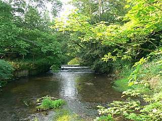
The River Sence is a river which flows in Leicestershire, England. The tributaries of the Sence, including the Saint and Tweed, fan out over much of western Leicestershire from Charnwood Forest and Coalville in the north-east to Hinckley and almost to Watling Street in the south and south-west. Its watershed almost coincides with Hinckley and Bosworth Borough of Leicestershire, which was formed in 1974 by amalgamation of Market Bosworth Rural District and Hinckley Urban District. It flows into the Anker, which in turn flows into the River Tame. It is part of the wider River Trent catchment, which covers much of central England. In 1881, Sebastian Evans wrote that the usual names for this river were Shenton Brook and Sibson Brook.

The River Mease is a lowland clay river in the Midlands area of England. It flows through the counties of Leicestershire, Derbyshire and Staffordshire and forms the administrative border between these counties for parts of its length.
Cound Brook is a tributary of the River Severn in Shropshire, England, running to south of the county town Shrewsbury. The Cound Brook rises in the Stretton Hills and discharges into the River Severn at Eyton on Severn after winding its way for 25 miles (40 km) across the southern Shropshire-Severn plains.

The River Sence is a Leicestershire (England) tributary of the larger River Soar. The River Sence can be traced eastwards up to the village of Billesdon, and then flows south west through Great Glen, Leicestershire, and then west until the confluence with the River Soar just to the west of Blaby. Tracing the River Sence upstream, the Environment Agency does monitor the river between Blaby and Great Glen, but there has been no significant flooding in recent years, and the land along the River Sence is largely agricultural. In 1881 Sebastian Evans wrote that the usual names for this river were Billesdon Brook and Burton Brook.

The River Calder is a river in West Yorkshire, in Northern England.

The River Swift is a 14-mile (23 km) long tributary of the River Avon that rises in south Leicestershire, and flows through the town of Lutterworth before joining the Avon at its confluence at Rugby in Warwickshire in the English Midlands.

River Mease SSSI is a 23.0 hectares biological Site of Special Scientific Interest. It is a stretch of the River Mease and its tributary Gilwiskaw Brook, running between Alrewas in Staffordshire and Packington in Leicestershire. It is also a Special Area of Conservation The river goes through private land, but it is crossed by roads and footpaths.

Kelham Bridge is a 8.1 hectares nature reserve north of Ibstock in Leicestershire. It is owned and managed by the Leicestershire and Rutland Wildlife Trust.
