Roads in Kazakhstan

Last updated

A list of roads in Kazakhstan.

Systems

The codes are in Latin, and thus, transliteration is not required (for example writing "P" as "R"). The highways of general government ("Republican") Significance are divided into three groups whose names differ by a code letter: [1]

Contents

There also are highways of Regional significance. Each region's highways get their own specific codes. The codes are in Latin, and thus, transliteration is not required.

International highways

RoadDirectionLength
M32-CIS.svg M 32 Border of RussiaOralAktobeKyzylordaShymkent 2059,6 km
M36-CIS.svg M 36
M36-Green-CIS.svg
Border of RussiaKostanayAstanaKaragandaAlmaty 2047,1 km
M38-CIS.svg M 38 Border of RussiaPavlodarSemeyMaikapschagai – Border of China 1081 km
M39-CIS.svg M 39 Border of KirghizistanLugovoy 24,1 km
M51-CIS.svg M 51 Border of RussiaPetropavl – Border of Russia190 km

National Highways

RoadNameDirectionLength
A1-KZ.svg A 1
A1-Green-KZ.svg
A1 AstanaKokshetauPetropavl 456 km
A2-KZ.svg A 2 A2 Border of UzbekistanShymkentTarazAlmaty – Border of China (after N312)
Branch: Kenen - Korday - Border of Kyrgyzstan
1292 km
A3-KZ.svg A 3
A3-Green-KZ.svg
A3 AlmatyOskemen 1212 km
A4-KZ.svg A 4 A4 AlmatyUzynagash – border of Kyrgyzstan 132 km
A5-KZ.svg A 5' A5 AksayChundzha – border of China 160 km
A6-KZ.svg A 6 A6 KokpekKegen – border of Kyrgyzstan 115 km
A7-KZ.svg A 7 A7 UsharalDostyk 184 km
A8-KZ.svg A 8 A8 TaskeskenBakhty – border of China 187 km
A9-KZ.svg A 9 A9 OskemenRidder – border of Russia 167 km
A10-KZ.svg A 10 A10 OskemenShemonaikha – border of Russia 120 km
A11-KZ.svg A 11 A11 SemeyRubtsovsk 111 km
A12-KZ.svg A 12 A12 PetropavlSokolovka – border of Russia 62 km
A13-KZ.svg A 13 A13 KokshetauKishkenekol – border of Russia (after P393)278 km
A14-KZ.svg A 14 A14 Taraz – border of Kyrgyzstan 14 km
A15-KZ.svg A 15 A15 Zhybek ZholyZhetysai – border of Uzbekistan 150 km
A16-KZ.svg A 16 A16 JezkazganPetropavl 940 km
A17-KZ.svg A 17
A17-Green-KZ.svg
A17 KyzylordaPavlodarUspenka 1509 km
A18-KZ.svg A 18 A18 PavlodarSharbakty – border of Russia 122 km
A19-KZ.svg A 19 A19 TerenkolMikhailovka – border of Russia 108 km
A20-KZ.svg A 20 A20 TemirtauAyagozTarbaghataiM38 (Bugas)921 km
A21-KZ.svg A 21 A21 MamlyutKostanay 398 km
A22-KZ.svg A 22 A22 KarabutakKomsomol'skoe, KazakhstanDenisovkaRudny, KazakhstanKostanay 551 km
A23-KZ.svg A 23 A23 DenisovkaZhetikaraMuktikol 142 km
A24-KZ.svg A 24 A24 AktobeMartok – border of Russia 105 km
A25-KZ.svg A 25 A25 AktobeAlimbet – border of Russia 127 km
A26-KZ.svg A 26 A26 KandyagashEmbiShalkarYrgyz 401 km
A27-KZ.svg A 27 A27 AktobeKandyagashAtyrau – border of Russia 871 km
A28-KZ.svg A 28 A28 OralAtyrau 487 km
A29-KZ.svg A 29 A29 OralTaskala – border of Russia 100 km
A30-KZ.svg A 30 A30 PodsepnoyeFyodorovka – border of Russia 144 km
A31-KZ.svg A 31 A31 ChapaevKaztalZhanybek 218 km
A32-KZ.svg A 32 A32 Oral – border of Russia 28 km
A33-KZ.svg A 33 A33 DossorAktau 798 km
A34-KZ.svg A 34 A34 ZhetybaiZhanaozen – border of Turkmenistan 237 km
A35-KZ.svg A 35 A35 AktobeKuryk 59 km
A36-KZ.svg A 36 A36 KurykZhetybai 64 km

Regional Highways

RoadNameDirectionLength
P1-KZ.svg P 1 P1 Beyneu - Akzhigit - Border of Uzbekistan 84 km
P2-KZ.svg P 2 P2 Astana - Korgalzhyn - Korgalzhyn Nature Reserve 161 km
P3-KZ.svg P 3 P3 Astana - Kievka - Temirtau 250 km
P4-KZ.svg P 4
P4-Green-KZ.svg
P4 Astana - Ereymetau - Shiderty 243 km
P6-KZ.svg P 6 P6 Makinsk - Stepnogorsk - Turgay 235 km
P7-KZ.svg P 7 P7 Burabay National Park 66 km
P8-KZ.svg P 8 P8 Shchuchinsk - Zeredi 80 km
P9-KZ.svg P 9 P9 Vyacheslavskoe Reservoir 17 km
P10-KZ.svg P 10 P10 Astana Bypass52.7 km
P11-KZ.svg P 11 P11 Kokshetau - Saumalkol - Ruzaevka 196 km
P12-KZ.svg P 12 P12 Kokshetau - Zerendi - Atbasar 184 km
P13-KZ.svg P 13 P13 Zhaksy - Esil - Buzuluk 82 km
P14-KZ.svg P 14 P14 Kokshetau Bypass18 km
P15-KZ.svg P 15 P15 Kegen - Narynkol 89 km
P16-KZ.svg P 16 P16 A6-KZ.svg A 6 - Zhalanash - Saty - Kolsay Lakes National Park 89 km
P17-KZ.svg P 17 P17 Almati - Talgar - Yevgenyevka 71 km
P18-KZ.svg P 18 P18 Kapchagay - Kurty 67 km
P19-KZ.svg P 19 P19 Bayserka - Chalaevo - Mezhdurechenskoe 52 km
P20-KZ.svg P 20 P20 Saryozek - Koktal 192 km
P21-KZ.svg P 21 P21 Alatau Mountains 15 km
P22-KZ.svg P 22 P22 Almati - Alma-Arasan 45 km
P23-KZ.svg P 23 P23 Semey - Kaynar 276 km
P24-KZ.svg P 24 P24 Oskemen - Semey 195 km
P25-KZ.svg P 25 P25 Oskemen - Zyryanovsk - Ulken-Naryn - Katonkaragay - Rakhmanovskie Klyuchi 446 km
P26-KZ.svg P 26 P26 M38-CIS.svg M 38 - Kalzhyr - Terekty 126 km
P27-KZ.svg P 27 P27 Kalkaman - Bayanaul - Umutker - Botakara 324 km
P28-KZ.svg P 28 P28 Saumalkol - Madeniet - Karasai and Agyntaya Batyr Memorial Complex 24 km
P29-KZ.svg P 29 P29 Merki - Shu - Khantau - M36-CIS.svg M 36 273 km
P30-KZ.svg P 30 P30 Shu - Kaynar 56 km
P31-KZ.svg P 31 P31 Kentau - Turkistan - Arystan Bab - tortkoly 145 km
P32-KZ.svg P 32 P32 Turkistan Bypass13 km
P33-KZ.svg P 33 P33 Kyzylorda - Zhalagash - M32-CIS.svg M 32 91 km
P34-KZ.svg P 34 P34 Togusken - Zhayrem - Karazhal - Atasu 144 km
P35-KZ.svg P 35 P35 Akchatau - Agadyr - Otrau - A17-KZ.svg A 17 195 km
P36-KZ.svg P 36 P36 Kostanay - Auliekol - Surgan 257 km
P37-KZ.svg P 37 P37 Botakara - Aktau - Temirtau
(Karaganda Bypass)
53 km
P38-KZ.svg P 38 P38 Kostanay Southern Bypass
(At Minchurinskoe)
6 km
P39-KZ.svg P 39 P39 Kostanay Western Bypass21 km
P40-KZ.svg P 40 P40 Atyrau Bypass45 km
P42-KZ.svg P 42 P42 Kabanbay Batyr - Kabanbay Batyr Memorial Complex
50.8726149,71.4145716
4 km
P43-KZ.svg P 43 P43 Rudny West Bypass6.9 km
P44-KZ.svg P 44 P44 Kaztal - Zhanybek - Border of Russia 162 km
P45-KZ.svg P 45 P45 Leninskoye - Aksi - Koktobe - Kurchatov 227 km
 P-46  P46 A1-Green-KZ.svg - Shchuchinsk-Borovoe Resort Zone8.9 km
 P-47  P47 Korday (A-2) - Karasu (P-66) - Border of Kyrgyzstan 17.7 km
 P-48  P48 Almaty - Alatau Park of Innovative Technologies9.95 km
 P-49  P49 Petropavl Bypass30 km
 P-50  P50 Northern Aktobe Bypass39.3 km
 P-51  P51 Önege (P-44) - Bisen - Saykyn 103 km
 P-52  P52 Novyy Koluton - Akkol - A1-Green-KZ.svg - Sazdı Bulaq - Stepnogorskoye (P-6)222 km
 P-53  P53 A2-KZ.svg A 2 - Turar Ryskulov - A2-KZ.svg A 2 31 km
 P-54  P54 M36-CIS.svg M 36 - Karaganda 16 km
 P-55  P55 P4-Green-KZ.svg - Ereymentau 36 km
 P-56  P56 P-51 - Khan Orda 21 km
 P-57  P57 Peterfeld (M-51) - A16-KZ.svg A 16 30.5 km
 P-58  P58 Bulayevo (M-51) - Vozvyshenka - Molodogvardeyskoye - Kirovo - Kiyaly - Roshchinsky (A-1/P-59)228.4 km
 P-59  P59 Roshchinsky (A-1/P-58) - Korneyevka - Voloshinka (P-60)86.9 km
 P-60  P60 Voloshinka (P-59) - Sergeyev - Timiryazevo (P-61)119.4 km
 P-61  P61 Timiryazevo (P-60) - Sarykol (M-36)31.6 km
 P-62  P62 A1-KZ.svg A 1 - Petropavl Airport 5 km
 P-63  P63 Denisovka - Tavrichen - Arshaly - Komarovka 96 km
 P-64  P64 Zhetikara - Chaykovsky 27 km
 P-65  P65 M36-CIS.svg M 36 - Marinkova 9 km
 P-66  P66 Karasu (P-47) - Masanchi - Sortobe 45 km

License plate Code

Region/CityOld codeNew code
Almaty A02
Almaty Region B05
Astana Z01
Akmola Region C03
Aktobe Region D04
Atyrau Region E06
Mangystau Region R12
North Kazakhstan Region T15
East Kazakhstan Region F16
Pavlodar Region S14
Karaganda Region M09
Kostanay Region P10
Kyzylorda Region N11
Jambyl Region H08
South Kazakhstan Region X13
West Kazakhstan Region L07

Related Research Articles

<span class="mw-page-title-main">Vehicle identification number</span> System for identifying vehicles

A vehicle identification number (VIN) (also called a chassis number or frame number) is a unique code, including a serial number, used by the automotive industry to identify individual motor vehicles, towed vehicles, motorcycles, scooters and mopeds, as defined by the International Organization for Standardization in ISO 3779 (content and structure) and ISO 4030 (location and attachment).
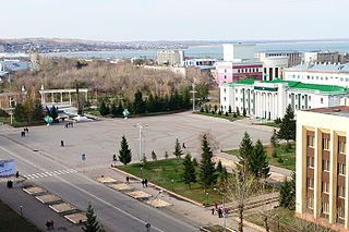
<span class="mw-page-title-main">Kokshetau</span> City in Akmola Region, Kazakhstan

Kokshetau, formerly known as Kokchetav is a lakeside city in northern Kazakhstan and the capital of Akmola Region (oblys), which stretches along the southern shore of Lake Kopa, lying in the north of Kokshetau Hills, a northern subsystem of the Kokshetau Uplands (Saryarka) and the southern edge of the Ishim Plain. It is named after the Mount Kokshe.

A raion is a type of administrative unit of several post-Soviet states. The term is used for both a type of subnational entity and a division of a city. The word is from the French rayon, and is commonly translated as "district" in English.

<span class="mw-page-title-main">Romanization of Hebrew</span> Transcription of Hebrew into the Latin alphabet

The Hebrew language uses the Hebrew alphabet with optional vowel diacritics. The romanization of Hebrew is the use of the Latin alphabet to transliterate Hebrew words.

<span class="mw-page-title-main">Chüy Region</span> Region of Kyrgyzstan

Chüy Region is the northernmost region (oblast) of the Kyrgyz Republic. This region surrounds the national capital of Kyrgyzstan, Bishkek. It is bounded on the north by Kazakhstan, and clockwise, Issyk-Kul Region, Naryn Region, Jalal-Abad Region, and Talas Region. Its administrative center is Bishkek. Its total area is 19,895 km2 (7,682 sq mi). The resident population of the region was 974,984 as of January 2021. The region has sizeable Russian and Dungan minorities. It takes its name from the river Chüy, that flows through the region.

<span class="mw-page-title-main">Talas Region</span> Region of Kyrgyzstan

Talas Region is a region (oblast) of Kyrgyzstan. Its capital is Talas. It is bordered on the west and north by Jambyl Region of Kazakhstan, on the east by Chüy Region, on the south by Jalal-Abad Region and on the southwest by a finger of Uzbekistan. Its total area is 13,406 km2 (5,176 sq mi). The resident population of the region was 270,994 as of January 2021. The historic Battle of Talas between the Abbasid Caliphate & the Tang dynasty was fought here, which culminated in an Abbasid victory and led to the Islamization of Central Asia.

<span class="mw-page-title-main">County highway</span> Type of highway

A county highway is a road in the United States and in the Canadian province of Ontario that is designated and/or maintained by the county highway department. Route numbering can be determined by each county alone, by mutual agreement among counties, or by a statewide pattern.

<span class="mw-page-title-main">Interchange (road)</span> Road junction that uses grade separation

In the field of road transport, an interchange or a grade-separated junction is a road junction that uses grade separations to allow for the movement of traffic between two or more roadways or highways, using a system of interconnecting roadways to permit traffic on at least one of the routes to pass through the junction without interruption from crossing traffic streams. It differs from a standard intersection, where roads cross at grade. Interchanges are almost always used when at least one road is a controlled-access highway or a limited-access divided highway (expressway), though they are sometimes used at junctions between surface streets.
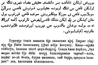
<span class="mw-page-title-main">Kazakh alphabets</span> Alphabets used to write the Kazakh language

Three alphabets are used to write Kazakh: the Cyrillic, Latin and Arabic scripts. The Cyrillic script is used in Kazakhstan and Mongolia. An October 2017 Presidential Decree in Kazakhstan ordered that the transition from Cyrillic to a Latin script be completed by 2031. The Arabic script is used in Saudi Arabia, Iran, Afghanistan, and parts of China.

Scientific transliteration, variously called academic, linguistic, international, or scholarly transliteration, is an international system for transliteration of text from the Cyrillic script to the Latin script (romanization). This system is most often seen in linguistics publications on Slavic languages.

<span class="mw-page-title-main">Highways in Spain</span>

The Spanish motorway (highway) network is the third largest in the world, by length. As of 2019, there are 17,228 km (10,705 mi) of High Capacity Roads in the country. There are two main types of such roads, autopistas and autovías, which differed in the strictness of the standards they are held to.

<span class="mw-page-title-main">Latin script</span> Writing system based on the alphabet used by the Romans

The Latin script, also known as the Roman script, is an alphabetic writing system based on the letters of the classical Latin alphabet, derived from a form of the Greek alphabet which was in use in the ancient Greek city of Cumae, in southern Italy. The Greek alphabet was altered by the Etruscans, and subsequently their alphabet was altered by the Romans. Several Latin-script alphabets exist, which differ in graphemes, collation and phonetic values from the classical Latin alphabet.
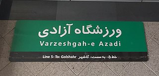
<span class="mw-page-title-main">Romanization of Persian</span> Representation of the Persian language with the Latin script

Romanization or Latinization of Persian is the representation of the Persian language with the Latin script. Several different romanization schemes exist, each with its own set of rules driven by its own set of ideological goals.
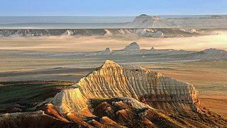
<span class="mw-page-title-main">Aktobe Region</span> Region of Kazakhstan

Aktobe Region is a region of Kazakhstan. The name Aktobe comes from Kazakh aq 'white' and töbe 'hill' or 'top '; supposedly, Aktobe's initial settlers were able to see white mountains far to the north. The Aktobe regional capital is the city of Aktobe. The region is located in the western part of Kazakhstan. Its area is 300,629 km2, which is 11 per cent of the territory of Kazakhstan. The population is 909 673 as of June 1, 2022.

<span class="mw-page-title-main">Soviet infrastructure in Central Asia</span> Soviet infrastructural presence in Central Asia

Much of the influence of the Soviet Union can be seen in the infrastructure of Central Asia. Central Asia is a nexus of said infrastructure for transportation, goods delivery and energy distribution. Much of the industrial infrastructure had greatly declined in the 1990s, after the fall of the Soviet Union, especially in Kyrgyzstan and Tajikistan. The roads, railroads and energy lines are thus oriented towards the Russian Federation and away from other regional neighbors, such as China, Afghanistan or Iran.

<span class="mw-page-title-main">Kostanay</span> City in Kostanay Region, Kazakhstan

Kostanay or Qostanai, Russian: Костанай) is a city located on the Tobol River in northern Kazakhstan. Kostanay is the administrative center of the Kostanay Region. As of 24 March 2022, the city's governor is Marat Zhundubayev.

<span class="mw-page-title-main">Shymkent</span> City of republican significance, Kazakhstan

Shymkent is a city in Kazakhstan, near the border with Uzbekistan. It is one of three Kazakh cities that have the status of a city of republican significance that of a region. It is the third-most populous city in Kazakhstan, behind Almaty and Astana, with an estimated population of 1,002,291 as of 1 June 2018. According to regional and city officials, the millionth resident of Shymkent was born on 17 May 2018. It is a regional cultural centre. Shymkent is situated 690 kilometres (430 mi) west of Almaty and 1,483 kilometres (920 mi) south of Astana. It is also 120 kilometres (75 mi) to the north of Tashkent, Uzbekistan.

<span class="mw-page-title-main">Roads in Azerbaijan</span>

Roads in Azerbaijan are the main transport network in Azerbaijan. With the railway network still undergoing modernization and not covering the entire country, especially mountainous areas and other areas with difficult topography, the road system is the most important form of transport in the country. Its role is important both with national, and as an important transit country, with international traffic.

The roads that join the towns of Dalby, Oakey and Cooyar form a triangle that encloses some of the most fertile land on the Darling Downs in Queensland, Australia. These roads are the Warrego Highway, Oakey–Cooyar Road and Dalby–Cooyar Road. Several of the more significant internal roads intersect with Dalby–Cooyar Road, and these are briefly described in this article, along with some significant external roads.

References

  1. Gemäß Anordnung der Regierung der Republik Kasachstan Nr. 1809 vom 5. Dezember 2000, mit nachfolgenden Änderungen

See also