Rochester, Iowa | |
|---|---|
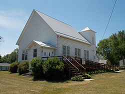 Rochester United Methodist Church | |
 Rochester Location within the state of Iowa | |
| Coordinates: 41°40′29″N91°09′03″W / 41.67472°N 91.15083°W [1] | |
| Country | United States |
| State | Iowa |
| County | Cedar |
| Area | |
• Total | 0.98 sq mi (2.53 km2) |
| • Land | 0.95 sq mi (2.46 km2) |
| • Water | 0.02 sq mi (0.06 km2) |
| Elevation | 696 ft (212 m) |
| Population (2020) | |
• Total | 142 |
| • Density | 149.16/sq mi (57.61/km2) |
| Time zone | UTC-6 (Central (CST)) |
| • Summer (DST) | UTC-5 (CDT) |
| ZIP code | 52772 |
| FIPS code | 19-67890 |
| GNIS feature ID | 2629971 [1] |
Rochester is an unincorporated community and census-designated place (CDP) in Rochester Township, Cedar County, Iowa, United States. As of the 2020 census it had a population of 142.
