Rock Island County is a county located in the U.S. state of Illinois, bounded on the west by the Mississippi River. According to the 2010 census, it had a population of 147,546. Its county seat is Rock Island; its largest city is neighboring Moline.

Hanapepe is a historic, unincorporated community in Kauai County, Hawaii, United States. The name means "crushed bay" in Hawaiian, which may refer to landslides in the area. Hanapepe is a census-designated place (CDP) for statistical purposes, with a population of 2,638 at the 2010 census, up from 2,153 at the 2000 census.

Munising Township is a civil township of Alger County in the U.S. state of Michigan. As of the 2010 census, the township population was 2,983.
Rockville is a city in Stearns County, Minnesota, United States. The population was 2,448 as of the 2010 census. It is part of the St. Cloud Metropolitan Statistical Area.

Villa Ridge is an unincorporated community and census-designated place (CDP) in Franklin County, Missouri, United States. The population was 2,636 at the 2010 census, up from 2,417 at the 2000 census.
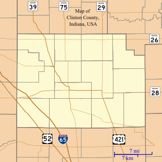
Manson is an unincorporated community in Perry Township, Clinton County, Indiana. The town is named for Mahlon Dickerson Manson, a general in the American Civil War and Lieutenant Governor of Indiana.
Black River is a 29.8-mile-long (48.0 km) river on the Upper Peninsula of the U.S. state of Michigan. The river flows into the Middle Branch Escanaba River in Ely Township of Marquette County at 46°23′53″N87°46′15″W and on into Lake Michigan.

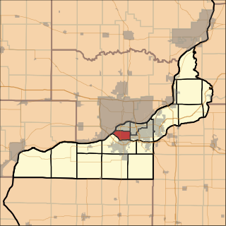
Hampton Township is located in Rock Island County, Illinois. As of the 2010 census, its population was 21,711 and it contained 9,119 housing units.
South Rock Island Township is located in Rock Island County, Illinois. As of the 2010 census, its population was 18,407 and it contained 8,951 housing units. South Rock Island Township formed from Rock Island Township on March 1, 1878.

Colona Township is one of twenty-four townships in Henry County, Illinois, USA. As of the 2010 census, its population was 6,822 and it contained 2,773 housing units. Colona Township changed its name from Green River Township on April 13, 1857.

Hanna Township is one of twenty-four townships in Henry County, Illinois, USA. As of the 2010 census, its population was 2,344 and it contained 923 housing units.

Phenix Township is one of twenty-four townships in Henry County, Illinois, USA. As of the 2010 census, its population was 1,672 and it contained 654 housing units.

Pontiac is an unincorporated community in Van Buren Township, Clay County, Indiana. It is part of the Terre Haute Metropolitan Statistical Area.

Valentine is an unincorporated community in Johnson Township, LaGrange County, Indiana.

Rock Grove Township is one of twelve townships in Floyd County, Iowa, USA. As of the 2000 census, its population was 1,849.

Glenn Ayr or Glenn Ayre is an unincorporated community in central Lost Creek Township, Vigo County, in the U.S. state of Indiana.
Larimer Hill is an unincorporated community in Sugar Creek Township, Vigo County, in the U.S. state of Indiana.
Round Grove is an unincorporated community in Round Grove Township, White County, in the U.S. state of Indiana.
Clinton Township is a township in Divide County, North Dakota, United States of America.