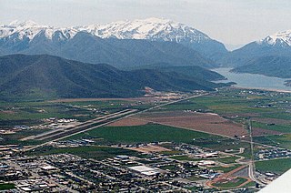
Rocky Ridge, Utah

Last updated

Rocky Ridge, Utah
Juab County Utah incorporated and unincorporated areas Rocky Ridge highlighted.svg
Location of Rocky Ridge within Juab County and the state of Utah
Coordinates: 39°55′30″N111°49′35″W / 39.92500°N 111.82639°W / 39.92500; -111.82639
Country United States
State Utah
County Juab
Incorporated January 1, 1998
Area
[1]
  Total1.71 sq mi (4.44 km2)
  Land1.71 sq mi (4.44 km2)
  Water0.00 sq mi (0.00 km2)
Elevation
[2]
4,951 ft (1,509 m)
Population
 (2020)
  Total848
  Density500.58/sq mi (193.32/km2)
Time zone UTC-7 (Mountain (MST))
  Summer (DST) UTC-6 (MDT)
ZIP Code
84645
FIPS code 49-64590 [3]
GNIS feature ID2412568 [2]
Website www.rockyridgetown.com

Rocky Ridge is a town on the northeastern edge of Juab County, Utah, United States. [2] [4] As of the 2010 census it had a population of 733, [5] and in 2018 the estimated population was 833. [6]

Contents

The town is located on the northern edge of the Juab Valley in the eastern foothills of the Wasatch Range, but entirely west of Interstate 15 (I‑15). [7] It is part of the Provo Orem, Utah Metropolitan Statistical Area.

While there is a "Rocky Ridge" [8] and a "Rocky Ridge Canyon" [9] in northeastern Juab County (both located east of the city of Nephi, approximately 16 miles [26 km] south‑southeast of the community), the town was named for "the rocks, in a bountiful array of types and colors, strewn plentifully across the surrounding ridges separating Juab and Utah counties," according to the town website. [10]

History

The original community in the area was known as York and was the southern terminus of the Utah Southern Railroad from February 1875 to May 1979. [10] (The Utah Southern Railroad was controlled by the Union Pacific Railroad.) [11] However, after the railroad was extended further south, the community of York was essentially abandoned. [10] [12] A post office had been established in the community in 1875, but it closed in 1879. [13]

Nearly a century passed without much change, but by 1971 Marvin L. Allred had purchased 225 acres (91 ha) in the area and I‑15 had been completed to just north of the Juab‑Utah county line. Over the next quarter century the community (which had become known as locally as Allred Ranch) [14] continued growing, with the completion of I‑15 through the valley and the addition of more than 950 acres (380 ha) to the community. [10]

In May 1996, the Juab County Commissioners received a petition to incorporate the area under the name "Rocky Ridge". (A few years prior some residents of the area had petitioned unsuccessfully for incorporation under the name "York".) The later petition indicated that the population of the area had reached 210. [14] By October of that year, the petition for incorporation was approved. [15]

Geography

Rocky Ridge is in the northeast corner of Juab County, at the northern end of the Juab Valley. It is bordered to the north by the city of Santaquin. Interstate 15 runs just east of the town limits, with access from the north at Exit 242 (Summit Ridge Parkway) in Santaquin. Payson is 11 miles (18 km) to the north, and Mona is 8 miles (13 km) to the south. Nephi, the Juab County seat, is 15 miles (24 km) south of Rocky Ridge.

According to the United States Census Bureau, the town has a total area of 2.1 square miles (5.5 km2), all land. [5]

Demographics

Historical population
CensusPop.Note
2000 403
2010 73381.9%
2020 84815.7%
U.S. Decennial Census [16]

As of the census [3] of 2000, there were 403 people, 61 households, and 60 families residing in the town. The population density was 214.9 people per square mile (82.8/km2). There were 73 housing units at an average density of 38.9 per square mile (15.0/km2). The racial makeup of the town was 99.26% White, 0.25% from other races, and 0.50% from two or more races. Hispanic or Latino of any race were 1.24% of the population.

There were 61 households, out of which 85.2% had children under the age of 18 living with them, 47.5% were married couples living together, 49.2% had a female householder with no husband present, and 1.6% were non-families. No households were made up of individuals, and none had someone living alone who was 65 years of age or older. The average household size was 6.61 and the average family size was 6.53.

In the town, the population was spread out, with 59.6% under the age of 18, 16.4% from 18 to 24, 16.9% from 25 to 44, 6.0% from 45 to 64, and 1.2% who were 65 years of age or older. The median age was 14 years. For every 100 females, there were 91.9 males. For every 100 females age 18 and over, there were 77.2 males.

The median income for a household in the town was $31,944, and the median income for a family was $31,944. Males had a median income of $25,536 versus $25,179 for females. The per capita income for the town was $6,180. About 25.0% of families and 18.5% of the population were below the poverty line, including 27.2% of those under age 18 and none of those age 65 or over.

Religion

The majority of the residents of Rocky Ridge are members of the Apostolic United Brethren. [17] [18]

See also

Related Research Articles

<span class="mw-page-title-main">Juab County, Utah</span> County in Utah, United States

Juab County is a county in western Utah, United States. As of the 2020 United States Census, the population was 11,786. Its county seat and largest city is Nephi.

<span class="mw-page-title-main">Millard County, Utah</span> County in Utah, United States

Millard County is a county in the U.S. state of Utah. As of the 2020 United States Census, the population was 12,975. Its county seat is Fillmore, and the largest city is Delta.

<span class="mw-page-title-main">Genoa, Ohio</span> Village in Ohio, United States

Genoa is a village in Ottawa County, Ohio, United States. The population was 2,232 at the 2020 census. Originally settled as Stony Ridge, it took its present name in 1856 and was incorporated as a village on December 10, 1868.

<span class="mw-page-title-main">Corinne, Utah</span> City in Utah, United States

Corinne is a city in Box Elder County, Utah, United States. The population was 809 at the 2020 census, up from the 2010 figure of 685.

<span class="mw-page-title-main">Deweyville, Utah</span> Town in the state of Utah, United States

Deweyville is a town in Box Elder County, Utah, United States. The population was 417 at the 2020 census, up from the 2010 figure of 332.

<span class="mw-page-title-main">Eureka, Utah</span> City in Juab County, Utah, United States

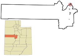
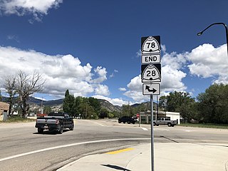
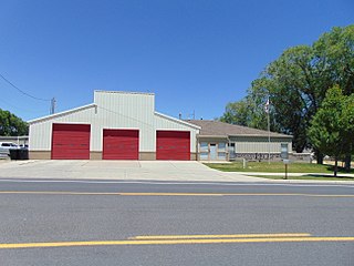
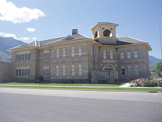
Eureka is a city in Juab County, Utah, United States. It is part of the Provo–Orem metropolitan area. The population was 669 at the 2010 census, down from 766 in 2000.

<span class="mw-page-title-main">Levan, Utah</span> Town in Juab County, Utah, United States

Levan is a town in Juab County, Utah, United States. As of the 2020 census it had a population of 862.

<span class="mw-page-title-main">Mona, Utah</span> City in Utah, United States

Mona is a city in Juab County, Utah, United States. As of the 2010 census it had a population of 1,547. It is part of the Provo–Orem metropolitan area.

<span class="mw-page-title-main">Nephi, Utah</span> City in and county seat of Juan County, Utah, United States

Nephi is a city in Juab County, Utah, United States. It is part of the Provo–Orem metropolitan area. The population was 6,443 at the 2020 census. It is the county seat of Juab County. It was settled by Mormon pioneers in 1851 as Salt Creek, and it acquired its current name in 1882. It is the principal city in the Juab Valley, an agricultural area. Nephi was named after Nephi, son of Lehi, from the Book of Mormon.

<span class="mw-page-title-main">Delta, Utah</span> City in Utah, United States

Delta is the largest city in Millard County, Utah, United States. It is located in the northeastern area of Millard County along the Sevier River and is surrounded by farmland. The population was 3,622 at the 2020 census.

<span class="mw-page-title-main">Fillmore, Utah</span> City in Utah, United States

Fillmore is a city and the county seat of Millard County, Utah, United States. The population was 2,592 at the 2020 United States Census. It is named for the thirteenth US President Millard Fillmore, who was in office when Millard County was created by the Utah Territorial legislature.

<span class="mw-page-title-main">Leamington, Utah</span> Town in the state of Utah, United States

Leamington is a town in Millard County, Utah. The population was 217 at the time of the 2000 census.

<span class="mw-page-title-main">Lynndyl, Utah</span> Town in the state of Utah, United States

Lynndyl is a town in Millard County, Utah, United States. The population was 106 at the 2010 census.

<span class="mw-page-title-main">Herriman, Utah</span> City in Utah, United States

Herriman is a city in southwestern Salt Lake County, Utah. The population was 55,144 as of the 2020 census. Although Herriman was a town in 2000, it has since been classified as a fourth-class city by state law. The city has experienced rapid growth since incorporation in 1999, as its population was just 1,523 at the 2000 census. It grew from being the 111th-largest incorporated place in Utah in 2000 to the 14th-largest in 2020.

<span class="mw-page-title-main">Elsinore, Utah</span> Town in the state of Utah, United States

Elsinore is a town in Sevier County, Utah, United States. The population was 847 at the 2010 census.

<span class="mw-page-title-main">Santaquin, Utah</span> City in Utah, United States

Santaquin is a city in Utah and Juab counties in the U.S. state of Utah. It is part of the Provo–Orem metropolitan area. The population was 13,725 at the 2020 census.

<span class="mw-page-title-main">Spring Lake, Utah</span> CDP in Utah, United States

Spring Lake is a census-designated place (CDP) in southern Utah County, Utah, United States. It is part of the Provo–Orem Metropolitan Statistical Area. The population was 458 at the 2010 census. It is an unincorporated part of Utah County, located just south of Payson and north of Santaquin.

<span class="mw-page-title-main">Heber City, Utah</span> City in Utah, United States

Heber City is a city and county seat of Wasatch County, Utah. The population was 16,856 as of the 2020 United States census. The city is located 43 miles southeast of Salt Lake City.

<span class="mw-page-title-main">Toquerville, Utah</span> City in Utah, United States

Toquerville is a city in east–central Washington County, Utah, United States. The population was 1,370 at the 2010 census.

<span class="mw-page-title-main">Provo–Orem metropolitan area</span> Metropolitan region in Utah, United States

The Provo–Orem, UT Metropolitan Statistical Area, as defined by the United States Office of Management and Budget, is an area consisting of two counties in Utah, anchored by the cities of Provo and Orem. As of the 2020 census, the MSA had a population of 671,185.

References

  1. "2019 U.S. Gazetteer Files". United States Census Bureau. Retrieved August 7, 2020.
  2. 1 2 3 U.S. Geological Survey Geographic Names Information System: Rocky Ridge, Utah
  3. 1 2 "U.S. Census website". factfincer2.census.gov. United States Census Bureau . Retrieved January 31, 2008.
  4. Google (February 23, 2018). "Rocky Ridge, Utah" (Map). Google Maps . Google. Retrieved February 23, 2018.
  5. 1 2 "Geographic Identifiers: 2010 Demographic Profile Data (G001): Rocky Ridge town, Utah". U.S. Census Bureau, American Factfinder. Retrieved December 28, 2018.[ dead link ]
  6. "Population and Housing Unit Estimates" . Retrieved June 4, 2019.
  7. "MyTopo Maps - Rocky Ridge Town, UT, USA" (Map). mytopo.com. Trimble Navigation, Ltd. Retrieved February 22, 2018. Note: While the town is not labeled on the map, the search for "Rocky Ridge Town, UT, USA" centers on the location of the town.
  8. "Rocky Ridge". Geographic Names Information System . United States Geological Survey, United States Department of the Interior.
  9. "Rocky Ridge Canyon". Geographic Names Information System . United States Geological Survey, United States Department of the Interior.
  10. 1 2 3 4 "About Us". rockyridgetown.com. Retrieved February 23, 2018.
  11. Strack, Don (February 17, 2018). "Utah Southern Railroad (1870-1881) Utah Southern Railroad Extension (1879-1881)". utahrails.net. Retrieved February 23, 2018.
  12. Van Cott, John W. (1990). Utah Place Names: A Comprehensive Guide to the Origins of Geographic Names: A Compilation. Salt Lake City: University of Utah Press. p. 408. ISBN   978-0-87480-345-7. OCLC   797284427.
  13. Forte, Jim. "Post Offices: Utah: Juab". postalhistory.com. Retrieved February 23, 2018.
  14. 1 2 "Newest Town in East Juab May become Rocky Ridge". Deseret News . Salt Lake City: Deseret Digital Media. May 24, 1996. Retrieved February 23, 2018.
  15. "New Town of Rocky Ridge Wins Juab County Approval". Deseret News . Salt Lake City: Deseret Digital Media. October 31, 1996. Retrieved February 23, 2018.
  16. "Census of Population and Housing". Census.gov. Retrieved June 4, 2015.
  17. "The Apostolic United Brethren (Allred Group)". mormonfundamentalism.com. Archived from the original on February 4, 2016. Retrieved February 23, 2018 via web.archive.org.
  18. The Primer: Helping Victims of Domestic Violence and Child Abuse in Polygamous Communities (PDF) (Report). Utah Attorney General. 2005. pp. 17–18. Retrieved February 23, 2018.