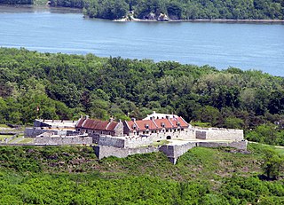
Fort Ticonderoga, formerly Fort Carillon, is a large 18th-century star fort built by the French at a narrows near the south end of Lake Champlain, in northern New York, in the United States. It was constructed by Canadian-born French military engineer Michel Chartier de Lotbinière, Marquis de Lotbinière between October 1755 and 1757, during the action in the "North American theater" of the Seven Years' War, often referred to in the US as the French and Indian War. The fort was of strategic importance during the 18th-century colonial conflicts between Great Britain and France, and again played an important role during the Revolutionary War.
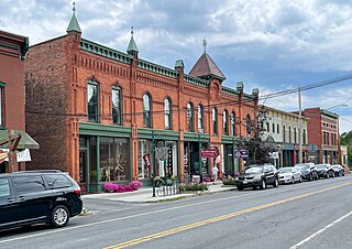
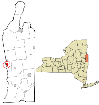
Schuylerville is a village in Saratoga County, New York, United States. The village is located in the northeastern part of the Town of Saratoga, east of Saratoga Springs. The Village of Victory is adjacent to Schuylerville to the southwest and the Hudson River forms the village's eastern border. The population was 1,386 at the 2010 census. The village was incorporated in 1831 and is named after the Schuyler family, a prominent family of Dutch descent in colonial America.
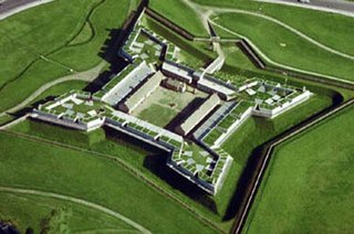
Fort Stanwix was a colonial fort whose construction commenced on August 26, 1758, under the direction of British General John Stanwix, at the location of present-day Rome, New York, but was not completed until about 1762. The bastion fort was built to guard a portage known as the Oneida Carry during the French and Indian War. Fort Stanwix National Monument, a reconstructed structure built by the National Park Service, now occupies the site.

Fort Michilimackinac was an 18th-century French, and later British, fort and trading post at the Straits of Mackinac; it was built on the northern tip of the lower peninsula of the present-day state of Michigan in the United States. Built around 1715, and abandoned in 1783, it was located along the Straits, which connect Lake Huron and Lake Michigan of the Great Lakes of North America.

Rogers' Rangers was a company of soldiers from the Province of New Hampshire raised by Major Robert Rogers and attached to the British Army during the Seven Years' War. The unit was quickly adopted into the British army as an independent ranger company. Robert Rogers trained and commanded the rapidly deployed light infantry force, which was tasked mainly with reconnaissance as well as conducting special operations against distant targets. Their tactics were built on earlier colonial precedents and were codified for the first time by Rogers as his 28 "Rules of Ranging". The tactics proved remarkably effective, so much so that the initial company was expanded into a ranging corps of more than a dozen companies. The ranger corps became the chief scouting arm of British Crown forces by the late 1750s. The British forces in America valued Rogers' Rangers for their ability to gather intelligence about the enemy. They were disbanded in 1761.
Fort Ontario is an American historic bastion fort situated by the City of Oswego in Oswego County, New York. It is owned by the state of New York and operated as a museum known as Fort Ontario State Historic Site.
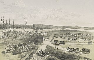
Fort Vancouver National Historic Site is a United States National Historic Site located in the states of Washington and Oregon. The National Historic Site consists of two units, one located on the site of Fort Vancouver in modern-day Vancouver, Washington; the other being the former residence of John McLoughlin in Oregon City, Oregon. The two sites were separately given national historic designation in the 1940s. The Fort Vancouver unit was designated a National Historic Site in 1961, and was combined with the McLoughlin House into a unit in 2003.

Fort Wadsworth is a former United States military installation on Staten Island in New York City, situated on The Narrows which divide New York Bay into Upper and Lower halves, a natural point for defense of the Upper Bay and Manhattan beyond. Prior to closing in 1994 it claimed to be the longest continually garrisoned military installation in the United States. It comprises several fortifications, including Fort Tompkins and Battery Weed and was given its present name in 1865 to honor Brigadier General James Wadsworth, who had been killed in the Battle of the Wilderness during the Civil War. Fort Wadsworth is now part of the Staten Island Unit of Gateway National Recreation Area, maintained by the National Park Service.
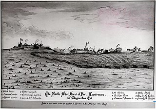
Fort Lawrence was a British fort built during Father Le Loutre's War and located on the Isthmus of Chignecto.
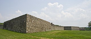
Fort Frederick State Park is a public recreation and historic preservation area on the Potomac River surrounding the restored Fort Frederick, a fortification active in the French and Indian War (1754–1763) and the American Revolutionary War (1775-1783). The state park lies south of the town of Big Pool, Maryland. The Chesapeake and Ohio Canal runs through the park grounds. The site was designated a National Historic Landmark in 1973.

Fort Necessity National Battlefield is a National Battlefield in Fayette County, Pennsylvania, United States, which preserves the site of the Battle of Fort Necessity. The battle, which took place on July 3, 1754, was an early battle of the French and Indian War, and resulted in the surrender of British colonial forces under Colonel George Washington, to the French and Indians, under Louis Coulon de Villiers.
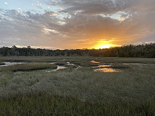
The Timucuan Ecological and Historic Preserve is a U.S. National Preserve in Jacksonville, Florida. It comprises 46,000 acres (19,000 ha) of wetlands, waterways, and other habitats in northeastern Duval County. Managed by the National Park Service in cooperation with the City of Jacksonville and Florida State Parks, it includes natural and historic areas such as the Fort Caroline National Memorial and the Kingsley Plantation.

Fort Massac is a French colonial and early National-era fort on the Ohio River in Massac County, Illinois.

Fort Edward is a National Historic Site of Canada in Windsor, Nova Scotia, and was built during Father Le Loutre's War (1749-1755). The British built the fort to help prevent the Acadian Exodus from the region. The Fort is most famous for the role it played both in the Expulsion of the Acadians (1755) and in protecting Halifax, Nova Scotia from a land assault in the American Revolution. While much of Fort Edward has been destroyed, including the officers' quarters and barracks, the blockhouse that remains is the oldest extant in North America. A cairn was later added to the site.

Fort Churchill State Historic Park is a state park of Nevada, United States, preserving the remains of a United States Army fort and a waystation on the Pony Express and Central Overland Routes dating back to the 1860s. The site is one end of the historic Fort Churchill and Sand Springs Toll Road. The park is in Lyon County south of the town of Silver Springs, on U.S. Route 95 Alternate, eight miles (13 km) south of U.S. Route 50. Fort Churchill was designated a National Historic Landmark in 1961. A 1994 park addition forms a corridor along the Carson River.

Fort Halifax is a former British colonial outpost on the banks of the Sebasticook River, just above its mouth at the Kennebec River, in Winslow, Maine. Originally built as a wooden palisaded fort in 1754, during the French and Indian War, only a single blockhouse survives. The oldest blockhouse in the United States, it is preserved as Fort Halifax State Historic Site, and is open to the public in the warmer months. The fort guarded Wabanaki canoe routes that reached to the St. Lawrence and Penobscot Valleys via the Chaudière-Kennebec and Sebasticook-Souadabscook rivers. The blockhouse was declared a National Historic Landmark and added to the National Register of Historic Places in 1968.
Fort Pierre Chouteau, also just Fort Pierre, was a major trading post and military outpost in the mid-19th century on the west bank of the Missouri River in what is now central South Dakota. Established in 1832 by Pierre Chouteau, Jr. of St. Louis, Missouri, whose family were major fur traders, this facility operated through the 1850s.

Fort Morris Historic Site is a Georgia state historic park in Liberty County, Georgia in the United States. The fort is on a bend in the Medway River and played an important role in the protection of southeast Georgia throughout various conflicts beginning in 1741 and ending in 1865 at the conclusion of the American Civil War, including the French and Indian and American Revolutionary Wars and War of 1812. The historic site is 70 acres (28 ha) and sits at an elevation of 23 feet (7.0 m).
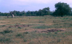
Fort Edward is a village in Washington County, New York, United States. It is part of the Glens Falls Metropolitan Statistical Area. The village population was 3,375 at the 2010 census. The name is derived from the younger brother of King George III, Edward Augustus, Duke of York and Albany.

Fort Edward is a town and the county seat of Washington County, New York, United States. The population was 10,205 at the 2011 census. The municipal center complex is on U.S. Route 4 between the villages of Hudson Falls and Fort Edward. When construction of the complex was completed in 1994, most of the administrative offices were moved from the original county seat of Hudson Falls to this location. The town of Fort Edward is part of the Glens Falls Metropolitan Statistical Area.


