Roland, Arkansas

Last updated

Roland, Arkansas
Pulaski County Arkansas Incorporated and Unincorporated areas Roland Highlighted 0560470.svg
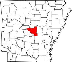
Location of Roland in Pulaski County, Arkansas.
USA Arkansas location map.svg
Red pog.svg
Roland, Arkansas
Coordinates: 34°54′23″N92°29′54″W / 34.90639°N 92.49833°W / 34.90639; -92.49833
Country United States
State Arkansas
County Pulaski
Area
[1]
  Total8.93 sq mi (23.13 km2)
  Land8.07 sq mi (20.90 km2)
  Water0.86 sq mi (2.23 km2)
Elevation
[2]
276 ft (84 m)
Population
 (2020)
  Total820
  Density101.60/sq mi (39.23/km2)
Time zone UTC-6 (Central (CST))
  Summer (DST) UTC-5 (CDT)
Area code 501
GNIS feature ID2582921 [2]

Roland is a census-designated place in Pulaski County, Arkansas, United States. It is part of the Central Arkansas metropolitan area. Per the 2020 census, the population was 820. [3]

Contents

Currently it is in the Pulaski County Special School District and is zoned to Joe T. Robinson Elementary School, Joe T. Robinson Middle School, and Joe T. Robinson High School. [4]

Demographics

2020 census

Roland CDP, Arkansas – Racial and ethnic composition
Note: the U.S. census treats Hispanic/Latino as an ethnic category. This table excludes Latinos from the racial categories and assigns them to a separate category. Hispanics/Latinos may be of any race.
Race / Ethnicity (NH = Non-Hispanic)Pop 2010 [5] Pop 2020 [6] % 2010% 2020
White alone (NH)65368387.53%83.29%
Black or African American alone (NH)51636.84%7.68%
Native American or Alaska Native alone (NH)510.67%0.12%
Asian alone (NH)220.27%0.24%
Pacific Islander alone (NH)100.13%0.00%
Some Other Race alone (NH)000.00%0.00%
Mixed Race or Multi-Racial (NH)11481.47%5.85%
Hispanic or Latino (any race)23233.08%2.80%
Total746820100.00%100.00%
Historical population
CensusPop.Note
2010 746
2020 8209.9%
U.S. Decennial Census [7]
2010 [5] 2020 [6]

Related Research Articles

<span class="mw-page-title-main">Hensley, Arkansas</span> Census-designated place in Arkansas, United States

Hensley is a census-designated place (CDP) in Pulaski County, Arkansas, United States. The population was 139 at the 2010 census. It is part of the Little Rock–North Little Rock–Conway Metropolitan Statistical Area.

<span class="mw-page-title-main">Landmark, Arkansas</span> CDP in Arkansas, United States

Landmark is a census-designated place (CDP) in Pulaski County, Arkansas, United States. Per the 2020 census, the population was 3,585. It is part of the Little Rock–North Little Rock–Conway Metropolitan Statistical Area.

<span class="mw-page-title-main">Kirby, Arkansas</span> Census-designated place in Arkansas, United States

Kirby is an unincorporated census-designated place in northern Pike County, Arkansas, United States. The community lies on U.S. Route 70; it is located halfway between Daisy and Glenwood. Per the 2020 census, the population was 721.

Silver Hill is an unincorporated community and census-designated place (CDP) in Prince George's County, Maryland, United States, approximately 1 mile (1.6 km) southeast of Washington, D.C. Per the 2020 census, the population was 6,381. Prior to 2010, Silver Hill was part of the Suitland-Silver Hill census-designated place.

<span class="mw-page-title-main">Center Ridge, Arkansas</span> Census-designated place in Arkansas, United States

Center Ridge is an unincorporated census-designated place in Conway County, Arkansas, United States. Per the 2020 census, the population was 2,235.

<span class="mw-page-title-main">Cherokee City, Arkansas</span> Census-designated place in Arkansas, United States

Cherokee City is an unincorporated census-designated place (CDP) in Benton County, Arkansas, United States. Per the 2020 census, the population was 73. It is the location of Coon Creek Bridge, which is located on Cty Rd. 24 and is listed on the National Register of Historic Places. The community was named for the Cherokee, since the Trail of Tears crossed the landscape when the Cherokee migrated west to Indian territory, now Oklahoma in the late 1830s. The town is within the Northwest Arkansas region, located about 5 miles east of Oklahoma and 4 miles south of the Missouri state line.

<span class="mw-page-title-main">Maysville, Arkansas</span> Census-designated place in Arkansas, United States

Maysville is an unincorporated community and census-designated place (CDP) in Benton County, Arkansas, United States. It is the westernmost settlement in the state of Arkansas. Per the 2020 census, the population was 117. It is located in the Northwest Arkansas region.

Midway is a census-designated place in Baxter County, Arkansas, United States. Midway is 5.5 miles (8.9 km) northwest of Mountain Home. Per the 2020 census, the population was 1,036. Midway has a post office with ZIP code 72651. Long home to a rural trading post, Midway became a boomtown during the construction of the Bull Shoals Dam, and later evolved to serve tourists and retirees attracted to the lake.

<span class="mw-page-title-main">Avilla, Arkansas</span> Census-designated place in Arkansas, United States

Avilla is a census-designated place in Saline County, Arkansas, United States. Per the 2020 census, the population was 1,325.

<span class="mw-page-title-main">Hagarville, Arkansas</span> Census-designated place in Arkansas, United States

Hagarville is a census-designated place in Johnson County, Arkansas, United States. Per the 2020 census, the population was 142.

<span class="mw-page-title-main">Lost Bridge Village, Arkansas</span> Census-designated place in Arkansas, United States

Lost Bridge Village is a residential subdivision near the town of Garfield in Benton County, Arkansas, United States. Per the 2020 census, the population was 397. It is located in the Northwest Arkansas region.

<span class="mw-page-title-main">Rye, Arkansas</span> Census-designated place in Arkansas, United States

Rye is a census-designated place in Cleveland County, Arkansas, United States. Per the 2020 census, the population was 123.

<span class="mw-page-title-main">Staves, Arkansas</span> Census-designated place in Arkansas, United States

Staves is a census-designated place in Cleveland County, Arkansas, United States. Per the 2020 census, the population was 133.

<span class="mw-page-title-main">Tumbling Shoals, Arkansas</span> Census-designated place in Arkansas, United States

Tumbling Shoals is a census-designated place in Cleburne County, Arkansas, United States. Per the 2020 census, the population was 902.

Woodlawn is a census-designated place in Cleveland County, Arkansas, United States. Per the 2020 census, the population was 174.

<span class="mw-page-title-main">Yarborough Landing, Arkansas</span> Census-designated place in Arkansas, United States

Yarborough Landing is a census-designated place in Little River County, Arkansas, United States. Per the 2020 census, the population was 457.

Oneida is an unincorporated community and census-designated place (CDP) in Phillips County, Arkansas, United States. Oneida is located along Arkansas Highway 85, 3.5 miles (5.6 km) north-northeast of Lake View. Oneida has a post office with ZIP code 72369. It was first listed as a CDP in the 2020 census with a population of 13.

Monroe is an unincorporated community and census-designated place (CDP) in Monroe County, Arkansas, United States. The unincorporated community extends beyond the CDP slightly into Lee County. It was first listed as a CDP in the 2020 census with a population of 51.

Cedarville is an unincorporated community and census-designated place in southern Prince George's County, Maryland, United States. As of the 2020 census the population was 639.

Melwood is an unincorporated community and census-designated place (CDP) in Prince George's County, Maryland, United States. It was newly delineated for the 2010 census, at which time its population was 3,051. Per the 2020 census, the population was 3,977.

References

  1. "2020 U.S. Gazetteer Files". United States Census Bureau. Retrieved October 29, 2021.
  2. 1 2 U.S. Geological Survey Geographic Names Information System: Roland, Arkansas
  3. "Roland CDP, Arkansas". United States Census Bureau . Retrieved April 15, 2022.
  4. "School Zone Map". Pulaski County Special School District . Retrieved March 3, 2021.
  5. 1 2 "P2 Hispanic or Latino, and Not Hispanic or Latino by Race – 2010: DEC Redistricting Data (PL 94-171) – Roland CDP, Arkansas". United States Census Bureau .
  6. 1 2 "P2 Hispanic or Latino, and Not Hispanic or Latino by Race – 2020: DEC Redistricting Data (PL 94-171) – Roland CDP, Arkansas". United States Census Bureau .
  7. "Decennial Census of Population and Housing by Decades". US Census Bureau.