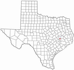
Starr County is a county located in the U.S. state of Texas. As of the 2010 census, its population was 60,968. Its county seat is Rio Grande City. The county was created in 1848. It is named for James Harper Starr, who served as Secretary of the Treasury of the Republic of Texas.

Anderson is a city and county seat of Grimes County, Texas, United States. The population was 222 as of the 2010 census. The town and its surroundings are listed on the National Register of Historic Places as the Anderson Historic District.

Roma is a city in Starr County, Texas, United States. The population was 9,765 at the 2010 census. The city is located along the Rio Grande, across from Ciudad Miguel Alemán in Tamaulipas, Mexico.

Dealey Plaza is a city park in the West End district of downtown Dallas, Texas. It is sometimes called the "birthplace of Dallas". It also was the location of the assassination of United States President John F. Kennedy, on November 22, 1963; 30 minutes after the shooting, Kennedy died at Parkland Memorial Hospital. The Dealey Plaza Historic District was named a National Historic Landmark on November 22, 1993, the 30th anniversary of the JFK assassination, to preserve Dealey Plaza, street rights-of-way, and buildings and structures by the plaza visible from the assassination site, that have been identified as witness locations or as possible locations for assassin(s).

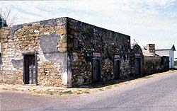
The Treviño–Uribe Rancho is a historic fortified home at the junction of Trevino and Uribe Streets in the small frontier town of San Ygnacio, Texas. With a construction history dating to 1830, it is one of the oldest surviving buildings from the period of Spanish-Mexican settlement of the north bank of the lower Rio Grande. The building was designated a National Historic Landmark in 1998.

The Roma–Ciudad Miguel Alemán International Bridge is a suspension bridge that spans the Rio Grande between Roma, Texas, and Ciudad Miguel Alemán, Tamaulipas.

The Mier expedition was an unsuccessful military operation launched in November 1842 by a Texian militia against Mexican border settlements; it was related to the Somervell expedition. It included a major battle at Ciudad Mier on December 26 and 27, 1842, which the Mexicans won. The Texian attack was launched partly in hopes of financial gain and partly in retaliation for the Dawson Massacre earlier that year, in which thirty-six Texas militia were killed by the Mexican Army. Both conflicts were part of continuing efforts by each side to control the land between the Rio Grande and Nueces River. The Republic of Texas believed that this territory had been ceded to it in the Treaties of Velasco, by which they gained independence; but Mexico did not agree.

James Riely Gordon was an architect who practiced in San Antonio until 1902 and then in New York City, where he established a national reputation. J. Riely Gordon is best known for his landmark county courthouses, in particular those in Texas. Working during the state's "Golden Age" (1883–1898) of courthouse construction, Gordon saw 18 of his designs erected from 1885 to 1901; today 12 remain.

Mier, also known as El Paso del Cántaro, is a city in Mier Municipality in Tamaulipas, located in northern Mexico near the Rio Grande, just south of Falcon Dam. It is 90 miles (140 km) northeast of Monterrey on Mexican Federal Highway 2.
Ciudad Miguel Alemán, known prior to 1950 as San Pedro de Roma, is a city in the Mexican state of Tamaulipas, located across the Rio Grande from the U.S. city of Roma, Texas. The two are linked by the Roma – Ciudad Miguel Alemán International Bridge, a suspension bridge. As of 2010, the population of the city was 19,997. The total population of the surrounding municipality was 27,015.

San Gabriel de Yungue-Ouinge, or San Gabriel de Yunque, was the site of the first Spanish capital of its provincial territory of Santa Fe de Nuevo México. It is located where the Rio Chama meets the Rio Grande, west of present-day Ohkay Owingeh, New Mexico. The pueblo of Yuque Yunque was provided as a gesture of goodwill toward Juan de Oñate, and he founded his colonial government there. It was moved to Santa Fe in 1610. The site was declared a National Historic Landmark in 1964. The archaeological site was leveled and plowed over in 1984, and a historical marker has been placed on the west side of the Rio Grande, off the old New Mexico State Road 74.

The East End Historic District encompasses a large 19th-century residential area in eastern Galveston, Texas. Roughly bounded by Eleventh Street, Broadway, Nineteenth and Sixteenth Streets, and Market and Post Office Streets, the area has one of the best-preserved and largest concentrations of 19th-century residential architecture in Texas. It was developed mainly at a time when Galveston was the state's preeminent port. The historic district, designated locally in 1970, was placed on the National Register of Historic Places in 1975 and declared a National Historic Landmark in 1976.

This is a list of the National Register of Historic Places listings in Tarrant County, Texas.

Fort Clark was a frontier fort located just off U.S. Route 90 near Brackettville, in the county of Kinney, in the U.S. state of Texas. It later became the headquarters for the 2nd Cavalry Division. The Fort Clark Historic District was added to the National Register of Historic Places on December 6, 1979. The Commanding Officer's Quarters at Fort Clark was designated a Recorded Texas Historic Landmark in 1988. The Fort Clark Guardhouse became a Recorded Texas Historic Landmark in 1962. The Fort Clark Officers' Row Quarters was designated a Recorded Texas Historic Landmark in 1991.

Alfred Giles (1853–1920) was a British architect who emigrated to the United States in 1873 at the age of 20. Many of the private homes and public buildings designed by Giles are on the National Register of Historic Places and have been designated Recorded Texas Historic Landmarks. Based in San Antonio, his buildings can be found predominantly in south Texas and northern Mexico. Giles is credited with "a profound influence on architecture in San Antonio."

The Roma Port of Entry was established in 1928 with the construction of the first suspension bridge. The current bridge was built in 1988, but the historic Roma – Ciudad Miguel Alemán International Bridge remains adjacent to it and is not currently used. The Mexican City of San Pedro de Roma was renamed Ciudad Miguel Alemán, Tamaulipas after former Mexican President Miguel Alemán Valdés. The city of Roma, Texas was once the westernmost navigable seaport on the Rio Grande, but by 1900, water drawn from the river for irrigation upstream had so severely lowered the water levels that vessel traffic had virtually ceased.

This is a list of the National Register of Historic Places listings in Medina County, Texas.

This is a list of the National Register of Historic Places listings in Llano County, Texas.

This is a list of the National Register of Historic Places listings in Parker County, Texas.

The Childress Commercial and Civic Historic District is a 110 acres (45 ha) historic district in Childress, Texas which was listed on the National Register of Historic Places in 2016. The district includes 93 contributing buildings, five contributing structures, three contributing sites, and two contributing objects, as well as 30 non-contributing buildings.


