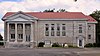
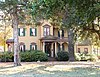
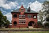
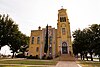
List of Recorded Texas Historic Landmarks (Sabine-Travis)

Last updated

The following is a partial list of Recorded Texas Historic Landmarks (RTHLs) arranged by county as designated by the Texas Historical Commission and local county historical commissions in Texas. This page includes RTHLs in the following counties: Sabine, San Augustine, San Jacinto, San Patricio, San Saba, Schleicher, Scurry, Shackelford, Shelby, Sherman, Smith, Somervell, Starr, Stephens, Sterling, Stonewall, Sutton, Swisher, Tarrant, Taylor, Terrell, Terry, Throckmorton, Titus, Tom Green, and Travis.

Contents

Recorded Texas Historic Landmarks listed by county
Anderson-CallahanCameron-DuvalEastland-GrayGrayson-HudspethHunt-MartinMason-Rusk • Sabine-Travis • Trinity-Zavala

KEY

Landmarks with multiple historic designations are colored according to their highest designation within the following hierarchy.

⁕ Listed individually on the National Register of Historic Places (NRHP) as a National Historic Landmark
⁂ Listed on the NRHP as a contributing property of a National Historic Landmark District
Listed individually on the NRHP
Listed as a contributing property of an NRHP Historic District
§ Listed individually as or as part of a State Historic Site
# Listed individually as or as part of a State Antiquities Landmark

Sabine County

Registered Texas Historic LandmarkImageMarker numberPhysical addressNearest cityYear designatedLocation description [1] [2]
C. A. Nethery & Sons General Merchandise 15813 SH 21 W of SH 87

31°25′56″N93°50′58″W / 31.43222°N 93.84944°W / 31.43222; -93.84944

Milam 2009
Cedar Grove Baptist Church 17881 3675 Cedar Grove Rd.

31°29′10″N93°48′3″W / 31.48611°N 93.80083°W / 31.48611; -93.80083

Milam 2014
Clark-James House 17568 377 Bowie Trl.

31°12′47″N93°45′43″W / 31.21306°N 93.76194°W / 31.21306; -93.76194

Hemphill 2013
Goodrich, William F. and Bertha Sutor, House 14533 Hemphill 2003
Harper Chapel Church 13791 Harpers Chapel Dr. at FM 83

31°22′44″N93°43′0″W / 31.37889°N 93.71667°W / 31.37889; -93.71667

Hemphill 20058 mi. E on FM 83 to Harper Chapel Drive on left
Sabine County Jail Sabine county tx former jail.jpg 7578 SW corner courthouse square at 201 Main St.

31°20′31″N93°50′59″W / 31.34194°N 93.84972°W / 31.34194; -93.84972

Hemphill 1981SH 87

San Augustine County

Registered Texas Historic LandmarkImageMarker numberPhysical addressNearest cityYear designatedLocation description [1] [2]
Anderson House 7585 End of N. Congress St.

31°31′57″N94°6′29″W / 31.53250°N 94.10806°W / 31.53250; -94.10806

San Augustine 1962
Augus Theatre Angus Theater (1 of 1).jpg 12176 110 E. Columbia St.

31°31′51″N94°6′36″W / 31.53083°N 94.11000°W / 31.53083; -94.11000

San Augustine 1998
Bland-Fisher Home 7588 FM 3230 S of CR 110

31°35′26″N94°6′45″W / 31.59056°N 94.11250°W / 31.59056; -94.11250

San Augustine 19815 mi. north of San Augustine off 1279 next to BNSF rail line
Bodine Place 7591 San Augustine 1962private property
Captain T. W. Blount House Hail Blount House, San Augustine, Texas.jpg
Commons-logo.svg More images
7589 SH 21 W of Spur 85

31°31′56″N94°10′3″W / 31.53222°N 94.16750°W / 31.53222; -94.16750

San Augustine 1962private property
China Grove - Dr. B. F. Sharp House 7595 San Augustine 1962not located
Christ Church Christ Church Episcopal San Augustine Wiki.jpg 7596 201 S. Ayish St.

31°31′42″N94°6′21″W / 31.52833°N 94.10583°W / 31.52833; -94.10583

San Augustine 1965Ayish St. between Main and Market St.
Col. Sexton House 7641 San Augustine 19628 mi NW; private property
Columbus-Cartwright House 7593 End of S. Clark St.

31°31′25″N94°5′57″W / 31.52361°N 94.09917°W / 31.52361; -94.09917

San Augustine 1962off SH 21 on Craft St.
Crocket House 7597 San Augustine 1962burned
Cullen House Ezekiel Cullen House, San Augustine, Texas.jpg
Commons-logo.svg More images
7598 205 S. Congress St.

31°31′35″N94°6′28″W / 31.52639°N 94.10778°W / 31.52639; -94.10778

San Augustine 1962
Harring House - Straddle Fork 7615 FM 705 S of SH 103

31°23′21″N94°9′32″W / 31.38917°N 94.15889°W / 31.38917; -94.15889

San Augustine 1965
Hillcrest 7616 1002 E. Main St.

31°31′37″N94°5′53″W / 31.52694°N 94.09806°W / 31.52694; -94.09806

San Augustine 1965
Horatio Hanks House 7612 San Augustine 1962West Walter Street, San Augustine
Inlow Lee Mathews House 7622 San Augustine 1962
Ketchum Place 7620 San Augustine 1962
Lewis Hotel Lewis Hotel Wiki.jpg 17066 500 W. Columbia St.

31°31′53″N94°6′55″W / 31.53139°N 94.11528°W / 31.53139; -94.11528

San Augustine 2011
Mathews, Inlow and Jeanette, House 14786 San Augustine 2004
Mathew Cartright Home Matthew Cartwright House, San Augustine, Texas.jpg
Commons-logo.svg More images
7594 503 E. Main St.

31°31′44″N94°6′19″W / 31.52889°N 94.10528°W / 31.52889; -94.10528

San Augustine 1962
McCauley House 7623 San Augustine 1962private property, no access
McRae Church 7625 CR 220 W of CR 277

31°31′56″N94°11′10″W / 31.53222°N 94.18611°W / 31.53222; -94.18611

San Augustine 19624 mi. west of San Augustine via SH 21, then .25 mi. north on McRae Cemetery Rd.
Memorial Presbyterian Church Presbyterian Church San Augustine Wiki (1 of 1).jpg 17388 205 E. Livingston St.

31°31′54″N94°6′29″W / 31.53167°N 94.10806°W / 31.53167; -94.10806

San Augustine 1962Spur 85 btwn FM 1277 and SH 21
Newt Whitton House (DEMOLISHED) 7649 1962structure gone - no access
Norwood House 7630 SH 103 and SH 147 San Augustine 1962private property - no access
Old Brookeland Depot 7592 San Augustine 1966private property - no access
Old Garrett House 7606 SH 21 W of CR 271

31°30′19″N94°17′4″W / 31.50528°N 94.28444°W / 31.50528; -94.28444

San Augustine 1962SH 21 about 11 mi. west of San Augustine
Old Greer House 7609 FM 1277 near US 96 San Augustine 1962southwestern edge of San Augustine off FM 1277
Old Mott House 7628 San Augustine 1962
Old Polk-Sharp House 7632 2 mi. E of FM 1277 W of town 9 mi. San Augustine 1962private property - no access
Old Union School Union School 2 (1 of 1).jpg 15560 1462 CR 278

31°30′40″N94°11′5″W / 31.51111°N 94.18472°W / 31.51111; -94.18472

San Augustine 1962
Old Wade Place 7648 CR 313 E of FM 705

31°21′12″N94°8′47″W / 31.35333°N 94.14639°W / 31.35333; -94.14639

San Augustine 1962FM 705 about 9.5 mi. south of San Augustine
"Pet" Sharp House 7642 105 N. Congress St.

31°31′51″N94°6′30″W / 31.53083°N 94.10833°W / 31.53083; -94.10833

San Augustine 1962
Polk House HornPolkHouse1 (1 of 1).jpg
Commons-logo.svg More images
7631 717 W. Columbia St.

31°31′54″N94°7′13″W / 31.53167°N 94.12028°W / 31.53167; -94.12028

San Augustine 1962SH 21 about 2 blocks west of junction Loop 547 and SH 21, south side of road
San Augustine County Courthouse # San augustine county tx courthouse 2015.jpg
Commons-logo.svg More images
12729 100 W. Columbia St.

31°31′49″N94°6′41″W / 31.53028°N 94.11139°W / 31.53028; -94.11139

San Augustine 2001Courthouse square, Columbia at Broadway (SH 147) streets
San Augustine County Jail # San augustine county tx former jail.jpg 18848 110 S. Harrison St.

31°31′48″N94°6′40″W / 31.53000°N 94.11111°W / 31.53000; -94.11111

San Augustine 2017San Augustine County Courthouse grounds, east side facing Harrison Street
Simp Miller House 7626 San Augustine 1962private property - no access
Stephen W. Blount Home 7590 503 E. Columbia St.

31°31′49″N94°6′19″W / 31.53028°N 94.10528°W / 31.53028; -94.10528

San Augustine 1962
Straddle Fork 7643 FM 705 S of SH 103

31°23′21″N94°9′32″W / 31.38917°N 94.15889°W / 31.38917; -94.15889

San Augustine 1965FM 705 about 8 mi. south of San Augustine
Sublett House Historic American Buildings Survey, Harry L. Starnes, Photographer June 5, 1936 FRONT ELEVATION. - Colonel Phillip A. Sublett House, Texas Route 21, San Augustine, San HABS TEX,203-SAUG.V,2-1.tif
Commons-logo.svg More images
7645 2419 SH 21 E

31°31′9″N94°3′30″W / 31.51917°N 94.05833°W / 31.51917; -94.05833

San Augustine 1962SH 21, 4 mi. east of San Augustine
The Gatling House 7608 850 S. Liberty St.

31°31′9″N94°6′43″W / 31.51917°N 94.11194°W / 31.51917; -94.11194

San Augustine 19671 mi. south of San Augustine off FM 2213 (Liberty St.) in Gatling Manor
William Garrett House Historic American Buildings Survey, E.O. Taylor, Photographer March 1, 1934 VIEW FROM SOUTHEAST (FRONT). - William Garrett Plantation House, Texas Route 21, San Augustine, San HABS TEX,203-SAUG.V,1-3 (edit).tif
Commons-logo.svg More images
7607 SH 21 W of CR 280

31°32′7″N94°8′23″W / 31.53528°N 94.13972°W / 31.53528; -94.13972

San Augustine 19621 mi. west of San Augustine via SH 21, north side of private road

San Jacinto County

Registered Texas Historic LandmarkImageMarker numberPhysical addressNearest cityYear designatedLocation description [1] [2]
Coldspring Methodist Church Coldspring methodist church coldspring tx.jpg 13848 1 Cemetery Rd.

30°35′33″N95°7′49″W / 30.59250°N 95.13028°W / 30.59250; -95.13028

Coldspring 1964Coldspring United Methodist Church
J. M. Hansbro's Law Office 7656 11 Byrd Ave.

30°35′34″N95°7′45″W / 30.59278°N 95.12917°W / 30.59278; -95.12917

Coldspring 1967across from Courthouse at SH 150 and FM 1514
San Jacinto County Courthouse San jacinto tx county courthouse 2014.jpg
Commons-logo.svg More images
12481 1 Byrd Ave.

30°35′32″N95°7′42″W / 30.59222°N 95.12833°W / 30.59222; -95.12833

Coldspring 2000Byrd Ave. at SH 150
San Jacinto County Jail Old san jacinto county jail coldspring tx.jpg 7669 200 Slade St.

30°35′46″N95°7′42″W / 30.59611°N 95.12833°W / 30.59611; -95.12833

Coldspring 1982just north of FM 1514 on Slade St. behind high school
Shepherd Methodist Church Shepherd Methodist Church Shepherd Texas 2023.jpg 7671 71 Spring Ave.

30°30′5″N95°0′3″W / 30.50139°N 95.00083°W / 30.50139; -95.00083

Shepherd 1970just north of SH 150 on FM 222
The Robert Tod Robinson House Robert Tod Robinson House Point Blank Texas 2023.jpg 7667 500 SH 156

30°44′15″N95°12′54″W / 30.73750°N 95.21500°W / 30.73750; -95.21500

Point Blank 1975SH 156, .75 mi. south of Point Blank

San Patricio County

Registered Texas Historic LandmarkImageMarker numberPhysical addressNearest cityYear designatedLocation description [1] [2]
James McGloin Home 14899 N end CR 899 at Round Lake

27°58′12″N97°47′34″W / 27.97000°N 97.79278°W / 27.97000; -97.79278

San Patricio 1963private property off FM 666
Odem Building 3665 201 E. Sinton St.

28°2′13″N97°30′33″W / 28.03694°N 97.50917°W / 28.03694; -97.50917

Sinton 1994Vineyard at Sinton Streets, Sinton

San Saba County

Registered Texas Historic LandmarkImageMarker numberPhysical addressNearest cityYear designatedLocation description [1] [2]
Campbell House 686 505 W. Dry St.

31°11′38″N98°43′31″W / 31.19389°N 98.72528°W / 31.19389; -98.72528

San Saba 1994505 Dry Street, San Saba.
Cedar Log Cabin Museum 772 271 S. Thomas Stewart Dr.

31°11′39″N98°42′43″W / 31.19417°N 98.71194°W / 31.19417; -98.71194

San Saba 1966Mill Pend Park, E. city limits, Highway 190, San Saba.
Estep-Burleson Building 17736 120 S. Cherokee St.

31°11′43″N98°43′4″W / 31.19528°N 98.71778°W / 31.19528; -98.71778

San Saba 2013interior of block west of courthouse, S. Cherokee Street
First Methodist Church First Methodist Church San Saba Texas.jpg 1743 204 W. Brown St.

31°11′49″N98°43′22″W / 31.19694°N 98.72278°W / 31.19694; -98.72278

San Saba 1965204 West Brown Street, San Saba.
First State Bank Building 12496 SW corner Main Ave. at Center St.

31°16′26″N98°56′42″W / 31.27389°N 98.94500°W / 31.27389; -98.94500

Richland Springs 2001corner of Main and Carter (FM 45)
Indian Signaling Grounds 2638 Rest area at US 190 about 4.5 mi. E of San Saba

31°12′18″N98°38′22″W / 31.20500°N 98.63944°W / 31.20500; -98.63944

San Saba 1967From San Saba, take 190 east about 4.5 miles.
Mill Pond House 3379 E. Commerce St. at S. Mill St.

31°11′42″N98°42′47″W / 31.19500°N 98.71306°W / 31.19500; -98.71306

San Saba 1962Mill Pond Park, 190, E. City Limits, San Saba (where E. Commerce meets S. Mill and Doug Sullivan).
San Saba County Courthouse SanSabaCourthouse1.JPG
Commons-logo.svg More images
15199 500 E. Wallace St.

31°11′43″N98°43′0″W / 31.19528°N 98.71667°W / 31.19528; -98.71667

San Saba 2004
San Saba County Jail Former San Saba County Jail.jpg 4555 104 S. Water St.

31°11′43″N98°42′54″W / 31.19528°N 98.71500°W / 31.19528; -98.71500

San Saba 1969Corner of East Commerce and South Water, San Saba.
T. A. and Emma Sloan House 18220 8810 FM 2732 San Saba 2015
Whitis-Moore House 14808 406 W. Commerce St.

31°11′43″N98°43′28″W / 31.19528°N 98.72444°W / 31.19528; -98.72444

San Saba 2005406 W. Commerce

Schleicher County

Registered Texas Historic LandmarkImageMarker numberPhysical addressNearest cityYear designatedLocation description [1] [2]
Colonel Black Ranch House 613 Ft. McKavett Cemetery Rd.

30°49′35″N100°7′59″W / 30.82639°N 100.13306°W / 30.82639; -100.13306

Fort McKavett 1962From Ft. McKavett take FM 864 to Ft. McKavett Cemetery Road for 1.3 miles.
First National Bank Building 1532 109 S.W. Main St.

30°51′33″N100°36′4″W / 30.85917°N 100.60111°W / 30.85917; -100.60111

Eldorado 1993109 S.W. Main Street
Old Courthouse and Jail 3639 1 W. Warner Ave.

30°51′38″N100°35′54″W / 30.86056°N 100.59833°W / 30.86056; -100.59833

Eldorado 1964On Courthouse grounds at US 190 & 277 intersection, El Dorado
Schleicher County Courthouse Schleicher County, TX, Courthouse IMG 1382.JPG 4406 164 E. Murchison Ave.

30°51′36″N100°35′54″W / 30.86000°N 100.59833°W / 30.86000; -100.59833

Eldorado 1991
West Texas Woolen Mills 5683 409 S.W. Main St.

30°51′25″N100°36′14″W / 30.85694°N 100.60389°W / 30.85694; -100.60389

Eldorado 1994409 SW Main St., Eldorado

Scurry County

Registered Texas Historic LandmarkImageMarker numberPhysical addressNearest cityYear designatedLocation description [1] [2]
Dodson House 1239 900 E. Coliseum Dr.

32°42′22″N100°53′24″W / 32.70611°N 100.89000°W / 32.70611; -100.89000

Snyder 1965Scurry County Heritage Village
E. W. Clark House, 1908 1315 2306 32nd St.

32°42′36″N100°55′28″W / 32.71000°N 100.92444°W / 32.71000; -100.92444

Snyder 19642306 32nd Street, Snyder.
F. J. Grayum Home 1524 2300 32nd St.

32°42′36″N100°55′26″W / 32.71000°N 100.92389°W / 32.71000; -100.92389

Snyder 19642300 32nd Street, Snyder.
First Presbyterian Church 1820 2706 Ave R.

32°42′52″N100°55′1″W / 32.71444°N 100.91694°W / 32.71444; -100.91694

Snyder 19692706 Avenue R, Snyder.
First State Bank Building 1870 2519 College Ave.

32°43′1″N100°55′7″W / 32.71694°N 100.91861°W / 32.71694; -100.91861

Snyder 1967Corner College and 25th St., Snyder (northwest courthouse square)
Harrell Ranch House 14419 Ranch road near bend in FM 176

32°47′23″N100°50′40″W / 32.78972°N 100.84444°W / 32.78972; -100.84444

Snyder 1964
Johnson House, 1910 2833 CR 1117 1.5 mi. N of CR 1116

32°50′48″N100°50′31″W / 32.84667°N 100.84194°W / 32.84667; -100.84194

Snyder 1964From Snyder take Ennis Creek Road north about 10 miles. Turn east on county road 1116. Drive for about 1.6 miles, turn north on County Road 1117, 1.5 miles to house.
R. L. McMullan Home 4153 2311 Ave N.

32°43′6″N100°54′45″W / 32.71833°N 100.91250°W / 32.71833; -100.91250

Snyder 19662311 Avenue N, Snyder.
Stanfield House, 1910 5096 2400 32nd St.

32°42′36″N100°55′32″W / 32.71000°N 100.92556°W / 32.71000; -100.92556

Snyder 19642400 32nd Street, Snyder.
Towle House 16902 2911 Ave. U

32°42′46″N100°55′18″W / 32.71278°N 100.92167°W / 32.71278; -100.92167

Snyder 2011NW corner of 30th & Ave. U

Shackelford County

Registered Texas Historic LandmarkImageMarker numberPhysical addressNearest cityYear designatedLocation description [1] [2]
H. C. Jacobs House 2313 24 S. Jacobs St.

32°43′32″N99°17′57″W / 32.72556°N 99.29917°W / 32.72556; -99.29917

Albany 1974Jacobs Street, Albany
Ledbetter Picket House 3059 112 S. Main St.

32°43′32″N99°17′52″W / 32.72556°N 99.29778°W / 32.72556; -99.29778

Albany 1962Webb Park -112 Main Street -Albany
Matthews Memorial Presbyterian Church 3257 211 S. Jacobs St.

32°43′26″N99°17′55″W / 32.72389°N 99.29861°W / 32.72389; -99.29861

Albany 1962Corner of Jacobs & S. 2nd Streets, Albany
Rye-Caperton House 4397 225 S. Walnut St.

32°43′22″N99°17′44″W / 32.72278°N 99.29556°W / 32.72278; -99.29556

Albany 1996225 South Walnut, Albany
Shackelford County Courthouse# Shackelford County Courthouse.jpg
Commons-logo.svg More images
4649 225 S. Main St.

32°43′22″N99°17′48″W / 32.72278°N 99.29667°W / 32.72278; -99.29667

Albany 1962Courthouse Square, intersection of SH 6 & Highway 180, Albany
Shackelford County's First Permanent Jail The Old Jail Art Center in Albany, Texas, seat of Shackelford County LCCN2014631738.tif 4650 201 S. Second St.

32°43′24″N99°17′41″W / 32.72333°N 99.29472°W / 32.72333; -99.29472

Albany 1962South 2nd Street, Albany
The Lynch Building 5373 340 S. Second St.

32°43′25″N99°17′50″W / 32.72361°N 99.29722°W / 32.72361; -99.29722

Albany 1975Faces courthouse grounds, intersection of SH 6 & Highway 180, Albany
Trinity Episcopal Church 5559 325 N. Ave. B

32°43′48″N99°17′58″W / 32.73000°N 99.29944°W / 32.73000; -99.29944

Albany 1962N. 2nd Street & Avenue B, Albany
Hartfield Building The Hartfield Building in Albany, Texas, seat of Shackelford County LCCN2014631732.tif 12365 224 W. Main St.

32°43′22″N99°17′51″W / 32.72278°N 99.29750°W / 32.72278; -99.29750

Albany 2000Courthouse Square
White Elephant Saloon 14887 232 S. Main St.

32°43′22″N99°17′51″W / 32.72278°N 99.29750°W / 32.72278; -99.29750

Albany 1998S. Main St

Shelby County

Registered Texas Historic LandmarkImageMarker numberPhysical addressNearest cityYear designatedLocation description [1] [2]
Eva Taylor Lane Home 7685 212 Houston St.

31°47′37″N94°10′50″W / 31.79361°N 94.18056°W / 31.79361; -94.18056

Center 1963
First Methodist Church of Shelbyville 7683 252 FM 417

31°45′29″N94°4′46″W / 31.75806°N 94.07944°W / 31.75806; -94.07944

Shelbyville 1963off SH 87 on Church St.
McClelland Community Church 7687 519 CR 2571

31°39′44″N94°4′19″W / 31.66222°N 94.07194°W / 31.66222; -94.07194

Shelbyville 19637 mi. south of Shelbyville, via SH 87 to SH 147 S to McClelland, then east on county road
Myrick's Ferry Log House 7689 Forest Service Road 100 Shelbyville 196314 mi. east of Shelbyville
Shelby County Courthouse# Previous courthouse in Shelby County, TX IMG 0957.JPG 7695 124 Austin St.

31°47′41″N94°10′53″W / 31.79472°N 94.18139°W / 31.79472; -94.18139

Center 1969
The Bickham House 7676 FM 2694 E of CR 2100

31°45′52″N94°3′1″W / 31.76444°N 94.05028°W / 31.76444; -94.05028

Shelbyville 19732 mi. east of Shelbyville via SH 147 to FM 2694

Sherman County

Registered Texas Historic LandmarkImageMarker numberPhysical addressNearest cityYear designatedLocation description [1] [2]
Sherman County Courthouse Sherman County courthouse May 2020.jpg 16130 701 N. 3rd St.

36°20′17″N102°4′13″W / 36.33806°N 102.07028°W / 36.33806; -102.07028

Stratford 2008

Smith County

Registered Texas Historic LandmarkImageMarker numberPhysical addressNearest cityYear designatedLocation description [1] [2]
Chilton-Lipstate-Taylor House 17993 727 S. Chilton Ave.

32°20′29″N95°18′19″W / 32.34139°N 95.30528°W / 32.34139; -95.30528

Tyler 2014house sits at the south west corner of South Chilton Avenue and West PhillipsStreet
Dewberry Plantation House Colonel John Dewberry Plantation House, Teaselville, Texas.jpg
Commons-logo.svg More images
7719 14007 FM 346 W

32°9′32″N95°24′17″W / 32.15889°N 95.40472°W / 32.15889; -95.40472

Teaselville 19624 miles west of Bullard on FM 344, then 0.5 mi. N of Teasleville on FM 346
Erasmus M. Hanna House 7731 118 N. Georgia St.

32°8′43″N95°7′13″W / 32.14528°N 95.12028°W / 32.14528; -95.12028

Troup 1968
First Baptist Church of Tyler Tyler May 2016 11 (First Baptist Church).jpg
Commons-logo.svg More images
7724 301 W. Ferguson St.

32°21′7″N95°18′11″W / 32.35194°N 95.30306°W / 32.35194; -95.30306

Tyler 1987
Frank Bell House 7704 17566 Beddingfield Rd.

32°13′27″N95°19′56″W / 32.22417°N 95.33222°W / 32.22417; -95.33222

Tyler 1978
Goodman Home, 1857 # Goodman-LeGrand House March 2019 03.jpg 7730 624 N. Broadway Ave.

32°21′24″N95°18′5″W / 32.35667°N 95.30139°W / 32.35667; -95.30139

Tyler 1962
Henry Gary House 14546 0.3 mi. S on US 69 from CR 461

32°27′34″N95°23′0″W / 32.45944°N 95.38333°W / 32.45944; -95.38333

Starrville 1962
John B. and Ketura Douglas House DouglasHouse3.JPG 12193 318 S. Fannin Ave.

32°20′51″N95°17′54″W / 32.34750°N 95.29833°W / 32.34750; -95.29833

Tyler 1998
Major John Dean House 7718 11810 CR 1141

32°18′36″N95°24′26″W / 32.31000°N 95.40722°W / 32.31000; -95.40722

Tyler 1972take SH 31 west about 5 mi. to Spur 364, go south about .5 mi. to CR 1134, go west 1 mi. to CR 1141, go south on CR 1141 .6 mi. to house on west side of road
Marvin Methodist Church Tyler May 2016 10 (Marvin United Methodist Church).jpg
Commons-logo.svg More images
7741 300 W. Erwin St.

32°21′1″N95°18′11″W / 32.35028°N 95.30306°W / 32.35028; -95.30306

Tyler 1968
Ramey House Ramey House.jpg 12196 605 S. Broadway Ave.

32°20′37″N95°18′4″W / 32.34361°N 95.30111°W / 32.34361; -95.30111

Tyler 1997
Smith County Jail, 1881 SmithCountyJail1.JPG 7723 309 E. Erwin St.

32°21′2″N95°17′53″W / 32.35056°N 95.29806°W / 32.35056; -95.29806

Tyler 1993
Starrville Community Center 17352 17936 FM 16 E

32°28′13″N95°6′18″W / 32.47028°N 95.10500°W / 32.47028; -95.10500

Winona 201217936 FM 16 E, South side of FM 16 E, 1 mile East of Starrville Well Historical Marker
The Connally Home 7715 700 S. Broadway Ave.

32°20′32″N95°18′0″W / 32.34222°N 95.30000°W / 32.34222; -95.30000

Tyler 1983
The George R. Philips House 7750 Tyler 1978
The Patterson Home 7749 1311 W. Oakwood St.

32°21′23″N95°18′55″W / 32.35639°N 95.31528°W / 32.35639; -95.31528

Tyler 1975
Tyler Carnegie Library # Tyler carnegie library.jpg
Commons-logo.svg More images
16531 125 S. College Ave.

32°21′0″N95°18′7″W / 32.35000°N 95.30194°W / 32.35000; -95.30194

Tyler 2010northwest corner of East Elm St. and South College Ave.
Whisenhunt-Kinzie House 15545 205 S. Main St.

32°30′51″N95°24′35″W / 32.51417°N 95.40972°W / 32.51417; -95.40972

Lindale 2008
Whitaker-McClendon House WhitakerMcClendonHouse1.JPG 7767 806 W. Houston St.

32°20′36″N95°18′34″W / 32.34333°N 95.30944°W / 32.34333; -95.30944

Tyler 1988
Woman's Building 7768 911 S. Broadway Ave.

32°20′19″N95°18′4″W / 32.33861°N 95.30111°W / 32.33861; -95.30111

Tyler 1990

Somervell County

Registered Texas Historic LandmarkImageMarker numberPhysical addressNearest cityYear designatedLocation description [1] [2]
A. J. Hart Home - 1884 13767 CR 404 at FM 199

32°13′51″N97°40′2″W / 32.23083°N 97.66722°W / 32.23083; -97.66722

Glen Rose 1965From Somervell, US 67 E 8 mi., then SW on FM 199
Barnard's Mill # Bernard's Mill (1 of 1).jpg
Commons-logo.svg More images
304 307 SW Barnard St.

32°13′54″N97°45′24″W / 32.23167°N 97.75667°W / 32.23167; -97.75667

Glen Rose 1962315 SW Barnard St.
Booker Home Booker Home (1 of 1).jpg 13768 1396 W. US 67

32°14′7″N97°45′21″W / 32.23528°N 97.75583°W / 32.23528; -97.75583

Glen Rose 1963US 67, 2 mi. W of Glen Rose
Campbell Building Campbell Building Glen Rose Wiki (1 of 1).jpg
Commons-logo.svg More images
684 200-202 NE Barnard St.

32°14′7″N97°45′17″W / 32.23528°N 97.75472°W / 32.23528; -97.75472

Glen Rose 1971
First National Bank First National Bank Glen Rose Wiki (1 of 1).jpg
Commons-logo.svg More images
1781 100 NE Bernard St.

32°14′5″N97°45′19″W / 32.23472°N 97.75528°W / 32.23472; -97.75528

Glen Rose 1964
Marks-English Hospital# Glen Rose August 2017 19 (Barnard's Mill and Art Museum).jpg
Commons-logo.svg More images
15571 307 SW Barnard St.

32°13′55″N97°45′25″W / 32.23194°N 97.75694°W / 32.23194; -97.75694

Glen Rose 1962
Old Somervell County Jail Old Somervell County Jail Glen Rose Wiki (1 of 1).jpg 3814 101 W. Cedar St.

32°14′4″N97°45′23″W / 32.23444°N 97.75639°W / 32.23444; -97.75639

Glen Rose 1962Corner of Cedar and Vernon, Glen Rose
Parker-Davis House, 1890 13765 NE of CR 1008 near Hood County line

32°17′3″N97°50′54″W / 32.28417°N 97.84833°W / 32.28417; -97.84833

Glen Rose 1964From Glen Rose, 9 mi. N on FM 201, 2 mi. W on CR.
Snyder Sanitarium Snyder Sanitarium2 (1 of 1).jpg 13766 205 SW Barnard St.

32°14′1″N97°45′21″W / 32.23361°N 97.75583°W / 32.23361; -97.75583

Glen Rose 1985209 SW Barnard St.
Somervell County Courthouse# Somervell County Courthouse Glen Rose Wiki (1 of 1).jpg
Commons-logo.svg More images
4978 101 NE Barnard St.

32°14′7″N97°45′21″W / 32.23528°N 97.75583°W / 32.23528; -97.75583

Glen Rose 1963Courthouse Square, Glen Rose

Starr County

Registered Texas Historic LandmarkImageMarker numberPhysical addressNearest cityYear designatedLocation description [1] [2]
Decker House 6061 S. Britton Ave. and Water St.

26°22′42″N98°49′15″W / 26.37833°N 98.82083°W / 26.37833; -98.82083

Rio Grande City 1964Corner of Britton and Water Streets, Rio Grande City. Not Located
Early Commercial Center Historic American Buildings Survey, W. Eugene George, Jr., Photographer September, 1961 SOUTH ELEVATION. - Church of our Lady of Refuge of Sinners, North end of Main Plaza on HABS TEX,214-ROMA,4-4.tif
Commons-logo.svg More images
6062 Marker on W side Portsheller St. at Main Plaza

26°24′21″N99°1′6″W / 26.40583°N 99.01833°W / 26.40583; -99.01833

Roma 1973Main Plaza and Hidalgo Street, Roma.
Early Commercial Center Historic American Buildings Survey, W. Eugene George, Jr., Photographer July, 1961 DETAIL OF SOUTH ELEVATION (PLAZA). - Manuel Guerra Residence and Store, West side of Main Plaza HABS TEX,214-ROMA,5-2.tif
Commons-logo.svg More images
14283 Marker on W side Portsheller St. at Main Plaza

26°24′21″N99°1′6″W / 26.40583°N 99.01833°W / 26.40583; -99.01833

Roma 1973
First Chapel in Roma⁂ 1697 708 Estrella St.

26°24′25″N99°1′4″W / 26.40694°N 99.01778°W / 26.40694; -99.01778

Roma 1973(Estrella and Lincoln Street, Roma), 708 Estrella, Roma.
Fort Ringgold, C.S.A. 2013 Ringgold Ave. at Lee Cir.

26°22′39″N98°48′35″W / 26.37750°N 98.80972°W / 26.37750; -98.80972

Rio Grande City 1965At Fort main entrance on school grounds, Rio Grande City.
Howard L. Bass Home 2584 100 Washington St.

26°22′41″N98°49′4″W / 26.37806°N 98.81778°W / 26.37806; -98.81778

Rio Grande City 1966Corner of Main Street and Washington Street, Rio Grande City.
John Peter Kelsey Home 2798 E. Mirasoles St. near S. Britton Ave.

26°22′43″N98°49′15″W / 26.37861°N 98.82083°W / 26.37861; -98.82083

Rio Grande City 1966Corner of Water Street and Mierisoles Street, Rio Grande City.
Knights of Columbus Hall⁂ 6058 901 Estrella St.

26°24′28″N99°1′7″W / 26.40778°N 99.01861°W / 26.40778; -99.01861

Roma 1963901 Estrella Street, Roma.
Lee House 6059 Lee Cir. across from Officers' Quarters

26°22′27″N98°48′32″W / 26.37417°N 98.80889°W / 26.37417; -98.80889

Rio Grande City 1965Fort Ringgold, US 83, Rio Grande City.
Manuel Guerra Home and Store⁂# Historic American Buildings Survey, W. Eugene George, Jr., Photographer July, 1961 SOUTH ELEVATION (PLAZA). - Manuel Guerra Residence and Store, West side of Main Plaza at HABS TEX,214-ROMA,5-1.tif
Commons-logo.svg More images
3200 702 Portsheller St.

26°24′22″N99°1′6″W / 26.40611°N 99.01833°W / 26.40611; -99.01833

Roma 1973Main Plaza and Portsheller Street, Roma.
Memorial Hospital⁂ Historic American Buildings Survey, W. Eugene George, Jr., Photographer September, 1961 NORTH FACADE OF OUTBUILDINGS FROM PATIO. - Rafael Garcia Ramirez House, East side of Main HABS TEX,214-ROMA,3-5.tif
Commons-logo.svg More images
3324 SW corner Estrella St. at Convent Ave.

26°24′22″N99°1′4″W / 26.40611°N 99.01778°W / 26.40611; -99.01778

Roma 1965Estrella Street at Main Plaza, Roma.
Noah Cox House⁂ 6055 101 Convent Ave.

26°24′21″N99°1′8″W / 26.40583°N 99.01889°W / 26.40583; -99.01889

Roma 1963101 Main Plaza - overlooking Rio Grande, Roma.
Old Garcia Home⁂ Historic American Buildings Survey, W. Eugene George, Jr., Photographer July, 1961 NORTH ELEVATION (PLAZA FACADE). - Leocadia Leandro Garcia House, Southwest corner of Main Plaza HABS TEX,214-ROMA,2-1.tif
Commons-logo.svg More images
3734 102 Convent Ave.

26°24′19″N99°1′8″W / 26.40528°N 99.01889°W / 26.40528; -99.01889

Roma 1964On Main Plaza overlooking Rio Grande River, Roma.
Old Ringgold Barracks Hospital 3794 Lee Cir. at Ringgold Ave.

26°22′36″N98°48′37″W / 26.37667°N 98.81028°W / 26.37667; -98.81028

Rio Grande City 1965Highway 83, Fort Ringgold, Rio Grande City.
Old Roma Convent Building⁂ 4342 NE corner Estrella St. at Convent Ave.

26°24′24″N99°1′3″W / 26.40667°N 99.01750°W / 26.40667; -99.01750

Roma 1964Estrella Street at Main Plaza, Roma.
Our Lady of Refuge Catholic Church⁂ Historic American Buildings Survey, W. Eugene George, Jr., Photographer September, 1961 VIEW FROM NORTHEAST. - Church of our Lady of Refuge of Sinners, North end of Main Plaza on HABS TEX,214-ROMA,4-5.tif
Commons-logo.svg More images
3885 4 W. St. Eugene de Mazedon Ave.

26°24′23″N99°1′2″W / 26.40639°N 99.01722°W / 26.40639; -99.01722

Roma 1962On Old Main Plaza, Roma.
Ramirez Hall⁂ 4174 NE corner Portsheller St. and Convent Ave.

26°24′21″N99°1′5″W / 26.40583°N 99.01806°W / 26.40583; -99.01806

Roma 1973Corner of Portscheller Street and Main Plaza, Roma.
Ramirez Memorial Hospital⁂ Historic American Buildings Survey, W. Eugene George, Jr., Photographer July, 1961 NORTH ELEVATION (PLAZA). - Rafael Garcia Ramirez House, East side of Main Plaza at Hidalgo HABS TEX,214-ROMA,3-1.tif
Commons-logo.svg More images
15532 SW corner Estrella St. at Convent Ave.

26°24′22″N99°1′4″W / 26.40611°N 99.01778°W / 26.40611; -99.01778

Roma 1965
Roma City Hall⁂ 4341 101 Water St.

26°24′22″N99°1′11″W / 26.40611°N 99.01972°W / 26.40611; -99.01972

Roma 1963Corner of Hidalgo and Gonzalez Avenues, Roma.

Stephens County

Registered Texas Historic LandmarkImageMarker numberPhysical addressNearest cityYear designatedLocation description [1] [2]
B. T. Brown House 257 US 183 at Brown Branch Creek bridge

32°44′24″N98°54′4″W / 32.74000°N 98.90111°W / 32.74000; -98.90111

Breckenridge 1976Just east of US 183 at the south edge of Breckenridge. Driveway is just south of Brown Branch Creek Bridge.
Breckenridge Stephens Walker Home Breckenridge Stephens Walker Home.jpg 498 1000 E. Connell St.

32°45′35″N98°53′25″W / 32.75972°N 98.89028°W / 32.75972; -98.89028

Breckenridge 19841000 E. Connell, Breckenridge.
Old First National Bank Building Old First National Bank Building Breckenridge TX.jpg 1784 116 W. Walker St.

32°45′21″N98°54′12″W / 32.75583°N 98.90333°W / 32.75583; -98.90333

Breckenridge 1984116 W. Walker, Breckenridge.
Stephens County Courthouse# Stephens1.JPG 5111 200 W. Walker St.

32°45′21″N98°54′15″W / 32.75583°N 98.90417°W / 32.75583; -98.90417

Breckenridge 1997SE corner of courthouse square, US 180, Breckenridge.

Sterling County

Registered Texas Historic LandmarkImageMarker numberPhysical addressNearest cityYear designatedLocation description [1] [2]
Brown House 533 Labadie St. and 7th St.

31°50′23″N100°58′21″W / 31.83972°N 100.97250°W / 31.83972; -100.97250

Sterling City 1962Corner of Labapie and 7th Street, Sterling City
Concho, San Saba & Llano Valley Railroad Station Concho San Saba and Llano Valley Railroad Station.jpg
Commons-logo.svg More images
1019 410 Stadium St.

31°50′32″N100°59′4″W / 31.84222°N 100.98444°W / 31.84222; -100.98444

Sterling City 1981Corner of Stadium Drive and north end of Washington Street, Sterling City
R. P. Brown Home 4154 705 5th St.

31°50′15″N100°59′21″W / 31.83750°N 100.98917°W / 31.83750; -100.98917

Sterling City 1962705 5th Avenue, Sterling City
Sterling County Jail Sterling County Texas Former Jail.jpg 5114 4th St. and Elm St., on Courthouse lawn

31°50′9″N100°59′17″W / 31.83583°N 100.98806°W / 31.83583; -100.98806

Sterling City 1981Courthouse Square corner of 4th and Elm Streets, Sterling City

Stonewall County

There are currently no Recorded Texas Historic Landmarks listed within the county.

Sutton County

Registered Texas Historic LandmarkImageMarker numberPhysical addressNearest cityYear designatedLocation description [1] [2]
Fort Terrett Headquarters 2024 CR 307 off IH-10 via exit 429

30°27′47″N100°11′9″W / 30.46306°N 100.18583°W / 30.46306; -100.18583

Sonora 1962From Sonora, take I-10 East about 30 miles to Exit 429 go under I-10 to FM 3130, go East on 3130 about 1 mile to CR 307, go down CR 307 about 1 mile to Ranch Headquarters *Private property*
Old Mercantile Building Mercantile Garden, Sonora, TX IMG 1365.JPG 3765 232 E. Main St.

30°34′18″N100°38′40″W / 30.57167°N 100.64444°W / 30.57167; -100.64444

Sonora 1982Corner of Water and Main Streets, Sonora
Old Rock Schoolhouse Old Rock Schoolhouse Sonora Texas 2023.jpg 3798 300 block of College St.

30°33′54″N100°38′23″W / 30.56500°N 100.63972°W / 30.56500; -100.63972

Sonora 1990300 block of College Street, Sonora
Site of Fort Terrett Fort Terrett.png 4799 CR 307 off IH-10 via exit 429

30°27′47″N100°11′9″W / 30.46306°N 100.18583°W / 30.46306; -100.18583

Sonora 1962From Sonora, take I-10 East about 30 miles to Exit 429 go under I-10 to FM 3130, go east on 3130 about 1 mile to CR 307, go down CR 307 about 1 mile to marker
Sutton County Courthouse # Sutton county courthouse 2009.jpg
Commons-logo.svg More images
5157 300 E. Oak St.

30°34′20″N100°38′37″W / 30.57222°N 100.64361°W / 30.57222; -100.64361

Sonora 1962Corner of Water and Main Streets, Sonora
Sutton County Jail Sutton County Jail Sonora Texas 2023.jpg 5158 300 E. Oak St.

30°34′24″N100°38′39″W / 30.57333°N 100.64417°W / 30.57333; -100.64417

Sonora 1975Courthouse Square; Corner of Water and Main Streets, Sonora
The Ike Miers House Ike Miers House Sonora Texas 2023.jpg 5357 307 E. Oak St.

30°34′15″N100°38′55″W / 30.57083°N 100.64861°W / 30.57083; -100.64861

Sonora 1970309 Oak Street, Sonora

Swisher County

Registered Texas Historic LandmarkImageMarker numberPhysical addressNearest cityYear designatedLocation description [1] [2]
Elm Tree Inn 1466 200 W. Broadway Ave.

34°32′15″N101°45′58″W / 34.53750°N 101.76611°W / 34.53750; -101.76611

Tulia 1962200 West Broadway-Tulia, not located
Flynt Building 1932 136 S. Maxwell Ave.

34°32′11″N101°45′53″W / 34.53639°N 101.76472°W / 34.53639; -101.76472

Tulia 1969136 South Maxwell-Tulia
JA Ranch Cabin 2689 E side 200 block Armstrong Ave. S of Tulia City Hall

34°32′6″N101°45′56″W / 34.53500°N 101.76556°W / 34.53500; -101.76556

Tulia 1969127 S.W. Main Street at Swisher County Museum
Swisher County Courthouse Swisher county courthouse 2009.jpg 5170 119 S. Maxwell Ave.

34°32′12″N101°45′50″W / 34.53667°N 101.76389°W / 34.53667; -101.76389

Tulia 1962Courthouse Square, Broadway & Briscoe, Tulia
Tulia Depot TuliaDepot (1 of 3).jpg 16606 End of W. Broadway Ave.

34°32′14″N101°46′40″W / 34.53722°N 101.77778°W / 34.53722; -101.77778

Tulia 2010Broadway at BNSF railroad tracks
Tulia First National Bank 5567 101 N. Maxwell Ave.

34°32′15″N101°45′54″W / 34.53750°N 101.76500°W / 34.53750; -101.76500

Tulia 1962at intersection of West Broadway & Briscoe, Tulia

Tarrant County

Registered Texas Historic LandmarkImageMarker numberPhysical addressNearest cityYear designatedLocation description [1] [2]
Administration Building TWU Administration Building (1 of 1).jpg 5986 1201 Wesleyan St.

32°43′57″N97°16′49″W / 32.73250°N 97.28028°W / 32.73250; -97.28028

Fort Worth 1962Texas Wesleyan College
Alice E. Carlson Elementary School# AliceCarlson1 (1 of 1).jpg 12202 3320 W. Cantey St.

32°42′44″N97°21′52″W / 32.71222°N 97.36444°W / 32.71222; -97.36444

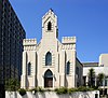
Fort Worth 2000
Allen Chapel A.M.E. Church AllenAME1.jpg
Commons-logo.svg More images
124 116 Elm St.

32°45′32″N97°19′39″W / 32.75889°N 97.32750°W / 32.75889; -97.32750
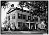
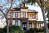
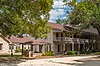
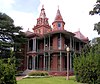
Fort Worth 1983
Ann Waggoner Hall Ann Waggoner Building (1 of 1).jpg 169 1301 Wesleyan St.

32°43′53″N97°16′50″W / 32.73139°N 97.28056°W / 32.73139; -97.28056

Fort Worth 1967Texas Wesleyan University, Ann Waggoner Fine Arts Building, northeast corner Wesleyan and E. Rosedale streets
Arlington Heights Lodge No. 1184, A.F. and A.M Arlington Heights Lodge (1 of 1).jpg Commons-logo.svg More images 200 4600 Camp Bowie Blvd.

32°44′25″N97°23′18″W / 32.74028°N 97.38833°W / 32.74028; -97.38833

Fort Worth 1987
Atelier Building TheAtelier (1 of 1).jpg 229 209 W. Eighth St.

32°45′5″N97°19′50″W / 32.75139°N 97.33056°W / 32.75139; -97.33056
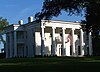
Fort Worth 1980
Baldridge House Baldridge House (1 of 1).jpg 286 5100 Crestline Rd.

32°44′25″N97°23′51″W / 32.74028°N 97.39750°W / 32.74028; -97.39750

Fort Worth 1978
Benton House BentonHouse1 (1 of 1).jpg
Commons-logo.svg More images
375 1730 Sixth Ave.

32°43′31″N97°20′24″W / 32.72528°N 97.34000°W / 32.72528; -97.34000

Fort Worth 1971
Bidault House Bidault House Colleyvile (1 of 1).jpg 401 1416 Glade Rd.

32°52′55″N97°8′43″W / 32.88194°N 97.14528°W / 32.88194; -97.14528

Colleyville 1980
Blackstone Hotel Blackstone04.jpg
Commons-logo.svg More images
12201 601-615 Main St.

32°45′13″N97°19′48″W / 32.75361°N 97.33000°W / 32.75361; -97.33000

Fort Worth 1998
Bryce Building Brycebuilding4.JPG
Commons-logo.svg More images
550 909 Throckmorton St.

32°45′4″N97°19′50″W / 32.75111°N 97.33056°W / 32.75111; -97.33056

Fort Worth 1983909 Throckmorton, Fort Worth
Cobb-Burney House Cobb-Burney House Fort Worth Wiki (1 of 1).jpg 925 1598 Sunset Ter.

32°44′37″N97°20′38″W / 32.74361°N 97.34389°W / 32.74361; -97.34389

Fort Worth 19851598 Sunset Terrace, Ft. Worth.
Curzon Place Cruzon Place (1 of 1).jpg 17337 3108 Winthrop Ave.

32°43′47″N97°24′58″W / 32.72972°N 97.41611°W / 32.72972; -97.41611

Fort Worth 2012South side of Curzon Ave between Winthrop Ave and Westridge Ave
Dorris-Brock House DorrisBrockHouse (1 of 1).jpg 16322 805 N. Main St.

32°56′49″N97°4′42″W / 32.94694°N 97.07833°W / 32.94694; -97.07833
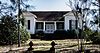
Grapevine 2010Grapevine, 805 N. Main St.
Douglass-Potts House Arlington April 2019 38 (Douglass-Potts House).jpg
Commons-logo.svg More images
12204 206 W. North St.

32°44′25″N97°6′32″W / 32.74028°N 97.10889°W / 32.74028; -97.10889

Arlington 1999
Dr. Clay Johnson House JohnsonElliot1.jpg
Commons-logo.svg More images
1266 3 Chase Ct.

32°43′31″N97°19′54″W / 32.72528°N 97.33167°W / 32.72528; -97.33167

Fort Worth 1983#3 Chase Ct., Fort Worth
Dr. George M. Munchus House NearSoutheast (1 of 1).jpg
Commons-logo.svg More images
1269 1130 E. Terrell Ave.

32°44′7″N97°18′43″W / 32.73528°N 97.31194°W / 32.73528; -97.31194

Fort Worth 19851130 E. Terrell Ave.
Eddleman-McFarland House 0011Eddleman McFarland House SE Fort Worth Texas.jpg
Commons-logo.svg More images
1385 1110 Penn St.

32°44′50″N97°20′33″W / 32.74722°N 97.34250°W / 32.74722; -97.34250

Fort Worth 19801110 Penn St., Fort Worth
Fairfield Gates Apartments Fairfield Gates (1 of 1).jpg 17336 3200 Fairfield Ave.

32°43′42″N97°25′8″W / 32.72833°N 97.41889°W / 32.72833; -97.41889

Fort Worth 2012Southwest corner of Fairfield Ave and Greenway Ave
Fairview, William J. Bryce House BryceHouse (1 of 1).jpg
Commons-logo.svg More images
1556 4900 Bryce Ave.

32°44′23″N97°23′35″W / 32.73972°N 97.39306°W / 32.73972; -97.39306

Fort Worth 19834900 Bryce St., Fort Worth
Fielder House Fielder House (1 of 1).jpg 1594 1616 W. Abram St.

32°44′7″N97°7′52″W / 32.73528°N 97.13111°W / 32.73528; -97.13111

Arlington 19791616 W. Abram, Arlington
First TV in Texas FirstWBAP-KXASstudiosandoffices.jpg 14651 3900 Barnett St.

32°45′1″N97°15′54″W / 32.75028°N 97.26500°W / 32.75028; -97.26500

Fort Worth 1967
Flatiron Building Fort Worth June 2016 15 (Flatiron Building).jpg
Commons-logo.svg More images
1910 1000 Houston St.

32°45′1″N97°19′46″W / 32.75028°N 97.32944°W / 32.75028; -97.32944

Fort Worth 19701000 Houston St., Fort Worth
Florence Shuman Hall WomensClub1 (1 of 1).jpg 1921 1300 Pennsylvania Ave.

32°44′20″N97°20′22″W / 32.73889°N 97.33944°W / 32.73889; -97.33944

Fort Worth 19671300 Pennsylvania Ave., Fort Worth
Former TSTA Building TSTA Building (1 of 1).jpg 1956 410 E. Weatherford St.

32°45′30″N97°19′48″W / 32.75833°N 97.33000°W / 32.75833; -97.33000

Fort Worth 1981410 E. Weatherford, Fort Worth
Fort Worth Elks Lodge 124 Elks Lodge 124.jpg
Commons-logo.svg More images
2027 512 W. Fourth St.

32°45′10″N97°20′5″W / 32.75278°N 97.33472°W / 32.75278; -97.33472

Fort Worth 1986512 W. 4th St., Fort Worth
Fort Worth Livestock Exchange 0011Fort Worth Stockyards Live Stock Exchange SE Texas.jpg
Commons-logo.svg More images
2029 201 E. Exchange Ave.

32°47′20″N97°20′48″W / 32.78889°N 97.34667°W / 32.78889; -97.34667
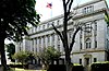
Fort Worth 1967201 E. Exchange St., Fort Worth
Fort Worth Main Post Office Building PostOffice1.jpg
Commons-logo.svg More images
2030 251 W. Lancaster Ave.

32°44′47″N97°19′46″W / 32.74639°N 97.32944°W / 32.74639; -97.32944

Fort Worth 1980251 W. Lancaster, Ft. Worth
Fort Worth Public Market Building 0011Public Market Full NE Fort Worth Texas.jpg
Commons-logo.svg More images
2031 1400 Henderson St.

32°44′39″N97°20′16″W / 32.74417°N 97.33778°W / 32.74417; -97.33778
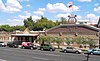
Fort Worth 19801400 Henderson, Fort Worth
Fort Worth Stock Yards Entrance# FtWorthStockyards1 (1 of 1).jpg
Commons-logo.svg More images
2033 100 blk. E. Exchange Ave.

32°47′20″N97°20′55″W / 32.78889°N 97.34861°W / 32.78889; -97.34861

Fort Worth 1985100 block of E. Exchange St., Fort Worth (2 markers on portal columns on either side of street)
Friday House Friday House Arlington Wiki (1 of 1).jpg 12206 1906 Ambers Cir.

32°43′50″N97°4′46″W / 32.73056°N 97.07944°W / 32.73056; -97.07944

Arlington 1999
Garvey-Veihl House Garvey-Veihl House (1 of 1).jpg 2105 769 Samuels Ave.

32°46′7″N97°19′52″W / 32.76861°N 97.33111°W / 32.76861; -97.33111

Fort Worth 1993769 Samuels Ave, Fort Worth
General Thomas N. Waul, C.S.A. Thomas Waul Wiki (1 of 1).jpg 2142 Oakwood Cemetery Section 31, 700 Grand Ave.

32°46′13″N97°20′55″W / 32.77028°N 97.34861°W / 32.77028; -97.34861

Fort Worth 1983701 Grand Ave., Fort Worth; Oakwood Cemetery, Section 31
George B. Monnig House Monning House (1 of 1).jpg 2150 115 W. Broadway Ave.

32°44′27″N97°19′36″W / 32.74083°N 97.32667°W / 32.74083; -97.32667

Fort Worth 1985115 W. Broadway, Fort Worth
Grammer-Pierce House 18100 2232 College Ave.

32°43′10″N97°20′7″W / 32.71944°N 97.33528°W / 32.71944; -97.33528

Fort Worth 2015
Greater Saint James Baptist Church GreaterSt.JamesChurch1 (1 of 1).jpg
Commons-logo.svg More images
2266 210 Harding St.

32°45′34″N97°19′28″W / 32.75944°N 97.32444°W / 32.75944; -97.32444

Fort Worth 1986210 Harding St., Fort Worth
Gunhild Weber House Gunhild Weber House Fort Worth (1 of 1).jpg 2305 1404 S. Adams St.

32°43′45″N97°20′13″W / 32.72917°N 97.33694°W / 32.72917; -97.33694

Fort Worth 19781404 S. Adams, Fort Worth
Hamilton House 15314 600 S. Collins St.

32°43′49″N97°5′53″W / 32.73028°N 97.09806°W / 32.73028; -97.09806

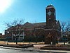
Arlington 2000
Hemphill Presbyterian Church Hemphill Presbyterian Church (1 of 1).jpg 2435 1701 Hemphill St.

32°43′33″N97°19′52″W / 32.72583°N 97.33111°W / 32.72583; -97.33111
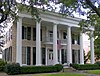
Fort Worth 19841701 Hemphill St.
Henry M. Williams Home Henry M. Williams Home Wiki (1 of 1).jpg 2450 4926 Crestline Rd.

32°44′30″N97°23′45″W / 32.74167°N 97.39583°W / 32.74167; -97.39583

Fort Worth 19824926 Crestline Rd., Fort Worth
Hotel Texas HotelTexas2 (1 of 1).jpg
Commons-logo.svg More images
2574 815 Main St.

32°45′9″N97°19′45″W / 32.75250°N 97.32917°W / 32.75250; -97.32917

Fort Worth 1982815 Main St., Fort Worth at main entrance, inside.
Hutcheson-Smith Home Hutcheson-Smith House (1 of 1).jpg
Commons-logo.svg More images
2601 312 N. Oak St.

32°44′24″N97°6′33″W / 32.74000°N 97.10917°W / 32.74000; -97.10917

Arlington 1982312 N. Oak St., Arlington
Ida Saunders Hall Ida Saunders Hall Fort Worth Womens Club (1 of 1).jpg 2614 1320 Pennsylvania Ave.

32°44′20″N97°20′25″W / 32.73889°N 97.34028°W / 32.73889; -97.34028

Fort Worth 19661300 block of Pennsylvania Ave., Fort Worth
J. D. Cooper House 2671 211 Willis Ave.

32°44′5″N97°5′33″W / 32.73472°N 97.09250°W / 32.73472; -97.09250

Arlington 1965211 Willis St., entrance to Meadowbrook Park. House damaged by fire 1999, possibly moved. RTHL marker may be in Fielder Museum.
James-Fujita House James-Fujita House (1 of 1).jpg 2741 2530 College Ave.

32°42′52″N97°20′8″W / 32.71444°N 97.33556°W / 32.71444; -97.33556
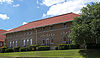
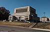
Fort Worth 19862530 College Ave, Fort Worth
Kennedale Independent School District Kennedale (1 of 1).jpg 18476 120 W. Kennedale Pkwy.

32°38′53″N97°13′19″W / 32.64806°N 97.22194°W / 32.64806; -97.22194

Kennedale 2016
Knights of Pythias KnightsofPythias2 (1 of 1).jpg
Commons-logo.svg More images
2967 315 Main St.

32°45′19″N97°19′52″W / 32.75528°N 97.33111°W / 32.75528; -97.33111

Fort Worth 1962110 East Third St., Fort Worth.
Land Title Building Land Title Block building (Fort Worth, Texas) 002.jpg
Commons-logo.svg More images
3030 155 E. Fourth St.

32°45′18″N97°19′51″W / 32.75500°N 97.33083°W / 32.75500; -97.33083

Fort Worth 1979111 W. 4th, Fort Worth
Laneri House Laneri House (1 of 1).jpg 3033 902 S. Jennings Ave.

32°44′7″N97°19′49″W / 32.73528°N 97.33028°W / 32.73528; -97.33028

Fort Worth 1982902 S. Jennings Ave., Fort Worth
Lanius House Lanius House (1 of 1).jpg 3035 2420 S. Adams St.

32°42′57″N97°20′13″W / 32.71583°N 97.33694°W / 32.71583; -97.33694

Fort Worth 19852420 W. Adams, Fort Worth
Margaret Meacham Hall Margaret Meacham Hall Wiki (1 of 1).jpg 3210 1326 Pennsylvania Ave.

32°44′20″N97°20′26″W / 32.73889°N 97.34056°W / 32.73889; -97.34056

Fort Worth 19671326 Pennsylvania Avenue, Fort Worth
Marshall R. Sanguinet House Sanguinet1.JPG
Commons-logo.svg More images
3224 4729 Collinwood Ave.

32°44′14″N97°23′26″W / 32.73722°N 97.39056°W / 32.73722; -97.39056

Fort Worth 19814729 Collinwood, Fort Worth
Masonic Temple Association of Fort Worth MasonicLodge1 (1 of 1).jpg
Commons-logo.svg More images
3246 1100 Henderson St.

32°44′50″N97°20′18″W / 32.74722°N 97.33833°W / 32.74722; -97.33833

Fort Worth 19841100 Henderson, Fort Worth
Maxwell-Liston House MaxwellListon House (1 of 1).jpg 3265 712 May St.

32°44′12″N97°19′46″W / 32.73667°N 97.32944°W / 32.73667; -97.32944

Fort Worth 1985712 May. St, Fort Worth
Mitchell-Schoonover Home Eighth Avenue Historic District1 (1 of 1).jpg
Commons-logo.svg More images
3425 600 Eighth Ave.

32°44′18″N97°20′39″W / 32.73833°N 97.34417°W / 32.73833; -97.34417
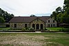
Fort Worth 1979600 S. 8th Ave, Ft.Worth
Nash Farm Nash Farm 1.JPG
Commons-logo.svg More images
17960 626 Ball St.

32°56′3″N97°5′9″W / 32.93417°N 97.08583°W / 32.93417; -97.08583

Grapevine 2014The nominated property includes all land bounded by West College Street, Ball Street, and Homestead Lane in Grapevine, Tarrant County, Texas.
Neil P. Anderson Building AndersonBuilding2.JPG
Commons-logo.svg More images
3569 411 W. Seventh St.

32°45′3″N97°19′56″W / 32.75083°N 97.33222°W / 32.75083; -97.33222

Fort Worth 1978
Nugent-Hart House NugentHart House.jpg 3628 312 S. Waxahachie St.

32°33′37″N97°8′13″W / 32.56028°N 97.13694°W / 32.56028; -97.13694

Mansfield 1983
Oakwood Cemetery OakwoodCemetery (1 of 1).jpg
Commons-logo.svg More images
3659 701 Grand Ave.

32°46′10″N97°20′52″W / 32.76944°N 97.34778°W / 32.76944; -97.34778

Fort Worth 1966Grand at Gould Avenue, Oakwood Cemetery, at gate, Fort Worth
Pioneer Cabin (STOLEN) 14084 Fort Worth 1962
Pollock-Capps House 0011Pollock Capps House E Fort Worth Texas.jpg
Commons-logo.svg More images
4066 1120 Penn St.

32°44′49″N97°20′33″W / 32.74694°N 97.34250°W / 32.74694; -97.34250

Fort Worth 19771120 Penn St., Fort Worth
Ponton, Dr. Arvel and Faye, House PontonHouse1 (1 of 1).jpg
Commons-logo.svg More images
15259 1208 Mistletoe Dr.

32°43′50″N97°21′22″W / 32.73056°N 97.35611°W / 32.73056; -97.35611

Fort Worth 20081208 Mistletoe Dr.
Ralph Man Homestead Ralph Sandiford and Julia Boisseau Man House Mansfield (1 of 1).jpg 54390 Mansfield 1977604 W. Broad St.
Rogers-O'Daniel House RogersODanielHouse1 (1 of 1).jpg
Commons-logo.svg More images
4339 2230 Warner Rd.

32°42′35″N97°20′50″W / 32.70972°N 97.34722°W / 32.70972; -97.34722

Fort Worth 19842230 Warner Rd., Fort Worth
Saint Ignatius Academy Building St. Ignatius Academy - Fort Worth, Texas.jpg
Commons-logo.svg More images
4441 1206-12 Throckmorton St.

32°44′55″N97°19′47″W / 32.74861°N 97.32972°W / 32.74861; -97.32972
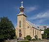
Fort Worth 19621206-12 Throckmorton, Fort Worth
Saint Mary of the Assumption Roman Catholic Church St. Mary of the Assumption.jpg
Commons-logo.svg More images
4464 509 W. Magnolia Ave.

32°43′49″N97°19′48″W / 32.73028°N 97.33000°W / 32.73028; -97.33000

Fort Worth 1979509 W. Magnolia Ave., Fort Worth
Saint Patrick's Cathedral St. Patrick Cathedral - Fort Worth, Texas 01.jpg
Commons-logo.svg More images
4475 1206 Throckmorton St.

32°44′57″N97°19′48″W / 32.74917°N 97.33000°W / 32.74917; -97.33000

Fort Worth 19621206 Throckmorton, Fort Worth
Sandidge-Walker House Sandidge-Walker House (1 of 1).jpg 4565 2420 College Ave.

32°42′57″N97°20′8″W / 32.71583°N 97.33556°W / 32.71583; -97.33556
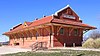
Fort Worth 19862420 College Ave, Fort Worth
Santa Fe Depot 0011Gulf Colorado and Sante Fe Station NW Fort Worth Texas.jpg
Commons-logo.svg More images
4577 1501 Jones St.

32°44′57″N97°19′26″W / 32.74917°N 97.32389°W / 32.74917; -97.32389
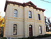
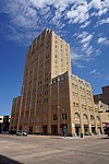
Fort Worth 19701501 Jones, Fort Worth
Sinclair Building SinclairBuilding3 (1 of 1).jpg
Commons-logo.svg More images
4709 512 Main St.

32°45′14″N97°19′51″W / 32.75389°N 97.33083°W / 32.75389; -97.33083
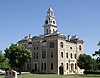
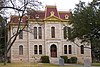
Fort Worth 1992512 Main St., Fort Worth
Tarrant County Courthouse # 0011Tarrant County Courthouse Full E Fort Worth Texas.jpg
Commons-logo.svg More images
5195 100 W. Weatherford St.

32°45′26″N97°19′58″W / 32.75722°N 97.33278°W / 32.75722; -97.33278

Fort Worth 1969Main at Weatherford Streets, Fort Worth
Tarrant County Criminal Courts Building Fort Worth June 2016 31 (Criminal Court).jpg 5196 200 W. Belknap St.

32°45′27″N97°20′5″W / 32.75750°N 97.33472°W / 32.75750; -97.33472
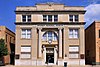
Fort Worth 1984200 W. Belknap, Fort Worth
Tarrant County State Bank Building Tarrant County State Bank (1 of 1).jpg 5197 332 S. Main St.

32°56′17″N97°4′43″W / 32.93806°N 97.07861°W / 32.93806; -97.07861

Grapevine 1986332 S. Main Street, Grapevine
Texas Garden Clubs, Inc., Headquarters Texas Garden Clubs Headquarters.jpg
Commons-logo.svg More images
16969 3111 Old Garden Rd.

32°44′9″N97°21′52″W / 32.73583°N 97.36444°W / 32.73583; -97.36444

Fort Worth 20113111 Old Garden Road, Fort Worth
Texas & Pacific Railroad Passenger Terminal Fort Worth June 2016 02 (T&P Station).jpg
Commons-logo.svg More images
5243 211 W. Lancaster Ave.

32°44′45″N97°19′43″W / 32.74583°N 97.32861°W / 32.74583; -97.32861
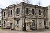
Fort Worth 1980Lancaster & Throckmorton St., Fort Worth
Thannisch Block Building Fort Worth Stockyards June 2016 09 (Hunter Brothers' H3 Ranch).jpg
Commons-logo.svg More images
5278 101-109 E. Exchange Ave.

32°47′21″N97°20′56″W / 32.78917°N 97.34889°W / 32.78917; -97.34889

Fort Worth 1983109 E. Exchange Avenue, Fort Worth
The Sanctuary - Gustavaus Adolphus Church The Sanctuary - Gustavaus Adolphus Church.jpg 5423 400 Hemphill St.

32°44′27″N97°19′55″W / 32.74083°N 97.33194°W / 32.74083; -97.33194
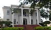
Fort Worth 1984400 Hemphill, Ft. Worth
Thistle Hill, The Cattle Baron's Mansion Wharton-Scott House1 (1 of 1).jpg
Commons-logo.svg More images
5463 1509 Pennsylvania Ave.

32°44′16″N97°20′32″W / 32.73778°N 97.34222°W / 32.73778; -97.34222
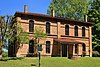
Fort Worth 19771509 Pennsylvania Ave., Fort Worth
Thomas G. & Marjorie Shaw House ThomasMajorieShawHouse (1 of 1).jpg
Commons-logo.svg More images
5469 2404 Medford Ct. E.

32°43′3″N97°21′24″W / 32.71750°N 97.35667°W / 32.71750; -97.35667

Fort Worth 19932404 Medford Ct., East, Fort Worth
Torian Log Cabin Torian Log Cabin in Grapevine, TX, Oct 2012.jpg 5508 205 S. Main St.

32°56′22″N97°4′41″W / 32.93944°N 97.07806°W / 32.93944; -97.07806

Grapevine 1978205 Main St. Grapevine
Van Zandt Cottage VanZandt3.jpg
Commons-logo.svg More images
5635 2900 Crestline Rd.

32°44′39″N97°21′32″W / 32.74417°N 97.35889°W / 32.74417; -97.35889

Fort Worth 19622900 Crestline Rd., Trinity Park. Marker reported missing Jul. 2006.
Newby, W.G., Memorial Building Newby, W.G., Memorial Building (1 of 1).jpg 14114 1316 Pennsylvania Ave.

32°44′20″N97°20′24″W / 32.73889°N 97.34000°W / 32.73889; -97.34000

Fort Worth 1967
Watauga Presbyterian Church Watauga Presbyterian Church2.jpg 5723 6209 Rusk St.

32°51′37″N97°16′3″W / 32.86028°N 97.26750°W / 32.86028; -97.26750

Haltom City 19726209 Rusk St., Haltom City
Westbrook Estate WestbrookHouse1 (1 of 1).jpg
Commons-logo.svg More images
15766 2232 Winton Terrace W.

32°43′15″N97°21′35″W / 32.72083°N 97.35972°W / 32.72083; -97.35972

Fort Worth 2009
Westover Manor Westover Manor Wiki (1 of 1).jpg
Commons-logo.svg More images
5771 8 Westover Rd.

32°44′31″N97°24′14″W / 32.74194°N 97.40389°W / 32.74194; -97.40389

Westover Hills 19888 Westover Rd., Westover Hills
William Reeves House WilliamReevesHouse (1 of 1).jpg Commons-logo.svg More images 5845 2200 Hemphill St.

32°43′13″N97°19′55″W / 32.72028°N 97.33194°W / 32.72028; -97.33194

Fort Worth 19842200 Hemphill, Fort Worth

Taylor County

Registered Texas Historic LandmarkImageMarker numberPhysical addressNearest cityYear designatedLocation description [1] [2]
Abilene Woman's Club Building 13446 3425 S. 14th St.

32°25′55″N99°46′5″W / 32.43194°N 99.76806°W / 32.43194; -99.76806

Abilene 20053425 South 14th
Butler, Dr. William & Beatrice, Home 14834 701 Mesquite St.

32°27′21″N99°43′46″W / 32.45583°N 99.72944°W / 32.45583; -99.72944

Abilene 2008
Ernie Wilson Museum 1497 133 Williams St.

32°17′10″N99°49′36″W / 32.28611°N 99.82667°W / 32.28611; -99.82667

Buffalo Gap 1962At Buffalo Gap Village, off Highway 89, Buffalo Gap
First Taylor County Jail - Courthouse OldTaylorCourthouse2 (1 of 1).jpg
Commons-logo.svg More images
1597 133 Williams St.

32°17′10″N99°49′36″W / 32.28611°N 99.82667°W / 32.28611; -99.82667

Buffalo Gap 1962Buffalo Gap Village, off Highway 89
Hardin-Simmons University HardinSimmonsClock.jpg
Commons-logo.svg More images
2373 2200 Hickory St.

32°28′35″N99°44′4″W / 32.47639°N 99.73444°W / 32.47639; -99.73444

Abilene 1967Hardin-Simmons University, corner of Ambler & Simmons Street, Abilene
Hattie and Henry Sayles Sr. House Henry Sayles Home Abilene Texas.jpg
Commons-logo.svg More images
2406 642 Sayles Blvd.

32°26′37″N99°44′53″W / 32.44361°N 99.74806°W / 32.44361; -99.74806

Abilene 1994642 Sayles Blvd., Abilene
Hotel Wooten Abilene June 2019 11 (Hotel Wooten).jpg
Commons-logo.svg More images
14423 1102 N. Third St.

32°27′7″N99°44′4″W / 32.45194°N 99.73444°W / 32.45194; -99.73444

Abilene 20081102 N. Third St.
Lawn Atlas ICBM Launch Facility 16131 1990 FM 604

32°8′26″N99°42′13″W / 32.14056°N 99.70361°W / 32.14056; -99.70361

Lawn 2008
Lytle Gap-Potosi Methodist Church 3157 2832 Potosi Rd.

32°19′55″N99°39′28″W / 32.33194°N 99.65778°W / 32.33194; -99.65778

Abilene 1981From Abilene, take FM 1750 southeast about 8 miles, then follow county road .25 mile north. Church reported destroyed by fire Sep. 2015.
Magee House Abilene June 2019 61 (J. D. Magee House).jpg
Commons-logo.svg More images
3292 1910 N. Third St.

32°27′11″N99°44′33″W / 32.45306°N 99.74250°W / 32.45306; -99.74250

Abilene 19711910 N. 3rd Street, Abilene
Miss Clara Bussell 3400 706 Cedar St.

32°27′22″N99°44′6″W / 32.45611°N 99.73500°W / 32.45611; -99.73500

Abilene 1967706 N. Cedar Street, Abilene
Old Weather Bureau Building Abilene June 2019 44 (U.S. Weather Bureau Building).jpg
Commons-logo.svg More images
3833 1482 N. First St.

32°27′0″N99°44′20″W / 32.45000°N 99.73889°W / 32.45000; -99.73889

Abilene 19811482 N. 1st Street, Abilene
Sacred Heart Catholic Church Sacred Heart Church Abilene Texas.jpg
Commons-logo.svg More images
4432 1633 S. Eighth St.

32°26′27″N99°44′32″W / 32.44083°N 99.74222°W / 32.44083; -99.74222

Abilene 19901633 S. 8th Street, Abilene
Site of Curfew by John J. Clinton 4766 S. First St. and Chestnut St.

32°26′54″N99°44′1″W / 32.44833°N 99.73361°W / 32.44833; -99.73361

Abilene 1967S. 1st & Chestnut Streets, Abilene
Texas & Pacific Railroad Depot Abilene June 2019 15 (Abilene Convention and Visitors Bureau - Texas & Pacific Railroad Station).jpg
Commons-logo.svg More images
18416 1101 N. First St.

32°26′57″N99°44′4″W / 32.44917°N 99.73444°W / 32.44917; -99.73444

Abilene 2016South Side of North First Street between Cypress Street and Cedar
William G. and Shirley Swenson Home 16526 1726 Swenson St.

32°28′10″N99°44′28″W / 32.46944°N 99.74111°W / 32.46944; -99.74111

Abilene 2010on block surrounded by N. 18th, Swenson, N. 17th & Merchant

Terrell County

Registered Texas Historic LandmarkImageMarker numberPhysical addressNearest cityYear designatedLocation description [1] [2]
El Buen Pastor Methodist Church 1407 SW corner 3rd St. and E. Pine St.

30°8′26″N102°33′39″W / 30.14056°N 102.56083°W / 30.14056; -102.56083

Sanderson 1962corner of 3rd and Pine St., Sanderson
Sanderson State Bank 4564 100 Persimmon Ave.

30°8′26″N102°23′57″W / 30.14056°N 102.39917°W / 30.14056; -102.39917

Sanderson 1962Corner of Persimmon and Dawnie Sts., Sanderson

Terry County

Registered Texas Historic LandmarkImageMarker numberPhysical addressNearest cityYear designatedLocation description [1] [2]
A. M. Brownfield Home 56 600 E. Cardwell St.

33°10′33″N102°16′8″W / 33.17583°N 102.26889°W / 33.17583; -102.26889

Brownfield 1985600 East Cardwell, Brownfield
M. B. Sawyer Ranch House 3159 CR 480 0.25 mi. E of FM 403

33°7′24″N102°17′17″W / 33.12333°N 102.28806°W / 33.12333; -102.28806

Brownfield 1970From Brownfield, take FM 403 South about 7.3 miles to county road; take county road 1/4 mile east.
Old Daugherty House 3718 1206 Tahoka Rd.

33°10′51″N102°15′40″W / 33.18083°N 102.26111°W / 33.18083; -102.26111

Brownfield 19691206 Tahoka Road, Brownfield.

Throckmorton County

Registered Texas Historic LandmarkImageMarker numberPhysical addressNearest cityYear designatedLocation description [1] [2]
Throckmorton County Courthouse # Throckmorton County Texas Courthouse 2015.jpg 15081 105 N. Minter Ave.

33°10′44″N99°10′40″W / 33.17889°N 99.17778°W / 33.17889; -99.17778

Throckmorton 2008

Titus County

Registered Texas Historic LandmarkImageMarker numberPhysical addressNearest cityYear designatedLocation description [1] [2]
Broadstreet Farmhouse 11170 2357 US 67

33°10′59″N94°55′36″W / 33.18306°N 94.92667°W / 33.18306; -94.92667

Mt. Pleasant 19723 mi. E on US 67
Center Grove Cemetery 11171 0.4 mi. E on CR 4340 from FM 1000

33°7′46″N94°50′43″W / 33.12944°N 94.84528°W / 33.12944; -94.84528

Mt. Pleasant 1983About 7 mi E of Mt Pleasant via SH 49 to N FM 1993 then right on CR SE 39
Cooper's Chapel Church and Cemetery 11172 CR 3425 at FM 1993

33°16′17″N94°51′28″W / 33.27139°N 94.85778°W / 33.27139; -94.85778

Mt. Pleasant 1993About 12 mi NE of Mt. Pleasant via US 30 to FM 1993, N about 1.5 mi
Florey Home 11176 702 S. Lide Ave.

33°9′4″N94°57′44″W / 33.15111°N 94.96222°W / 33.15111; -94.96222

Mt. Pleasant 1982
Greenhill Presbyterian Church Building 11178 350 CR 1660

33°14′59″N94°59′26″W / 33.24972°N 94.99056°W / 33.24972; -94.99056

Mt. Pleasant 1963Off FM 2152 on CR, in Green Hill Community
Home of William Augusta Old 11169 Mt. Pleasant 1964
Monticello Missionary Baptist Church 13957 FM 127 at CR 2715

33°5′32″N95°5′16″W / 33.09222°N 95.08778°W / 33.09222; -95.08778

Mt. Pleasant 20078.5 mi SW on FM 127
Old, William August, Home 14352 Mt. Pleasant 1966
The Lide House 11180 315 E. Third St.

33°9′29″N94°57′56″W / 33.15806°N 94.96556°W / 33.15806; -94.96556

Mt. Pleasant 1971
W. A. Keith House 11179 US 67 Cookville 1970US 67 in Cookville, About 7 mi E of Mt. Pleasant
W. R. M. Slaughter Home 11181 1 mi. N of Greenhill community Mt. Pleasant 1965

Tom Green County

Registered Texas Historic LandmarkImageMarker numberPhysical addressNearest cityYear designatedLocation description [1] [2]
Administration Building of the Fort Concho Museum# 87 Burgess St. between E. Ave. C and E. Ave. D at E. center line of parade ground

31°27′15″N100°25′40″W / 31.45417°N 100.42778°W / 31.45417; -100.42778

San Angelo 1962Fort Concho on Center Green, N. End, between Avenues C & D, San Angelo
Chapel & Schoolhouse# 15367 E. Ave. D and Burgess St.

31°27′11″N100°25′43″W / 31.45306°N 100.42861°W / 31.45306; -100.42861

San Angelo 1962
Chapel and School House of Fort Concho# 805 E. Ave. D and Burgess St.

31°27′11″N100°25′43″W / 31.45306°N 100.42861°W / 31.45306; -100.42861

San Angelo 1962Located on southwest corner of intersection of E. Ave. D and Burgess Street. Fort Concho, San Angelo
Emanuel Episcopal Church Emmanuel Episcopal Church San Angelo Texas.jpg 15549 3 S. Randolph St.

31°27′44″N100°26′27″W / 31.46222°N 100.44083°W / 31.46222; -100.44083

San Angelo 1967
Emmanuel Episcopal Church 1478 3 S. Randolph St.

31°27′44″N100°26′27″W / 31.46222°N 100.44083°W / 31.46222; -100.44083

San Angelo 1967Harris & Randolf St., San Angelo
Enlisted Men's Barracks #1# Fort Concho visitors center.jpg 14716 630 S. Oakes St.

31°27′17″N100°25′51″W / 31.45472°N 100.43083°W / 31.45472; -100.43083

San Angelo 1962
Enlisted Men's Barracks #2# 15603 E. Ave. C between S. Oakes St. and Burgess St.

31°27′17″N100°25′49″W / 31.45472°N 100.43028°W / 31.45472; -100.43028

San Angelo 1962
Enlisted Men's Barracks, # 5# 1487 E. Ave. C between S. Oakes St. and Burgess St.

31°27′18″N100°25′44″W / 31.45500°N 100.42889°W / 31.45500; -100.42889

San Angelo 1962Fort Concho, 2nd Building, West from corner of Burgess & Ave C, San Angelo
Enlisted Men's Barracks, # 6# 1486 E. Ave. C at Burgess St.

31°27′18″N100°25′42″W / 31.45500°N 100.42833°W / 31.45500; -100.42833

San Angelo 1962Corner of Ave C and Burgess St. San Angelo
Fred Beck Homestead Beck Farm House.jpg 2056 1231 Culberson St.

31°27′44″N100°25′3″W / 31.46222°N 100.41750°W / 31.46222; -100.41750

San Angelo 19891231 Culberson, San Angelo
Maier House, The 5375 Relocated to Arden, Irion Co. San Angelo 1978moved from 437 West Twohig, San Angelo after 1983
Municipal Swimming Pool San angelo tx municipal pool bldg.jpg
Commons-logo.svg More images
3536 18 E. Ave. A

31°27′24″N100°25′59″W / 31.45667°N 100.43306°W / 31.45667; -100.43306

San Angelo 198918 E. Avenue A, San Angelo
Officers' Quarters #2# 15354 115 E. Ave. D

31°27′12″N100°25′51″W / 31.45333°N 100.43083°W / 31.45333; -100.43083

San Angelo 1962
Officers' Quarters #4# Danner Museum Fort Concho.jpg 14073 201 E. Ave. D

31°27′12″N100°25′49″W / 31.45333°N 100.43028°W / 31.45333; -100.43028

San Angelo 1963
Officers' Quarters #8# 14203 301 E. Ave D

31°27′12″N100°25′45″W / 31.45333°N 100.42917°W / 31.45333; -100.42917

San Angelo 1962
Officers Quarters No. 2# 3673 115 E. Ave. D

31°27′12″N100°25′51″W / 31.45333°N 100.43083°W / 31.45333; -100.43083

San Angelo 1962115 East Avenue D, San Angelo 2nd building from West end of Officers Row.
Officers Quarters No. 4, Fort Concho, Texas (missing)# 3676 201 E. Ave. D

31°27′12″N100°25′49″W / 31.45333°N 100.43028°W / 31.45333; -100.43028

San Angelo 1962201 East Avenue D, San Angelo, Texas.
Officers Quarters No. 8, Fort Concho, Texas.# 3675 301 E. Ave D

31°27′12″N100°25′45″W / 31.45333°N 100.42917°W / 31.45333; -100.42917

San Angelo 1962Building on North one-half of Lot No. 8, Block 55, Fort Concho Addition, City of San Angelo
Orient-Santa Fe Depot A freight engine and cars parked beside the old Santa Fe railroad station in San Angelo, the seat of Tom Green County, Texas LCCN2014631393.tif
Commons-logo.svg More images
15218 700 S. Chadbourne St.

31°27′14″N100°26′5″W / 31.45389°N 100.43472°W / 31.45389; -100.43472

San Angelo 2008
Schwartz & Raas and San Angelo National Bank Building SCHWARTZ AND RAAS BUILDING.jpg 4611 20-26 E. Concho Ave.

31°27′38″N100°26′3″W / 31.46056°N 100.43417°W / 31.46056; -100.43417

San Angelo 198120-26 East Concho Street, San Angelo

Travis County

Registered Texas Historic LandmarkImageMarker numberPhysical addressNearest cityYear designatedLocation description [1] [2]
Catherine Robinson House Catherine Robinson (1 of 1).jpg 6431705 San Antonio St.Austin1962
Walter Bremond Home Walter Bremond (1 of 1).jpg 6432711 San Antonio St.Austin1962711 San Antonio (409 W. 8th Street) (Texas Classroom Teachers Association executive offices)
Pierre Bremond Home Pierre BremondHouse (1 of 1).jpg 6433402 W 7th St.Austin1962
Eugene Bremond House EugeneBremondHouse (1 of 1).jpg 6434404 W. 7th St.Austin1962
John Bremond Jr. House John Bremond House (1 of 1).jpg 6435700 Guadalupe St.Austin1962
Hale Houston Home The Phillips-Bermond-Houston House 2.jpg 6436706 Guadalupe Ave.Austin1962
Hirshfeld House Hirshfeld House (1 of 1).jpg 6440303 W 9th St.Austin1962303 W. 9th St., Austin
Hirshfeld Cottage Hirshfeld Cottage (1 of 1).jpg 6441305 W 9th St.Austin1962305 W 9th St., Austin
Mrs. Alfred Robinson, Sr. Home Bremond Block Historic Dis. House 2.jpg 4306404 W. 7thAustin1962
German Free School German Free School Austin Texas 2023.jpg 12732507 E. 10th StreetAustin1962507 E. 10th Street
Elisabet Ney Home Elizabeth Ney (1 of 1).jpg 13829304 E 44th StAustin1962Elisabet Ney Museum
The Governor's Mansion⁕ Texas governors mansion.jpg 139321010 ColoradoAustin1962
Beriah Graham House Beriah Graham House Austin Texas 2023.jpg 139262605 SaladoAustin1962
Jacob Leser Home Jacob Lesser Home (1 of 1).jpg 142543506 West AvenueAustin1962
McNeal Home McNeal Home Austin Texas 2023.jpg 14448706 Rio GrandeAustin1962Medallion reported missing Mar. 2010.
Gethsemane Church Gethsemane lutheran church austin 2009.jpg 147701510 N. Congress Ave.Austin1962Texas Historical Commission offices
French Legation French legation 2011.jpg 14828802 San Marcos StAustin1962
Littlefield Home Littlefield house 2007.jpg 14889Austin196224th at Whitis
TMI Castle TMI castle austin 2014.jpg 149351111 W. 11thAustin1962
Sweetbrush (Swisher-Scott Home)149362408 Sweetbrush DrAustin1962
Old Land Office Building General land office building 2006.jpg 15288108 E.11thAustin1962
Woodlawn Woodlawn austin 2006.jpg 153036 Niles RoadAustin1962
Wells-LaRue House145924524 Ave FAustin1963
Haynie Chapel Methodist Church Haynie Chapel Garfield Texas 2023.jpg 1412716415 Greenwood DriveDel Valle1964
Onion Creek Lodge 220, AF & AM14905Austin1964
Fortress Home Fortress Home Austin Texas 2022.jpg 153521425 Fort Dessau Rd.Austin1964
Millett Opera House Millett Opera House (1 of 1).jpg 14910111 E. 9thAustin1965
R. K. Smoot Home Richmond kelley smoot house.jpg 145181316 W. 6thAustin1965
Texas State Capitol⁕ Texas capitol day.jpg 141501100 Congress AvenueAustin1965Texas State Capitol grounds. 1964 Recorded Texas Historic Landmark as Texas State Capitol, 1976 Official Texas Historical Marker as The Texas Capitol.
Austin Woman's Club Austin Woman's Club (1 of 1).jpg 6430708 San Antonio StreetAustin1965708 San Antonio St., Austin
The Johnson Home The Johnson Home Austin, Texas 2023.jpg 6448404 Atlanta St.Austin1966(American Legion Post No. 76)
Driskill Hotel Driskell Hotel (1 of 1).jpg 13931604 Brazos StAustin19666th and Brazos
Saint David's Episcopal Church St-davids-episcopal-austin.jpg 141967th at San JacintoAustin1966
Swedish Log Cabin Exterior view - Swedish Log Cabin - Zilker Botanical Garden - Austin, Texas - DSC08800.jpg 14405Austin1966Zilker Botanical Gardens, Zilker Park
Old Bakery Lundberg Bakery (1 of 1).jpg 149491006 CongressAustin19661100 block Congress Ave. Medallion reported missing Nov. 2016.
Rocky Cliff14979802 Barton BlvdAustin1966
Neill-Cochran Home Neill cochran house 2007.jpg 151342312 San GabrielAustin1966
Old Depot Hotel15476504 E. 5thAustin1966(Carmelo's, formerly Mi Casa es Su Casa)
Austin State Hospital Austin State Hospital (1 of 1).jpg 156484110 GuadalupeAustin1966
Scottish Rite Temple Scottish Rite Temple Austin Texas 2022.jpg 15644207 W. 18thAustin1967
Las Ventanas Las ventanas 2007.jpg 15110602 HarthanAustin1967
The Old Zimmerman Home150211600 Peyton Gin RoadAustin1967
Seiders Oaks15302Austin1967Shoal Creek Trail, west of Seton Hospital, near W. 38th Street and Shoal Creek Blvd. -- Seider Springs Park, west side of low water crossing
Millbrook (Roy-Hardin House)129791803 Evergreen AveAustin1967Austin, 1803 Evergreen Avenue
Scholz Garten Scholz garden 2007.jpg 122451607 San JacintoAustin1967
B. J. Smith Property6439610 Guadalupe St.Austin1968
I. V. Davis Homestead141701610 Virginia AveAustin1968
Walnut Creek Baptist Church1543512200 N. LamarAustin1969
Goodman Building GoodmanBldg-2010-08-b.JPG 64381300 Colorado St.Austin1969
Christianson-Leberman Home John hancock house 2011.jpg 64371304 ColoradoAustin1969across from State Capitol, Austin (Old John Hancock House)
Old Rock Store Old Rock Store Front Half Austin 2019.jpg 122446266 Hwy. 290WAustin1970
St. Charles House St Charles House Austin Texas 2022.jpg 14909316 E 6thAustin1971Contributing property to Sixth Street Historic District
Wahrenberger House WahrenbergerHouseAustinTX.JPG 6421208 W. 14th St.Austin1972
Carrington-Covert House CarringtonCovertAustinTX.JPG 64231511 Colorado StreetAustin19721511 Colorado Street, Austin
Saint Edward's University Main Building StEdwardsUniv-April2008-a.JPG 148213001 S. CongressAustin1972
Buen Retiro15258300 W. 27thAustin1972(Phi Gamma Delta fraternity house)
The Governor Horton Place151686706 Bluff Springs RoadAustin1972
West Hill West Hill Austin Texas 2022.jpg 64581703 West Ave.Austin1974
William Green Hill House6415910 Blanco St.Austin1974
Brizendine House Brizedine House (1 of 1).jpg 6453507 W 11th St.Austin1974507 W 11th St., Austin
Dawson Stone House142741105 S. LamarAustin1974
O. Henry Hall OHenryHall.JPG 15479601 ColoradoAustin1974Contributing property to Sixth Street Historic District
Radkey House Radkey House (1 of 1).jpg 154733706 JeffersonAustin1974
Gerhard-Schoch House156322212 NuecesAustin1974
Claudia Taylor Johnson Hall JohnsonClaudiaTaylorHallAustinTX.JPG 14916210 W. 6thAustin1974(1912 U. S. Post Office)
Esperanza School Building14956Austin1974Zilker Botanical Garden, Zilker Park
Hotel Provident & Heierman Bldg. Hotel Provident and Heierman Building Austin Texas 2023.jpg 14733115-117 E. 5thAustin1974
Henry G. Madison Cabin Henry Green Madison Cabin.jpg 147002300 Rosewood AveAustin1974Rosewood Park
Donnan-Hill House123262528 Tanglewood TrailAustin1975
Smith-Clark-Smith House Smith bickler house 2011.jpg 6419504 W. 14th St.Austin1975
Emma West Flats Emma West Flats (1 of 1).jpg 6451511 West 7thAustin1976511 West 7th, Austin
Green Pastures Green pastures 2007.jpg 6444811 W Live OakAustin1976811 W. Live Oak, Austin
Paramount Theater Paramount Austin (1 of 1).jpg 14684713 N. CongressAustin1976
West-Bremond Cottage West-Bremon Cottage (1 of 1).jpg 14858607 NuecesAustin1976
Paggi Carriage Shop Paggi Carriage Shop Austin Texas 2022.jpg 15638421 E. 6thAustin1976
Walter Tips House Southeast Corner Walter Tips House Austin 2019.jpg 137752336 S. Congress Ave.Austin19762336 S. Congress Ave.
Southwestern Telegraph & Telephone Bldg. Southwestern telegraph and telephone building 2013.jpg 14090410 CongressAustin1977
Saint Mary's Cathedral St.MarysChurch (1 of 1).jpg 14676201 E. 10thAustin1977
Mary Street Stone House64451001 W Mary St.Austin1978
Denny-Holliday House Denny Holliday House Austin 2020.jpg 146681803 West AvenueAustin1978
Thompson Home Thompson Home Austin Texas 2023.jpg 148981171 San BernardAustin1978(Zeta Phi Beta sorority)
Jeremiah Hamilton House142091101 Red RiverAustin1978
Boardman-Webb House Boardman Webb House (1 of 1).jpg 14502602 W. 9thAustin1979
Moore's Crossing Bridge Moores crossing bridge.jpg 14007Austin1980Richard Moya Park, Burleson Road
Contributing structure to the Moore's Crossing Historic District
Michael Paggi House Michael paggi house 2013.jpg 14112200 Lee Barton DriveAustin1980
Walter Tips Company Building, The The Walter Tips Company Building Austin Texas 2022.jpg 13774710-712 S. Congress Ave.Austin1980Contributing property to Congress Avenue Historic District
Gilfillan House Gilfillan 2011.jpg 14373603 W. 8thAustin1981
Brueggemann-Sandbo House15080200 E. 30th StreetAustin1981
Hugh B. Hancock House Hugh Hancock House Austin 2020.jpg 64571717 West Ave.Austin1981
Mauthe-Myrick Mansion Mauthe Myrick Mansion Austin 2020.jpg 6420408 W. 14th St.Austin1981
Fischer House Fischer House Austin, Texas 2023.jpg 64521008 West Ave.Austin1982
George W. Sampson Home George sampson house 2011.jpg 21621003 Rio Grande St.Austin1982
Bloor House Bloor House Manor Texas 2022.jpg 1511410 Lexington StManor1982
Platt-Simpson Building Platt Simpson Building Austin Texas 2022.jpg 14334310 E. 6thAustin1982Contributing property to Sixth Street Historic District
The Shipe House Monroe Shipe House.jpg 143613816 Avenue GAustin1982
Jacob Larmour House Jacob Larmour House Austin Texas 2022.jpg 142461711 Rio GrandeAustin1982
Sampson Building14087618-622 Congress AveAustin1982
Openheimer-Montgomery Building Openheimer Montgomery Building Austin Texas 2022.jpg 14111105-109 W 8thAustin1983
E. H. Carrington Grocery Store and Lyons Hall Carrington Building Austin Texas 2022.jpg 14345522 E. 6thAustin1983Contributing property to Sixth Street Historic District
J. L. Buaas Building Buaas Building Austin Texas 2022.jpg 14635407 E. 6th StAustin1983Contributing property to Sixth Street Historic District
Okewell147481505 Windsor RoadAustin1983
Hofheintz-Reissig Store Hofheintz-Reissig Store1 (1 of 1).jpg 14765600 E 3rd StAustin1983
Barr Mansion Sprinkle-tx(barr-mansion)2016-1.jpg 1562010463 Sprinkle RoadAustin1983
Laguna Gloria AMOA-Laguna Gloria.jpg 64723809 W 35th StreetAustin1983just west of Loop 1
Daniel H. Caswell House Daniel H. Caswell House.jpg 64541404 West AvenueAustin1984
Moore-Flack House Moore-Flack House Austin Texas 2023.jpg 12243901 Rio GrandeAustin1984
John M. King Log House14429Austin1984Off FM 2769, Cypress Creek in Twin Creeks subdivision, overlooking the golf course. Limited public access
The Academy Mather kirkland house 2011.jpg 14493400 Academy DriveAustin1985
William Pfluger Home William Pfluger Home Pflugerville Texas 2022.jpg 162211512 E Pflugerville PkwyPflugerville1985N of E. Pflugerville Pkwy, between Mammoth Cave Blvd. and Dessau Rd.
The Texas Federation of Women's Clubs Headquarters Texas federation womens clubs headquarters 2007.jpg 64602313 San Gabriel St.Austin1986
Robinson-Macken House Robinson macken house 2007.jpg 4309702 Rio Grande St.Austin1986702 Rio Grande St., Austin
Reuter House Louis reuter house 2011.jpg 14457806 Rosedale TerraceAustin1986
Kuempel Home1551716900 Cameron RoadPflugerville1987
Herblin - Shoe House Herblin Shoe House Austin Texas 2023.jpg 6459712 W. 16th St.Austin1987
Southgate-Lewis House Southgate lewis house.jpg 152301501 E. 12thAustin1988
Kopperl House139414212 Avenue FAustin1989
Kappa Kappa Gamma House Kappa kappa gamma house 2013.jpg 144522001 UniversityAustin1989
Goodall Wooten House Goodall wooten house2 2007.jpg 64551900 Rio GrandeAustin19901900 Rio Grande
Ashford McGill House (Zilker Park Refectory) Ashford McGill House Austin Texas.jpg 64422416 Barton Springs Rd.Austin1990Austin Nature Center, Zilker Park
J. Frank Dobie House J Frank Dobie House.jpg 14242702 E. 26thAustin1991
Moore-Hancock Farmstead Moore hancock farmstead 2008.jpg 150324811 Sinclair AveAustin1992
1933 Austin Public Library Austin history center 2006.jpg 6425810 Guadalupe St.Austin1993810 Guadalupe St., Austin
Randerson-Lundell Building Randerson Lundell Building Austin Texas 2022.jpg 13859701 E 6th StAustin1994
Elvira T. Manor Davis House150424112 Avenue BAustin1994
Keith House145692400 Harris BlvdAustin1994
Pemberton Castle (Fisher-Gideon House)142901415 WoolridgeAustin1996
Hodnette House122424300 Avenue FAustin1998
Addcox House12238900 E 37th StAustin1999NE corner of E 37th Street at Red River
Stanley and Emily Finch House Stanley and Emily Finch House 2021.jpg 122393312 Duval St.Austin1999
Joseph and Mary Robinson Martin House Joseph and Mary Robinson Martin House (1 of 1).jpg 12793600 W. 7th St.Austin2001600 W. 7th St.
Scarbrough Building ScarboroughBldg-2010-08-a.JPG 12733101 E. 6th StreetAustin2001Contributing property to Sixth Street Historic District
Henry H. and Bertha Sterzing Ziller House Ziller house 2007.jpg 127361110 Blanco StreetAustin20011110 Blanco Street
Robert S. Stanley House Robert S Stanley House Austin Texas 2021.jpg 150371811 NewtonAustin20011811 Newton
Edmund and Emily Miller House12592910 Poplar St.Austin2001
Williams-Weigl House Williams Weigl House Austin 2021.jpg 128874107 Avenue HAustin20024107 Avenue H
Stephen F. Austin Hotel StephenFAustinHotel-2010--8-b.JPG 13141701 N. CongressAustin2002
Littlefield Building LittlefieldBldg-Nov2007.JPG 12734601 N. CongressAustin2002Contributing property to Sixth Street Historic District
Penn and Nellie Wooldridge House143133124 Wheeler St.Austin20033124 Wheeler St.
Philquist-Wood House151964007 Avenue GAustin2003
Buddington-Benedict-Sheffield Compound13232500-508 W 34th StAustin2004500-508 W 34th St
King-Von Rosenberg House135221500 Lorrain StAustin20041500 Lorrain St, at int. of Enfield Rd and Lorrain St., just W of N. Lamar Blvd.
Bohls House Bohls House Pflugerville Texas 2022.jpg 13542901 Old Austin Hutto RdPflugerville2005901 Old Hutto Road
Norwood Tower NorwoodTower-2010-08-b.JPG 13620114 W 7th StAustin2006114 W. 7th Street
Mathews School13654906 West LynnAustin2006906 West Lynn
Malcolm and Margaret Badger Reed Estate135352407 Harris BlvdAustin20062407 Harris Blvd.
Seaholm Power Plant Seaholm power plant austin 2013.jpg 13974800 W Cesar Chavez StAustin2007800 W. Cesar Chavez St.
Becker School BeckerESAustin.JPG 13992906 W MiltonAustin2007906 West Milton
Walter and Mae Simms House Simms house 2011.jpg 14486906 MariposaAustin2008
Crusemann-Marsh-Bell House157161509 Marshall LaneAustin2009
J.W. & Cornelia Rice Scarbrough House Rice Scarbrough House Austin Texas 2023.jpg 162891801 West Ave.Austin20101801 West Ave.
St. David's Rectory St Davids Rectory Austin Texas 2022.jpg 163451603 Pearl StreetAustin2010
Granger House and The Perch Granger house austin 2011.jpg 16353805 West 16th StreetAustin2010805 West 16th Street
Zeta Tau Alpha House169542711 NuecesAustin2010
Matsen House Matsen House Austin Texas 2023.jpg 168031800 San Gabriel St.Austin2011
Pease School Building Pease School Austin Texas 2023.jpg 171811106 Rio Grande StreetAustin20121106 Rio Grande Street, Austin
Westgate Tower WestgateTower-2010-08-c.JPG 171821122 Colorado StreetAustin2012
Edward Clark House Outbuilding and Possible Slave Quarters Clark House Outbuilding Austin, Texas 2023.jpg 17293604 West 11th StreetAustin2012
Hezikiah Haskell House175371703 WatersonAustin20121703 Waterson, Austin
William T. and Valerie Mansbendel Williams House175893820 Avenue FAustin2013in front of home at 3820 Avenue F
Splitrock (Burns-Klein House)176362815 Wooldridge DriveAustin2013
Peter and Clotilde Mansbendel House Mansbendel-house-austin.jpg 177213824 Avenue FAustin2013
Helena and Robert Ziller House17746800 Edgecliff TerraceAustin2013
All Saints' Episcopal Church All Saints Chapel (1 of 1).jpg 17873209 W 27th StreetAustin2013
Brown Building BrownBldg-2010-08-f.JPG 17512710 Colorado StreetAustin2013
McClendon-Price House McClendon Price House Austin Texas 2022.jpg 175131606 Pearl StreetAustin2013Southwest corner of Pearl and 17th Streets
Ireland and Mary Graves House175252 Green LanesAustin2013
Millett Opera House (REPLACEMENT) Millett Opera House (1 of 1).jpg 14910110 E. Ninth StreetAustin2014
Hancock Recreation Center Hancock recreation center austin.jpg 17925811 East 41st StreetAustin2014
Cranfill Apartments18279182791909 Cliff Street, Building BAustin2015
George A. Peterson House George peterson house 2011.jpg 182381012 E. 8th StreetAustin2015
Downs Field Entrance Downs Field Austin Texas.jpg 178112816 East 12th StreetAustin2015
James M. and Leana B. Walsh House184003701 Bonnie RoadAustin2016
Colored Teachers State Association of Texas Building Teachers state association bldg 2011.jpg 184011191 NavasotaAustin2016
Rainey House Rainey House Austin Texas 2022.jpg 183713941 Balcones Dr.Austin2016
Sparks House Sparks House Austin Texas 2023.jpg 183701510 West AvenueAustin2016
Whitley-Keltner House18690200 East 32nd StreetAustin2017
Snead-Rieck House200552220 ParkwayAustin2018
Pennybacker - Alexander House20054811 East 38th StreetAustin2018
Carrington Bluff House200531900 David StreetAustin2018
Willie Wells Home Willie Wells House Austin Texas 2021.jpg 233741705 Newton St.Austin2021
Broken Spoke233843201 S. Lamar Blvd.Austin2021

See also

Recorded Texas Historic Landmarks listed by county
Anderson-CallahanCameron-DuvalEastland-GrayGrayson-HudspethHunt-MartinMason-Rusk • Sabine-Travis • Trinity-Zavala

Related Research Articles

<span class="mw-page-title-main">Texas Historical Commission</span> Agency of the State of Texas, United States

The Texas Historical Commission is an agency dedicated to historic preservation within the U.S. state of Texas. It administers the National Register of Historic Places for sites in Texas.

<span class="mw-page-title-main">National Register of Historic Places listings in Tom Green County, Texas</span>

The following properties are listed on the National Register of Historic Places in Tom Green County, Texas.

<span class="mw-page-title-main">National Register of Historic Places listings in Bexar County, Texas</span>

This is a list of the National Register of Historic Places listings in Bexar County, Texas.

<span class="mw-page-title-main">National Register of Historic Places listings in Lamar County, Texas</span>

This is a list of the National Register of Historic Places listings in Lamar County, Texas.

Recorded Texas Historic Landmark (RTHL) is a designation awarded by the Texas Historical Commission for historically and architecturally significant properties in the U.S. state of Texas. RTHL is a legal designation and the highest honor the state can bestow on a historic structure. Purchase and display of a historical marker is a required component of the RTHL designation process. Because it is a legal designation, owners of RTHL-designated structures must give 60 days' notice before any alterations are made to the exterior of the structure. Changes that are unsympathetic may result in removal of the designation and historical marker. More than 3,600 RTHL structures are spread throughout the state.

<span class="mw-page-title-main">National Register of Historic Places listings in Robertson County, Texas</span>

This is a list of the National Register of Historic Places listings in Robertson County, Texas.

<span class="mw-page-title-main">National Register of Historic Places listings in McLennan County, Texas</span>

This is a list of the National Register of Historic Places listings in McLennan County, Texas.

<span class="mw-page-title-main">National Register of Historic Places listings in Hidalgo County, Texas</span>

This is a list of the National Register of Historic Places listings in Hidalgo County, Texas

<span class="mw-page-title-main">National Register of Historic Places listings in Medina County, Texas</span>

This is a list of the National Register of Historic Places listings in Medina County, Texas.

<span class="mw-page-title-main">National Register of Historic Places listings in Llano County, Texas</span>

This is a list of the National Register of Historic Places listings in Llano County, Texas.

<span class="mw-page-title-main">National Register of Historic Places listings in Walker County, Texas</span>

This is a list of the National Register of Historic Places listings in Walker County, Texas.

<span class="mw-page-title-main">National Register of Historic Places listings in Parker County, Texas</span>

This is a list of the National Register of Historic Places listings in Parker County, Texas.

References

  1. 1 2 3 4 5 6 7 8 9 10 11 12 13 14 15 16 17 18 19 20 21 22 23 24 25 E-Mail Correspondence with History Programs Division, Texas Historical Commission, date stamped 1:21 PM, November 28, 2016, and Excel Spreadsheet of RTHL markers accompanying e-mail correspondence. Available from editor upon request.
  2. 1 2 3 4 5 6 7 8 9 10 11 12 13 14 15 16 17 18 19 20 21 22 23 24 25 "Home - Atlas: Texas Historical Commission". atlas.thc.state.tx.us. Retrieved 2016-11-28. All data from the spreadsheet cited at Ref 1 can be reproduced using the Texas Historical Commission's digital atlas at this link. Search by state or county for RTHL markers only.

Commons-logo.svg Media related to Recorded Texas Historic Landmarks at Wikimedia Commons