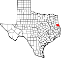
Shelby County, Texas

Last updated

Shelby County
Shelby County, TX, Courthouse IMG 0965.JPG
Shelby County Courthouse in Center
Map of Texas highlighting Shelby County.svg
Location within the U.S. state of Texas
Texas in United States.svg
Texas's location within the U.S.
Coordinates: 31°47′N94°08′W / 31.79°N 94.14°W / 31.79; -94.14
CountryFlag of the United States.svg United States
StateFlag of Texas.svg  Texas
Founded1837
Named for Isaac Shelby
Seat Center
Largest cityCenter
Area
  Total835 sq mi (2,160 km2)
  Land796 sq mi (2,060 km2)
  Water39 sq mi (100 km2)  4.7%
Population
 (2020)
  Total24,022
  Density29/sq mi (11/km2)
Time zone UTC−6 (Central)
  Summer (DST) UTC−5 (CDT)
Congressional district 1st
Website www.co.shelby.tx.us

Shelby County is a county located in the far eastern portion of the U.S. state of Texas. As of the 2020 census, its population was 24,022. [1] Its county seat is Center. [2] The county was established in 1835 as a municipality of Mexico and organized as a county in 1837. [3] [4] It is named for Isaac Shelby, a soldier in the American Revolution who became the first governor of Kentucky.

Contents

History

Shelby County was established in 1837. It was named for Isaac Shelby, a soldier from Tennessee during the American Revolution, and first Governor of Kentucky.

Geography

According to the U.S. Census Bureau, the county has a total area of 835 square miles (2,160 km2), of which 796 square miles (2,060 km2) are land and 39 square miles (100 km2) (4.7%) are covered by water. [5]

Adjacent counties and parishes

National protected area

Demographics

Historical population
CensusPop.Note
1850 4,239
1860 5,36226.5%
1870 5,7326.9%
1880 9,53266.3%
1890 14,36550.7%
1900 20,45242.4%
1910 26,42329.2%
1920 27,4643.9%
1930 28,6274.2%
1940 29,2352.1%
1950 23,479−19.7%
1960 20,479−12.8%
1970 19,672−3.9%
1980 23,08417.3%
1990 22,034−4.5%
2000 25,22414.5%
2010 25,4480.9%
2020 24,022−5.6%
U.S. Decennial Census [6]
1850–2010 [7] 2010–2020 [8]
Shelby County, Texas - Demographic Profile
(NH = Non-Hispanic)
Race / EthnicityPop 2010 [9] Pop 2020 [8] % 2010% 2020
White alone (NH)16,53514,41664.98%60.01%
Black or African American alone (NH)4,4143,80517.35%15.84%
Native American or Alaska Native alone (NH)61500.24%0.21%
Asian alone (NH)763640.30%1.52%
Pacific Islander alone (NH)0140.00%0.06%
Some Other Race alone (NH)17490.07%0.20%
Mixed Race/Multi-Racial (NH)1816390.71%2.66%
Hispanic or Latino (any race)4,1644,68516.36%19.50%
Total25,44824,022100.00%100.00%

Note: the US Census treats Hispanic/Latino as an ethnic category. This table excludes Latinos from the racial categories and assigns them to a separate category. Hispanics/Latinos can be of any race.

As of the census [10] of 2000, 25,224 people, 9,595 households, and 6,908 families resided in the county. The population density was 32 people per square mile (12 people/km2). The 11,955 housing units averaged 15 units per square mile (5.8 units/km2). The racial makeup of the county was 72.65% White, 19.44% African American, 0.36% Native American, 0.23% Asian, 0.02% Pacific Islander, 5.87% from other races, and 1.44% from two or more races. About 9.87% of the population was Hispanic or Latino of any race.

Of the 9,595 households, 32.40% had children under the age of 18 living with them, 55.10% were married couples living together, 12.90% had a female householder with no husband present, and 28.00% were notfamilies. About 25.40% of all households were made up of individuals, and 13.60% had someone living alone who was 65 years of age or older. The average household size was 2.59 and the average family size was 3.08.

In the county, the population was distributed as 26.60% under the age of 18, 8.80% from 18 to 24, 25.80% from 25 to 44, 22.20% from 45 to 64, and 16.60% who were 65 years of age or older. The median age was 37 years. For every 100 females, there were 92.40 males. For every 100 females age 18 and over, there were 89.20 males.

The median income for a household in the county was $29,112, and for a family was $34,021. Males had a median income of $26,501 versus $20,280 for females. The per capita income for the county was $15,186. About 14.90% of families and 19.40% of the population were below the poverty line, including 24.70% of those under age 18 and 16.90% of those age 65 or over.

Education

These school districts serve Shelby County:

Media

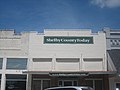
The Light and Champion, a news and information company, marked its 140th year of operation in 2017. It serves Shelby County, as well as Logansport, Louisiana. The Light and Champion produces a weekly print edition, a weekly free-distribution print product called The Merchandiser, operates a web site, www.lightandchampion.com, and a Facebook page. The Light and Champion is owned by Moser Community Media, based in Brenham, Texas.

Transportation

Major highways

US 59 passes through Shelby County. It is planned to be upgraded to interstate standards as part of the planned Interstate 69 up to Tenaha, where the planned Interstate 369 will follow US 59 northward to both Interstate 30 and Interstate 49 in Texarkana. US 84 is planned to be upgraded to interstate standards as part of the planned Interstate 69 from Tenaha to the Louisiana state line.

Mass transportation

Greyhound Lines operates the Center Station at the Shelby County's Best Yogurt store in Center. [11]

Communities

Cities

Town

Unincorporated communities

Images

Politics

United States presidential election results for Shelby County, Texas [13]
Year Republican Democratic Third party
No.%No.%No.%
2020 7,97579.06%2,06820.50%440.44%
2016 7,17979.01%1,75819.35%1491.64%
2012 6,87974.03%2,32224.99%910.98%
2008 6,63071.91%2,54827.64%420.46%
2004 6,29567.84%2,95131.80%330.36%
2000 5,69263.21%3,22735.84%860.96%
1996 3,48243.27%3,72046.22%84610.51%
1992 3,21736.96%3,98645.79%1,50217.25%
1988 3,99948.34%4,26151.50%130.16%
1984 4,86357.21%3,61042.47%280.33%
1980 3,50044.85%4,21554.01%891.14%
1976 2,69536.48%4,68063.35%120.16%
1972 4,29270.45%1,79229.42%80.13%
1968 1,12716.28%2,51136.27%3,28547.45%
1964 2,22038.87%3,48761.06%40.07%
1960 1,67933.63%3,26665.41%480.96%
1956 1,98836.54%3,40362.56%490.90%
1952 1,79229.63%4,24970.27%60.10%
1948 3077.61%3,05175.59%67816.80%
1944 42812.01%2,92782.13%2095.86%
1940 3496.88%4,72093.10%10.02%
1936 1364.11%3,16795.62%90.27%
1932 1203.21%3,59496.25%200.54%
1928 67625.53%1,96174.06%110.42%
1924 1604.33%3,40892.16%1303.52%
1920 1506.42%1,70072.77%48620.80%
1916 1316.30%1,76784.99%1818.71%
1912 764.02%1,50779.74%30716.24%

See also

Related Research Articles

<span class="mw-page-title-main">Orange County, Texas</span> County in Texas, United States

Orange County is a county located in the very southeastern corner of the U.S. state of Texas, sharing a boundary with Louisiana, within the Golden Triangle of Texas. As of the 2020 census, its population was 84,808. The county seat is the city of Orange, and it falls within the Beaumont–Port Arthur metropolitan area.

<span class="mw-page-title-main">Montgomery County, Texas</span> County in Texas, United States

Montgomery County is a county in the U.S. state of Texas. As of the 2020 U.S. census, the county had a population of 620,443. The county seat is Conroe. The county was created by an act of the Congress of the Republic of Texas on December 14, 1837, and is named for the town of Montgomery. Between 2000 and 2010, its population grew by 55%, the 24th-fastest rate of growth of any county in the United States. Between 2010 and 2020, its population grew by 36%. According to the U.S. Census Bureau, the estimated population is 711,354 as of July 1, 2023.

<span class="mw-page-title-main">Titus County, Texas</span> County in Texas, United States

Titus County is a county located in the northeastern region of the U.S. state of Texas. As of the 2020 census, its population was 31,247. Its county seat is Mount Pleasant. The county is named for Andrew Jackson Titus, an early settler. Titus County comprises the Mount Pleasant micropolitan statistical area.

<span class="mw-page-title-main">San Jacinto County, Texas</span> County in Texas, United States

San Jacinto County is a county in the U.S. state of Texas. As of the 2020 census, its population was 27,402. Its county seat is Coldspring. The county's name comes from the Battle of San Jacinto which secured Texas' independence from Mexico and established a republic in 1836.

<span class="mw-page-title-main">Sabine County, Texas</span> County in the United States

Sabine County is a county located on the central eastern border of the U.S. state of Texas. As of the 2020 census, its population was 9,894. The county was organized on December 14, 1837, and named for the Sabine River, which forms its eastern border.

<span class="mw-page-title-main">Rusk County, Texas</span> County in Texas, United States

Rusk County is a county located in Texas. As of the 2020 census, its population was 52,214. Its county seat is Henderson. The county is named for Thomas Jefferson Rusk, a secretary of war of the Republic of Texas.

<span class="mw-page-title-main">Panola County, Texas</span> County in Texas, United States

Panola County is a county located in the U.S. state of Texas. As of the 2020 census, its population was 22,491. The county seat is Carthage. Located in East Texas and originally developed for cotton plantations, the county's name is derived from a Choctaw word for cotton.

<span class="mw-page-title-main">Newton County, Texas</span> County in Texas, United States

Newton County is the easternmost county in the U.S. state of Texas. As of the 2020 census, its population was 12,217. Its county seat is Newton. The county is named for John Newton, a veteran of the American Revolutionary War.

<span class="mw-page-title-main">Nacogdoches County, Texas</span> County in Texas, United States

Nacogdoches County is a county located in the U.S. state of Texas. As of the 2020 census, its population was 64,653. Its county seat is Nacogdoches.

<span class="mw-page-title-main">Jasper County, Texas</span> County in Texas, United States

Jasper County is a county located in the U.S. state of Texas. As of the 2020 census, its population was 32,980. Its county seat is Jasper. The county was created as a municipality in Mexico in 1834, and in 1837 was organized as a county in the Republic of Texas. It is named for William Jasper, an American Revolutionary War hero.

<span class="mw-page-title-main">Hopkins County, Texas</span> County in Texas, United States

Hopkins County is a county located in the U.S. state of Texas. As of the 2020 census, its population was 36,787. Its county seat is Sulphur Springs. Hopkins County is named for the family of David Hopkins, an early settler in the area. Hopkins County comprises the Sulphur Springs, TX Micropolitan Statistical Area. Hopkins County was once known as the Dairy Capital of Texas. Although dairy farms declined in the area in the late 1990s there are still a number of these located there. The Southwest Dairy Museum is located in Sulphur Springs.

<span class="mw-page-title-main">Harrison County, Texas</span> County in Texas, United States

Harrison County is a county on the eastern border of the U.S. state of Texas. As of the 2020 United States census, its population was 68,839. The county seat is Marshall. The county was created in 1839 and organized in 1842. It is named for Jonas Harrison, a lawyer and Texas revolutionary.

<span class="mw-page-title-main">Gregg County, Texas</span> County in Texas, United States

Gregg County is a county located in the eastern part of the U.S. state of Texas. As of the 2020 census, its population was 124,239. Its county seat is Longview. The county is named after John Gregg, a Confederate general killed in action during the American Civil War.

<span class="mw-page-title-main">Franklin County, Texas</span> County in Texas, United States

Franklin County is a county located in the U.S. state of Texas. As of the 2020 census, its population was 10,359. The county seat is Mount Vernon.

<span class="mw-page-title-main">Fannin County, Texas</span> County in Texas, United States

Fannin County is a county in the far northeast of the U.S. state of Texas, on the border with Oklahoma. As of the 2020 census, its population was 35,662. The county seat is Bonham.

<span class="mw-page-title-main">Cass County, Texas</span> County in Texas, United States

Cass County is a county located in the U.S. state of Texas. As of the 2020 census, its population was 28,454. The county seat is Linden. The county was named for United States Senator Lewis Cass (D-Michigan), who favored the U.S. annexation of Texas in the mid-19th century.

<span class="mw-page-title-main">Cleveland, Texas</span> City in Texas, United States

Cleveland is a city in the U.S. state of Texas, within the Greater Houston metropolitan area and Liberty County. The population was 7,471 at the 2020 census.

<span class="mw-page-title-main">Tenaha, Texas</span> Town in Texas, United States

Tenaha is a town in Shelby County, Texas, United States. The population was 989 at the 2020 census.

<span class="mw-page-title-main">Timpson, Texas</span> City in Texas, United States

Timpson is a city in Shelby County, Texas, United States. The population was 989 at the 2020 census. The community is named after T.B Timpson, a railroad engineer.

<span class="mw-page-title-main">Caddo Parish, Louisiana</span> Parish in Louisiana, United States

Caddo Parish is a parish located in the northwestern corner of the U.S. state of Louisiana. According to the 2020 U.S. census, the parish had a population of 237,848. The parish seat is Shreveport, which developed along the Red River.

References

  1. "Shelby County, Texas". United States Census Bureau . Retrieved January 30, 2022.
  2. "Find a County". National Association of Counties. Retrieved June 7, 2011.
  3. "Texas: Individual County Chronologies". Texas Atlas of Historical County Boundaries. The Newberry Library. 2008. Retrieved June 23, 2015.
  4. "Shelby County". Texas Almanac. Texas State Historical Association. Retrieved June 23, 2015.
  5. "2010 Census Gazetteer Files". United States Census Bureau. August 22, 2012. Retrieved May 10, 2015.
  6. "Decennial Census of Population and Housing by Decades". US Census Bureau.
  7. "Texas Almanac: Population History of Counties from 1850–2010" (PDF). Texas Almanac. Archived (PDF) from the original on October 9, 2022. Retrieved May 10, 2015.
  8. 1 2 "P2 HISPANIC OR LATINO, AND NOT HISPANIC OR LATINO BY RACE - 2020: DEC Redistricting Data (PL 94-171) - Shelby County, Texas". United States Census Bureau .
  9. "P2 HISPANIC OR LATINO, AND NOT HISPANIC OR LATINO BY RACE - 2010: DEC Redistricting Data (PL 94-171) - Shelby County, Texas". United States Census Bureau .
  10. "U.S. Census website". United States Census Bureau . Retrieved May 14, 2011.
  11. " "Greyhound.com | Locations : States : Texas". Archived from the original on August 15, 2012. Retrieved July 30, 2012.." Greyhound Lines. Retrieved on July 29, 2012. NOTE: The information for Center appears as a pop-up window.
  12. JR., HARPER, CECIL (June 15, 2010). "PATROON, TX". tshaonline.org. Retrieved July 30, 2018.{{cite web}}: CS1 maint: multiple names: authors list (link)
  13. Leip, David. "Dave Leip's Atlas of U.S. Presidential Elections". uselectionatlas.org. Retrieved July 30, 2018.

31°47′N94°08′W / 31.79°N 94.14°W / 31.79; -94.14