Montgomery County, Texas

Last updated

Montgomery County
Montgomery county tx courthouse 2014.jpg
The Montgomery County Courthouse in Conroe
Map of Texas highlighting Montgomery County.svg
Location within the U.S. state of Texas
Texas in United States.svg
Texas's location within the U.S.
Coordinates: 30°18′N95°30′W / 30.3°N 95.5°W / 30.3; -95.5
CountryFlag of the United States.svg United States
StateFlag of Texas.svg  Texas
Founded1837
Named for Montgomery, Texas
Seat Conroe
Largest township The Woodlands
Area
  Total1,077 sq mi (2,790 km2)
  Land1,042 sq mi (2,700 km2)
  Water35 sq mi (90 km2)  3.3%
Population
 (2020)
  Total620,443
  Estimate 
(2023)
711,354 Increase2.svg
  Density580/sq mi (220/km2)
Time zone UTC−6 (Central)
  Summer (DST) UTC−5 (CDT)
Congressional districts 2nd, 8th
Website www.mctx.org

Montgomery County is a county in the U.S. state of Texas. As of the 2020 U.S. census, the county had a population of 620,443. [1] The county seat is Conroe. [2] The county was created by an act of the Congress of the Republic of Texas on December 14, 1837, and is named for the town of Montgomery. [3] Between 2000 and 2010, its population grew by 55%, the 24th-fastest rate of growth of any county in the United States. Between 2010 and 2020, its population grew by 36%. According to the U.S. Census Bureau, the estimated population is 711,354 as of July 1, 2023.

Contents

Montgomery County is part of the Houston-The Woodlands-Sugar Land, TX Metropolitan Statistical Area.

Geography

According to the U.S. Census Bureau, the county has a total area of 1,077 square miles (2,790 km2), of which 1,042 square miles (2,700 km2) are land and 35 square miles (91 km2) (3.3%) are covered by water. [4]

Adjacent counties

National protected area

Communities

Cities

Towns

Census-designated places

Unincorporated communities

Demographics

Historical population
CensusPop.Note
1850 2,384
1860 5,479129.8%
1870 6,48318.3%
1880 10,15456.6%
1890 11,76515.9%
1900 17,06745.1%
1910 15,679−8.1%
1920 17,33410.6%
1930 14,588−15.8%
1940 23,05558.0%
1950 24,5046.3%
1960 26,8399.5%
1970 49,47984.4%
1980 128,487159.7%
1990 182,20141.8%
2000 293,76861.2%
2010 455,74655.1%
2020 620,44336.1%
2023 (est.)711,35414.7%
U.S. Decennial Census [6]
1850–2010 [7] 2010–2020 [8]
Montgomery County, Texas - Demographic Profile
(NH = Non-Hispanic)
Race / EthnicityPop 2010 [9] Pop 2020 [10] % 2010% 2020
White alone (NH)324,611371,40371.23%59.86%
Black or African American alone (NH)18,53734,1774.07%5.51%
Native American or Alaska Native alone (NH)1,8071,8840.40%0.30%
Asian alone (NH)9,34721,4362.05%3.45%
Pacific Islander alone (NH)2416340.05%0.10%
Some Other Race alone (NH)6352,5220.14%0.41%
Mixed Race/Multi-Racial (NH)5,87024,2981.29%3.92%
Hispanic or Latino (any race)94,698164,08920.78%26.45%
Total455,746620,443100.00%100.00%

Note: the US Census treats Hispanic/Latino as an ethnic category. This table excludes Latinos from the racial categories and assigns them to a separate category. Hispanics/Latinos can be of any race.

As of the 2010 census, [11] there were 455,746 people, 162,530 households, and 121,472 families residing in the county. The population density was 423 people per square mile (163 people/km2). There were 177,647 housing units at an average density of 165 per square mile (64/km2).

In 2010, the racial makeup of the county was 83.5% White, 4.3% Black or African American, 0.7% Native American, 2.1% Asian, 0.1% Pacific Islander, 7.0% from other races, and 2.3% from two or more races. 20.8% of the population were Hispanic or Latino of any race. At the 2020 census, the racial and ethnic makeup was 59.86% non-Hispanic white, 5.51% African American or Black, 0.30% Native American, 3.45% Asian alone, 0.10% Pacific Islander, 0.41% some other race, 3.92% multiracial, and 26.45% Hispanic or Latino American of any race.

At the 2010 census there were 162,530 households, out of which 36.20% had children under the age of 18 living with them, 59.50% were married couples living together, 10.60% had a female householder with no husband present, 4.70% had a male householder with no wife present, and 25.30% were non-families. 20.60% of all households were made up of individuals, and 6.50% had someone living alone who was 65 years of age or older. The average household size was 2.78 and the average family size was 3.22.

In the county, 27.60% of the population was under the age of 18, 8.00% from 18 to 24, 27.40% from 25 to 44, 26.60% from 45 to 64, and 10.40% who were 65 years of age or older. The median age was 36.1 years. For every 100 females, there were 98.29 males. For every 100 females age 18 and over, there were 95.94 males.

At the 2000 census, the median income for a household in the county was $50,864, and the median income for a family was $58,983. Males had a median income of $42,400 versus $28,270 for females. The per capita income for the county was $24,544. About 7.10% of families and 9.40% of the population were below the poverty line, including 10.90% of those under age 18 and 10.10% of those age 65 or over.

From 2010 to 2016, 54% of all vehicle-related fatalities in the county were related to the use of controlled substances, including alcohol, marijuana, methamphetamine and synthetic drugs. According to Tyler Dunman, former Montgomery County assistant district attorney, approximately 60-70% of all crime in the county is connected to substance abuse. [12]

Politics

Montgomery County has given Republican candidates 70 percent or more of the vote since 2000, and the county has not been won by a Democratic presidential candidate since 1964, when native Texan and favorite son Lyndon Johnson won 60.9% of the county's vote. [13]

In 2004, county voters gave 78.1 percent of their vote to Republican candidate George W. Bush. [14] In 2008, 75.8% of the voters supported the Republican ticket of John McCain and Sarah Palin. [15] In 2016, this was the only county in the United States where Republican nominee Donald Trump won against Democratic nominee Hillary Clinton by a margin of greater than 100,000 votes. [16]

In 2020, Trump won Montgomery County again, with an expanded margin of 119,000 votes. [17]

United States presidential election results for Montgomery County, Texas [18]
Year Republican Democratic Third party
No.%No.%No.%
2020 193,38271.22%74,37727.39%3,7841.39%
2016 150,31473.00%45,83522.26%9,7554.74%
2012 137,96979.51%32,92018.97%2,6341.52%
2008 119,88475.76%36,70323.19%1,6641.05%
2004 104,65478.11%28,62821.37%7060.53%
2000 80,60075.89%23,28621.92%2,3272.19%
1996 51,01165.23%20,72226.50%6,4698.27%
1992 39,97651.28%18,55123.80%19,43124.92%
1988 40,36068.24%18,39431.10%3920.66%
1984 41,23075.39%13,29324.31%1670.31%
1980 26,23765.64%12,59331.51%1,1412.85%
1976 15,73953.07%13,71846.25%2020.68%
1972 15,06777.48%4,35822.41%220.11%
1968 4,35332.84%4,02130.34%4,88136.82%
1964 3,16738.64%4,98960.87%400.49%
1960 3,30947.70%3,51050.60%1181.70%
1956 3,36056.24%2,57243.05%420.70%
1952 2,96946.32%3,43253.54%90.14%
1948 54416.30%1,79553.77%99929.93%
1944 2196.05%2,90280.17%49913.78%
1940 40810.87%3,34789.13%00.00%
1936 1867.05%2,44392.61%90.34%
1932 1266.00%1,97193.90%20.10%
1928 61340.36%90559.58%10.07%
1924 1669.83%1,50088.81%231.36%
1920 20314.00%93564.48%31221.52%
1916 19716.13%88072.07%14411.79%
1912 12012.67%61364.73%21422.60%

United States Congress

SenatorsNamePartyFirst ElectedLevel
 Senate Class 1 Ted Cruz Republican 2012Junior Senator
 Senate Class 2 John Cornyn Republican 2002Senior Senator
RepresentativesNamePartyFirst ElectedArea(s) of Montgomery County Represented
 District 2 Dan Crenshaw Republican 2018South county
 District 8 Morgan Luttrell Republican 2020West and north county

Texas Legislature

Texas Senate

DistrictNamePartyFirst ElectedArea(s) of Montgomery County Represented
 3 Robert Nichols Republican 2006North
 4 Brandon Creighton Republican Special election 2014South and central (including The Woodlands and Conroe)

Texas House of Representatives

DistrictNamePartyFirst ElectedArea(s) of Montgomery County Represented
 3 Cecil Bell Jr. Republican 2012Southwest to southeast
 15 Steve Toth Republican 2014South (including The Woodlands)
 16Will Metcalf Republican 2014North and east (including Conroe)

Education

Public schools

Several school districts operate public schools in the county: [19]

Private schools

Pre-K to 12
Pre-K to 8

The closest Catholic high school is Frassati Catholic High School in north Harris County; the planners of the school intended for it to serve The Woodlands. [20]

Colleges and universities

The county is also home to two campuses of the Lone Star College System (formerly North Harris-Montgomery Community College District): Montgomery and The University Center.

Lone Star College's service area under Texas law includes, in Montgomery County: Conroe, Magnolia, Montgomery, New Caney, Splendora, Tomball, and Willis ISDs. The portion in Richards ISD is zoned to Blinn Junior College District. [21]

Former colleges for black students in the pre-desegregation era included Conroe Normal and Industrial College and Royal College. [22]

Libraries

The county operates the Montgomery County Memorial Library System.

Healthcare

In 1938, the Montgomery County Hospital, a public institution, opened, the first public hospital in the county. It had 25 beds. [23] The Montgomery County Hospital District opened in the 1970s, and the purpose of the district was making a new hospital, which opened in 1982 and replaced the former hospital. [24]

Transportation

Airports

Conroe-North Houston Regional Airport, a general aviation airport, is located in Conroe.

The Houston Airport System stated that Montgomery County is within the primary service area of George Bush Intercontinental Airport, an international airport in Houston in Harris County. [25]

Major highways

Toll roads

Montgomery County has several toll roads within its borders, most of which are operated as "pass-through toll roads" [26] or shadow toll roads.

There are two "true" toll roads within Montgomery County. One toll road consists of a section of mainlanes of State Highway 249 between the Harris County line at Spring Creek to FM 1774 in Pinehurst and is signed as MCTRA 249 Tollway (maintained by the Montgomery County Toll Road Authority). [27] North of Pinehurst, the toll road continues as the TxDOT maintained Aggie Expressway (SH 249 Toll) up north to FM 1774 near Todd Mission then as a two-lane freeway up to State Highway 105 near Navasota. [28] The other toll road within Montgomery County (also maintained by TxDOT) is Grand Parkway (State Highway 99) between the Harris County line at Spring Creek, with an interchange at I-69/US 59 near New Caney, and reentering Harris County before continuing into Liberty and Chambers Counties.

See also

Related Research Articles

<span class="mw-page-title-main">Brazoria County, Texas</span> County in Texas, United States

Brazoria County is a county in the U.S. state of Texas. As of the 2020 census, the population of the county was 372,031. The county seat is Angleton.

<span class="mw-page-title-main">Waller County, Texas</span> County in Texas, United States

Waller County is a county in the U.S. state of Texas. As of the 2020 census, its population was 56,794. Its county seat is Hempstead. The county was named for Edwin Waller, a signer of the Texas Declaration of Independence and first mayor of Austin.

<span class="mw-page-title-main">San Jacinto County, Texas</span> County in Texas, United States

San Jacinto County is a county in the U.S. state of Texas. As of the 2020 census, its population was 27,402. Its county seat is Coldspring. The county's name comes from the Battle of San Jacinto which secured Texas' independence from Mexico and established a republic in 1836.

<span class="mw-page-title-main">Liberty County, Texas</span> County in Texas, United States

Liberty County is a county in the U.S. state of Texas. As of the 2020 census, its population was 91,628. The county seat is Liberty. It was founded in 1831, as a municipality in Mexico as Villa de la Santísima Trinidad de la Libertad by commissioner José Francisco Madero and organized as a county of the Republic of Texas in 1836. Its name was anglicized as Liberty based on the ideal of American liberty.

<span class="mw-page-title-main">Harris County, Texas</span> County in Texas, U.S.

Harris County is a county located in the U.S. state of Texas; as of the 2020 census, the population was 4,731,145, making it the most populous county in Texas and the third-most populous county in the United States. Its county seat is Houston, the most populous city in Texas and fourth-most populous city in the United States. The county was founded in 1836 and organized in 1837. It is named for John Richardson Harris, who founded the town of Harrisburg on Buffalo Bayou in 1826. According to the July 2022 census estimate, Harris County's population has shifted to 4,780,913 comprising over 16% of Texas's population. Harris County is included in the nine-county Houston–The Woodlands–Sugar Land metropolitan statistical area, which is the fifth-most populous metropolitan area in the United States.

<span class="mw-page-title-main">Galveston County, Texas</span> County in Texas, United States

Galveston County is a county in the U.S. state of Texas, located along the Gulf Coast adjacent to Galveston Bay. As of the 2020 census, its population was 350,682. The county was founded in 1838. The county seat is the City of Galveston, founded the following year, and located on Galveston Island. The most-populous municipality in the county is League City, a suburb of Houston at the northern end of the county, which surpassed Galveston in population during the early 2000s.

<span class="mw-page-title-main">Chambers County, Texas</span> County in Texas, United States

Chambers County is a county in the U.S. state of Texas. As of the 2020 census, its population was 46,571. The county seat is Anahuac.

<span class="mw-page-title-main">Cleveland, Texas</span> City in Texas, United States

Cleveland is a city in the U.S. state of Texas, within the Greater Houston metropolitan area and Liberty County. The population was 7,471 at the 2020 census.

<span class="mw-page-title-main">Conroe, Texas</span> City in Texas, United States

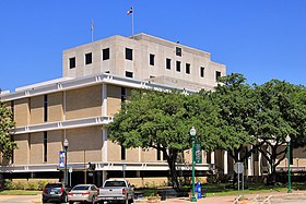
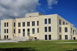
Conroe is a city in and the county seat of Montgomery County, Texas, United States, about 40 miles (64 km) north of Houston. It is a principal city in the Houston–The Woodlands–Sugar Land metropolitan area.

<span class="mw-page-title-main">Cut and Shoot, Texas</span> City in Texas, United States

Cut and Shoot is a city in eastern Montgomery County, Texas, United States, about 6 mi (9.7 km) east of Conroe and 40 mi (64 km) north of Houston. Until 2006, Cut and Shoot was considered and called a town. Then, the town council elected for it to be considered and referred to as a city. The population was 1,087 at the 2020 census.

<span class="mw-page-title-main">Patton Village, Texas</span> City in Texas, United States

Patton Village is a city in Montgomery County, Texas, United States. The population was 1,647 at the 2020 census. It is located in Greater Houston.

<span class="mw-page-title-main">Pinehurst, Montgomery County, Texas</span> Census designated place in Texas, United States

Pinehurst is a census-designated place (CDP) in Montgomery County, Texas, United States. The population was 5,195 at the 2020 census.

<span class="mw-page-title-main">Porter Heights, Texas</span> Populated place in Texas, United States

Porter Heights is a census-designated place (CDP) in Montgomery County, Texas, United States. The population was 1,903 at the 2020 census.

<span class="mw-page-title-main">Splendora, Texas</span> City in Texas, United States

Splendora is a city in Montgomery County, Texas, United States. The population was 1,683 at the 2020 census. Splendora was named in reference to the "splendor of its floral environment."

<span class="mw-page-title-main">The Woodlands, Texas</span> Census-designated place and special-purpose district in Texas, United States

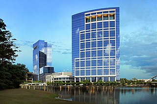
The Woodlands is a special-purpose district and census-designated place (CDP) in the U.S. state of Texas in the Houston–The Woodlands–Sugar Land metropolitan statistical area. The Woodlands is primarily located in Montgomery County, with portions extending into Harris County. The Woodlands is governed by The Woodlands Township, an organization that provides municipal services and is administered by an elected board of directors. As of the 2020 U.S. Census, the township had a population of 114,436 people.

<span class="mw-page-title-main">Conroe Independent School District</span> School district in Texas

Conroe Independent School District (CISD) is a school district in Montgomery County, Texas. The current superintendent has been Dr. Curtis Null since June of 2018. As of April 2024, Conroe ISD was the 9th largest school district in Texas and 60th largest in the United States.

<span class="mw-page-title-main">Texas State Highway 249</span> Highway in Texas

State Highway 249, also known depending on its location as West Mount Houston Road, the Tomball Parkway, Tomball Tollway, MCTRA 249 Tollway, or the Aggie Expressway, is a 49.443-mile (79.571 km) generally north–south highway in Southeast Texas. The southern terminus is in North Houston at Interstate 45 (I-45). The current northern terminus of the highway is east of Navasota at SH 105.

<span class="mw-page-title-main">Caney Creek High School</span> Public school in Conroe, Texas, United States

Caney Creek High School is a high school in Montgomery County, Texas, near Conroe. It is part of the Conroe Independent School District. Caney Creek serves several areas in Montgomery County, including the city of Cut and Shoot, the census-designated place (CDP) of Grangerland, a portion of the Porter Heights CDP, and a portion of the Deerwood CDP. In 2018–2019, the school received a C grade from the Texas Education Agency.

<span class="mw-page-title-main">Porter, Texas</span> Unincorporated community in Texas, United States

Porter is an unincorporated community in Montgomery County in Southeastern Texas, United States, within the Houston–The Woodlands–Sugar Land metropolitan area. In 2010, its population was estimated at 25,769. Porter is north of the Kingwood area of Houston.

Deerwood is an unincorporated community and census-designated place (CDP) in Montgomery County, Texas, United States. It was first listed as a CDP prior to the 2020 census.

References

  1. "U.S. Census website". United States Census Bureau . Retrieved December 13, 2021.
  2. "Find a County". National Association of Counties. Retrieved June 7, 2011.
  3. Searle, Kameron K. The Early History of Montgomery, Texas. City of Montgomery, Texas: July 7, 2012. Accessed on June 5, 2021.
  4. "2010 Census Gazetteer Files". United States Census Bureau. August 22, 2012. Retrieved May 4, 2015.
  5. "Archived copy". Archived from the original on January 6, 2022. Retrieved January 6, 2022.{{cite web}}: CS1 maint: archived copy as title (link)
  6. "Decennial Census of Population and Housing by Decades". US Census Bureau.
  7. "Texas Almanac: Population History of Counties from 1850–2010" (PDF). Texas Almanac. Retrieved May 4, 2015.
  8. "State & County QuickFacts". United States Census Bureau. Archived from the original on June 24, 2011. Retrieved December 22, 2013.
  9. "P2 HISPANIC OR LATINO, AND NOT HISPANIC OR LATINO BY RACE - 2010: DEC Redistricting Data (PL 94-171) - Montgomery County, Texas". United States Census Bureau .
  10. "P2 HISPANIC OR LATINO, AND NOT HISPANIC OR LATINO BY RACE - 2020: DEC Redistricting Data (PL 94-171) - Montgomery County, Texas". United States Census Bureau .
  11. "U.S. Census website". United States Census Bureau . Retrieved May 14, 2011.
  12. Zedaker, Hannah. Officials: Substance abuse rising in Montgomery County. Community Impact Newspaper: June 12, 2017. Retrieved April 23, 2018
  13. "Dave Leip's Atlas of U.S. Presidential Elections - Data Graphs". uselectionatlas.org. Retrieved March 22, 2018.
  14. "Dave Leip's Atlas of U.S. Presidential Elections - Data Graph --2004 Montgomery County, Texas". uselectionatlas.org. Retrieved March 22, 2018.
  15. "Dave Leip's Atlas of U.S. Presidential Elections - Data Graph --2008 Montgomery County, Texas". uselectionatlas.org. Retrieved March 22, 2018.
  16. "2016 Presidential Election Results". The New York Times. August 9, 2017.
  17. 2020 Presidential General Election Results - Montgomery County, TX, Dave Leip's Atlas of U.S. Elections, LLC.
  18. Leip, David. "Dave Leip's Atlas of U.S. Presidential Elections". uselectionatlas.org. Retrieved March 22, 2018.
  19. "2020 CENSUS - SCHOOL DISTRICT REFERENCE MAP: Montgomery County, TX" (PDF). U.S. Census Bureau . Retrieved June 29, 2022. - Text list
  20. Dominguez, Catherine (August 29, 2012). "New Catholic high school breaks ground". The Spring Observer . Retrieved March 25, 2017.
  21. Texas Education Code, Sec. 130.168. BLINN JUNIOR COLLEGE DISTRICT SERVICE AREA. Sec. 130.191. LONE STAR COLLEGE SYSTEM DISTRICT SERVICE AREA.
  22. Hernandez, Sondra (February 15, 2024). "Montgomery County's early Black schools laid the groundwork for today's education ecosystem". Houston Chronicle . Retrieved February 15, 2024.
  23. "Mary Swain Sanitarium, County Hospital cornerstones to local modern healthcare". Montgomery County Courier . November 22, 2017. Retrieved April 28, 2021.
  24. Hernandez, Sondra (March 23, 2021). "Developer looks to renovate old Montgomery County Hospital property". Montgomery County Courier . Retrieved April 28, 2021. - See at Houston Chronicle , see at Press Reader.
  25. "Master Plan Executive Summary Archived July 11, 2011, at the Wayback Machine ." George Bush Intercontinental Airport Master Plan. Houston Airport System. December 2006. 2-1 (23/130). Retrieved on December 14, 2010.
  26. TxDot's Pass-Through Financing Program
  27. Montgomery County Toll Road Authority (MCTRA) SH 249 Retrieved May 8, 2020
  28. First stretch of ‘Aggie Expressway’ toll road opens Saturday Houston Chronicle. August 8, 2020 (same-day retrieval)

30°18′N95°30′W / 30.30°N 95.50°W / 30.30; -95.50