Crockett County, Texas

Last updated

Crockett County
Crockett County Courthouse November 2020.jpg
Map of Texas highlighting Crockett County.svg
Location within the U.S. state of Texas
Texas in United States.svg
Texas's location within the U.S.
Coordinates: 30°44′N101°25′W / 30.73°N 101.41°W / 30.73; -101.41
CountryFlag of the United States.svg United States
StateFlag of Texas.svg  Texas
Founded1891
Named for Davy Crockett
Seat Ozona
Largest communityOzona
Area
  Total2,807 sq mi (7,270 km2)
  Land2,807 sq mi (7,270 km2)
  Water0.02 sq mi (0.05 km2)  0.0%
Population
 (2020)
  Total3,098
  Density1.1/sq mi (0.43/km2)
Time zone UTC−6 (Central)
  Summer (DST) UTC−5 (CDT)
Congressional district 23rd
Website www.co.crockett.tx.us

Crockett County is a county located on the Edwards Plateau in the U.S. state of Texas. As of the 2020 census, its population was 3,098. [1] [2] The county seat is Ozona. [3] The county was founded in 1875 and later organized in 1891. [4] It is named in honor of Davy Crockett, the legendary frontiersman who died at the Battle of the Alamo.

Contents

History

Geography

According to the U.S. Census Bureau, the county has a total area of 2,807 square miles (7,270 km2), virtually all of which is land. [16]

Major highways

Adjacent counties

Crockett County is among the few counties in the United States to border as many as nine counties.

Demographics

Historical population
CensusPop.Note
1880 127
1890 19452.8%
1900 1,591720.1%
1910 1,296−18.5%
1920 1,50015.7%
1930 2,59072.7%
1940 2,8098.5%
1950 3,98141.7%
1960 4,2095.7%
1970 3,885−7.7%
1980 4,60818.6%
1990 4,078−11.5%
2000 4,0990.5%
2010 3,719−9.3%
2020 3,098−16.7%
U.S. Decennial Census [17]
1850–2010 [18] 2010 [19] 2020 [20]
Crockett County, Texas - Demographic Profile
(NH = Non-Hispanic)
Race / EthnicityPop 2010 [19] Pop 2020 [20] % 2010% 2020
White alone (NH)1,3121,08035.28%34.86%
Black or African American alone (NH)13180.35%0.58%
Native American or Alaska Native alone (NH)890.22%0.29%
Asian alone (NH)11100.30%0.32%
Pacific Islander alone (NH)000.00%0.00%
Some Other Race alone (NH)490.11%0.29%
Mixed Race/Multi-Racial (NH)19520.51%1.68%
Hispanic or Latino (any race)2,3521,92063.24%61.98%
Total3,7193,098100.00%100.00%

Note: the US Census treats Hispanic/Latino as an ethnic category. This table excludes Latinos from the racial categories and assigns them to a separate category. Hispanics/Latinos can be of any race.

As of the census [21] of 2000, there were 4,099 people, 1,524 households, and 1,114 families residing in the county. The population density was 1.46 people per square mile (0.56 people/km2). There were 2,049 housing units at an average density of 0.73 per square mile (0.28/km2). The racial makeup of the county was 76.34% White, 0.68% Black or African American, 0.59% Native American, 0.27% Asian, 0.02% Pacific Islander, 19.71% from other races, and 2.39% from two or more races. 54.70% of the population were Hispanic or Latino of any race.

There were 1,524 households, out of which 36.50% had children under the age of 18 living with them, 60.30% were married couples living together, 9.30% had a female householder with no husband present, and 26.90% were non-families. 24.70% of all households were made up of individuals, and 11.80% had someone living alone who was 65 years of age or older. The average household size was 2.65 and the average family size was 3.19.

In the county, the population was spread out, with 28.90% under the age of 18, 7.10% from 18 to 24, 26.40% from 25 to 44, 24.70% from 45 to 64, and 12.90% who were 65 years of age or older. The median age was 37 years. For every 100 females there were 98.20 males. For every 100 females age 18 and over, there were 97.60 males.

The median income for a household in the county was $29,355, and the median income for a family was $34,653. Males had a median income of $29,925 versus $14,695 for females. The per capita income for the county was $14,414. About 14.90% of families and 19.40% of the population were below the poverty line, including 24.30% of those under age 18 and 18.20% of those age 65 or over.

Communities

Census-designated place

Ghost town

Politics

United States presidential election results for Crockett County, Texas [22]
Year Republican Democratic Third party
No.%No.%No.%
2020 1,22077.51%34421.86%100.64%
2016 98070.25%37226.67%433.08%
2012 95765.68%48032.94%201.37%
2008 1,02666.41%51233.14%70.45%
2004 1,24872.22%47327.37%70.41%
2000 92466.09%46733.40%70.50%
1996 71445.98%68444.04%1559.98%
1992 62337.87%65339.70%36922.43%
1988 93251.24%88148.43%60.33%
1984 1,09464.96%58934.98%10.06%
1980 88559.24%59539.83%140.94%
1976 80249.88%80450.00%20.12%
1972 85172.12%32927.88%00.00%
1968 50937.45%57142.02%27920.53%
1964 40933.77%79965.98%30.25%
1960 63554.93%51744.72%40.35%
1956 70269.57%30530.23%20.20%
1952 65468.13%30631.88%00.00%
1948 12723.30%40073.39%183.30%
1944 11222.76%32365.65%5711.59%
1940 13223.91%42076.09%00.00%
1936 7524.35%23175.00%20.65%
1932 16833.80%32966.20%00.00%
1928 29181.97%6418.03%00.00%
1924 11261.54%6937.91%10.55%
1920 8046.78%8952.05%21.17%
1916 1618.60%6575.58%55.81%
1912 58.06%5385.48%46.45%

See also

Related Research Articles

<span class="mw-page-title-main">Yoakum County, Texas</span> County in Texas, United States

Yoakum County is a county located in the far western portion of the U.S. state of Texas. As of the 2020 census, the population was 7,694. Its county seat is Plains. The county was created in 1876 and later organized in 1907. It is named for Henderson King Yoakum, a Texas historian.

<span class="mw-page-title-main">Ward County, Texas</span> County in Texas, United States

Ward County is a county located in the U.S. state of Texas. As of the 2020 census, its population was 11,644. The county seat is Monahans. The county was created in 1887 and organized in 1892. It is named for Thomas W. Ward, a soldier in the Texas Revolution.

<span class="mw-page-title-main">Val Verde County, Texas</span> County in Texas, United States

Val Verde County is a county located on the southern Edwards Plateau in the U.S. state of Texas. The 2020 population is 47,586. Its county seat is Del Rio. The Del Rio micropolitan statistical area includes all of Val Verde County.

<span class="mw-page-title-main">Upton County, Texas</span> County in Texas, United States

Upton County is a county located on the Edwards Plateau in the U.S. state of Texas. As of the 2020 census, its population was 3,308. Its county seat is Rankin. The county was created in 1887 and later organized in 1910. It is named for two brothers: John C. and William F. Upton, both colonels in the Confederate Army.

<span class="mw-page-title-main">Trinity County, Texas</span> County in Texas, United States

Trinity County is a county located in the U.S. state of Texas. As of the 2020 census, the population was 13,602. Its county seat is Groveton. The county is named for the Trinity River.

<span class="mw-page-title-main">Terrell County, Texas</span> County in Texas, United States

Terrell County is a county in the U.S. state of Texas. As of the 2020 census, its population was 760, making it the seventh-least populous county in Texas, and the 37th-least populous county in the nation. Its county seat is the census-designated place of Sanderson; no incorporated municipalities are in the county. The county was named for Alexander W. Terrell, a Texas state senator. Terrell County is one of the nine counties in the Trans-Pecos region of West Texas. It is the setting for Cormac McCarthy's novel No Country for Old Men, and the Academy Award-winning film adaptation of the same name.

<span class="mw-page-title-main">Sutton County, Texas</span> County in Texas, United States

Sutton County is a county located on the Edwards Plateau in the U.S. state of Texas. As of the 2020 census, the population was 3,372. Its county seat is Sonora. The county was created in 1887 and organized in 1890. Sutton County is named for John S. Sutton, an officer in the Confederate Army.

<span class="mw-page-title-main">Schleicher County, Texas</span> County in Texas, United States

Schleicher County is a county located on the Edwards Plateau in the U.S. state of Texas. As of the 2020 census, its population was 2,451. Its county seat is Eldorado. The county was created in 1887 and organized in 1901. It is named for Gustav Schleicher, a German immigrant who became a surveyor and politician.
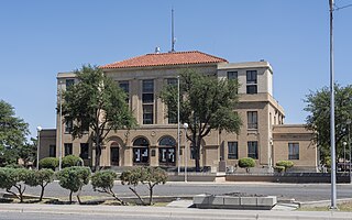
<span class="mw-page-title-main">Reeves County, Texas</span> County in the United States

Reeves County is a county located in the U.S. state of Texas. As of the 2020 census, its population was 14,748. Its county seat and most populous city is Pecos. The county was created in 1883 and organized the next year. It is named for George R. Reeves, a Texas state legislator and colonel in the Confederate Army. It is one of the nine counties that comprise the Trans-Pecos region of West Texas. Reeves County comprises the Pecos micropolitan statistical area.

<span class="mw-page-title-main">Reagan County, Texas</span> County in Texas, United States

Reagan County is a county on the Edwards Plateau in the U.S. state of Texas. As of the 2020 census, its population was 3,385. The county seat is Big Lake. The county is named after John Henninger Reagan (1818–1905), who was the postmaster general of the Confederate States and also a U.S. senator, U.S. representative, and first chairman of the Railroad Commission of Texas.

<span class="mw-page-title-main">Presidio County, Texas</span> County in Texas, United States

Presidio County is a county located in the U.S. state of Texas. As of the 2020 census, its population was 6,131. Its county seat is Marfa. The county was created in 1850 and later organized in 1875. Presidio County is in the Trans-Pecos region of West Texas and is named for the border settlement of Presidio del Norte. It is on the Rio Grande, which forms the Mexican border.

<span class="mw-page-title-main">McCulloch County, Texas</span> County in Texas, United States

McCulloch County is a county located on the Edwards Plateau in the U.S. state of Texas. At the 2020 census, its population was 7,630. Its county seat is Brady. The county was created in 1856 and later organized in 1876. It is named for Benjamin McCulloch, a famous Texas Ranger and Confederate general.

<span class="mw-page-title-main">Houston County, Texas</span> County in Texas, United States

Houston County is a county located in the U.S. state of Texas. As of the 2020 census, its population was 22,066. Its county seat is Crockett. Houston County was one of 46 entirely dry counties in the state of Texas, until voters in a November 2007 special election legalized the sale of alcohol in the county.
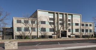
<span class="mw-page-title-main">Gaines County, Texas</span> County in Texas, United States

Gaines County is a county in the U.S. state of Texas. As of the 2020 census, its population was 21,598. The county seat is Seminole.

<span class="mw-page-title-main">Crane County, Texas</span> County in Texas, United States

Crane County is a county located in the U.S. state of Texas. As of the 2020 census, its population was 4,675. The county seat is Crane. The county was created in 1887 and later organized in 1927. It was named for William Carey Crane, a president of Southern Baptist-affiliated Baylor University in Waco, Texas.

<span class="mw-page-title-main">Borden County, Texas</span> County in Texas, United States

Borden County is a rural county located in the U.S. state of Texas. It is in West Texas and its county seat is Gail.

<span class="mw-page-title-main">Ozona, Texas</span> Census-designated place in Texas, United States

Ozona is an unincorporated community and census-designated place (CDP) that serves as the county seat of Crockett County, Texas, United States. The population was 3,225 at the time of the 2010 census. Ozona is the only Census Bureau–recognized community in Crockett County, which is named for Colonel Davy Crockett, a hero of the Alamo.

<span class="mw-page-title-main">Pecos, Texas</span> City in Texas, United States

Pecos is the largest city in and the county seat of Reeves County, Texas, United States. It is in the valley on the west bank of the Pecos River at the eastern edge of the Chihuahuan Desert, in the Trans-Pecos region of West Texas and just south of New Mexico's border. Its population was 12,916 at the 2020 census. On January 24, 2012, Pecos City appeared on the Forbes 400 as the second-fastest growing small town in the United States. The city is a regional commercial center for ranching, oil and gas production, and agriculture. The city is most recognized for its association with the local cultivation of cantaloupes. Pecos claims to be the site of the world's first rodeo on July 4, 1883.

<span class="mw-page-title-main">Grandfalls, Texas</span> Town in Texas, United States

Grandfalls is a town in Ward County, Texas, United States. It was named for its location near the "grand falls" of the Pecos River, located roughly 3 miles (4.8 km) to the west. Early settlers were attracted to the Grandfalls area in the late 1880s by the steady supply of water flowing in the Pecos River. Its population was 360 at the 2010 census.

<span class="mw-page-title-main">Runnels County, Texas</span> County in Texas, United States

Runnels County is a county located in the U.S. state of Texas. As of the 2020 census, its population was 9,900. Its county seat is Ballinger. The county was created in 1858 and later organized in 1880. It is named for Hiram G. Runnels, a Texas state legislator.

References

  1. "U.S. Census Bureau QuickFacts: Crockett County, Texas". United States Census Bureau. Retrieved January 31, 2022.
  2. "Crockett County, Texas". United States Census Bureau . Retrieved February 23, 2021.
  3. "Find a County". National Association of Counties. Archived from the original on May 31, 2011. Retrieved June 7, 2011.
  4. "Texas: Individual County Chronologies". Texas Atlas of Historical County Boundaries. The Newberry Library. 2008. Archived from the original on May 13, 2015. Retrieved May 21, 2015.
  5. 1 2 3 4 5 6 7 8 9 10 Smith, Julia Cauble. "Crockett County". Handbook of Texas Online. Texas State Historical Association. Retrieved November 29, 2010.
  6. Chipman, Donald E. "Gaspar Castaño de Sosa". Handbook of Texas Online. Texas State Historical Association. Retrieved November 29, 2010.
  7. Weddle, Robert S. "Juan Domínguez de Mendoza". Handbook of Texas Online. Texas State Historical Association. Retrieved November 29, 2010.
  8. Crockett County Historical Society (1976). A History of Crockett County (Texas). Anchor Publishing. p. 22.
  9. Parent, Laurence (1997). Official Guide to Texas State Parks . University of Texas Press. p.  16. ISBN   978-0-292-76575-7.
  10. Blackburn Jr, Edward A (2005). Wanted: Historic County Jails of Texas. TAMU Press. pp. 88–89. ISBN   978-1-58544-308-6.
  11. Smith, Julia Cauble. "Camp Melvin". Handbook of Texas Online. Texas State Historical Association. Retrieved November 29, 2010.
  12. "Crockett County Courthouse". Texas Escapes. Texas Escapes - Blueprints For Travel, LLC. Retrieved November 29, 2010.
  13. Olien, Diana; Olien, Roger (2002). Oil in Texas, The Gusher Age, 1895-1945. Austin: University of Texas Press. p. 152. ISBN   0292760566.
  14. "Davy Crockett Monument". Texas Escapes. Texas Escapes - Blueprints For Travel, LLC. Retrieved November 29, 2010.
  15. Brochure, Crockett County Museum, Ozona, Texas
  16. "2010 Census Gazetteer Files". United States Census Bureau. August 22, 2012. Retrieved April 21, 2015.
  17. "Decennial Census by Decade". US Census Bureau.
  18. "Texas Almanac: Population History of Counties from 1850–2010" (PDF). Texas Almanac. Archived (PDF) from the original on October 9, 2022. Retrieved April 21, 2015.
  19. 1 2 "P2 HISPANIC OR LATINO, AND NOT HISPANIC OR LATINO BY RACE - 2010: DEC Redistricting Data (PL 94-171) - Crockett County, Texas". United States Census Bureau .
  20. 1 2 "P2 HISPANIC OR LATINO, AND NOT HISPANIC OR LATINO BY RACE - 2020: DEC Redistricting Data (PL 94-171) - Crockett County, Texas". United States Census Bureau .
  21. "U.S. Census website". United States Census Bureau . Retrieved May 14, 2011.
  22. Leip, David. "Dave Leip's Atlas of U.S. Presidential Elections". uselectionatlas.org. Retrieved July 21, 2018.

30°44′N101°25′W / 30.73°N 101.41°W / 30.73; -101.41