Hood County, Texas

Last updated

Hood County
Granbury June 2018 35 (Hood County Courthouse).jpg
The Hood County Courthouse in Granbury
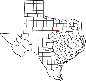
Map of Texas highlighting Hood County.svg
Location within the U.S. state of Texas
Texas in United States.svg
Texas's location within the U.S.
Coordinates: 32°26′N97°50′W / 32.43°N 97.83°W / 32.43; -97.83
CountryFlag of the United States.svg United States
StateFlag of Texas.svg  Texas
Founded1866
Named for John Bell Hood
Seat Granbury
Largest cityGranbury
Area
  Total437 sq mi (1,130 km2)
  Land421 sq mi (1,090 km2)
  Water16 sq mi (40 km2)  3.7%
Population
 (2020)
  Total61,598
  Density140/sq mi (54/km2)
Time zone UTC−6 (Central)
  Summer (DST) UTC−5 (CDT)
Congressional district 25th
Website www.co.hood.tx.us

Hood County is a county in the U.S. state of Texas. As of the 2020 census, the population was 61,598. [1] Its county seat is Granbury. [2] The county is named for John Bell Hood, a Confederate lieutenant general and the commander of Hood's Texas Brigade.

Contents

Hood County is part of the Granbury micropolitan area. It is adjacent to and is influenced by the Dallas–Fort Worth metroplex.

History

Hood County was formed in 1866 from portions of Johnson and Erath Counties. It was named after John Bell Hood, [3] a general of the Confederate Army and commander of Hood's Texas Brigade.

Geography

According to the U.S. Census Bureau, the county has a total area of 437 sq mi (1,130 km2), of which 421 sq mi (1,090 km2) are land and 16 sq mi (41 km2) (3.7%) are covered by water. [4]

Major highways

Adjacent counties

Demographics

Historical population
CensusPop.Note
1870 2,585
1880 6,125136.9%
1890 7,61424.3%
1900 9,14620.1%
1910 10,0089.4%
1920 8,759−12.5%
1930 6,779−22.6%
1940 6,674−1.5%
1950 5,287−20.8%
1960 5,4433.0%
1970 6,39817.5%
1980 17,714176.9%
1990 28,98163.6%
2000 41,10041.8%
2010 51,18224.5%
2020 61,59820.4%
U.S. Decennial Census [5]
1850–2010 [6] 2010 [7] 2020 [8]
Hood County, Texas - Demographic Profile
(NH = Non-Hispanic)
Race / EthnicityPop 2010 [7] Pop 2020 [8] % 2010% 2020
   White alone (NH)44,58849,81587.12%80.87%
   Black or African American alone (NH)2254950.44%0.80%
   Native American or Alaska Native alone (NH)2883400.56%0.55%
Asian alone (NH)2964680.58%0.76%
Pacific Islander alone (NH)32530.06%0.09%
Some Other Race alone (NH)341800.07%0.29%
Mixed Race/Multi-Racial (NH)4852,2890.95%3.72%
Hispanic or Latino (any race)5,2347,95810.23%12.92%
Total51,18261,598100.00%100.00%

Note: the US Census treats Hispanic/Latino as an ethnic category. This table excludes Latinos from the racial categories and assigns them to a separate category. Hispanics/Latinos can be of any race.

As of the census [9] of 2000, 41,100 people, 16,176 households, and 12,099 families were residing in the county. The population density was 98 people/sq mi (38 people/km2). The 19,105 housing units averaged 45 per square mile (17/km2). The racial makeup of the county was 94.77% White, 0.33% African American, 0.82% Native American, 0.31% Asian, 2.44% from other races, and 1.32% from two or more races. About 7.24% of the population were Hispanic or Latinos of any race.

Of the 16,176 households, 28.80% had children under 18 living with them, 63.60% were married couples living together, 7.80% had a female householder with no husband present, and 25.20% were not families. About 21.60% of all households were made up of individuals, and 10.00% had someone living alone who was 65 or older. The average household size was 2.50, and the average family size was 2.88. As of the 2010 census, about 3.4 same-sex couples per 1,000 households were in the county. [10]

In the county, the age distribution was 23.60% under 18, 6.70% from 18 to 24, 25.20% from 25 to 44, 26.60% from 45 to 64, and 17.90% who were 65 or older. The median age was 42 years. For every 100 females, there were 96.20 males. For every 100 females age 18 and over, there were 94.10 males.

The median income for a household in the county was $43,668, and for a family was $50,111. Males had a median income of $38,662 versus $23,723 for females. The per capita income for the county was $22,261. About 6.00% of families and 8.50% of the population were below the poverty line, including 10.00% of those under age 18 and 7.40% of those age 65 or over.

Media

The restored Granbury Opera House was adorned with patriotic decorations during the 2014 Fourth of July festival. Granbury Opera House at Twilight.JPG
The restored Granbury Opera House was adorned with patriotic decorations during the 2014 Fourth of July festival.

Hood County is part of the Dallas/Fort Worth television media market in North Central Texas. Local news media outlets are KDFW-TV, KXAS-TV, WFAA-TV, KTVT-TV, KERA-TV, KTXA-TV, KDFI-TV, KDAF-TV, KFWD-TV, and KDTX-TV. Hood County is served by two newspapers, Hood County Free Press , an online daily publication, and the biweekly Hood County News https://hcnews.com.

Education

These school districts serve Hood County:

Politics

In presidential elections, Hood County has become a predominantly Republican county since 1980.

United States presidential election results for Hood County, Texas [11]
Year Republican Democratic Third party
No.%No.%No.%
2020 26,49681.42%5,64817.36%3971.22%
2016 21,38281.42%4,00815.26%8723.32%
2012 18,40981.53%3,84317.02%3271.45%
2008 17,29976.46%5,08722.48%2381.05%
2004 16,28076.46%4,86522.85%1480.70%
2000 12,42971.00%4,70426.87%3722.13%
1996 7,57552.06%5,45937.52%1,51610.42%
1992 5,31337.52%4,35930.78%4,49031.70%
1988 7,40063.16%4,25536.32%610.52%
1984 6,81768.71%3,06330.87%410.41%
1980 3,75554.11%3,00143.24%1842.65%
1976 1,85736.69%3,18162.85%230.45%
1972 1,74364.32%94935.02%180.66%
1968 59327.44%1,15553.45%41319.11%
1964 42320.27%1,66179.59%30.14%
1960 94343.12%1,23856.61%60.27%
1956 75140.55%1,09559.13%60.32%
1952 78036.52%1,35663.48%00.00%
1948 16911.24%1,27384.64%624.12%
1944 1469.92%1,20381.73%1238.36%
1940 16611.18%1,31888.75%10.07%
1936 1029.32%98890.31%40.37%
1932 1068.62%1,11990.98%50.41%
1928 64057.09%47942.73%20.18%
1924 1229.71%1,07485.51%604.78%
1920 17517.16%69768.33%14814.51%
1916 647.60%69382.30%8510.10%
1912 384.53%67480.43%12615.04%

Communities

Cities

Census-designated places

Unincorporated communities

See also

Related Research Articles

<span class="mw-page-title-main">Morris County, Texas</span> County in Texas, United States

Morris County is a county located near the eastern border of the U.S. state of Texas. As of the 2020 census, its population was 11,973. Its county seat is Daingerfield. Morris County is probably named for William Wright Morris, an early judge and planter from Henderson, also in northeast Texas. As of 2016, Morris County is no longer one of six entirely dry, prohibition counties in the state of Texas. Morris County is "partially wet."

<span class="mw-page-title-main">Montague County, Texas</span> County in Texas, United States

Montague County is a county located in the U.S. state of Texas, established in 1857. As of the 2020 census, its population was 19,965. The county seat is Montague. The county was created in 1857 and organized the next year. It is named for Daniel Montague, a surveyor and soldier in the Mexican–American War.

<span class="mw-page-title-main">Milam County, Texas</span> County in Texas, United States

Milam County is a county located in the U.S. state of Texas. As of the 2020 census, its population was 24,754. The county seat is Cameron. The county was created in 1834 as a municipality in Mexico and organized as a county in 1837. Milam County is named for Benjamin Rush Milam, an early settler and a soldier in the Texas Revolution.

<span class="mw-page-title-main">Lampasas County, Texas</span> County in Texas, United States

Lampasas County is a county located on the Edwards Plateau in the U.S. state of Texas. As of the 2020 census, its population was 21,627. Its county seat is Lampasas. The county is named for the Lampasas River.
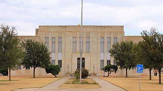
<span class="mw-page-title-main">Knox County, Texas</span> County in Texas, United States

Knox County is a county located in the U.S. state of Texas. As of the 2020 census, its population was 3,353. Its county seat is Benjamin. The county was created in 1858 and later organized in 1886. It is named for Henry Knox, an American Revolutionary War general.

<span class="mw-page-title-main">Johnson County, Texas</span> County in Texas, United States

Johnson County is a county located in the U.S. state of Texas. As of the 2020 census, its population was 179,927. Its county seat is Cleburne. Johnson County is named for Colonel Middleton Tate Johnson Sr., a Texas Ranger, politician and soldier in the Mexican-American War and the American Civil War. Johnson County is included in the Dallas–Fort Worth–Arlington metropolitan statistical area.

<span class="mw-page-title-main">Hunt County, Texas</span> County in Texas, United States

Hunt County is a county in the U.S. state of Texas. As of the 2020 census, its population was 99,956. Its county seat is Greenville. The county is named for Memucan Hunt, Jr., the first Republic of Texas Minister to the United States from 1837 to 1838 and the third Texas Secretary of the Navy from 1838 to 1839. Hunt County is located in Northeast Texas, at the eastern edge of the Dallas/Fort Worth Metroplex and the western edge of East Texas. Hunt County is part of the Dallas-Fort Worth-Arlington metropolitan statistical area.

<span class="mw-page-title-main">Hopkins County, Texas</span> County in Texas, United States

Hopkins County is a county located in the U.S. state of Texas. As of the 2020 census, its population was 36,787. Its county seat is Sulphur Springs. Hopkins County is named for the family of David Hopkins, an early settler in the area. Hopkins County comprises the Sulphur Springs, TX Micropolitan Statistical Area. Hopkins County was once known as the Dairy Capital of Texas. Although dairy farms declined in the area in the late 1990s there are still a number of these located there. The Southwest Dairy Museum is located in Sulphur Springs.

<span class="mw-page-title-main">Gregg County, Texas</span> County in Texas, United States

Gregg County is a county located in the eastern part of the U.S. state of Texas. As of the 2020 census, its population was 124,239. Its county seat is Longview. The county is named after John Gregg, a Confederate general killed in action during the American Civil War.

<span class="mw-page-title-main">Fannin County, Texas</span> County in Texas, United States

Fannin County is a county in the far northeast of the U.S. state of Texas, on the border with Oklahoma. As of the 2020 census, its population was 35,662. The county seat is Bonham.

<span class="mw-page-title-main">Eastland County, Texas</span> County in Texas, United States

Eastland County is a county located in central West Texas. As of the 2020 census, its population was 17,725. The county seat is Eastland. The county was founded in 1858 and later organized in 1873. It is named for William Mosby Eastland, a soldier during the Texas Revolution and the only officer to die as a result of the "Black Bean executions" of the Mier Expedition.
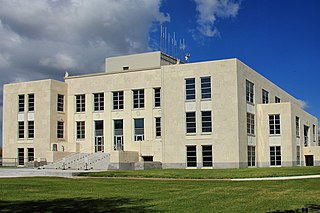
<span class="mw-page-title-main">Chambers County, Texas</span> County in Texas, United States

Chambers County is a county in the U.S. state of Texas. As of the 2020 census, its population was 46,571. The county seat is Anahuac.
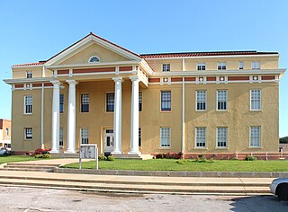
<span class="mw-page-title-main">Cass County, Texas</span> County in Texas, United States

Cass County is a county located in the U.S. state of Texas. As of the 2020 census, its population was 28,454. The county seat is Linden. The county was named for United States Senator Lewis Cass (D-Michigan), who favored the U.S. annexation of Texas in the mid-19th century.

<span class="mw-page-title-main">Bailey County, Texas</span> County in Texas, United States

Bailey County is a county located in the U.S. state of Texas. It is in West Texas and its county seat is Muleshoe. As of the 2020 census, its population was 6,904.

<span class="mw-page-title-main">Granbury, Texas</span> City in Texas, United States

Granbury is a city in and the county seat of Hood County, Texas, United States. As of the 2020 census, the city's population was 10,958, and it is the principal city of the Granbury micropolitan statistical area. Granbury is named after Confederate General Hiram B. Granbury.

<span class="mw-page-title-main">Lipan, Texas</span> City in Texas, United States

Lipan is a city in northwestern Hood County, Texas, United States. The population was 430 at the 2010 census. It is part of the Granbury, Texas Micropolitan Statistical Area.

<span class="mw-page-title-main">Pecan Plantation, Texas</span> Census-designated place in Texas, United States

Pecan Plantation is an unincorporated community and census-designated place (CDP) in southeastern Hood County, Texas, United States. Its population was 5,294 at the 2010 census, up from 3,544 at the 2000 census. It is part of the Granbury, Texas, micropolitan statistical area.
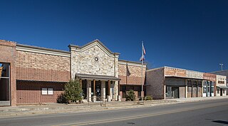
<span class="mw-page-title-main">Tolar, Texas</span> City in Texas, United States

Tolar is a city in Hood County, Texas, United States. Its population was 681 at the 2010 census. It is part of the Granbury, Texas micropolitan statistical area.
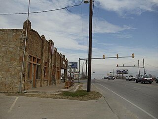
<span class="mw-page-title-main">Cresson, Texas</span> City in Texas, United States

Cresson is a city located at the corners of Hood, Johnson, and Parker counties in the U.S. state of Texas. It is located at the intersection of U.S. Highway 377 and State Highway 171, 25 miles (40 km) southwest of Fort Worth. Incorporated in 2001, Cresson had a population of 741 at the 2010 census. By 2020, it had a population of 1,349.

<span class="mw-page-title-main">Granbury micropolitan area</span>

The Granbury micropolitan statistical area, as defined by the United States Census Bureau, was an area consisting of two counties in North Central Texas, anchored by the city of Granbury. In 2013, though, the Office of Management and Budget reclassified the area as a part of the Fort Worth-Arlington metropolititan division within the Dallas-Fort Worth-Arlington metropolitan area.

References

  1. "Hood County, Texas". United States Census Bureau . Retrieved January 30, 2022.
  2. "Find a County". National Association of Counties. Archived from the original on May 31, 2011. Retrieved June 7, 2011.
  3. Gannett, Henry (1905). The Origin of Certain Place Names in the United States. Govt. Print. Off. pp.  160.
  4. "2010 Census Gazetteer Files". United States Census Bureau. August 22, 2012. Retrieved April 30, 2015.
  5. "Decennial Census of Population and Housing by Decades". US Census Bureau.
  6. "Texas Almanac: Population History of Counties from 1850–2010" (PDF). Texas Almanac. Archived (PDF) from the original on October 9, 2022. Retrieved April 30, 2015.
  7. 1 2 "P2 HISPANIC OR LATINO, AND NOT HISPANIC OR LATINO BY RACE - 2010: DEC Redistricting Data (PL 94-171) - Hood County, Texas". United States Census Bureau .
  8. 1 2 "P2 HISPANIC OR LATINO, AND NOT HISPANIC OR LATINO BY RACE - 2020: DEC Redistricting Data (PL 94-171) - Hood County, Texas". United States Census Bureau .
  9. "U.S. Census website". United States Census Bureau . Retrieved May 14, 2011.
  10. Where Same-Sex Couples Live, June 26, 2015, retrieved July 6, 2015
  11. Leip, David. "Dave Leip's Atlas of U.S. Presidential Elections". uselectionatlas.org. Retrieved July 25, 2018.
  12. U.S. Geological Survey Geographic Names Information System: Thorp Spring

32°26′N97°50′W / 32.43°N 97.83°W / 32.43; -97.83