DeSoto, Texas

Last updated

DeSoto, Texas
City of DeSoto
Flag of DeSoto, Texas.png
City of DeSoto logo, 2006.jpg
Motto(s): 
"Live, Work, Play in DeSoto" [1]
Dallas County Texas Incorporated Areas DeSoto highighted.svg
Location of DeSoto in Dallas County, Texas
Coordinates: 32°35′57″N96°51′32″W / 32.59917°N 96.85889°W / 32.59917; -96.85889
Country Flag of the United States.svg  United States of America
State Flag of Texas.svg  Texas
County Flag of Dallas County, Texas.svg Dallas
Incorporated1949
Government
  Type Council-manager
   City Council Mayor Rachel Proctor
Dinah Marks
Pierette Parker
Andre Byrd
Nicole Raphiel
Crystal Chism
Letitia Hughes
Area
[2]
  Total21.67 sq mi (56.12 km2)
  Land21.63 sq mi (56.03 km2)
  Water0.03 sq mi (0.09 km2)
Elevation
666 ft (203 m)
Population
 (2020)
  Total56,145
  Density2,595.34/sq mi (1,002.07/km2)
Time zone UTC-6 (Central)
  Summer (DST) UTC-5 (Central)
ZIP codes
75115, 75123
Area code(s) 214, 469, 945, 972
FIPS code 48-20092 [3]
GNIS feature ID1373357 [4]
Website The City of DeSoto, Texas

DeSoto is a city in Dallas County, Texas, United States. DeSoto is a suburb of Dallas and is part of the Best Southwest area, which includes DeSoto, Cedar Hill, Duncanville, and Lancaster.

Contents

History

The area was first settled in 1847, making it one of the oldest communities in North Texas. A post office was established in 1881, and the settlement was named DeSoto in honor of Thomas Hernando DeSoto Stewart, a doctor dedicated to the community. By 1885, DeSoto was home to around 120 people, a cotton gin, and a general store. Soon after, the population declined to below 50. In 1930, 97 people were living in the community, with several businesses.

DeSoto circa 1911 De soto texas 1.jpg
DeSoto circa 1911

After World War II, DeSoto and surrounding areas began to grow. To improve the inadequate water distribution system, residents felt the need to incorporate the town. On February 17, 1949, a petition signed by 42 eligible voters was presented to the Dallas County judge requesting an election for incorporation. The vote took place on March 2. Of the 52 people who cast ballots, 50 voted in favor of incorporation and two were opposed. On March 3, 1949, the results were entered into the records of the Dallas County Commissioners Court, thereby creating the City of DeSoto. The new city was less than one square mile in size. On March 15, Wayne A. Chowning was elected mayor along with five aldermen. The first city council meeting was held two days later.

The first census conducted after DeSoto's incorporation occurred in 1950. eight businesses and 298 people were in the city. Following a series of annexations in 1953, the city covered around 15 sq mi (39 km2). By 1960, the population had grown to 1,969. In 1970, DeSoto was home to 6,617 people and 71 businesses.

During the 1970s, continued growth brought about improvements to the municipal infrastructure, including road construction, and a new water/sewage system. Industrial, commercial, and residential construction also increased. On October 26, 1974, an election was held to determine the status of Woodland Hills, a small, incorporated community located northwest of DeSoto. The result was 221 votes in favor of a merger with DeSoto and 219 opposed. Woodland Hills had a population of 366 at the time of annexation. The rapid growth that began in the early 1970s was sustained throughout the 1980s; 1980 census figures put the city's population at slightly over 15,000. By 1984, DeSoto had a total of 360 businesses, up from 168 in 1980.

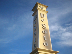
The population surpassed 30,000 in 1990. City development progressed in the following years. A primary example of this was the creation of DeSoto's Town Center. Officials converted an abandoned strip center located at one of the city's main intersections into a unique central business district. Since its opening, the Town Center has become an anchor of the community, housing city hall, the public library, a civic center, recreation cente, and a 180-seat auditorium and outdoor amphitheater.

Throughout the 1990s, DeSoto experienced a significant change in the demographic composition of the city. In the 1990 census, Whites comprised 75.97% of the city's population, but that figure had declined to 48.83% in the 2000 census, and 17.4% non-Hispanic White by 2010. By contrast, the African American population grew rapidly. In 2000, African Americans were 45.53% of the population, up from 20.83% in 1990. Hispanics accounted for 4.98% of the population in 1990 and 7.30% in 2000. With roughly 45,500 residents as of 2005, DeSoto is the largest and most diverse city in southwest Dallas County.

On June 11, 2006, the National Civic League named DeSoto an "All-America City". The All-America City Award is the nation's oldest community-recognition program and recognizes communities whose citizens work together to identify and tackle community-wide challenges and achieve uncommon results.

A 2015 article related a growing trend of largely middle class and educated African Americans moving to DeSoto. [5]

Geography

DeSoto is located at 32°35′57″N96°51′32″W / 32.59917°N 96.85889°W / 32.59917; -96.85889 (32.599286, −96.858828). [6]

According to the United States Census Bureau, the city has a total area of 21.6 sq mi (56 km2), all land.

Demographics

Historical population
CensusPop.Note
1950 298
1960 1,969560.7%
1970 6,617236.1%
1980 15,538134.8%
1990 30,54496.6%
2000 37,64623.3%
2010 49,04730.3%
2020 56,14514.5%
U.S. Decennial Census [7]

[8]

2020 census

DeSoto city, Texas – Racial and ethnic composition
Note: the US Census treats Hispanic/Latino as an ethnic category. This table excludes Latinos from the racial categories and assigns them to a separate category. Hispanics/Latinos may be of any race.
Race / Ethnicity (NH = Non-Hispanic)Pop 2010 [9] Pop 2020 [10] % 2010% 2020
White alone (NH)8,5425,64017.42%10.05%
Black or African American alone (NH)33,33738,97167.97%69.41%
Native American or Alaska Native alone (NH)1111210.23%0.22%
Asian alone (NH)4464870.91%0.87%
Pacific Islander alone (NH)22130.04%0.02%
Some Other Race alone (NH)572290.12%0.41%
Mixed Race or Multi-Racial (NH)6181,3671.26%2.43%
Hispanic or Latino (any race)5,9149,31712.06%16.59%
Total49,04756,145100.00%100.00%

As of the 2020 United States census, 56,145 people, 19,041 households, and 13,093 families resided in the city.

Politics

DeSoto city vote
by party in Presidential elections [11]
Year Democratic Republican Third Parties
2020 85.76%24,22713.29% 3,7540.95% 269
2016 83.59%19,83514.63% 3,4721.78% 422
2012 82.39%19,18717.16% 3,9970.45% 105

Government

Map of DeSoto's six council districts (places) DeSoto Council Districts.png
Map of DeSoto's six council districts (places)

DeSoto is a home-rule city with a council–manager form of government. Under this type of local government, the day-to-day management of the city is directed by a city manager, who is appointed by the city council and serves as chief administrative officer for the city. The city charter states this position will execute the laws and administer the government of the city.

The city council consists of the mayor and six council members. The mayor represents the city as a whole and six council members represent particular districts (places) within the city. All are elected citywide for a term of three years with a limit of two terms.

Current City Council Members [12]
Place 1Rachel Proctor (mayor)
Place 2Pierette Parker
Place 3Nicole Raphiel
Place 4Andre' Byrd Sr.
Place 5Dr. Dinah Marks
Place 6Crystal Chism
Place 7Letitia Hughes (mayor pro tem)
DeSoto entrance marker at I-35E and Pleasant Run Rd. DeSotoTower.png
DeSoto entrance marker at I-35E and Pleasant Run Rd.

Mayors

TermMayor
1949–1953Wayne A. Chowning
1953Willis Dawson
1953–1955Floyd Huffstutler
1955–1959J. B. Wadlington
1959–1963E. G. Anderson
1963–1965John Campbell
1965–1967Les C. Zeiger
1967–1969L. Carroll Moseley
1969–1971H. H. Chandler
1971–1972Roy Orr
1972–1973Robert Nunneley
1973–1977Charles Harwell
1977–1979Durward Davis
1979–1983Willis Russell
1983–1987Ernest Roberts
1987–1995David Doyle
1995–2001Richard Rozier
2001–2007Michael Hurtt
2007–2010Bobby Waddle
2010–2016Carl Sherman
2016–2020Curtistene S. McCowan (died in office during her second term)
2021–PresentRachel L. Proctor

City managers

TermCity manager
1964–1970Dewayne White
1970–1973Jim Pratt
1973–1977Joel Larkin
1977–1981Dorothy Talley
1981–1984Cliff Johnson
1984–1985Jim McAlister
1985–1987Kerry Sweatt
1987–1992Mark Sowa
1992–1993Ed Brady (interim)
1993–1994Gary Whittle (interim)
1994–1996Ron Holifield
1996–1997Bill Lindley (interim)
1997–2011Jim Baugh
2011–2019Dr. Tarron J. Richardson
2019–2020M. Renee Johnson (interim)
2020–2023Brandon Wright

Education

Most of DeSoto lies within the DeSoto Independent School District. The district has 12 schools (seven elementary schools, three middle schools, a high school, and a freshman campus) that serve about 8,000 students. The district's mascot is the eagle. A small portion of the city is located in the Duncanville Independent School District. Another small portion is in the Dallas Independent School District. [13]

Dallas County residents are zoned to Dallas College (formerly Dallas County Community College). [14]

Several private and parochial schools are in or near the city.

Media

The Focus Daily News is a daily newspaper published in DeSoto, covering Dallas County. It is owned by Publishers Newspapers. [15] It was founded in 1987, and has a daily circulation of 28,065 and a Sunday circulation of 36,297 as of 2012. [16]

Transportation

Major highways

Air

The city of DeSoto jointly owns the DeSoto Heliport with the Texas Department of Transportation and the DeSoto Economic Development Corporation. [17] The facility is operated by SKY Helicopters. [17] [18]

Notes

    Related Research Articles

    <span class="mw-page-title-main">Kaufman County, Texas</span> County in Texas, United States

    Kaufman County is a county in the northeastern area of the U.S. state of Texas. As of the 2020 census, its population was 145,310. Its county seat is Kaufman. Both the county, established in 1848, and the city were named for David S. Kaufman, a U.S. Representative and diplomat from Texas. Kaufman County is part of the Dallas-Fort Worth-Arlington metropolitan statistical area.

    <span class="mw-page-title-main">Ellis County, Texas</span> County in Texas, United States

    Ellis County is a county located in the U.S. state of Texas. As of 2020, its population was estimated to be 192,455. The county seat is Waxahachie. The county was founded in 1849 and organized the next year. It is named for Richard Ellis, president of the convention that produced the Texas Declaration of Independence. Ellis County is included in the Dallas–Fort Worth–Arlington metropolitan statistical area.

    <span class="mw-page-title-main">Dallas County, Texas</span> County in Texas, United States

    Dallas County is the second-most populous county in the U.S. state of Texas with a 2020 U.S. census of 2,613,539, making it the ninth-most populous county in the country. Dallas County is included in the Dallas-Arlington-Fort Worth metropolitan statistical area—colloquially referred to as the Dallas–Fort Worth metroplex. Municipal expansion within Dallas County has blurred the geographic lines between cities and between neighboring counties.

    <span class="mw-page-title-main">Collin County, Texas</span> County in Texas, United States

    Collin County is located in the U.S. state of Texas. It is part of the Dallas-Fort Worth-Arlington metropolitan statistical area, and a small portion of the city of Dallas is in the county. At the 2020 United States census, the county's population is 1,064,465, making it the sixth-most populous county in Texas and the 43rd-largest county by population in the United States. Its county seat is McKinney.

    <span class="mw-page-title-main">Fairview, Texas</span> Town in Texas, United States

    Fairview is a town in Collin County, Texas, United States. It is part of the Dallas-Fort Worth metropolitan area. As of the 2017 census, the town population was 8,950. The estimated population in 2018 was 9,092. The town is adjacent to the 289-acre (1.17 km2) Heard Natural Science Museum and Wildlife Sanctuary.

    <span class="mw-page-title-main">Parker, Texas</span> City in Texas, United States

    Parker is a city in Collin County, Texas, United States. The population was 5,462 in 2020.

    <span class="mw-page-title-main">Cockrell Hill, Texas</span> City in Texas, United States

    Cockrell Hill is a city in Dallas County, Texas, United States. The population was 4,193 at the 2010 census, and 3,815 in 2020. It is completely surrounded by the city of Dallas.

    <span class="mw-page-title-main">Duncanville, Texas</span> City in Texas, United States

    Duncanville is a city in southwestern Dallas County, Texas, United States. Duncanville's population was 40,706 at the 2020 census. The city is part of the Best Southwest area, which includes Duncanville, Cedar Hill, DeSoto, and Lancaster.

    <span class="mw-page-title-main">Red Oak, Texas</span> City in Texas, United States

    Red Oak is a city in Ellis County, Texas, United States. It is part of the Dallas–Fort Worth metroplex. The population was 10,769 at the 2010 census, up from 4,301 at the 2000 census. The North Central Texas Council of Governments projects that number to grow to 63,329 by the year 2030, as it is on the verge of explosive suburban growth. Red Oak was one of the exterior locations for filming True Stories, directed by David Byrne of Talking Heads and released in 1986.

    <span class="mw-page-title-main">Sachse, Texas</span> City in Texas, United States

    Sachse is a city in Collin and Dallas counties in the U.S. state of Texas and is part of the DFW metroplex. A northeastern suburb of Dallas, the city population was 27,103, as of the 2020 census with an estimated population of 33, 768 people today. Sachse is located off Texas State Highway 78 and President George Bush Turnpike and is approximately 1 mile (1.6 km) north of the Firewheel Town Center.

    <span class="mw-page-title-main">Van Alstyne, Texas</span> City in Texas, United States

    Van Alstyne is a city in Grayson and Collin Counties in the U.S. state of Texas. The population was 3,046 at the 2010 census, up from 2,502 at the 2000 census. The Grayson County portion of Van Alstyne is part of the Sherman–Denison Metropolitan Statistical Area.

    <span class="mw-page-title-main">Wylie, Texas</span> City in Texas, United States of America

    Wylie is a city and northeastern suburb of Dallas, that was once solely located in Collin County, but now extends into neighboring Dallas and Rockwall counties in the U.S. state of Texas. It is located on State Route 78 about 24 miles (39 km) northeast of central Dallas and centrally located between nearby Lavon Lake and Lake Ray Hubbard.

    <span class="mw-page-title-main">Combine, Texas</span> City in Texas, United States

    Combine is a city in Dallas and Kaufman counties in the U.S. state of Texas. The population was 2,245 in 2020.

    <span class="mw-page-title-main">Ferris, Texas</span> City in Texas, United States

    Ferris is a city in Dallas and Ellis counties in the U.S. state of Texas. It is 20 miles (32 km) south of downtown Dallas. The population was 2,788 in 2020.

    <span class="mw-page-title-main">Glenn Heights, Texas</span> City in Texas, United States

    Glenn Heights is a city in Dallas and Ellis counties in the U.S. state of Texas. The population was 11,278 at the 2010 census, and 15,819 in 2020.

    <span class="mw-page-title-main">Ovilla, Texas</span> City in Texas, United States

    Ovilla is a city in Dallas and Ellis Counties in the U.S. state of Texas. The population was 4,304 at the 2020 census.

    <span class="mw-page-title-main">Rowlett, Texas</span> City in Dallas and Rockwall counties in Texas, United States

    Rowlett is a city in Dallas and Rockwall counties in Texas, United States, and an eastern suburb of Dallas. The total population estimate is 73,270 in 2021. It is a growing, upscale community with nearly $1.5 billion in development in the Dallas–Fort Worth metroplex, located on Lake Ray Hubbard.

    Duncanville Independent School District is a school district based in Duncanville, Texas (USA).

    The Best Southwest is a term commonly applied to four Dallas suburbs – Cedar Hill, DeSoto, Duncanville, and Lancaster – in southwestern Dallas County, Texas, United States. As of the 2010 census, the four suburbs had a combined population of 168,960.

    <span class="mw-page-title-main">Cedar Hill, Texas</span> City in Texas, United States

    Cedar Hill is a city in Dallas and Ellis counties in the U.S. state of Texas. It is located approximately 16 miles (26 km) southwest of downtown Dallas and is situated along the eastern shore of Joe Pool Lake and Cedar Hill State Park. Per the 2020 United States census, the population was 49,148. Cedar Hill is a suburb of the city of Dallas and is part of the Best Southwest area, which includes the nearby cities of DeSoto, Duncanville, and Lancaster.

    References

    1. "The City of DeSoto, Texas". The City of DeSoto, Texas. Retrieved August 14, 2012.
    2. "2020 U.S. Gazetteer Files". United States Census Bureau. Retrieved February 7, 2024.
    3. "U.S. Census website". United States Census Bureau . Retrieved January 31, 2008.
    4. "US Board on Geographic Names". United States Geological Survey. October 25, 2007. Retrieved January 31, 2008.
    5. "Affluent African-Americans Flock to DeSoto". nbcdfw.com. Retrieved June 22, 2021.
    6. "US Gazetteer files: 2010, 2000, and 1990". United States Census Bureau. February 12, 2011. Retrieved April 23, 2011.
    7. "Census of Population and Housing". Census.gov. Retrieved June 4, 2015.
    8. "City and Town Population Totals: 2010-2020". Census.gov. Retrieved January 13, 2024.
    9. "P2 Hispanic or Latino, and Not Hispanic or Latino by Race – 2010: DEC Redistricting Data (PL 94-171) – DeSoto city, Texas". United States Census Bureau .
    10. "P2 Hispanic or Latino, and Not Hispanic or Latino by Race – 2020: DEC Redistricting Data (PL 94-171) - DeSoto city, Texas". United States Census Bureau .
    11. "Dallas County Election Results".
    12. City of DesotoCity Council. Retrieved 7 February 2024.
    13. "2020 CENSUS - SCHOOL DISTRICT REFERENCE MAP: Dallas County, TX" (PDF). U.S. Census Bureau . Retrieved April 18, 2021.
    14. Texas Education Code, Sec. 130.176. DALLAS COUNTY COMMUNITY COLLEGE DISTRICT SERVICE AREA.
    15. "Focus Daily News". Archived from the original on August 15, 2012. Retrieved August 14, 2012.
    16. "Focus Daily News". Nationwide Newspapers. Retrieved August 14, 2012.
    17. 1 2 Epstein, Curt (October 8, 2014). "New Heliport Opens in Texas". Aviation International News . Retrieved May 11, 2018.
    18. "DeSoto Heliport". SKY Helicopters. Retrieved May 11, 2018.