Henderson County, Texas

Last updated

Henderson County
Henderson courthouse tx 2010.jpg
Map of Texas highlighting Henderson County.svg
Location within the U.S. state of Texas
Texas in United States.svg
Texas's location within the U.S.
Coordinates: 32°13′N95°51′W / 32.21°N 95.85°W / 32.21; -95.85
CountryFlag of the United States.svg United States
StateFlag of Texas.svg  Texas
Founded1846
Named for James Pinckney Henderson
Seat Athens
Largest cityAthens
Area
  Total948 sq mi (2,460 km2)
  Land874 sq mi (2,260 km2)
  Water75 sq mi (190 km2)  7.9%
Population
 (2020)
  Total82,150 Increase2.svg
  Density87/sq mi (34/km2)
Time zone UTC−6 (Central)
  Summer (DST) UTC−5 (CDT)
Congressional district 5th
Website www.co.henderson.tx.us
"Courts Under the Oaks" in Athens "Courthouse under the Oaks" historical marker, Athens, TX IMG 0577.JPG
"Courts Under the Oaks" in Athens
Henderson County Peace Officers Association monument Henderson County, TX, Peace Officers Assn. monument IMG 0585.JPG
Henderson County Peace Officers Association monument

Henderson County is a county in the U.S. state of Texas. As of the 2020 census, its population was 82,150. [1] The county seat is Athens. [2] The county is named in honor of James Pinckney Henderson, the first attorney general of the Republic of Texas, and secretary of state for the republic. [3] He later served as the first governor of Texas. Henderson County was established in 1846, the year after Texas gained statehood. Its first town was Buffalo, laid out in 1847. [4] Henderson County comprises the Athens micropolitan statistical area, which is also included in the Dallas-Fort Worth combined statistical area.

Contents

Geography

According to the U.S. Census Bureau, the county has a total area of 948 sq mi (2,460 km2), of which 75 sq mi (190 km2) (7.9%) are covered by water. [5]

Major highways

Adjacent counties

Communities

Cities

Towns

Census-designated place

Unincorporated communities

Ghost towns

Demographics

Historical population
CensusPop.Note
1850 1,237
1860 4,595271.5%
1870 6,78647.7%
1880 9,73543.5%
1890 12,28526.2%
1900 19,97062.6%
1910 20,1310.8%
1920 28,32740.7%
1930 30,5838.0%
1940 31,8224.1%
1950 23,405−26.5%
1960 21,786−6.9%
1970 26,46621.5%
1980 42,60661.0%
1990 58,54337.4%
2000 73,27725.2%
2010 78,5327.2%
2020 82,1504.6%
U.S. Decennial Census [6]
1850–2010 [7] 2010–2020 [8]
Demographic Profile of Henderson County, Texas
(NH = Non-Hispanic)
Race / EthnicityPop 2010 [9] Pop 2020 [8] % 2010% 2020
White alone (NH)63,49461,85480.85%75.29%
Black or African American alone (NH)4,8134,7056.13%5.73%
Native American or Alaska Native alone (NH)3494140.44%0.50%
Asian alone (NH)3185100.40%0.62%
Pacific Islander alone (NH)27310.03%0.04%
Some Other Race alone (NH)762110.10%0.26%
Mixed Race/Multi-Racial (NH)9653,1831.23%3.87%
Hispanic or Latino (any race)8,49011,24210.81%13.68%
Total78,53282,150100.00%100.00%

Note: the US Census treats Hispanic/Latino as an ethnic category. This table excludes Latinos from the racial categories and assigns them to a separate category. Hispanics/Latinos can be of any race.

As of the census [10] of 2000, 73,277 people, 28,804 households, and 20,969 families were residing in the county. Its population density was 84 people/sq mi (32 people/km2). The 35,935 housing units averaged 41 units per square mile (16/km2). The racial makeup of the county was 88.50% White, 6.61% African American, 0.54% Native American, 0.30% Asian, 2.75% from other races, and 1.30% from two or more races. About 6.92% of the population was Hispanic or Latino of any race. At the 2020 census, its population increased to 82,150 with a predominantly non-Hispanic white population; the Hispanic or Latino population of any race increased to 13.68% reflecting nationwide demographic trends. [11]

Government


Politics

United States presidential election results for Henderson County, Texas [12]
Year Republican Democratic Third party
No.%No.%No.%
2020 28,91179.61%7,06019.44%3460.95%
2016 23,65078.72%5,66918.87%7262.42%
2012 21,23176.85%6,10622.10%2901.05%
2008 20,85771.94%7,91327.29%2230.77%
2004 20,21070.05%8,50529.48%1340.46%
2000 16,60764.80%8,70433.96%3161.23%
1996 10,34545.43%10,08544.29%2,34210.28%
1992 8,36834.49%9,10537.53%6,78827.98%
1988 11,00552.61%9,81946.94%940.45%
1984 12,72563.38%7,30236.37%490.24%
1980 7,90348.47%8,19950.29%2031.25%
1976 4,65836.01%8,24563.73%340.26%
1972 6,26369.49%2,74130.41%90.10%
1968 2,31529.19%3,11939.32%2,49831.49%
1964 1,98829.61%4,69769.96%290.43%
1960 2,52142.23%3,41157.14%380.64%
1956 2,47944.51%3,06555.04%250.45%
1952 2,53436.33%4,43963.65%10.01%
1948 54012.24%3,66983.14%2044.62%
1944 42710.12%3,21976.28%57413.60%
1940 80316.34%4,11183.66%00.00%
1936 2607.38%3,25992.45%60.17%
1932 2195.82%3,52293.67%190.51%
1928 1,12839.52%1,72660.48%00.00%
1924 4059.41%3,81988.73%801.86%
1920 53818.62%1,68458.29%66723.09%
1916 26811.11%1,79074.18%35514.71%
1912 1376.84%1,37068.36%49724.80%

Media

Henderson County is part of the Dallas/Fort Worth DMA. Local media outlets are: KDFW-TV, KXAS-TV, WFAA-TV, KTVT-TV, KERA-TV, KTXA-TV, KDFI-TV, KDAF-TV, and KFWD-TV. Other nearby stations that provide coverage for Henderson County come from the Tyler/Longview/Jacksonville market and they include: KLTV, KTRE-TV, KYTX-TV, KFXK-TV, KCEB-TV, and KETK-TV.

Newspaper coverage of the area can be found in the Athens Daily Review , based in Athens; The Monitor is published in Mabank, which is primarily in Kaufman County, but also covers news in parts of Henderson County, as well.

Crime

Paul Knight of the Houston Press said in a 2009 article that some people blamed the development of the artificial Cedar Creek Lake, which opened in 1965, and development of the area surrounding the lake for the initial influx of crime and recreational drugs into the county and the East Texas region. Carroll Dyson, a retired pilot and Henderson County resident interviewed by the Houston Press, said in 2009 that the lake attracted "white flight" from metropolitan areas. [13] Dyson added, "When all your rich people from Dallas and Houston move out here, the thieves are just drawn to them. Thieves are just wired that way. You used to not have to lock your door in Henderson County." Ray Nutt, the sheriff of Henderson County, said in the same article that when the lake first opened, it had no zoning and "a lot of elderly people bought a mobile home and moved in; it was nice. Then, they passed away and family members sold them off or just let them go down." Nutt added that the area around the lake has "a lot of good people," yet it also where "a lot of criminals tend to flow." [14]

See also

Related Research Articles

<span class="mw-page-title-main">Wichita County, Texas</span> County in Texas, United States

Wichita County is a county located in the U.S. state of Texas. As of the 2020 census, its population was 129,350. The county seat is Wichita Falls. The county was created in 1858 and organized in 1882. Wichita County is part of the Wichita Falls, Texas, TX metropolitan statistical area.

<span class="mw-page-title-main">Van Zandt County, Texas</span> County in Texas, United States

Van Zandt County is a county located in the U.S. state of Texas, in the northeastern part of the state. As of the 2020 census, its population was 59,541. Its county seat is Canton. The county is named for Isaac Van Zandt (1813–1847), a member of the Congress of the Republic of Texas.

<span class="mw-page-title-main">Smith County, Texas</span> County in Texas, United States

Smith County is a county in the U.S. state of Texas. As of the 2020 census, its population was 233,479. Its county seat is Tyler. Smith County is named for James Smith, a general during the Texas Revolution.
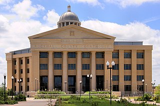
<span class="mw-page-title-main">Rockwall County, Texas</span> County in Texas, United States

Rockwall County is a county in the U.S. state of Texas. At 149 square miles, Rockwall County has the smallest area of any Texas county. Per the 2020 Census, its population was 107,819. Its county seat is Rockwall. The county and city are named for a wall-like subterranean rock formation that runs throughout the county.

<span class="mw-page-title-main">Navarro County, Texas</span> County in Texas, United States

Navarro County is a county in the U.S. state of Texas. As of the 2020 census, the population was 52,624. Its county seat is Corsicana. The county is named for José Antonio Navarro, a Tejano leader in the Texas Revolution who signed the Texas Declaration of Independence.

<span class="mw-page-title-main">Llano County, Texas</span> County in Texas, United States

Llano County is a county located on the Edwards Plateau in the U.S. state of Texas. As of the 2020 census, its population was 21,243. Its county seat is Llano, and the county is named for the Llano River.
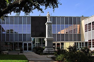
<span class="mw-page-title-main">Kaufman County, Texas</span> County in Texas, United States

Kaufman County is a county in the northeastern area of the U.S. state of Texas. As of the 2020 census, its population was 145,310. Its county seat is Kaufman. Both the county, established in 1848, and the city were named for David S. Kaufman, a U.S. Representative and diplomat from Texas. Kaufman County is part of the Dallas-Fort Worth-Arlington metropolitan statistical area.

<span class="mw-page-title-main">Jeff Davis County, Texas</span> County in Texas, United States

Jeff Davis County is a county in the U.S. state of Texas. As of the 2020 census, its population was 1,996. Its county seat is Fort Davis. The county is named for Jefferson Davis, who served as the 23rd United States Secretary of War in the 1850s, and as Confederate president.

<span class="mw-page-title-main">Jasper County, Texas</span> County in Texas, United States

Jasper County is a county located in the U.S. state of Texas. As of the 2020 census, its population was 32,980. Its county seat is Jasper. The county was created as a municipality in Mexico in 1834, and in 1837 was organized as a county in the Republic of Texas. It is named for William Jasper, an American Revolutionary War hero.

<span class="mw-page-title-main">Grimes County, Texas</span> Country in Texas, United States

Grimes County is a county located in southeastern Texas, United States. As of the 2020 census, its population was 29,268. The seat of the county is Anderson. The county was formed from Montgomery County in 1846. It is named for Jesse Grimes, a signer of the Texas Declaration of Independence and early European-American settler of the county.

<span class="mw-page-title-main">Galveston County, Texas</span> County in Texas, United States

Galveston County is a county in the U.S. state of Texas, located along the Gulf Coast adjacent to Galveston Bay. As of the 2020 census, its population was 350,682. The county was founded in 1838. The county seat is the City of Galveston, founded the following year, and located on Galveston Island. The most-populous municipality in the county is League City, a suburb of Houston at the northern end of the county, which surpassed Galveston in population during the early 2000s.

<span class="mw-page-title-main">Ellis County, Texas</span> County in Texas, United States

Ellis County is a county located in the U.S. state of Texas. As of 2020, its population was estimated to be 192,455. The county seat is Waxahachie. The county was founded in 1849 and organized the next year. It is named for Richard Ellis, president of the convention that produced the Texas Declaration of Independence. Ellis County is included in the Dallas–Fort Worth–Arlington metropolitan statistical area.
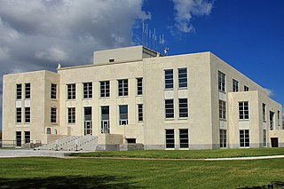
<span class="mw-page-title-main">Chambers County, Texas</span> County in Texas, United States

Chambers County is a county in the U.S. state of Texas. As of the 2020 census, its population was 46,571. The county seat is Anahuac.

<span class="mw-page-title-main">Anderson County, Texas</span> County in Texas, United States

Anderson County is a county in the U.S. state of Texas. Located within East Texas, its county seat is Palestine. As of the 2020 United States census, the population of Anderson County was 57,922. Anderson County comprises the Palestine micropolitan statistical area. Anderson County was organized in 1846, and was named after Kenneth Lewis Anderson (1805-1845), the last vice president of the Republic of Texas.

<span class="mw-page-title-main">Athens, Texas</span> City in Texas, United States

Athens is a city and the county seat of Henderson County, Texas, in the United States. As of the 2020 census, the city population was 12,857. The city has called itself the "Black-Eyed Pea Capital of the World." Athens was selected as one of the first "Certified Retirement Communities" in Texas. Athens was incorporated in 1856 and was named after Athens, the capital of Greece.

<span class="mw-page-title-main">Brownsboro, Texas</span> City in Texas, United States

Brownsboro is a city in Henderson County, Texas, United States. The population was 1,212 at the 2020 census, up from 1,039 at the 2010 census. The city is on Texas State Highway 31.
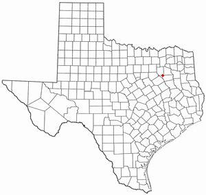
<span class="mw-page-title-main">Gun Barrel City, Texas</span> Town in Texas, United States

Gun Barrel City is a town in Henderson County, Texas, United States. Its population was 6,190 at the 2020 census, an increase over the figure of 5,672 tabulated in 2010.

<span class="mw-page-title-main">Tool, Texas</span> City in Texas, United States

Tool is a city in Henderson County, Texas, United States. The population was 2,175 at the 2020 census. Located on the west side of Cedar Creek Lake, it is a popular second home and retiree destination.
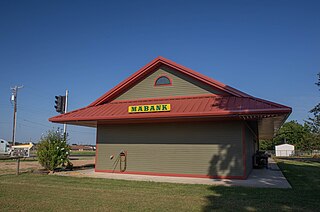
<span class="mw-page-title-main">Mabank, Texas</span> Town in Texas, United States

Mabank is a town in Henderson, Van Zandt and Kaufman counties in the U.S. state of Texas. Its population was 4,050 at the 2020 census.

<span class="mw-page-title-main">Seven Points, Texas</span> City in Texas, United States

Seven Points is a city in Henderson and Kaufman counties in the U.S. state of Texas. The population was 1,455 at the 2010 census, up from 1,145 at the 2000 census.

References

  1. "Henderson County, Texas". United States Census Bureau . Retrieved January 30, 2022.
  2. "Find a County". National Association of Counties. Archived from the original on May 31, 2011. Retrieved June 7, 2011.
  3. Gannett, Henry (1905). The Origin of Certain Place Names in the United States. Govt. Print. Off. pp.  154.
  4. A Memorial and Biographical History of Navarro, Henderson, Anderson, Limestone, Freestone and Leon Counties, Texas. Chicago: Lewis Publishing Company. 1893. p. 199. Retrieved September 28, 2014.
  5. "2010 Census Gazetteer Files". United States Census Bureau. August 22, 2012. Retrieved April 28, 2015.
  6. "Decennial Census of Population and Housing by Decades". US Census Bureau.
  7. "Texas Almanac: Population History of Counties from 1850–2010" (PDF). Texas Almanac. Archived (PDF) from the original on October 9, 2022. Retrieved April 28, 2015.
  8. 1 2 "P2 HISPANIC OR LATINO, AND NOT HISPANIC OR LATINO BY RACE - 2020: DEC Redistricting Data (PL 94-171) - Henderson County, Texass". United States Census Bureau .
  9. "P2 HISPANIC OR LATINO, AND NOT HISPANIC OR LATINO BY RACE - 2010: DEC Redistricting Data (PL 94-171) - Henderson County, Texas". United States Census Bureau .
  10. "U.S. Census website". United States Census Bureau . Retrieved May 14, 2011.
  11. Passel, Jeffrey S.; Lopez, Mark Hugo; Cohn, D'Vera. "U.S. Hispanic population continued its geographic spread in the 2010s". Pew Research Center. Retrieved May 13, 2022.
  12. Leip, David. "Dave Leip's Atlas of U.S. Presidential Elections". uselectionatlas.org. Retrieved April 10, 2018.
  13. Knight, Paul. "Superthief." September 22, 2009. 1. Retrieved on September 28, 2009.
  14. Knight, Paul. "Superthief." September 22, 2009. 2. Retrieved on September 28, 2009.

32°13′N95°51′W / 32.21°N 95.85°W / 32.21; -95.85