Malakoff, Texas

Last updated
Malakoff, Texas
Downtown Malakoff Wiki (1 of 1).jpg
Downtown Malakoff
TXMap-doton-Malakoff.PNG
Location of Malakoff, Texas
Henderson County Malakoff.svg
Coordinates: 32°10′41″N96°1′6″W / 32.17806°N 96.01833°W / 32.17806; -96.01833
Country United States
State Texas
County Henderson
Area
[1]
  Total2.89 sq mi (7.47 km2)
  Land2.87 sq mi (7.43 km2)
  Water0.01 sq mi (0.04 km2)
Elevation
[2]
374 ft (114 m)
Population
 (2020)
  Total2,179
  Density801.74/sq mi (309.58/km2)
Time zone UTC-6 (Central (CST))
  Summer (DST) UTC-5 (CDT)
ZIP code
75148
Area code 903
FIPS code 48-46224 [3]
GNIS feature ID1340877 [2]
Website cityofmalakoff.net

Malakoff is a city in Henderson County, Texas, United States. The population was 2,179 at the 2020 census. [4] The city is named after a Russian fort of Malakoff (Malakhov kurgan), which played a pivotal role during the siege of Sevastopol during the Crimean War.

Contents

History

The community was formerly known as "Caney Creek" and "Mitcham Chapel". [5] An application for a named post office in 1854 under "Purdam" or "Mitcham" resulted in the current name, because the other names were already in use. [5] In the 1920s coal mining became an important activity. [5] The "Malakoff Man", a large prehistoric carved head found in the 1930s, resembles a carving of the Olmec culture. [5]

Geography

Malakoff is located in western Henderson County at 32°10′41″N96°1′6″W / 32.17806°N 96.01833°W / 32.17806; -96.01833 (32.178182, –96.018264). [6] Texas State Highway 31 runs through the center of the city, leading east 9 miles (14 km) to Athens and west 27 miles (43 km) to Corsicana. Texas State Highway 198 leads north from the center of Malakoff 17 miles (27 km) to Mabank.

According to the United States Census Bureau, Malakoff has a total area of 2.9 square miles (7.5 km2), of which 0.02 square miles (0.04 km2), or 0.50%, are water. [4] The city is 3 miles (5 km) south of Cedar Creek Reservoir and is part of the Trinity River watershed.

Demographics

Historical population
CensusPop.Note
1950 1,286
1960 1,65728.8%
1970 2,04523.4%
1980 2,0821.8%
1990 2,038−2.1%
2000 2,25710.7%
2010 2,3243.0%
2020 2,179−6.2%
U.S. Decennial Census [7]
Malakoff racial composition as of 2020 [8]
(NH = Non-Hispanic) [lower-alpha 1]
RaceNumberPercentage
White (NH)1,20555.3%
Black or African American (NH)44720.51%
Native American or Alaska Native (NH)70.32%
Asian (NH)90.41%
Pacific Islander (NH)20.09%
Some Other Race (NH)60.28%
Mixed/Multi-Racial (NH)733.35%
Hispanic or Latino 43019.73%
Total2,179

As of the 2020 United States census, there were 2,179 people, 938 households, and 624 families residing in the city.

As of the census [3] of 2000, there were 2,257 people, 874 households, and 566 families residing in the city. The population density was 804.4 inhabitants per square mile (310.6/km2). There were 1,036 housing units at an average density of 369.2 per square mile (142.5/km2). The racial makeup of the city was 72.49% White, 21.98% African American, 0.49% Native American, 0.13% Asian, 0.13% Pacific Islander, 3.46% from other races, and 1.33% from two or more races. Hispanic or Latino of any race were 10.32% of the population.

There were 874 households, out of which 33.3% had children under the age of 18 living with them, 42.8% were married couples living together, 18.5% had a female householder with no husband present, and 35.2% were non-families. 31.2% of all households were made up of individuals, and 16.2% had someone living alone who was 65 years of age or older. The average household size was 2.48 and the average family size was 3.09.

In the city, the population was spread out, with 28.3% under the age of 18, 8.9% from 18 to 24, 25.5% from 25 to 44, 18.7% from 45 to 64, and 18.7% who were 65 years of age or older. The median age was 36 years. For every 100 females, there were 84.1 males. For every 100 females age 18 and over, there were 77.8 males.

The median income for a household in the city was $24,022, and the median income for a family was $30,029. Males had a median income of $29,663 versus $22,228 for females. The per capita income for the city was $12,109. About 27.7% of families and 27.6% of the population were below the poverty line, including 33.5% of those under age 18 and 32.3% of those age 65 or over

Education

Malakoff's students are served by Malakoff Independent School District. In 2014–2015, Malakoff ISD served more than 1,200 students. [11]

Climate

The climate in this area is characterized by hot, humid summers and generally mild to cool winters. According to the Köppen Climate Classification system, Malakoff has a humid subtropical climate, abbreviated "Cfa" on climate maps. [12]

Related Research Articles

<span class="mw-page-title-main">Hopkins County, Texas</span> County in Texas, United States

Hopkins County is a county located in the U.S. state of Texas. As of the 2020 census, its population was 36,787. Its county seat is Sulphur Springs. Hopkins County is named for the family of David Hopkins, an early settler in the area. Hopkins County comprises the Sulphur Springs, TX Micropolitan Statistical Area. Hopkins County was once known as the Dairy Capital of Texas. Although dairy farms declined in the area in the late 1990s there are still a number of these located there. The Southwest Dairy Museum is located in Sulphur Springs.

<span class="mw-page-title-main">Jourdanton, Texas</span> City in Texas, United States

Jourdanton is a city in and the county seat of Atascosa County, Texas, United States. The population is 4,094. It is part of the San Antonio metropolitan statistical area. The mayor is Robert "Doc" Williams. The city manager is Bobby J. Martinez. The police chief is Eric Kaiser. The fire chief is Jay Fojtik.

<span class="mw-page-title-main">De Kalb, Texas</span> City in Texas, United States

De Kalb is a city in Bowie County, Texas, United States; it is part of the Texarkana metropolitan statistical area. Its two area codes are 430 and 903. Its ZIP code is 75559. It is in the Central Time Zone, and its population was 1,527 at the 2020 United States census.

<span class="mw-page-title-main">Caldwell, Texas</span> City in Texas, United States

Caldwell is a city in and the county seat of Burleson County, Texas, United States. The population was 3,993 at the 2020 census. It is part of the Bryan-College Station metropolitan area.

<span class="mw-page-title-main">Baird, Texas</span> City in Texas, United States

Baird is a city and the county seat of Callahan County, Texas, United States. Its population was 1,496 at the 2010 census. The city is named after Matthew Baird, the owner and director of the Texas and Pacific Railway. The railway depot is now operated as the visitor center and a transportation museum.
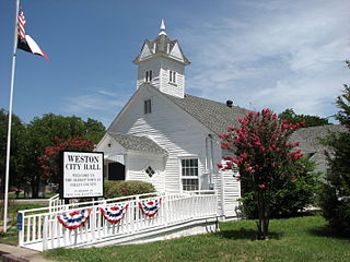
<span class="mw-page-title-main">Weston, Texas</span> City in Texas, United States

Weston is a city in Collin County, Texas, United States. The population was 563 at the 2010 census, and 283 at the 2020 United States census.
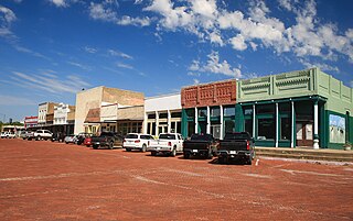
<span class="mw-page-title-main">Leonard, Texas</span> City in Texas, United States

Leonard is a city in Fannin County, Texas, United States. The population was 1,990 at the 2010 census.

<span class="mw-page-title-main">Fairfield, Texas</span> City in Texas, United States

Fairfield is a city in Freestone County, Texas, United States. The population was 2,850 at the 2020 census, down from 3,094 at the 2000 census. It is the county seat of Freestone County and was founded as such in 1851.
<span class="mw-page-title-main">Caney City, Texas</span> City in Texas, United States

Caney City is a city in Henderson County, Texas, United States. The population was 217 at the 2010 census.

<span class="mw-page-title-main">Log Cabin, Texas</span> City in Texas, United States

Log Cabin is a city in Henderson County, Texas, United States. The population was 714 at the 2010 census.
<span class="mw-page-title-main">Star Harbor, Texas</span> City in Texas, United States

Star Harbor is a city in Henderson County, Texas, United States. The population was 482 at the 2020 census.

<span class="mw-page-title-main">Tool, Texas</span> City in Texas, United States

Tool is a city in Henderson County, Texas, United States. The population was 2,175 at the 2020 census. Located on the west side of Cedar Creek Lake, it is a popular second home and retiree destination.

<span class="mw-page-title-main">Trinidad, Texas</span> City in Texas, United States

Trinidad is a city in Henderson County, Texas, United States, near the Trinity River from which the town's name was derived. The population was 860 at the 2020 census, down from 886 at the 2010 census.

<span class="mw-page-title-main">Itasca, Texas</span> City in Texas, United States

Itascaeye-TAS-kə is a city in Hill County in Northern Central Texas. As of the 2010 census, the city population was 1,644.
<span class="mw-page-title-main">Evadale, Texas</span> Census-designated place in Texas, United States

Evadale is an unincorporated community and census-designated place (CDP) in Jasper County, Texas, United States. The population was 1,246 at the 2020 census.

<span class="mw-page-title-main">Goldthwaite, Texas</span> City in Texas, United States

Goldthwaite is a town and the county seat of Mills County, Texas, United States. The population was 1,878 at the 2010 census.

<span class="mw-page-title-main">Kerens, Texas</span> City in Texas, United States

Kerens is a city in Navarro County, Texas, United States. The population was 1,573 at the 2010 census.

<span class="mw-page-title-main">Rice, Texas</span> City in Texas, United States

Rice is a city in Navarro County, Texas, United States. The population was 923 at the 2010 census.
<span class="mw-page-title-main">Rankin, Texas</span> City in Texas, United States

Rankin is a city in Upton County, Texas, United States. Its population was 778 at the 2010 census. It is named after F.E. Rankin, a local rancher. It is the county seat of the thinly populated county; in 2010, only 3,355 people lived in the entire county, and McCamey was the only larger town. During the early 20th century, the town grew due to the discovery of oil in the nearby Yates Oil Field. However, since a second oil boom in the '80s, the town has seen a decline in its economy and population.

<span class="mw-page-title-main">Summersville, Missouri</span> City in Missouri, United States

Summersville is a city in Shannon and Texas counties in the U.S. state of Missouri. The population was 453 at the 2020 census.

References

  1. "2019 U.S. Gazetteer Files". United States Census Bureau. Retrieved August 7, 2020.
  2. 1 2 U.S. Geological Survey Geographic Names Information System: Malakoff, Texas
  3. 1 2 "U.S. Census website". United States Census Bureau . Retrieved 2008-01-31.
  4. 1 2 "Geographic Identifiers: 2010 Census Summary File 1 (G001): Malakoff city, Texas". American Factfinder. U.S. Census Bureau. Archived from the original on February 13, 2020. Retrieved February 12, 2018.
  5. 1 2 3 4 Texas State Historical Association. "Malakoff, TX", The Handbook of Texas.
  6. "US Gazetteer files: 2010, 2000, and 1990". United States Census Bureau. 2011-02-12. Retrieved 2011-04-23.
  7. "Census of Population and Housing". Census.gov. Retrieved June 4, 2015.
  8. "Explore Census Data". data.census.gov. Retrieved 2022-05-24.
  9. https://www.census.gov/ [ not specific enough to verify ]
  10. "About the Hispanic Population and its Origin". www.census.gov. Retrieved 18 May 2022.
  11. "About Malakoff ISD". Malakoff ISD. Retrieved 2018-04-02.
  12. Climate Summary for Malakoff, Texas
  1. Note: the US Census treats Hispanic/Latino as an ethnic category. This table excludes Latinos from the racial categories and assigns them to a separate category. Hispanics/Latinos can be of any race. [9] [10]