Texas State Highway 31

Last updated

Texas 31.svg

State Highway 31

Texas State Highway 31
Route information
Maintained by TxDOT
Length149.813 mi [1]  (241.101 km)
Existed1919–present
Major junctions
West endUS 84.svg US 84 near Waco
Major intersections
East endUS 80.svgTexas Spur 63.svg US 80  / Spur 63 at Longview
Location
Country United States
State Texas
Counties McLennan, Hill, Navarro, Henderson, Smith, Gregg
Highway system
Texas 30.svg SH 30 Texas 32.svg SH 32

State Highway 31 (SH 31) runs from U.S. 84 northeast of Waco via Corsicana, Athens, Tyler, Kilgore to U.S. 80 in Longview.

Contents

History

Historic SH 31 Old Texas 31.svg
Historic SH 31

SH 31 was a route proposed on October 9, 1917 to run from Waco northeast via Corsicana and Athens to Tyler, which remains the western portion of its current route to this day. [2] On November 27, 1922, the route had been extended northeast to Gladewater, replacing part of SH 15 so that SH 15 had only one route west of Gladewater. On October 26, 1932, SH 31 Spur was designated through Malakoff. [3] On September 26, 1939, the section from Tyler to Gladewater was reassigned to U.S. 271 (which it had been cosigned with earlier), with SH 31 now being extended east to Kilgore over former SH 176. SH 31 Spur was renumbered as Spur 63. On June 30, 1971, SH 31 was extended north to I-20 concurrent with US 259. When U.S. 259 was rerouted on July 25, 1985, SH 31 was extended northeast into Longview. In 2013, a new route was designated around Corsicana for a proposed bypass. Construction on the bypass began in 2016 and opened to traffic in 2021. [4] [5]

Route description

SH 31 Bus. as East Tyler Street in Athens Athens October 2017 03 (E Tyler Street).jpg
SH 31 Bus. as East Tyler Street in Athens

SH 31 begins at an interchange with US 84 northeast of Waco. The highway travels through rural areas of McLennan County, passing just north of Axtell. SH 31 intersects FM 939 then enters Hill County. In Hill County, the highway bypasses the towns of Mount Calm and Hubbard. Entering Navarro County, SH 31 runs through Dawson and has an overlap with FM 709 through the town then intersects FM 667 near Navarro Mills Lake. The highway then bypasses Corsicana, passing near or through the towns of Oak Valley, Retreat, and Mildred and intersects I-45 and US 287 in southeast Corsicana. SH 31 passes just north of the Richland-Chambers Reservoir before entering the town of Powell. The highway then travels through the town of Kerens before crossing the Trinity River into Henderson County.

In Henderson County, the route becomes less rural. SH 31 passes just south of the Cedar Creek Reservoir while serving the towns of Trinidad and Malakoff. The highway then enters Athens, bypassing the town on Loop 7; along with Loop 7, SH 31 also has overlaps with US 175 and SH 19 around Athens. SH 31 then leaves the loop in northeast Athens near an intersection with FM 317 then travels through the towns of Murchison and Brownsboro. The highway crosses over the northwestern segment of Lake Palestine, travels through Chandler, then crosses the Neches River into Smith County. SH 31 intersects Loop 49 Toll and travels through suburban areas of Smith County before entering Tyler. The highway travels through Tyler along Front Street, passing just south of the downtown area and serves as the southern terminus of US 271 near The Health Science Center at UT Tyler, then leaves the city just after intersecting Loop 323 for a second time. Leaving Tyler, the highway's route becomes more rural again, traveling through wooded areas before entering Kilgore. In Kilgore, SH 31 has a brief overlap with US 259 that lasts until I-20. The highway has an interchange with Loop 281 then enters Longview. SH 31 turns in a more northward direction at South Street then ends at US 80 near downtown, with the road continuing north as Spur 63.

Major intersections

CountyLocationmikmDestinationsNotes
McLennan 0.0–
0.4
0.0–
0.64
US 84.svg US 84  / League Ranch Road Waco, Mexia, Fairfield Interchange
3.25.1South plate.svg
Texas FM 1330.svg
FM 1330 south Axtell
Interchange
5.08.0West plate.svg
Texas FM 2311.svg
FM 2311 west / Sutherland Road Leroy
7.812.6South plate.svg
Texas FM 939.svg
FM 939 south / County Line Road Mart
Hill 12.119.5Business plate.svg
Texas 31-K.svg
To plate.svg
Texas FM 339.svg
Bus. SH 31-K to FM 339  Mount Calm, Birome
Interchange; eastbound exit and entrance
12.520.1Texas FM 339.svg FM 339  Mount Calm, Birome Interchange; westbound exit and entrance
13.020.9Business plate.svg
Texas 31-K.svg
Bus. SH 31-K
Interchange; eastbound exit and entrance
16.927.2Business plate.svg
Texas 31-C.svg
Bus. SH 31-C
Interchange
18.429.6Texas FM 936.svg FM 936 Interchange
Hubbard 20.332.7Texas 171.svg SH 171  Hubbard, Coolidge Interchange
22.235.7Business plate.svg
Texas 31-C.svg
Bus. SH 31-C
Interchange; westbound exit and eastbound entrance
Navarro 24.138.8East plate.svg
Texas FM 709.svg
FM 709 east
Dawson 26.542.6East plate.svg
Texas FM 709.svg
FM 709 east Dawson
West end of FM 709 overlap
26.743.0West plate.svg
Texas FM 709.svg
FM 709 west Spring Hill
East end of FM 709 overlap
30.849.6North plate.svg
Texas FM 667.svg
FM 667 north Navarro Mills
33.553.9North plate.svg
Texas FM 55.svg
FM 55 north Blooming Grove
West end of FM 55 overlap
33.954.6South plate.svg
Texas FM 55.svg
FM 55 south
East end of FM 55 overlap
38.962.6Texas FM 1126.svg FM 1126  Barry
40.364.9South plate.svg
Texas FM 2452.svg
FM 2452 south Corbet
41.166.1East plate.svg
Business plate.svg
Texas 31-D.svg
Bus. SH 31-D east Corsicana
Retreat 44.070.8Texas FM 2555.svg FM 2555 Interchange
45.573.2Texas FM 709.svg FM 709 Interchange
Corsicana 46.775.2I-45.svg I-45 I-45 exit 227
48.077.2US 287.svg US 287  Corsicana, Palestine Interchange
52.985.1West plate.svg
Business plate.svg
Texas 31-D.svg
Bus. SH 31-D west Corsicana
55.088.5North plate.svg
Texas FM 1129.svg
FM 1129 north Roane
Powell 56.290.4South plate.svg
Texas FM 633.svg
To plate.svg
Texas FM 1393.svg
FM 633 south to FM 1393
58.293.7South plate.svg
Texas FM 1393.svg
To plate.svg
Texas FM 633.svg
FM 1393 south to FM 633
Kerens 61.999.6North plate.svg
Texas FM 636.svg
FM 636 north
62.3100.3South plate.svg
Texas 309.svg
To plate.svg
US 287.svg
SH 309 south to US 287  Goodlow
67.5108.6South plate.svg
Texas FM 3096.svg
FM 3096 south Samaria
Henderson Trinidad 70.2113.0North plate.svg
Texas 274.svg
South plate.svg
Texas FM 764.svg
SH 274 north / FM 764 south Seven Points, Tool, Trinidad Business District
70.9114.1South plate.svg
Texas FM 1667.svg
FM 1667 south
Malakoff 75.2121.0North plate.svg
Texas 198.svg
South plate.svg
Texas FM 2636.svg
SH 198 north / FM 2636 south Gun Barrel City, Caney City, Log Cabin, Cross Roads
79.7128.3South plate.svg
Texas FM 753.svg
FM 753 south
Athens 81.5131.2Airport Sign.svgHospital sign.svgWest plate.svg
Texas Loop 7.svg
East plate.svg
Business plate.svg
Texas 31-H.svg
Loop 7 west / Bus. SH 31-H east Downtown Athens, Airport
Interchange; west end of Loop 7 overlap; access to UT Health Athens
83.9135.0West plate.svg
US 175.svg
East plate.svg
Business plate.svg
US 175.svg
US 175 west / Bus. US 175 east Mabank, Downtown Athens
Interchange; west end of US 175 overlap
85.6137.8North plate.svg
Texas 19.svg
South plate.svg
Business plate.svg
Texas 19-J.svg
SH 19 north / Bus. SH 19-J south Canton, Downtown Athens
Interchange; west end of SH 19 overlap
87.5140.8Texas FM 1616.svg FM 1616
88.0141.6Airport Sign.svgHospital sign.svgWest plate.svg
Business plate.svg
Texas 31-H.svg
South plate.svg
Texas Loop 7.svg
Bus. SH 31-H west / Loop 7 south (US 175 east / SH 19 south) Airport
Interchange; east end of Loop 7, US 175, and SH 19 overlaps; access to UT Health Athens
88.4142.3East plate.svg
Texas FM 317.svg
FM 317 east Leagueville
Murchison 93.3150.2North plate.svg
Texas FM 773.svg
FM 773 north (North Second Street) Ben Wheeler
95.5153.7South plate.svg
Texas FM 1803.svg
FM 1803 south / County Road 3823
West end of FM 1803 overlap
96.3155.0North plate.svg
Texas FM 1803.svg
FM 1803 north / County Road 3622
East end of FM 1803 overlap
Brownsboro 100.6161.9South plate.svg
Texas FM 607.svg
FM 607 south Leagueville, La Rue
101.7163.7Texas FM 314.svg FM 314  Edom, Poynor, Moore Station
102.1164.3East plate.svg
Texas FM 3204.svg
FM 3204 east
107.0172.2West plate.svg
Texas FM 3204.svg
FM 3204 west
Chandler 109.8176.7Texas FM 315.svg FM 315 (North Broad Street)
Smith 112.4180.9Texas FM 2661.svg FM 2661
113.7183.0Toll Texas 49 new.svg Loop 49 Toll
115.0185.1East plate.svg
Texas Spur 364.svg
Spur 364 east
115.6186.0South plate.svg
Texas FM 206.svg
FM 206 south
116.1186.8South plate.svg
Texas Spur 164.svg
Spur 164 south / County Road 1125
Tyler 118.4190.5Texas Loop 323.svg Loop 323
118.8191.2East plate.svg
Texas Loop 235.svg
Loop 235 east (Chandler Highway)
120.0193.1US 69.svgTexas 64.svgTexas 110.svg US 69  / SH 64  / SH 110 (South Glenwood Boulevard)
121.2195.1Texas 155.svgNorth plate.svg
US 271.svg
Hospital sign.svg SH 155  / US 271 north (South Beckham Avenue)
Access to The Health Science Center at UT Tyler
121.4195.4Saunders Avenue / Fleishel AvenueInterchange
122.4197.0East plate.svg
Texas Loop 124.svg
Loop 124 east (Old Henderson Highway) Henderson
122.8197.6Texas Loop 323.svg Loop 323 (South Southeast Loop 323)
125.6202.1West plate.svg
Texas FM 850.svg
FM 850 west
West end of FM 850 overlap
125.7202.3East plate.svg
Texas FM 850.svg
FM 850 east Overton
East end of FM 850 overlap
128.5206.8North plate.svg
Texas FM 2908.svg
FM 2908 north
132.1212.6North plate.svg
Texas FM 757.svg
FM 757 north / County Road 21 Starrville
Gregg 140.3225.8West plate.svg
Texas FM 2767.svg
FM 2767 west
140.7226.4Texas FM 3053.svg FM 3053  Liberty City, Overton
142.8229.8South plate.svg
Texas FM 1639.svg
FM 1639 south
142.9230.0South plate.svg
Texas FM 2012.svg
FM 2012 south
Kilgore 145.1233.5Texas 135.svg SH 135  Gladewater, Overton Interchange
146.6235.9Texas 42.svg SH 42  White Oak, Kilgore Business District
147.8237.9South plate.svg
Business plate.svg
US 259.svg
East plate.svg
Texas FM 349.svg
Airport Sign.svg Bus. US 259 south / FM 349 east Kilgore
West end of US 259 Bus. overlap
149.1240.0South plate.svg
US 259.svg
End plate.svg
Business plate.svg
US 259.svg
US 259 south / Bus. US 259 ends Henderson
Interchange; westbound exit and eastbound entrance; east end of US 259 Bus. overlap; west end of US 259 overlap
149.9241.2I-20.svgNorth plate.svg
US 259.svg
I-20  / US 259 north Dallas
I-20 exit 589 westbound, 589A-B eastbound; east end of US 259 overlap
150.3241.9West plate.svg
Texas FM 1252.svg
FM 1252 west
Longview 154.4248.5Texas Loop 281.svg Loop 281 Interchange
155.7250.6West plate.svg
Texas FM 2205.svg
FM 2205 west
156.5251.9US 80.svgNorth plate.svg
Texas Spur 63.svg
US 80 (West Marshall Avenue) / Spur 63 north Gladewater, Marshall
1.000 mi = 1.609 km; 1.000 km = 0.621 mi

Business routes

SH 31 has four business routes.

Hubbard business loop

Business plate.svg

Texas 31-C.svg

Business State Highway 31-C

Location Hubbard
Length4.6 mi [6]  (7.4 km)

Business State Highway 31-C (Bus. SH 31-C) is a business loop that runs through Hubbard. The highway is known locally as North 4th Street.

Junction list

The entire route is in Hill County.

Locationmi [6] kmDestinationsNotes
0.00.0Texas 31.svg SH 31Interchange
1.52.4South plate.svg
Texas FM 936.svg
FM 936 south
Hubbard 3.45.5Texas 171.svg SH 171  Hillsboro, Mexia
4.67.4Texas 31.svg SH 31Interchange
1.000 mi = 1.609 km; 1.000 km = 0.621 mi

Corsicana business loop

Business plate.svg

Texas 31-D.svg

Business State Highway 31-D

Location Corsicana
Length10.5 mi [7]  (16.9 km)
Existed2013 [1] –present

Business State Highway 31-D (Bus. SH 31-D) is a business loop that runs through Corsicana. The route was designated in 2013.

The highway is known locally as 7th Avenue or Dr. Martin Luther King, Jr. Boulevard. Just east of FM 2555 (45th Street) the road passes by Navarro College.

Junction list

The entire route is in Navarro County.

Locationmi [7] kmDestinationsNotes
0.00.0Texas 31.svg SH 31
Corsicana 2.94.7Texas FM 2555.svgHospital sign.svg FM 2555 (North 45th Street)Access to Navarro Regional Hospital
5.38.5West plate.svg
Texas 22.svg
West plate.svg
Texas FM 709.svg
Hospital sign.svg SH 22 west / FM 709 west (South 15th Street) Barry, Pursley
Access to Navarro Regional Hospital
5.99.5Business Loop 45.svg I-45 BL (South 7th Street)Interchange
7.011.3I-45.svg I-45 (US 287) Ennis, Richland I-45 exit 231
10.516.9Texas 31.svg SH 31
1.000 mi = 1.609 km; 1.000 km = 0.621 mi

Athens business loop

Business plate.svg

Texas 31-H.svg

Business State Highway 31-H

Location Athens
Length5.754 mi [8]  (9.260 km)
ExistedMay 27, 2004 [8] –present

Business State Highway 31-H (Bus. SH 31-H) is a business loop that runs through Athens. The route was designated in 2004 when SH 31 was re-routed along Loop 7.

The highway is known locally as Corsicana Street west of downtown and east of downtown it is known as Tyler Street and briefly runs along Prairieville Street for a block near the Henderson County Courthouse. SH 31 Bus. H has an overlap with US 175 Bus. in the western part of town.

Junction list

The entire route is in Athens, Henderson County.

mi [9] kmDestinationsNotes
0.00.0Texas 31.svgTexas Loop 7.svg SH 31 / Loop 7  Corsicana, Mabank Interchange
2.43.9West plate.svg
Business plate.svg
US 175.svg
Bus. US 175 west Kaufman
West end of US 175 Bus. overlap
3.25.1East plate.svg
Business plate.svg
US 175.svg
South plate.svg
Texas FM 2494.svg
Bus. US 175 east (Corsicana Street) / FM 2494 south (Prairieville Street) Jacksonville, Trinity Valley Community College
East end of US 175 Bus. overlap
3.45.5Hospital sign.svgAirport Sign.svgBusiness plate.svg
Texas 19-J.svg
Bus. SH 19-J (Palestine Street) Airport
Access to UT Health Athens
4.87.7East plate.svg
Texas FM 2495.svg
FM 2495 east (Flat Creek Road) Lake Athens
5.58.9North plate.svg
Texas FM 1616.svg
FM 1616 north
6.410.3Texas 31.svgTexas Loop 7.svg SH 31 / Loop 7 (US 175 / SH 19) Corsicana, Jacksonville Interchange
1.000 mi = 1.609 km; 1.000 km = 0.621 mi

Mount Calm business loop

Business plate.svg

Texas 31-K.svg

Business State Highway 31-K

Location Mount Calm
Length0.8 mi [10]  (1,300 m)
ExistedJuly 30, 2015 [10] –present

Business State Highway 31-K (Bus. SH 31-K) is a business loop that runs near Mount Calm. The road was designated on July 30, 2015 when SH 31 was rerouted to the west.

Both ends of the highway have no access to westbound SH 31 with traffic only be able to access eastbound SH 31. The only highway SH 31 Bus. K intersects between its termini is FM 339.

Junction list

The entire route is in Hill County.

Locationmi [11] kmDestinationsNotes
0.00.0East plate.svg
Texas 31.svg
SH 31 east
Mount Calm 0.30.48Texas FM 339.svgTo plate.svg
West plate.svg
Texas 31.svg
FM 339 to SH 31 west Birome
0.81.3East plate.svg
Texas 31.svg
SH 31 east Hubbard
1.000 mi = 1.609 km; 1.000 km = 0.621 mi

See also

Related Research Articles

<span class="mw-page-title-main">U.S. Route 175</span> U.S. Highway in the state of Texas

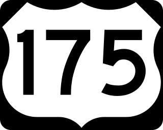
U.S. Highway 175 (US 175) is a 111.0-mile (178.6 km) east-west United States Numbered Highway located completely within the state of Texas. It comes very close to meeting its parent route, US 75, but decommissioning and rerouting in Downtown Dallas leaves it short a couple of miles. Before the decommissioning of US 75 south of downtown Dallas in favor of Interstate 45 (I-45), US 175 met US 75. US 175's western terminus is in Dallas at I-45. The highway's eastern terminus is in Jacksonville at an intersection with US 69.

<span class="mw-page-title-main">U.S. Route 190</span> Highway in the United States

U.S. Route 190 (US 190) is an east–west United States Highway in Louisiana and Texas. Segments of US 190 will be upgraded to Interstate 14 (I-14); the first 24.8-mile (39.9 km) segment was opened on January 26, 2017.

<span class="mw-page-title-main">U.S. Route 290</span> Highway in Texas

U.S. Route 290 is an east–west U.S. Highway located entirely within the state of Texas. Its western terminus is at Interstate 10 southeast of Segovia, and its eastern terminus is at Interstate 610 in northwest Houston. It is the main highway between Houston and Austin and is a cutoff for travelers wanting to bypass San Antonio on Interstate 10. Throughout its length west of Austin, US 290 cuts across mountainous hills comprising the Texas Hill Country and the Edwards Plateau; between Austin and Houston, the highway then travels through gradually hilly grasslands and pine forests comprising the Gulf Coastal Plains.

<span class="mw-page-title-main">Texas State Highway 6</span> State highway in Texas

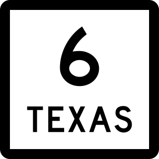
State Highway 6 (SH 6) runs from the Red River, the Texas–Oklahoma state line, to northwest of Galveston, where it is known as the Old Galveston Highway. In Sugar Land and Missouri City, it is known as Alvin-Sugarland Road and runs perpendicular to Interstate 69/U.S. Highway 59 (I-69/US 59). In the Houston area, it runs north to Farm to Market Road 1960 (FM 1960), then northwest along US 290 to Hempstead, and south to Westheimer Road and Addicks, and is known as Addicks Satsuma Road. In the Bryan–College Station area, it is known as the Earl Rudder Freeway. In Hearne, it is known as Market Street. In Calvert, it is known as Main Street. For most of its length, SH 6 is not a limited-access road. In 1997, the Texas Legislature designated SH 6 as the Texas Korean War Veterans Memorial Highway.

<span class="mw-page-title-main">Texas State Highway 7</span> State highway in Texas

State Highway 7 (SH 7) is an east–west state highway in the U.S. state of Texas that runs from Interstate 35 at Eddy to U.S. Highway 84 about 3 miles (4.8 km) west of the Louisiana state line. Between Crockett and Nacogdoches, SH 7 passes through the Davy Crockett National Forest. Commissioned on April 4, 1917, SH 7 is one of the original state highways established in Texas, and has been re-routed several times since its original conception. In earlier years, SH 7 mostly followed present day U.S. Highway 84, U.S. Highway 67, U.S. Highway 70 among other highways between northwest Texas and the Louisiana state line. By 1939, most of the mileage belonging to SH 7 was transferred to the U.S. Highway System, leaving the highway extant only within eastern Texas. SH 7 subsequently went through several other major reroutings, truncations and extensions between 1939 and 1990, before becoming the highway it is today.

<span class="mw-page-title-main">Texas State Highway 19</span> State highway in Texas

State Highway 19 is a state highway in Texas runs from Huntsville to Paris in east Texas.

<span class="mw-page-title-main">Texas State Highway Loop 323</span>

Loop 323 is a state highway loop in Texas in the United States. It is a 19.7-mile (31.7 km) highway circling the city of Tyler in Smith County.

<span class="mw-page-title-main">Texas State Highway 208</span>

State Highway 208 is a Texas state highway that runs from San Angelo to southeast of Spur.

<span class="mw-page-title-main">U.S. Route 59 in Texas</span> Section of U.S. Numbered Highway in Texas, United States

U.S. Highway 59 (US 59) in the U.S. state of Texas is named the Lloyd Bentsen Highway, after Lloyd Bentsen, former U.S. senator from Texas. In northern Houston, US 59, co-signed with Interstate 69 (I-69), is the Eastex Freeway. To the south, which is also co-signed with I-69, it is the Southwest Freeway. The stretch of the Southwest Freeway just west of The Loop was formerly one of the busiest freeways in North America, with a peak AADT of 371,000 in 1998.

<span class="mw-page-title-main">Business routes of Interstate 35</span>

Interstate business routes are roads connecting a central or commercial district of a city or town with an Interstate bypass. These roads typically follow along local streets often along a former U.S. Route or state highway that had been replaced by an Interstate. Interstate business route reassurance markers are signed as either loops or spurs using a green shield shaped sign and numbered like the shield of the parent Interstate highway.

<span class="mw-page-title-main">Special routes of U.S. Route 67</span>

Numerous special routes of U.S. Route 67, all business routes, exist. One other route, formerly an alternate route in western Illinois, has since been downgraded to state Route 267.

<span class="mw-page-title-main">Business routes of Interstate 20 in Texas</span>

All of the business loops within Texas are maintained by the Texas Department of Transportation (TxDOT). Interstate 20 (I-20) has 15 business loops in the state, all located in western Texas. Along I-20, TxDOT identifies each business route as Business Interstate 20 followed by an alphabetic suffix. Along Texas Interstates, the alphabetic suffixes on business route names ascend eastward and northward. There are gaps in the alphabetic values to allow for future system expansion. The alphabetic naming suffixes are included as small letters on the bottom of route shields.

<span class="mw-page-title-main">Business routes of Interstate 25</span> Route system

Interstate business routes are roads connecting a central or commercial district of a city or town with an Interstate bypass. These roads typically follow along local streets often along a former US or state highway that had been replaced by an Interstate. Interstate business route reassurance markers are signed as either loops or spurs using a green shield shaped sign and numbered like the shield of the parent Interstate Highway.

<span class="mw-page-title-main">Special routes of U.S. Route 79</span>

A total of twelve special routes of U.S. Route 79 exist, divided between the states of Arkansas, Louisiana, Tennessee and Texas. Currently, they are all business routes, except for one bypass of Humboldt, Tennessee, and one bypass of Homer, Louisiana.

<span class="mw-page-title-main">Texas State Highway Loop 7</span>

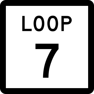
Loop 7 is a beltway in the U.S. state of Texas around the town of Athens. The highway additionally serves as a bypass for U.S. Highway 175 (US 175), State Highway 19 (SH 19), and SH 31 around the town.

<span class="mw-page-title-main">Special routes of U.S. Route 84</span>

At least 13 special routes of U.S. Route 84 have existed.

<span class="mw-page-title-main">Business routes of Interstate 45</span>

All of the business loops are maintained by the Texas Department of Transportation (TxDOT). Interstate 45 (I-45) has four business loops in the state, all located in northern Texas. Along I-45, TxDOT identifies each business route as Business Interstate 45 followed by an alphabetic suffix. Along Texas Interstates, the alphabetic suffixes on business route names ascend eastward and northward. There are gaps in the alphabetic values to allow for future system expansion. The alphabetic naming suffixes are included as small letters on the bottom of route shields.

<span class="mw-page-title-main">Business routes of U.S. Route 175</span>

There are currently four business routes of U.S. Route 175 that are designated and maintained by the Texas Department of Transportation (TxDOT). The business routes in the US state of Texas are traditionally short spurs or loops that connect the main route, in this case, U.S. Route 175 (US 175), to the center or commercial district of a city. The routes commonly follow the course of an decommissioned state highway, or the old course of the main route. Business routes are signed with the traditional US 175 highway shield, and with a small "business plate" placed above the marker. TxDOT regards business routes as official highways, and is responsible for the maintenance of the route.

References

  1. 1 2 Transportation Planning and Programming Division (n.d.). "State Highway No. 31". Highway Designation Files. Texas Department of Transportation . Retrieved October 30, 2010.
  2. "Minutes for State Highway Commission - February 20, 1918" (PDF).
  3. "Minutes for State Highway Commission - October 24, 1932" (PDF).
  4. "No Matter What Happens, Corsicana Team Is Building This Bypass". Sundt Construction Company. July 8, 2020. Retrieved February 28, 2022.
  5. Kormos, Michael (October 23, 2021). "TxDOT opens Hwy 31 relief route to traffic". Corsicana Daily Sun . Retrieved February 28, 2022.
  6. 1 2 Google (July 28, 2022). "Overview Map of SH 31 Bus. C" (Map). Google Maps . Google. Retrieved July 28, 2022.
  7. 1 2 Google (July 28, 2022). "Overview Map of SH 31 Bus. D" (Map). Google Maps . Google. Retrieved July 28, 2022.
  8. 1 2 Transportation Planning and Programming Division (n.d.). "Business State Highway No. 31-H". Highway Designation Files. Texas Department of Transportation.
  9. Google (July 28, 2022). "Overview Map of SH 31 Bus. H" (Map). Google Maps . Google. Retrieved July 28, 2022.
  10. 1 2 Transportation Planning and Programming Division (n.d.). "Business State Highway No. 31-K". Highway Designation Files. Texas Department of Transportation.
  11. Google (July 28, 2022). "Overview Map of SH 31 Bus. K" (Map). Google Maps . Google. Retrieved July 28, 2022.

Commons-logo.svg Media related to Texas State Highway 31 at Wikimedia Commons