Waller County, Texas

Last updated

Waller County
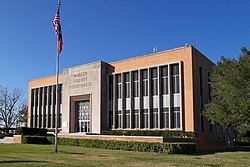
Waller county courthouse.jpg
The Waller County Courthouse in Hempstead
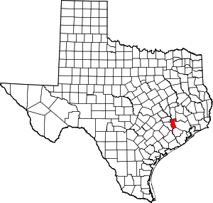
Map of Texas highlighting Waller County.svg
Location within the U.S. state of Texas
Texas in United States.svg
Texas's location within the U.S.
Coordinates: 30°01′N95°59′W / 30.01°N 95.98°W / 30.01; -95.98
CountryFlag of the United States.svg United States
StateFlag of Texas.svg  Texas
Founded1873
Named for Edwin Waller
Seat Hempstead
Largest city Prairie View
Area
  Total518 sq mi (1,340 km2)
  Land513 sq mi (1,330 km2)
  Water4.4 sq mi (11 km2)  0.8%
Population
 (2020)
  Total56,794
  Density110/sq mi (42/km2)
Time zone UTC−6 (Central)
  Summer (DST) UTC−5 (CDT)
Congressional district 10th
Website www.co.waller.tx.us

Waller County is a county in the U.S. state of Texas. As of the 2020 census, its population was 56,794. [1] Its county seat is Hempstead. [2] The county was named for Edwin Waller, a signer of the Texas Declaration of Independence and first mayor of Austin.

Contents

Waller County is included in the Houston-The Woodlands-Sugar Land, TX metropolitan statistical area. It is home of the Prairie View A&M University.

Geography

According to the U.S. Census Bureau, the county has a total area of 518 square miles (1,340 km2), of which 4.4 square miles (11 km2) (0.8%) are covered by water. [3]

Adjacent counties

Communities

Cities

Town

Unincorporated areas

Demographics

Historical population
CensusPop.Note
1880 9,024
1890 10,88820.7%
1900 14,24630.8%
1910 12,138−14.8%
1920 10,292−15.2%
1930 10,014−2.7%
1940 10,2802.7%
1950 11,96116.4%
1960 12,0710.9%
1970 14,28518.3%
1980 19,79838.6%
1990 23,39018.1%
2000 32,66339.6%
2010 43,20532.3%
2020 56,79431.5%
2023 (est.)63,553 [4] 11.9%
U.S. Decennial Census [5]
1850–2010 [6] 2010–2020 [7] [8]
Waller County, Texas - Demographic Profile
(NH = Non-Hispanic)
Race / EthnicityPop 2010 [9] Pop 2020 [8] % 2010% 2020
White alone (NH)19,26023,49444.58%41.37%
Black or African American alone (NH)10,53712,10424.39%21.31%
Native American or Alaska Native alone (NH)1412100.33%0.37%
Asian alone (NH)2137850.49%1.38%
Pacific Islander alone (NH)9100.02%0.02%
Some Other Race alone (NH)543140.12%0.55%
Mixed race/multiracial (NH)4551,3911.05%2.45%
Hispanic or Latino (any race)12,53618,48629.02%32.55%
Total43,20556,794100.00%100.00%

Note: the U.S. Census Bureau treats Hispanic/Latino as an ethnic category. This table excludes Latinos from the racial categories and assigns them to a separate category. Hispanics/Latinos can be of any race.

As of the 2000 census, [10] 32,663 people, 10,557 households, and 7,748 families resided in the county. The population density was 64 people per square mile (25 people/km2). The 11,955 housing units averaged 23 units per square mile (8.9 units/km2). The racial makeup of the county was 57.83% White, 29.25% Black or African American, 0.49% Native American, 0.38% Asian, 0.02% Pacific Islander, 10.28% from other races, and 1.76% from two or more races. About 19.42% of the population was Hispanic or Latino of any race.

Of the 10,557 households, 35.1% had children under 18 living with them, 55.7% were married couples living together, 13.0% had a female householder with no husband present, and 26.6% were not families. About 21.0% of all households were made up of individuals, and 7.5% had someone living alone who was 65 or older. The average household size was 2.79, and the average family size was 3.25.

In the county, the population was distributed as 25.70% under 18, 18.10% from 18 to 24, 26.40% from 25 to 44, 20.50% from 45 to 64, and 9.40% who were 65 or older. The median age was 30 years. For every 100 females, there were 98.70 males. For every 100 females 18, and over, there were 96.10 males.

The median income for a household in the county was $38,136, and for a family was $45,868. Males had a median income of $34,447 versus $25,583 for females. The per capita income for the county was $16,338. About 11.50% of families and 16.00% of the population were below the poverty line, including 20.00% of those under age 18 and 12.30% of those age 65 or over.

Economy

Igloo Corporation, a manufacturer of cooling and portable refrigeration products, is headquartered in unincorporated Waller County between Brookshire and Katy. [11] In 2004, Igloo announced that it was consolidating its corporate, distribution, and manufacturing operations in Waller County. [12]

Goya Foods has its Texas offices in an unincorporated area of the county near Brookshire. [13]

Politics and government

United States presidential election results for Waller County, Texas [14]
Year Republican Democratic Third party
No.%No.%No.%
2020 14,26062.73%8,19136.03%2831.24%
2016 10,53162.74%5,74834.25%5053.01%
2012 9,24458.13%6,51440.96%1440.91%
2008 8,26553.30%7,15346.12%900.58%
2004 7,67955.32%6,14544.27%570.41%
2000 5,68652.37%5,04646.47%1261.16%
1996 3,55941.28%4,53552.60%5286.12%
1992 3,06533.84%4,27047.14%1,72319.02%
1988 3,60747.31%3,95751.90%600.79%
1984 4,11651.69%3,82848.07%190.24%
1980 3,01946.71%3,32951.51%1151.78%
1976 1,99240.97%2,82858.17%420.86%
1972 2,26358.95%1,53840.06%380.99%
1968 95827.86%1,68448.97%79723.18%
1964 98031.12%2,16768.82%20.06%
1960 1,11549.18%1,10148.57%512.25%
1956 1,42659.49%92938.76%421.75%
1952 1,48754.01%1,26445.91%20.07%
1948 44827.42%81249.69%37422.89%
1944 19013.23%1,00770.13%23916.64%
1940 30021.96%1,06577.96%10.07%
1936 11111.08%88988.72%20.20%
1932 896.94%1,19292.91%20.16%
1928 37642.68%50457.21%10.11%
1924 20313.89%1,23984.80%191.30%
1920 16713.36%67453.92%40932.72%
1916 18222.03%63677.00%80.97%
1912 14416.78%59469.23%12013.99%

United States Congress

SenatorsNamePartyFirst ElectedLevel
 Senate Class 1 John Cornyn Republican 2002Senior Senator
 Senate Class 2 Ted Cruz Republican 2012Junior Senator
RepresentativesNamePartyFirst ElectedArea(s) of Waller County Represented
 District 10 Michael McCaul Republican 2004Entire county

Texas Legislature

Texas Senate

District 18: Lois Kolkhorst (R)- first elected in 2014.

Texas House of Representatives

District 3: Cecil Bell, Jr. (R)- first elected in 2013.

Voting controversies

A history of controversies exists regarding the reluctance of county officials to allow students attending historically black Prairie View A&M University to vote in Waller County. [15] [16]

As reported by the US District Court (Southern District of Texas, Corpus Christi Division) in Veasey v Perry, October 2014 (CIVIL ACTION NO. 13-CV-00193), pp 6–7 verbatim:

In 2018, the NAACP Legal Defense Fund filed a lawsuit in U.S. district court, alleging that the county's early-voting plan unduly limits early voting opportunities for students at Prairie View A&M. [17] On October 10, Jacob Aronowitz, a field director for Democratic U.S. House candidate Mike Siegel, delivered a letter from Siegel, which indicated a solution to attempts to keep students at Prairie View A&M University from voting, to a clerk on the county executive's staff. As a result, Aronowitz was arrested for what he was told was "48 hour investigative detention." [18]

Law enforcement

As of 2021 the current sheriff is Troy Guidry, who was elected in 2020. [19] [20] The previous sheriff was Glenn Smith, who had been sheriff since 2008. Smith was previously chief of the police department of Hempstead, where he had been fired by the town council. after allegations that he and four white officers had exhibited racism and police brutality during the arrest of a 35-year-old black man. [21]

In November 2021, a 16 year old was charged with six counts of aggravated assault for crashing into six people on bicycles while attempting to roll coal. All four of the riders were hospitalized for their injuries, two of them being airlifted. [22] [23] According to attorneys hired by the injured, the injuries included "broken vertebrae, cervical and lumbar spinal injuries, broken collar bones, hands, and wrists [requiring surgical intervention], multiple traumatic brain injuries, lacerations, soft tissue damage, road rash, and extensive bruising" [24] The Waller county district attorney, Elton Mathis, released a statement about the handling of the case by the Waller Police Department in which he said "This case was not handled appropriately by the investigating agency. PERIOD." According to his statement, the Texas Department of Public Safety urged the local police to treat the scene as a crime scene, and to contact the district attorney's office. Despite this, the local police released the 16 year old without doing an investigation. [22] [23]

Education

School districts serving Waller County include: [25]

Brazos Valley Sudbury School was previously in operation in Waller County.

Blinn College is the designated community college for all of the county. [26]

Prairie View A&M University is the only university located within the county.

Media

The Waller Times publishes local community news, school news, and sports news weekly on Mondays. [27] It was founded in 1991 and is still family owned and operated.

Transportation

Houston Executive Airport Houston Executive Airport (3).jpg
Houston Executive Airport

Major highways

The TTC-69 component (recommended preferred) of the once-planned Trans-Texas Corridor went through Waller County. [28]

Airports

Houston Executive Airport is located between Brookshire and Katy in an unincorporated area. Skydive Houston Airport (Skylake Airport) is located south of Waller in an unincorporated area.

The Houston Airport System stated that Waller County is within the primary service area of George Bush Intercontinental Airport, an international airport in Houston in Harris County. [29] In addition William P. Hobby Airport in Houston and in Harris County has commercial airline service.

See also

Related Research Articles

<span class="mw-page-title-main">Brazoria County, Texas</span> County in Texas, United States

Brazoria County is a county in the U.S. state of Texas. As of the 2020 census, the population of the county was 372,031. The county seat is Angleton.
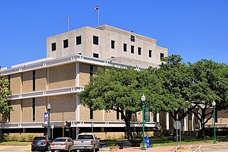
<span class="mw-page-title-main">Montgomery County, Texas</span> County in Texas, United States

Montgomery County is a county in the U.S. state of Texas. As of the 2020 U.S. census, the county had a population of 620,443. The county seat is Conroe. The county was created by an act of the Congress of the Republic of Texas on December 14, 1837, and is named for the town of Montgomery. Between 2000 and 2010, its population grew by 55%, the 24th-fastest rate of growth of any county in the United States. Between 2010 and 2020, its population grew by 36%. According to the U.S. Census Bureau, the estimated population is 711,354 as of July 1, 2023.

<span class="mw-page-title-main">Travis County, Texas</span> County in Texas, U.S.

Travis County is located in Central Texas. As of the 2020 census, the population was 1,290,188. It is the fifth-most populous county in Texas. Its county seat and most populous city is Austin, the capital of Texas. The county was established in 1840 and is named in honor of William Barret Travis, the commander of the Republic of Texas forces at the Battle of the Alamo. Travis County is part of the Austin–Round Rock–Georgetown Metropolitan Statistical Area. It is located along the Balcones Fault, the boundary between the Edwards Plateau to the west and the Blackland Prairie to the east.

<span class="mw-page-title-main">Tarrant County, Texas</span> County in Texas, United States

Tarrant County is a county located in the U.S. state of Texas with a 2020 U.S. census population of 2,110,640, making it the third-most populous county in Texas and the 15th-most populous in the United States. Its county seat is Fort Worth. Tarrant County, one of 26 counties created out of the Peters Colony, was established in 1849 and organized the next year. It is named after Edward H. Tarrant, a lawyer, politician, and militia leader.

<span class="mw-page-title-main">Liberty County, Texas</span> County in Texas, United States

Liberty County is a county in the U.S. state of Texas. As of the 2020 census, its population was 91,628. The county seat is Liberty. It was founded in 1831, as a municipality in Mexico as Villa de la Santísima Trinidad de la Libertad by commissioner José Francisco Madero and organized as a county of the Republic of Texas in 1836. Its name was anglicized as Liberty based on the ideal of American liberty.

<span class="mw-page-title-main">Houston County, Texas</span> County in Texas, United States

Houston County is a county located in the U.S. state of Texas. As of the 2020 census, its population was 22,066. Its county seat is Crockett. Houston County was one of 46 entirely dry counties in the state of Texas, until voters in a November 2007 special election legalized the sale of alcohol in the county.

<span class="mw-page-title-main">Harris County, Texas</span> County in Texas, U.S.

Harris County is a county located in the U.S. state of Texas; as of the 2020 census, the population was 4,731,145, making it the most populous county in Texas and the third-most populous county in the United States. Its county seat is Houston, the most populous city in Texas and fourth-most populous city in the United States. The county was founded in 1836 and organized in 1837. It is named for John Richardson Harris, who founded the town of Harrisburg on Buffalo Bayou in 1826. According to the July 2022 census estimate, Harris County's population has shifted to 4,780,913 comprising over 16% of Texas's population. Harris County is included in the nine-county Houston–The Woodlands–Sugar Land metropolitan statistical area, which is the fifth-most populous metropolitan area in the United States.

<span class="mw-page-title-main">Galveston County, Texas</span> County in Texas, United States

Galveston County is a county in the U.S. state of Texas, located along the Gulf Coast adjacent to Galveston Bay. As of the 2020 census, its population was 350,682. The county was founded in 1838. The county seat is the City of Galveston, founded the following year, and located on Galveston Island. The most-populous municipality in the county is League City, a suburb of Houston at the northern end of the county, which surpassed Galveston in population during the early 2000s.

<span class="mw-page-title-main">Fort Bend County, Texas</span> County in Texas, United States

Fort Bend County is a county located in the U.S. state of Texas. The county was founded in 1837 and organized the next year. It is named for a blockhouse at a bend of the Brazos River. The community developed around the fort in early days. The county seat is Richmond. The largest city located entirely within the county borders is Sugar Land. The largest city by population in the county is Houston; however, most of Houston's population is located in neighboring Harris County.
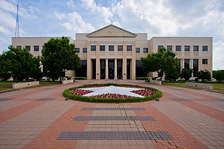
<span class="mw-page-title-main">Denton County, Texas</span> County in Texas, United States

Denton County is located in the U.S. state of Texas. As of the 2020 census, its population was 906,422, making it the seventh-most populous county in Texas. The county seat is Denton. The county, which was named for John B. Denton, was established in 1846. Denton County constitutes part of the Dallas–Fort Worth metroplex. In 2007, it was one of the fastest-growing counties in the United States.

<span class="mw-page-title-main">Dallas County, Texas</span> County in Texas, United States

Dallas County is the second-most populous county in the U.S. state of Texas with a 2020 U.S. census of 2,613,539, making it the ninth-most populous county in the country. Dallas County is included in the Dallas-Arlington-Fort Worth metropolitan statistical area—colloquially referred to as the Dallas–Fort Worth metroplex. Municipal expansion within Dallas County has blurred the geographic lines between cities and between neighboring counties.
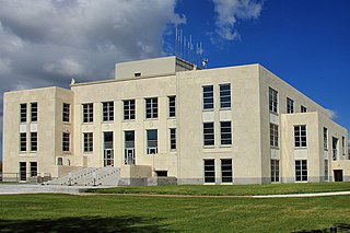
<span class="mw-page-title-main">Chambers County, Texas</span> County in Texas, United States

Chambers County is a county in the U.S. state of Texas. As of the 2020 census, its population was 46,571. The county seat is Anahuac.

<span class="mw-page-title-main">Aldine, Texas</span> Place in Texas, United States

Aldine is a census-designated place (CDP) in unincorporated central Harris County, Texas, United States, located within the extraterritorial jurisdiction of Houston. The population was 15,999 at the 2020 census. The community is located on the Hardy Toll Road, Union Pacific Railroad, and Farm to Market Road 525. The Aldine area is near Houston's George Bush Intercontinental Airport, the second largest aviation facility in Texas.

<span class="mw-page-title-main">Spring, Texas</span> Census-designated place in Texas, U.S.

Spring is a census-designated place (CDP) within the extraterritorial jurisdiction of Houston in Harris County, Texas, United States, part of the Houston–The Woodlands–Sugar Land metropolitan area. The population was 62,559 at the 2020 census. While the name "Spring" is popularly applied to a large area of northern Harris County and a smaller area of southern Montgomery County, the original town of Spring, now known as Old Town Spring, is located at the intersection of Spring-Cypress and Hardy roads and encompasses perhaps 1 square kilometer (0.39 sq mi).

<span class="mw-page-title-main">Magnolia, Texas</span> City in Texas, United States

Magnolia is a city in southwestern Montgomery County, Texas, United States within the Houston metropolitan area. It is named for the magnolia trees that grow in the area. The population was 2,359 at the 2020 United States Census.

<span class="mw-page-title-main">Brookshire, Texas</span> City in Texas, United States

Brookshire is a city in Waller County, Texas, United States, with a population of 5,066 as of the 2020 census.

<span class="mw-page-title-main">Hempstead, Texas</span> City in Texas, United States

Hempstead is a city in and the county seat of Waller County, Texas, United States, part of the Houston–The Woodlands–Sugar Land metropolitan area.

<span class="mw-page-title-main">Prairie View, Texas</span> City in Texas, United States

Prairie View is a city in Waller County, Texas, United States, situated on the northwestern edge of the Houston–The Woodlands–Sugar Land metropolitan area. The population was 8,184 at the 2020 census.
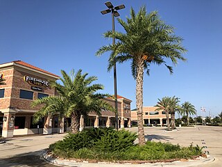
<span class="mw-page-title-main">Katy, Texas</span> City in Texas, United States

Katy is a city in the U.S. state of Texas. It is the Greater Katy area, itself forming the western part of the Greater Houston metropolitan area. Homes and businesses may have Katy postal addresses without being in the City of Katy. The city of Katy is approximately centered at the tripoint of Harris, Fort Bend, and Waller counties. Katy had a population of 21,894 at the 2020 U.S. census, up from 14,102 in 2010.

<span class="mw-page-title-main">Tomball, Texas</span> City in Texas, United States

Tomball is a city in Harris County in the U.S. state of Texas, a part of the Houston metropolitan area. The population was 12,341 at the 2020 U.S. census. In 1907, the community of Peck was renamed Tomball for local congressman Thomas Henry Ball, who had a major role in the development of the Port of Houston.
References

  1. "Waller County, Texas". United States Census Bureau . Retrieved January 30, 2022.
  2. "Find a County". National Association of Counties. Retrieved June 7, 2011.
  3. "2010 Census Gazetteer Files". United States Census Bureau. August 22, 2012. Retrieved May 12, 2015.
  4. "Annual Estimates of the Resident Population for Counties: April 1, 2020 to July 1, 2022". United States Census Bureau. Retrieved March 8, 2024.
  5. "Decennial Census of Population and Housing by Decades". US Census Bureau.
  6. "Texas Almanac: Population History of Counties from 1850–2010" (PDF). Texas Almanac. Archived (PDF) from the original on October 9, 2022. Retrieved May 12, 2015.
  7. "State & County QuickFacts". United States Census Bureau. Archived from the original on July 28, 2011. Retrieved December 29, 2013.
  8. 1 2 "P2 HISPANIC OR LATINO, AND NOT HISPANIC OR LATINO BY RACE - 2020: DEC Redistricting Data (PL 94-171) - Waller County, Texas". United States Census Bureau .
  9. "P2 HISPANIC OR LATINO, AND NOT HISPANIC OR LATINO BY RACE - 2010: DEC Redistricting Data (PL 94-171) - Waller County, Texas". United States Census Bureau .
  10. "U.S. Census website". United States Census Bureau . Retrieved May 14, 2011.
  11. "Igloo Worldwide Headquarters Archived 2010-04-21 at the Wayback Machine ." Igloo Corporation . Accessed September 5, 2008. "Igloo Products Corp. 777 Igloo Road Katy, Texas 77494"
  12. "Igloo consolidating operations in Katy facility." Houston Business Journal . Monday October 18, 2004. Retrieved on March 2, 2011. "1001 W. Sam Houston Parkway North" for the old Houston facility
  13. "Contact Us." Goya Foods. Retrieved on March 26, 2016. "Goya Foods of Texas 30602 McAllister Road Brookshire, TX 77423"
  14. "Dave Leip's Atlas of U.S. Presidential Elections".
  15. "2 Voter Rights Cases, One Gripping a College Town, Stir Texas" by Ralph Blumenthal, New York Times, May 28, 2008
  16. "Judges slap Waller voter rules, give hand to Prairie View" by Cindy George, Houston Chronicle October 24, 2008
  17. "Fighting for the Right to Vote in a Tiny Texas County" by Vann R. Newkirk II and Adam Harris, The Atlantic magazine.
  18. Eversden, Andrew; Platoff, Emma (October 11, 2018). "Campaign for congressional candidate Mike Siegel disputes account of worker's arrest". The Texas Tribune. Retrieved May 15, 2021.
  19. "HOME". www.wallercountytexassheriff.org. Retrieved December 12, 2021.
  20. Lewis, Brooke A. (October 23, 2020). "Waller County voters to elect first new sheriff since 2008". Houston Chronicle. Retrieved December 12, 2021.
  21. Foxhall, Emily. "Waller County sheriff seeks 3rd term after difficult year". Houston Chronicle. Retrieved March 3, 2017.
  22. 1 2 "Teen who hit 6 bicyclists with truck while allegedly harassing them faces felony charges, authorities say". The Washington Post .
  23. 1 2 "16-Year-Old Texas Truck Driver Who Hit Six Cyclists Charged With Felonies". November 9, 2021.
  24. "Coal-rolling Texas truck driver plows into 6 cyclists". October 2, 2021.
  25. "2020 CENSUS - SCHOOL DISTRICT REFERENCE MAP: Waller County, TX" (PDF). U.S. Census Bureau. Archived (PDF) from the original on October 9, 2022. Retrieved June 29, 2022. - Text list
  26. Texas Education Code Sec. 130.168. BLINN JUNIOR COLLEGE DISTRICT SERVICE AREA.
  27. McLemee, Scott (February 6, 2004). "Justice Department to Look Into Alleged Threat to Students' Voting Rights", The Chronicle of Higher Education 50 (22): A30.
  28. TxDoT, TTC Section C & S, Detailed Map 1, 2007-12-17 Archived February 7, 2009, at the Wayback Machine
  29. "Master Plan Executive Summary." George Bush Intercontinental Airport Master Plan. Houston Airport System. December 2006. 2-1 (23/130). Retrieved on December 14, 2010.

30°01′N95°59′W / 30.01°N 95.98°W / 30.01; -95.98