Gillespie County, Texas

Last updated

Gillespie County
Gillespie County Courthouse Fredericksburg TX.JPG
The Gillespie County Courthouse in Fredericksburg
Map of Texas highlighting Gillespie County.svg
Location within the U.S. state of Texas
Texas in United States.svg
Texas's location within the U.S.
Coordinates: 30°19′N98°57′W / 30.31°N 98.95°W / 30.31; -98.95
CountryFlag of the United States.svg United States
StateFlag of Texas.svg  Texas
Founded1848
Named for Robert Addison Gillespie
Seat Fredericksburg
Largest cityFredericksburg
Area
  Total1,062 sq mi (2,750 km2)
  Land1,058 sq mi (2,740 km2)
  Water3.5 sq mi (9 km2)  0.3%
Population
 (2020)
  Total26,725
  Density25/sq mi (9.7/km2)
Time zone UTC−6 (Central)
  Summer (DST) UTC−5 (CDT)
Congressional district 21st
Website www.gillespiecounty.org

Gillespie County is a county located on the Edwards Plateau in the U.S. state of Texas. As of the 2020 census, its population was 26,725. [1] The county seat is Fredericksburg. [2] It is located in the heart of the rural Texas Hill Country in Central Texas. Gillespie is named for Robert Addison Gillespie, a soldier in the Mexican–American War.

Contents

On December 15, 1847, a petition was submitted to create Gillespie County. In 1848, the legislature formed Gillespie County from Bexar and Travis Counties. While the signers were overwhelmingly German immigrants, names also on the petition were Castillo, Pena, Munos, and a handful of non-German Anglo names.

Gillespie County comprises the Fredericksburg, TX Micropolitan Statistical Area.

History

Early native inhabitants were the Tonkawa, Comanche, Kiowa, and Lipan Apache peoples. [3] In 1842, the Adelsverein organized in Germany to promote emigration to Texas. [4] The Fisher–Miller Land Grant set aside three million acres (12,000 km2) to settle 600 families and single men of German, Dutch, Swiss, Danish, Swedish, and Norwegian ancestry in Texas. [5] Henry Francis Fisher sold his interest in the land grant to the Adelsverein in 1844. [3] Prince Carl of Solms-Braunfels secured the title to 1,265 acres (5.12 km2) of the Veramendi grant the next year, including the Comal Springs and River, for the Adelsverein. Thousands of German immigrants were stranded at port of disembarkation, Indianola, on Matagorda Bay. With no food or shelters, living in holes dug into the ground, an estimated 50% die from disease or starvation. The living began to walk to their destinations hundreds of miles away. About 200 German colonists, who walked from Indianola, founded the town of New Braunfels at the crossing of the San Antonio-Nacodoches Road on the Guadalupe River. John O. Meusebach arrived in Galveston. The first wagon train of 120 settlers arrived from New Braunfels. Surveyor Hermann Wilke laid out the town. Meusebach named it Fredericksburg, in honor of Prince Frederick of Prussia. [3] [6] [7] [8] [9] [10]

In 1847, the Meusebach–Comanche Treaty was made. About 150 settlers petitioned the Texas Legislature to establish a new county, suggested names "Pierdenales" or "Germania". The Vereins Kirche became the first public building in Fredericksburg. It served as a nondenominational church, school, town hall, and fort. Locals referred to it as “the Coffee Mill Church” for its shape. Wilhelm Victor Keidel was the county's first doctor. Mormon leader Lyman Wight founded the community of Zodiac. [11] [12] [13]

The Legislature formed Gillespie County from Bexar and Travis Counties in 1848. They named it after Tennessee transplant Capt. Robert Addison Gillespie, [14] a hero of the 1846 Battle of Monterrey in the Mexican–American War. Fredericksburg became the county seat.

Fort Martin Scott was established in 1848 at Barons Creek, a Pedernales tributary. [15] [16] An angry mob of soldiers burned down the store-courthouse in 1850, destroying all county records. The melee apparently started when County Clerk John M. Hunter, who also owned the store, refused to sell whiskey to a soldier. Words were exchanged, and Hunter stabbed the soldier; about 50 soldiers stormed and burned the store, destroying all contents. Soldiers prevented townspeople from saving the county records. [17] [18]

John O. Meusebach was elected to the Texas Senate in 1851 to represent Bexar, Comal, and Medina Counties, [9] and in 1854, received a special appointment as commissioner from Governor Elisha M. Pease to issue land certificates to those immigrants of 1845 and 1846 who had been promised them by the Adelsverein. The Texas State Convention of Germans met in San Antonio and adopted a political, social, and religious platform, including: Equal pay for equal work, direct election of the President of the United States, abolition of capital punishment, "Slavery is an evil, the abolition of which is a requirement of democratic principles", free schools – including universities – supported by the state, without religious influence, and total separation of church and state. [9] [19] [20]

In 1852, Bremen seaman Charles Henry Nimitz, grandfather of Fleet Admiral Chester Nimitz, built the Nimitz Hotel in Fredericksburg. In 1870, he added a steamboat-shaped façade. [21] [22]

Surveyor Jacob Kuechler was commissioned as a captain by Sam Houston to enroll state militia troops in Gillespie County. Texas seceded from the Union in 1861, and joined the Confederate States of America, and Houston was dismissed from office in March by the Confederacy. Gillespie County voted 400 -17 against secession from the Union. Unionists from Kerr, Gillespie, and Kendall Counties participated in the formation of the Union League, a secret organization to support President Abraham Lincoln's policies. Kuechler signed up only German Unionists in his frontier company, and was dismissed by Governor Francis R. Lubbock. [23] [24]

In 1862, 54 Gillespie County men joined the Confederate Army. Eventually, 300 enlisted with the CSA to avoid conscription. The Union League formed companies to protect the frontier against Indians and their families against local Confederate forces. Conscientious objectors to the military draft were primarily among Tejanos and Germans. Confederate authorities imposed martial law on Central Texas. The Nueces massacre occurred in Kinney County. Jacob Kuechler served as a guide for 61 conscientious objectors attempting to flee to Mexico. Scottish-born Confederate irregular James Duff and his Duff's Partisan Rangers pursued and overtook them at the Nueces River; 34 were killed, some executed after being taken prisoner. Jacob Kuechler survived the battle. The cruelty shocked the people of Gillespie County. About 2,000 took to the hills to escape Duff's reign of terror.

The Treue der Union Monument ("Loyalty to the Union") in Comfort was dedicated in 1866 to the Texans slain at the Nueces massacre. It is the only monument to the Union other than the National Cemeteries on Confederate territory. It is one of only six such sites allowed to fly the United States flag at half-mast in perpetuity. [25] [26] Spring Creek Cemetery near Harper in Gillespie County has a singular grave with the names Sebird Henderson, Hiram Nelson, Gus Tegener, and Frank Scott. The inscription reads “Hanged and thrown in Spring Creek by Col. James Duff’s Confederate Regiment.” [27] [28]

Kiowa raiders massacred residents of the McDonald farm in the Harper vicinity in 1864. [29] During 1865, Gillespie County suffered a war-time crime wave, as 17 individuals were convicted of murder. [30]

In 1870, Herman Lehmann and his brother Willie were captured by Apaches, but Willie escaped within days. [31] [32] Herman Lehmann, escorted by soldiers, was finally returned to his family in 1878. [31]

In 1881, Gillespie County became the first county in Texas to hold a fair. [33]

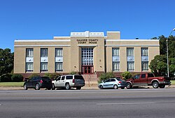
From 1874 to 1875, Andreas Lindig built the county's first lime kiln. [34] The original Gillespie County Courthouse was constructed in 1882; it later became the Pioneer Memorial Library. [35]

Chester W. Nimitz, future Commander in Chief, United States Pacific Fleet, was born in 1885 in Fredericksburg. His father, Chester B. Nimitz, died before his birth, leaving his seaman grandfather as role model. [36] John O. Meusebach died at his farm at Loyal Valley in Mason County on May 27, 1897, and was buried in the Marschall Meusebach Cemetery at Cherry Spring. [9]

In 1908, future President of the United States Lyndon B. Johnson was born in a small farmhouse on the Pedernales River. Johnson became the Vice President of the United States in 1961 and subsequently President of the United States. His ranch at Stonewall was known as the Texas Whitehouse. Tourism became an important industry. [37] Ranch Road 1 was designated in 1963. On January 22, 1973, President Johnson died at his Stonewall ranch. He, and later Lady Bird Johnson, were laid to rest at the family cemetery on the ranch. [37]

The Gillespie County Historical Society was formed in 1934, [38] and the Pedernales Electric Cooperative was formed to provide rural electrification four years later. [39] In 1948, the county began its annual Easter Fire event to commemorate the Meusebach treaty signing. [40]

Admiral Nimitz died February 20, 1966. The next February, the Fleet Admiral Chester W. Nimitz Memorial Naval Museum opened in the old Nimitz Hotel on Main Street in Fredericksburg. [41]

The Japanese Garden of Peace, a gift from the people of Japan, was dedicated on the 130th anniversary of the founding of Fredericksburg at the Nimitz Museum on May 8, 1976. [42] In 1981, the state legislature placed the Nimitz Museum under Texas Parks and Wildlife Department as the National Museum of the Pacific War. [42]

The State of Texas opened Enchanted Rock State Natural Area after adding facilities in 1984. That same year, it is also added to the National Register of Historic Places, [43]

The Texas White House officially opened to the public August 27, 2008. [37] In 2009, the George H. W. Bush Gallery opened at the Nimitz museum. [42]

Geography

According to the U.S. Census Bureau, the county has a total area of 1,062 square miles (2,750 km2), of which 1,058 square miles (2,740 km2) is land and 3.5 square miles (9.1 km2) (0.3%) is water. [44]

Adjacent counties

Major highways

National protected area

Demographics

Historical population
CensusPop.Note
1850 1,240
1860 2,736120.6%
1870 3,56630.3%
1880 5,22846.6%
1890 7,05635.0%
1900 8,22916.6%
1910 9,44714.8%
1920 10,0156.0%
1930 11,02010.0%
1940 10,670−3.2%
1950 10,520−1.4%
1960 10,048−4.5%
1970 10,5535.0%
1980 13,53228.2%
1990 17,20427.1%
2000 20,81421.0%
2010 24,83719.3%
2020 26,7257.6%
U.S. Decennial Census [45]
1850–2010 [46] 2010 [47] 2020 [48]
Gillespie County, Texas - Demographic Profile
(NH = Non-Hispanic)
Race / EthnicityPop 2010 [47] Pop 2020 [48] % 2010% 2020
White alone (NH)19,47219,88478.40%74.40%
Black or African American alone (NH)47840.19%0.31%
Native American or Alaska Native alone (NH)68690.27%0.26%
Asian alone (NH)881270.35%0.48%
Pacific Islander alone (NH)1110.04%0.00%
Some Other Race alone (NH)281000.11%0.37%
Mixed Race/Multi-Racial (NH)1546940.62%2.60%
Hispanic or Latino (any race)4,9695,76620.01%21.58%
Total24,83726,725100.00%100.00%

Note: the US Census treats Hispanic/Latino as an ethnic category. This table excludes Latinos from the racial categories and assigns them to a separate category. Hispanics/Latinos can be of any race.

As of the census [49] of 2000, 20,814 people resided in the county, organized into 8,521 households, and 6,083 families. The population density was 20 people per square mile (7.7 people/km2). The 9,902 housing units averaged nine per square mile (3.5/km2). The racial makeup of the county was 92.82% White, 0.33% Native American, 0.21% Black or African American, 0.18% Asian, 0.02% Pacific Islander, 5.27% from other races and 1.18% from two or more races. About 15.90% of the population was Hispanic or Latino of any race. In terms of ancestry, 40.8% were of German, 10.3% were of English, 10.0% were of Irish, 6.0% were of American, 3.1% were of Scotch-Irish, 2.5% were of Scottish,2.5% were of French. In 1990, about 3,000 speakers of Texas German were in Gillespie and Kendall Counties, but this is believed to have declined since. [50]

Of the 8,521 households, 25.90% had children under the age of 18 living with them, 62.10% were married couples living together, 7.00% had a female householder with no husband present, and 28.60% were not families. About 25.80% of all households were made up of individuals, and 14.20% had someone living alone who was 65 years of age or older. The average household size was 2.38 and the average family size was 2.84.

In the county, the population was distributed as 21.60% under the age of 18, 5.50% from 18 to 24, 21.20% from 25 to 44, 26.20% from 45 to 64, and 25.50% who were 65 years of age or older. The median age was 46 years. For every 100 females, there were 89.70 males. For every 100 females age 18 and over, there were 88.10 males.

The median income for a household in the county was $38,109, and for a family was $45,315. Males had a median income of $26,675 versus $20,918 for females. The per capita income for the county was $20,423, and 10.20% of the population and 7.10% of families were below the poverty line. Of the total population, 13.40% of those under the age of 18 and 9.90% of those 65 and older were living below the poverty line.

Politics

Gillespie County is part of the 21st District in the United States House of Representatives, represented by Republican Chip Roy, the 25th district of the Texas State Senate, represented by Republican Donna Campbell, and the 19th District of the Texas House of Representatives and is represented by Republican Ellen Troxclair.

Historically, the county was a massive outlier in Texas. While Texas was overwhelmingly Democratic up until recent decades, Gillespie County has long been a Republican stronghold. This is largely due to the heavily German American heritage of the county and that Gillespie was the fountainhead of Texas’ small Unionist movement during the Civil War. Most Texas Germans acquiesced to secession, but Fredericksburg was still self-sufficient and sold surplus food to the army. [51]

Gillespie County has been won by Republicans in every election since 1896 with only four exceptions. Theodore Roosevelt's Progressive Party won the county in 1912 (but carried no other counties in the state). In 1924, it was one of only two Texas counties won by Progressive candidate Robert M. La Follette. [52] Gillespie County has backed a Democratic nominee only twice since the 19th century: in 1932 and 1964, [53] both of which were landslide victories for the party, and the latter being for county native Lyndon Johnson. No Democrat since Jimmy Carter in 1976 [54] has received so much as 22 percent of the county's vote. [55]

Franklin D. Roosevelt won the county by almost 60 percentage points in 1932, despite the county's massive Republican lean. At his fourth and final election in 1944, he received less than one-tenth of its vote - a decline of more than 70 percentage points from his first election in the county.

United States presidential election results for Gillespie County, Texas [56]
Year Republican Democratic Third party
No.%No.%No.%
2020 12,51478.95%3,17620.04%1601.01%
2016 10,44679.05%2,28817.31%4803.63%
2012 10,30682.12%2,05516.37%1891.51%
2008 9,56377.51%2,57620.88%1991.61%
2004 9,29780.47%2,10418.21%1521.32%
2000 8,09681.61%1,51115.23%3133.16%
1996 5,86771.98%1,65520.30%6297.72%
1992 4,71256.28%1,60019.11%2,06024.61%
1988 5,66277.42%1,58821.71%630.86%
1984 5,49682.63%1,13717.10%180.27%
1980 4,73678.70%1,17019.44%1121.86%
1976 3,54172.49%1,26025.79%841.72%
1972 3,49085.67%52612.91%581.42%
1968 2,94571.74%72517.66%43510.60%
1964 1,69542.80%2,26457.17%10.03%
1960 2,68776.62%81623.27%40.11%
1956 3,07092.61%2407.24%50.15%
1952 3,68792.29%3007.51%80.20%
1948 2,74180.31%59317.37%792.31%
1944 2,95082.56%3339.32%2908.12%
1940 3,21386.74%48713.15%40.11%
1936 1,42156.52%1,01640.41%773.06%
1932 66219.96%2,64279.65%130.39%
1928 1,44755.12%1,17444.72%40.15%
1924 76828.42%35213.03%1,58258.55%
1920 1,27060.36%1376.51%69733.13%
1916 1,46377.74%40521.52%140.74%
1912 21913.70%30719.20%1,07367.10%

Communities

City

Census-designated places

Unincorporated communities

Ghost towns

Education

School districts in the county include: [57]

It is within Central Texas College's attendance area. [58]

Notable people

See also

Related Research Articles

<span class="mw-page-title-main">Mason County, Texas</span> County in Texas, United States

Mason County is a rural county located on the Edwards Plateau in the U.S. state of Texas. At the 2020 census, its population was 3,953. Its county seat is Mason. The county is named for Fort Mason, which was located in the county.

<span class="mw-page-title-main">Llano County, Texas</span> County in Texas, United States

Llano County is a county located on the Edwards Plateau in the U.S. state of Texas. As of the 2020 census, its population was 21,243. Its county seat is Llano, and the county is named for the Llano River.

<span class="mw-page-title-main">Kendall County, Texas</span> County in Texas, United States

Kendall County is a county located on the Edwards Plateau in the U.S. state of Texas. In 2020 census, its population was 44,279. Its county seat is Boerne. The county is named for George Wilkins Kendall, a journalist and Mexican–American War correspondent.

<span class="mw-page-title-main">Comal County, Texas</span> County in Texas, United States

Comal County is a county located on the Edwards Plateau in the U.S. state of Texas. As of the 2020 census, its population was 161,501. Comal County is known for its rich German-Texan and European history. Its county seat is New Braunfels.

<span class="mw-page-title-main">Blanco County, Texas</span> County in Texas, United States

Blanco County is a United States county located in the U.S. state of Texas. It is located in Central Texas and its county seat is Johnson City.

<span class="mw-page-title-main">Fredericksburg, Texas</span> City in Texas, United States

Fredericksburg is a city in and the seat of Gillespie County, Texas, United States. As of the 2010 Census, this city had a population of 10,530.

Doss is an unincorporated farming and ranching community at the crossroads juncture of FMs 648 and 783 in northwestern Gillespie County, Texas, United States. It is 19 miles northwest of Fredericksburg and 14 miles northeast of Harper. The zip code is 78618. The mean elevation is 1729 feet.

<span class="mw-page-title-main">Adelsverein</span> Germany colony in Texas

The Mainzer Adelsverein at Biebrich am Rhein, better known as the Mainzer Adelsverein, organized on April 20, 1842, was a colonial attempt to establish a new German settlement within the borders of Texas.

<span class="mw-page-title-main">Cherry Spring, Texas</span> Unincorporated community in Texas, United States

Cherry Spring is an unincorporated farming and ranching community established in 1852 in Gillespie County, in the U.S. state of Texas. It is located on Cherry Spring Creek, which runs from north of Fredericksburg to Llano. The creek was also sometimes known as Cherry Springs Creek by residents. The community is located on the old Pinta Trail. The Cherry Spring School was added to the National Register of Historic Places Listings in Gillespie County, Texas on May 6, 2005. The school was designated a Recorded Texas Historic Landmark in 1985.

Wilhelm Victor Keidel was the first medical doctor, as well as first Chief Justice, in Gillespie County, Texas. He was a veteran of the Mexican–American War. Keidel founded the settlement of Pedernales.

Alfred P. C. Petsch (1887–1981) was a Democratic member of the Texas House of Representatives for the 85th District of Fredericksburg and Gillespie County. He was a retired lieutenant colonel who saw service in both World War I and World War II. Petsch was also an educator, a lawyer, a civic leader and a philanthropist.

Grapetown is an unincorporated farming and ranching community 9.5 miles (15.3 km) south of Fredericksburg, situated on South Grape Creek in Gillespie County, in the U.S. state of Texas. It is located on the old Pinta Trail. Grapetown is noted for being the site of the first annual Gillespie County Bundes Schützenfest. The school was designated a Recorded Texas Historic Landmark in 1984, Marker number 10048.

Pedernales was an early settlement of German immigrants in Gillespie County, Texas, United States, and was part of the Adelsverein colonization of Texas. No trace of the settlement remains today. It was located 7 miles (11 km) southwest of Fredericksburg near what is now Texas State Highway 16. The Pedernales school received a Texas Historical Commission Subject Marker in 1993, Marker number 10095.

<span class="mw-page-title-main">Tivydale, Texas</span> Unincorporated community in Texas, United States

Tivydale is an unincorporated farming and ranching community located in Gillespie County, Texas, United States, located 14 miles (23 km) west of Fredericksburg, and was originally known as Bunkesville and Pumpkinville.

Ludwig "Louis" Martin was with the first settlers to Fredericksburg, Texas. He was the first sheriff of Gillespie County, and also served as District Clerk of the county. Martin was a co-founder of the Mason County community of Hedwigs Hill.

<span class="mw-page-title-main">Wrede School (Gillespie County, Texas)</span> United States historic place

Wrede School is located at 3929 S. State Highway 16, Fredericksburg, Gillespie County, Texas. It was first built in 1896. The school district was consolidated with Fredericksburg Independent School District in 1960. The schoolhouse now serves as a community center. It was added to the National Register of Historic Places in Texas on June 1, 2005.

Zodiac is a vanished Mormon settlement established in 1847 on the Pedernales River, located 4 miles (6.4 km) southeast of Fredericksburg, in Gillespie County, in the U.S. state of Texas. The area it was located on eventually converted to private acreage, and no trace of the settlement remains today. It was the first Mormon colony established by Lyman Wight in Texas. The second settlement was Mormon Mill in Burnet County in 1851, and his third and final settlement was Mormon Camp in 1854 in Bandera County. In 1936, Zodiac was designated a Recorded Texas Historic Landmark, Marker number 10133.

Emil Kriewitz was a German immigrant and veteran of the Mexican–American War, who came to this country with the Adelsverein colonists. After John O. Meusebach successfully negotiated the Meusebach–Comanche Treaty, Kriewitz lived among the Penateka Comanche as an intermediary between the whites and Penateka. In 1993, his home in Castell, Texas, was designated a Recorded Texas Historic Landmark, Marker number 9444.

Charles Henry Nimitz was born in Bremen, Germany, the son of a merchant seaman. Like his father before him, he was already a veteran seaman before the Nimitz family immigrated to South Carolina in the early 1840s, and later became part of the Adelsverein colonization experiment in the newly annexed state of Texas. He was the grandfather of, and role model for, Fleet Admiral Chester Nimitz. In 1852, he built the Nimitz Hotel in Fredericksburg, Texas, in the United States. The hotel he built now houses the National Museum of the Pacific War. The Nimitz Hotel was designated a Recorded Texas Historic Landmark in 1989, Marker number 10089. Nimitz was elected to the Twenty-second Texas Legislature in 1890, representing Gillespie, Comal and Blanco counties, which constituted District 89.

<span class="mw-page-title-main">History of Fredericksburg, Texas</span>

The History of Fredericksburg, Texas dates back to its founding in 1846. It was named after Prince Frederick of Prussia. Fredericksburg is also notable as the home of Texas German, a dialect spoken by the first generations of German settlers who initially refused to learn English. Fredericksburg shares many cultural characteristics with New Braunfels, which had been established by Prince Carl of Solms-Braunfels the previous year.

References

  1. "Gillespie County, Texas". United States Census Bureau . Retrieved February 23, 2021.
  2. "Find a County". National Association of Counties. Archived from the original on May 31, 2011. Retrieved June 7, 2011.
  3. 1 2 3 Kohout, Martin Donnell. "Gillespie County, Texas". Handbook of Texas Online. Texas State Historical Association. Retrieved November 13, 2010.
  4. Brister, Louis E. "Adelsverein". Handbook of Texas Online. Texas State Historical Association. Retrieved November 13, 2010.
  5. Ramos, Mary G. "The German Settlements in Central Texas". Texas Almanac. Texas State Historical Association. Archived from the original on February 7, 2011. Retrieved November 13, 2010.
  6. "Indianola, Texas". Blueprints For Travel, LLC. Retrieved November 13, 2010.
  7. Block, W T. "The Story of our Texas' German Pilgrims". Blueprints For Travel, LLC. Retrieved November 13, 2010.
  8. "Near River Crossing Used by New Braunfels' First Settlers – New Braunfels, Comal County, Texas". William Nienke, Sam Morrow. Archived from the original on July 18, 2011. Retrieved November 13, 2010.
  9. 1 2 3 4 Smith, Cornelia Marshall; Tetzlaff, Otto W. "Meusebach, John O". Handbook of Texas Online. Texas State Historical Association. Retrieved November 13, 2010.
  10. Kohout, Martin Donnell. "Fredericksburg, Texas". Handbook of Texas Online. Texas State Historical Association. Retrieved November 13, 2010.
  11. "Comanche Indian Treaty". William Nienke, Sam Morrow. Archived from the original on July 18, 2011. Retrieved November 13, 2010.
  12. "Signers of Petition to Create Gillespie County December 15, 1847". Texas Gen Web. Archived from the original on July 28, 2011. Retrieved November 13, 2010.
  13. Kohout, Martin Donnell. "Vereins-Kirche". Handbook of Texas Online. Texas State Historical Association. Retrieved November 13, 2010.
  14. Gannett, Henry (1905). The Origin of Certain Place Names in the United States. Govt. Print. Off. pp.  137.
  15. Spurlin, Charles D. "Gillespie, Robert Addison". Handbook of Texas Online. Texas State Historical Association. Retrieved November 13, 2010.
  16. Brooks Jr, Paul R M. "Fort Martin Scott". Handbook of Texas Online. Texas State Historical Association. Retrieved November 13, 2010.
  17. "Angry soldiers burn Fredericksburg store, destroying early Gillespie County records". Handbook of Texas Online. Texas State Historical Association. Archived from the original on October 19, 2012. Retrieved November 13, 2010.
  18. Beverly, Travis Wooster. "Gillespie County Records Destroyed". Texas Gen Web. Archived from the original on July 28, 2011. Retrieved November 13, 2010.
  19. Biesele, R L (April 1930). "The Texas State Convention of Germans in 1854". The Southwestern Historical Quarterly. XXXIII (24).
  20. "Nimitz, Charles and Sophia". Der Stadt Friedhof. Gillespie County Historical Association. Retrieved November 13, 2010.
  21. Kohout, Martin Donnell. "Nimitz, Charles Henry". Handbook of Texas Online. Texas State Historical Association. Retrieved November 13, 2010.
  22. "Nimitz Hotel". William Nienke, Sam Morrow. Archived from the original on July 7, 2011. Retrieved November 13, 2010.
  23. Moneyhon, Charles H. "The Union League". Handbook of Texas Online. Texas State Historical Association. Retrieved November 13, 2010.
  24. McGuire, James Patrick. "Kkuechler, Jacob". Handbook of Texas Online. Texas State Historical Association. Retrieved November 13, 2010.
  25. "Treue der Union Monument". Blueprints For Travel, LLC. Retrieved November 13, 2010.
  26. "List of Dead-Treue Der Union Monument". Texas Gen Web. Archived from the original on February 26, 2012. Retrieved November 13, 2010.
  27. Shook, Robert W. "Duff, James". Handbook of Texas Online. Texas State Historical Association. Retrieved November 13, 2010.
  28. "Spring Creek Cemetery". Texas Gen Web. Archived from the original on December 2, 2008. Retrieved November 13, 2010.
  29. "Site of the McDonald Massacre". William Nienke, Sam Morrow. Archived from the original on September 28, 2011. Retrieved November 13, 2010.
  30. "Fugutives from Justice". Texas Gen Web. Archived from the original on October 3, 2011. Retrieved November 13, 2010.
  31. 1 2 Lehmann, Herman; Hunter, J Marvin; Giese, Dale F (1993). Nine Years Among the Indians, 1870–1879: The Story of the Captivity and Life of a Texan Among the Indians . University of New Mexico Press. ISBN   978-0-8263-1417-8.
  32. Hudspeth, Brewster. "The Savage Life Of Herman Lehmann". Texas Escapes – Blueprints For Travel, LLC. Retrieved April 30, 2010. Texas Escapes – Blueprints For Travel, LLC.
  33. "Gillespie County Fair". Archived from the original on January 17, 2010. Retrieved November 13, 2010.
  34. "Site of The Andreas Lindig Lime Kiln". William Nienke, Sam Morrow. Archived from the original on September 28, 2011. Retrieved November 13, 2010.
  35. "Gillespie County Courthouse". Texas Escapes – Blueprints For Travel, LLC. Retrieved April 30, 2010. Texas Escapes – Blueprints For Travel, LLC.
  36. Potter, Elmer Belmont (2008). Nimitz. Naval Institute Press. p. 26. ISBN   978-1-59114-580-6.
  37. 1 2 3 "President Lyndon B. Johnson's Biography". LBJ Library. Archived from the original on January 18, 2012. Retrieved November 13, 2010.
  38. "Gillespie County Historical Society" . Retrieved November 13, 2010.
  39. Wentsch, George. "Pedernales Electric Cooperative". Handbook of Texas Online. Texas State Historical Association. Retrieved November 13, 2010.
  40. "History of the Easter Fires". Texas Less Traveled. Retrieved November 13, 2010.
  41. "Pacific War Museum". Archived from the original on November 9, 2010. Retrieved November 13, 2010.
  42. 1 2 3 Kohout, Martin Donell. "Nimitz Museum". Handbook of Texas Online. Texas State Historical Association. Retrieved November 13, 2010.
  43. Kohout, Martin Donell. "Enchanted Rock State Natural Area". Handbook of Texas Online. Texas State Historical Association. Retrieved November 13, 2010.
  44. "2010 Census Gazetteer Files". United States Census Bureau. August 22, 2012. Retrieved April 27, 2015.
  45. "Decennial Census of Population and Housing by Decade". US Census Bureau.
  46. "Texas Almanac: Population History of Counties from 1850–2010" (PDF). Texas Almanac. Archived (PDF) from the original on October 9, 2022. Retrieved April 27, 2015.
  47. 1 2 "P2 HISPANIC OR LATINO, AND NOT HISPANIC OR LATINO BY RACE - 2010: DEC Redistricting Data (PL 94-171) - Gillespie County, Texas". United States Census Bureau .
  48. 1 2 "P2 HISPANIC OR LATINO, AND NOT HISPANIC OR LATINO BY RACE - 2020: DEC Redistricting Data (PL 94-171) - Gillespie County, Texas". United States Census Bureau .
  49. "U.S. Census website". United States Census Bureau . Retrieved May 14, 2011.
  50. The Death of Texas German in Gillespie County
  51. Bünger, Walter L.; ‘Secession and the Texas German Community: Editor Lindheimer vs. Editor Flake’; The Southwestern Historical Quarterly, Vol. 82, No. 4 (Apr. 1979), pp. 379-402
  52. Presidential election of 1896 (and subsequent years)
  53. Sullivan, Robert David; ‘How the Red and Blue Map Evolved Over the Past Century’; America Magazine in The National Catholic Review; June 29, 2016
  54. 1976 Presidential General Election Data Graphs – Texas by County
  55. The New York Times electoral map (Zoom in on Texas)
  56. Leip, David. "Dave Leip's Atlas of U.S. Presidential Elections". uselectionatlas.org. Retrieved January 25, 2018.
  57. "2020 CENSUS - SCHOOL DISTRICT REFERENCE MAP: Gillespie County, TX" (PDF). U.S. Census Bureau. Archived (PDF) from the original on October 9, 2022. Retrieved June 29, 2022. - List
  58. "Sec. 130.171. CENTRAL TEXAS COLLEGE DISTRICT SERVICE AREA".
  59. "Fisher Miller Colony Transfers". Texas General Land Office. Archived from the original on July 26, 2011. Retrieved May 26, 2011.

Further reading

30°19′N98°57′W / 30.31°N 98.95°W / 30.31; -98.95