| Registered Texas Historic Landmark | Image | Marker number | Physical address | Nearest city | Year designated | Location description [1] [2] |
|---|
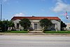
| Forum of Civics |  | 10667 | 2503 Westheimer | Houston | 1964 | Westheimer at Kirby |
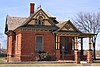
| Old Dyer House, 1890 | | | 11510 S. Garden | Missouri City | 1966 | |
| Nichols-Rice-Cherry House | | | | Houston | 1967 | 400 block McKinney, Sam Houston Heritage Park |
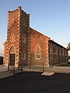
| St. Peter Church | | | 9022 Long Point Rd. | Houston | 1967 | 9022 Long Point Rd. at S. Campbell |
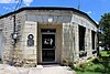
| San Felipe Cottage |  | | 515 Allen Parkway | Houston | 1967 | in Heritage Park |
| Pillot House |  | | | Houston | 1967 | Sam Houston Heritage Park, 400 block McKinney |
| Kellum-Noble House | | | 212 Dallas Street | Houston | 1967 | The Heritage Society at Sam Houston Park |
| Annunciation Church |  | | | Houston | 1969 | 600 block of Crawford & Texas |
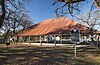
| Griffin Memorial House | | | | Tomball | 1969 | 400 block of Pine St. |
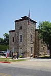
| Cedar Bayou Masonic Lodge No. 321, A. F. & A. M. |  | | 2850 Ferry Road | Baytown | 1970 | |
| Hall of Cedar Bayou Masonic Lodge No. 321, A. F. & A. M. | | | 2850 Ferry Rd. | Baytown | 1970 | |
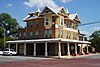
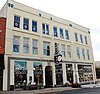
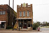
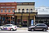
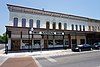
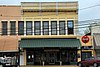
| Sweeney, Coombs, and Fredericks Building |  | | 301 Main St. | Houston | 1974 | |
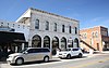
| Houston Cotton Exchange and Board of Trade |  | | 202 Travis St. | Houston | 1974 | 202 Travis St. at Franklin |
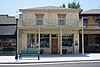
| W. L. Foley Building |  | | 214-18 Travis Street | Houston | 1978 | |
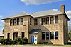
| McGhee Elementary School Building | | | | Channelview | 1979 | Crockett and 1st St., behind de Zavala Elementary School |
| John Milroy House | | | 1102 Heights Blvd. | Houston | 1979 | |
| Heritage Presbyterian Church | | | 7934 SH 6 | Houston | 1980 | 7 mi. N. of IH-10W |
| Hogg Building |  | | 401 Louisiana St. | Houston | 1981 | |
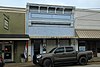
| Kennedy Bakery |  | | 813 Congress | Houston | 1981 | |
| Rose Hill Methodist Church Building | | | 21014 Rose Hill Church Rd. | Tomball | 1982 | off FM 2920 about 5 mi. west of Tomball in the Rose Hill community |
| The Sheridan Apartments |  | | 802-804 McGowen St. | Houston | 1984 | |
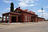
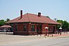
| Wunsche Bros. Saloon and Hotel | | | 103 Midway | Spring | 1984 | next to railroad tracks |
| Merchants and Manufacturers Building | | | 1 Main St. | Houston | 1984 | U. of Houston Downtown |
| Ezekial and Mary Jane Miller House | | | 304 Hawthorne | Houston | 1984 | |
| Auditorium Hotel |  | | 710 Texas Avenue | Houston | 1984 | |
| DePelchin Faith Home |  | | 2700 Albany at Drew | Houston | 1984 | |
| Arthur B. Cohn House | | | 1711 Rusk | Houston | 1985 | |
| Trinity Episcopal Church |  | | 3404 S. Main | Houston | 1986 | |
| Rose Hill United Methodist Church | | | 21014 Rose Hill Church Rd. | Tomball | 1987 | of FM 2920 about 5 mi. west of Tomball in the Rose Hill community |
| St. Nicholas Catholic Church | | | 2508 Clay St. | Houston | 1987 | |
| Houston Fire Station No. 7 |  | | 2403 Milam St. | Houston | 1988 | |
| Clayton House | 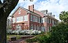 | | 5300 Caroline | Houston | 1988 | |
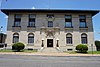
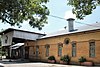
| Baytown Post Office |  | | 220 W. Defee | Baytown | 1988 | |
| Saint Joseph's Catholic Church | | | | Houston | 1989 | |
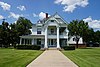
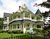
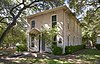
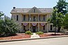
| Fondren Mansion |  | | 3410 Montrose Blvd. | Houston | 1989 | |
| Holcombe House |  | | 1905 Holcombe Blvd. | Houston | 1991 | east of medical center now called "The Hospice" |
| David Barker House | | | 121 E. 16th St. | Houston | 1991 | |
| Houston Light Guard Armory | 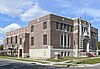 | | 3816 Caroline | Houston | 1991 | |
| Wade and Mamie Irvin House |  | | 431 Bayridge Rd. | Morgan's Point | 1991 | |
| Baker-Jones House | | | 22 Courtlandt Place | Houston | 1991 | |
| K'Nesseth Israel Synagogue | | | | Baytown | 1991 | Commerce and Sterling St. |
| John M. Dorrance House | | | 9 Courtlandt Place | Houston | 1991 | |
| West Mansion |  | | 3301 NASA Rd. 1 | Webster | 1993 | Razed Nov. 2019 |
| Autry House, Rice University | | | 6265 Main St. | Houston | 1994 | |
| Antioch Missionary Baptist Church | | | 600 Clay Street | Houston | 1994 | |
| Thomas J. and Mary Donoghue House | | | 17 Courtlandt Place | Houston | 1994 | |
| Moore Log House |  | | 440 Wilchester Blvd. | Houston | 1996 | House/marker is in Edith L. Moore Nature Sanctuary, approx. three tenths mile west of Sam Houston Toll way; park entrance via United Methodist Church parking lot off of Memorial Drive; fence on west parking lot boundary marks sanctuary, gate mid-way along |
| J. W. Garrow House | | | 19 Courtlandt Place | Houston | 1997 | |
| James Judson and Lena Carter Carroll House | | | 16 Courtlandt Place | Houston | 1997 | |
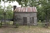
| Pioneer Memorial Log House | 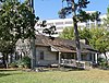 | | 1510 N. MacGregor | Houston | 1997 | Hermann Park |
| Rutherford B. H. Yates Sr. House | | | 1314 Andrews St. | Houston | 1998 | |
| Bryan-Chapman House | | | 15 Courtlandt Place | Houston | 1998 | |
| Ned A. & Linda S. Eppes House | | | 5322 Institute Lane | Houston | 1998 | |
| Dr. Penn B. and Annie A. Thornton House | | | 327 W. 16th St. | Houston | 1998 | |
| Minchen House | | | 1753 North Blvd. | Houston | 1999 | |
| Sessums & Virginia Cleveland House | | | 8 Courtlandt Place | Houston | 1999 | |
| Third Church of Christ, Scientist | | | 5516 Almeda Rd. | Houston | 1999 | |
| Houston Heights City Hall and Fire Station | | | 107 W. 12th St. | Houston | 2001 | 107 W. 12th St. |
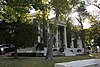
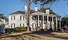
| Link–Lee House | | | 3800 Montrose Blvd. | Houston | 2001 | |
| Harper House | | | 319 Hawthorne St. | Houston | 2001 | |
| Benjamin Apartments | | | 1218 Webster St. | Houston | 2001 | |
| Anderson House | | | 3925 Del Monte | Houston | 2001 | |
| First Evangelical Church | | | 1300 Holman | Houston | 2002 | 1300 Holman |
| Blue Triangle Branch, Y. W. C. A. Building | 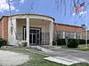 | | 3005 McGowen | Houston | 2002 | 3005 McGowen |
| F.C.L. and Emilie Neuhaus House | | | 6 Courtlandt Place | Houston | 2002 | #6 Courtlandt Place, Houston |
| Julia Ideson Building |  | 13888 | 500 McKinney | Houston | 2003 | |
| Magnolia Brewery Building |  | | 715 Franklin | Houston | 2003 | 715 Franklin |
| Hugo Victor Neuhaus Jr. House | | | 2910 Lazy Ln | Houston | 2005 | |
| Angelo and Lillian Minella House | | | 6328 Brookside Dr | Houston | 2006 | 6328 Brookside Dr |
| Kleb Family House | | | | Tomball | 2006 | south of Draper Road and west of Mueschke Road |
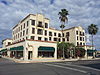
| Gulf Building |  | | 712 Main and 711 Travis | Houston | 2007 | 712 Main and 711 Travis |
| Matthews-Johnson House | | | 1835 Cortlandt St | Houston | 2008 | |
| Farnsworth & Chambers Building |  | | 2999 South Wayside Drive | Houston | 2009 | |
| Magnolia Park City Hall and Central Fire Station | | | 7301 Avenue F | Houston | 2009 | 7301 Avenue F |
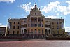
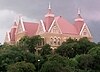
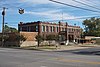
| Harris County 1910 Courthouse |  | | 301 Fannin | Houston | 2010 | |
| James L. Autry House |  | | 5 Courtlandt Place | Houston | 2010 | Houston, 5 Courtlandt Place |
| Jones-Hunt House | | | 24 Courtlandt Place | Houston | 2010 | |
| Hidalgo Park Quiosco |  | | 7000 Ave. Q | Houston | 2010 | |
| John and Bessie Parker House | | | 2 Courtlandt Place | Houston | 2011 | |
| Myer-Hall House | | | 4 Courtlandt Place | Houston | 2011 | |
| W. T. Carter Jr. House | | | 18 Courtlandt Place | Houston | 2011 | |
| Robert E. Lee High School | | | 1809 Market Street | Baytown | 2011 | Baytown, 1809 Market Street |
| Sylvan Beach Pavilion |  | | 554 North Bayshore | La Porte | 2011 | La Porte, 554 North Bayshore |
| Underwood and Clara Nazro House | | | 25 Courtlandt Place | Houston | 2012 | Houston, 25 Courtlandt Place |
| Gov. John B. Connally Jr. Home | | | 2411 River Oaks Blvd. | Houston | 2012 | 3 miles from central business district |
| Dr. John H. Foster House | | | 320 Branard Street | Houston | 2012 | northeast corner of Branard and Bute |
| Isaiah P. Walker House | | | 3534 Miramar Dr | Shoreacres | 2012 | LT 7 & LT 10 & N 20 FT OF LT 11 & E 40 FT OF LT 16 & TR 7A BLK 10 SHOREACRES |
| A. M. Armand House | | | 110 Stratford | Houston | 2013 | |
| W. T. Carter, Sr. House | | | 14 Courtlandt Place | Houston | 2014 | 14 Courtlandt Place |
| Edwin and Daphne Neville House | | | 11 Courtlandt Place | Houston | 2014 | 11 Courtlandt Place, Houston |