Troup, Texas | |
---|---|
Coordinates: 32°8′40″N95°7′12″W / 32.14444°N 95.12000°W | |
Country | United States |
State | Texas |
Counties | Smith, Cherokee |
Area | |
• Total | 2.47 sq mi (6.39 km2) |
• Land | 2.46 sq mi (6.37 km2) |
• Water | 0.01 sq mi (0.03 km2) |
Elevation | 456 ft (139 m) |
Population (2020) | |
• Total | 2,006 |
• Density | 831.57/sq mi (321.10/km2) |
Time zone | UTC-6 (Central (CST)) |
• Summer (DST) | UTC-5 (CDT) |
ZIP code | 75789 |
Area code | 903 |
FIPS code | 48-73724 [2] |
GNIS feature ID | 1348809 [3] |
Website | trouptx |
Troup is a city in Smith and Cherokee Counties in the U.S. state of Texas. Its population was 2,006 at the 2020 census. [4] Troup lies in two counties in East Texas.
Troup is situated between the two very old Choctaw, Chickasaw, Cherokee, and Creek intertribal settlements of Nanih Shinuk (Sand Hill) and Ofunlo Hina (Screech Owl Bend). Descendants of these peoples still live there as part of the state-recognized Mount Tabor Indian Community.
Troup was developed as a railroad town when the International Railroad Company opened the Palestine-Troupe line in 1872. The town was platted in 1873. [5]
The town may have been named after a governor or a county in Georgia.
Troup is located in southeastern Smith County at 32°8′40″N95°7′12″W / 32.14444°N 95.12000°W (32.144382, –95.120018). [6] The city limits extend south into Cherokee County. Texas State Highway 110 passes through the center of town, leading northwest 19 miles (31 km) to Tyler and south 26 miles (42 km) to Rusk. Texas State Highway 135 shares two blocks of Duval Street (named after John Crittenden Duval, the only survivor of the Goliad Massacre, and known as the "Father of Texas literature") with Highway 110 in the center of town; it leads northeast 25 miles (40 km) to Kilgore and southwest 17 miles (27 km) to Jacksonville.
According to the United States Census Bureau, the city of Troup has a total area of 2.4 square miles (6.2 km2), of which 0.01 square miles (0.03 km2), or 0.44%, is covered by water. [4]
Census | Pop. | Note | %± |
---|---|---|---|
1880 | 352 | — | |
1890 | 465 | 32.1% | |
1900 | 724 | 55.7% | |
1910 | 1,126 | 55.5% | |
1920 | 1,258 | 11.7% | |
1930 | 1,318 | 4.8% | |
1940 | 1,526 | 15.8% | |
1950 | 1,539 | 0.9% | |
1960 | 1,667 | 8.3% | |
1970 | 1,668 | 0.1% | |
1980 | 1,911 | 14.6% | |
1990 | 1,659 | −13.2% | |
2000 | 1,949 | 17.5% | |
2010 | 1,869 | −4.1% | |
2020 | 2,006 | 7.3% | |
U.S. Decennial Census [7] |
Race | Number | Percentage |
---|---|---|
White (NH) | 1,286 | 64.11% |
Black or African American (NH) | 345 | 17.2% |
Native American or Alaska Native (NH) | 5 | 0.25% |
Asian (NH) | 10 | 0.5% |
Some Other Race (NH) | 1 | 0.05% |
Mixed/Multi-Racial (NH) | 72 | 3.59% |
Hispanic or Latino | 287 | 14.31% |
Total | 2,006 |
As of the 2020 United States census, there were 2,006 people, 655 households, and 468 families residing in the city.
As of the census [2] of 2000, 1,949 people, 731 households, and 491 families were residing in the city. The population density was 829.9 inhabitants per square mile (320.4/km2). The 839 housing units averaged 357.3 per mi2 (137.8/km2). The racial makeup of the city was 73.01% White, 20.88% African American 0.62% Native American, 0.41% Asian, 0.10% Pacific Islander, 3.03% from other races, and 1.95% from two or more races. Hispanics or Latinos of any race were 6.93% of the population.
Of the 731 households, 35.7% had children under the age of 18 living with them, 46.1% were married couples living together, 17.1% had a female householder with no husband present, and 32.8% were not families. About 29.7% of all households were made up of individuals, and 18.5% had someone living alone who was 65 years of age or older. The average household size was 2.60, and the average family size was 3.24.
In the city, the age distribution was 29.8% under 18, 8.5% from 18 to 24, 27.0% from 25 to 44, 17.6% from 45 to 64, and 17.1% who were 65 or older. The median age was 34 years. For every 100 females, there were 81.6 males. For every 100 females age 18 and over, there were 77.7 males.
The median income for a household in the city was $29,969, and for a family was $35,750. Males had a median income of $30,761 versus $18,370 for females. The per capita income for the city was $13,554. About 13.6% of families and 18.8% of the population were below the poverty line, including 25.0% of those under age 18 and 19.1% of those age 65 or over.
Public education in the city of Troup is provided by the Troup Independent School District.
Troup High School was the 1995 Texas 2A state science champion.
The Troup High School Tigers won the Texas 1A state football championship in 1973 and the Texas 2A state boys' basketball championship in 1992 and 1993. The Tigers also competed in the 2004 Texas State Football Championship, losing to the Crawford Pirates in the final game. Troup High School golfers won the Texas B state golf championship in 1951, the Texas 1A state golf championship in 1971, and the Texas 2A state golf championship in 1985, and competed in the Texas 2A state golf Championship in 2007. They also won the 2017 3A golf state championship. Numerous students have won event state championships in track and field over the years.
Troup is also the hometown of Byron Payton, a member of the United States 1980 Olympic boxing team. He died with 21 other members of the team on 14 March 1980 when their Polish Airlines Ilyushin IL-62 crashed short of the runway in Warsaw, Poland. [11] The Byron Payton Memorial Gym in Troup is named after him. The Byron Payton Memorial Fight Night has been held there annually in his honor since 1985.
Former Troup Tiger standout Keylon Kincade enjoyed an All Conference career at SMU, leading the WAC in yards from scrimmage in 2003, as well as carries in both 2002 and 2003. He played a game in 2006 with the Dallas Cowboys and was named the Whataburger Coach of the Week in November 2019 while at Winona High.
Cullman County is a county located in the north central portion of the U.S. state of Alabama. As of the 2020 census, the population was 87,866. Its county seat and largest city is Cullman. Its name is in honor of Colonel John G. Cullmann.
Upshur County is a county located in the eastern part of the U.S. state of Texas. As of the 2020 census, the population was 40,892. The county seat is Gilmer. The county is named for Abel P. Upshur, who was U.S. Secretary of State during President John Tyler's administration.
Smith County is a county in the U.S. state of Texas. As of the 2020 census, its population was 233,479. Its county seat is Tyler. Smith County is named for James Smith, a general during the Texas Revolution.
Rusk County is a county located in Texas. As of the 2020 census, its population was 52,214. Its county seat is Henderson. The county is named for Thomas Jefferson Rusk, a secretary of war of the Republic of Texas.
Matagorda County is a county located in the U.S. state of Texas. As of the 2020 census, the population was 36,255. Its county seat is Bay City, not to be confused with the larger Baytown in Harris and Chambers Counties. Matagorda County is named for the canebrakes that once grew along the coast.
Cherokee County is a county located in the U.S. state of Texas. As of the 2020 census, its population was 50,412. The county seat is Rusk, which lies 130 miles southeast of Dallas and 160 miles north of Houston. The county was named for the Cherokee, who lived in the area before being expelled in 1839. Cherokee County comprises the Jacksonville micropolitan statistical area, which is also included in the Tyler–Jacksonville combined statistical area.
Mayes County is a county located in the U.S. state of Oklahoma. As of the 2020 census, the population was 39,046. Its county seat is Pryor Creek. Named for Samuel Houston Mayes, Principal Chief of the Cherokee Nation from 1895 to 1899, it was originally created at the Sequoyah Convention in August 1905.
Cherokee is a city in Crawford County, Kansas, United States. As of the 2020 census, the population of the city was 590.
Inman is a city in McPherson County, Kansas, United States. As of the 2020 census, the population of the city was 1,341.
Danbury is a city in Brazoria County, Texas, United States. It is located northeast of Angleton along the Union Pacific Railroad and County Road 171. The city boasts its own school district. The population was 1,671 at the 2020 census.
Alto is a town in Cherokee County, Texas, United States. With a population of 1,027 at the 2020 U.S. census, Alto is the closest municipality to the Caddo Mounds State Historic Site, an archaeological site dating back to 800 BC, featuring a prehistoric village and ceremonial center.
Cuney is a town located in northwestern Cherokee County, Texas, United States. With a population of 116 at the 2020 U.S. census, Cuney was the only "wet" town in Cherokee County from the mid-1980s until 2009, when voters in Rusk came out in favor of beer/wine sales. After that result, voters in Jacksonville and Frankston have since voted in favor of beer/wine sales, and Rusk voters returned to the polls to vote in favor of liquor sales.
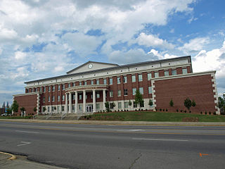
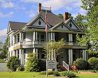
New Summerfield is a city in Cherokee County, Texas, United States. The population was 843 at the 2020 U.S. census.
Rusk is a city and the county seat of Cherokee County in the U.S. state of Texas. At the 2020 United States census, it had a population of 5,285.
Toco is a city in Lamar County, Texas, United States. The population was 75 at the 2010 census, and 91 in 2020.
Panorama Village is a city in Montgomery County, Texas, United States.
Arp is a city in Smith County, in the U.S. state of Texas. It is part of the Tyler metropolitan statistical area. According to the United States Census Bureau. The population was 892 in the 2020 census.
Sonora is a city in and the county seat of Sutton County, Texas, United States. The population was 3,027 at the 2010 census.
Horseshoe Bay is a city in Llano and Burnet counties in the U.S. state of Texas.
The Tyler metropolitan area, or Greater Tyler area centered on the city of Tyler, Texas, is one of the largest Texan metropolitan areas in East Texas. It had a combined population of 216,080 according to the 2010 U.S. census, and 233,479 in 2020. The Tyler metropolitan area encompasses all of Smith County.