Rosario, La Union

Last updated
Rosario
Municipality of Rosario
RosarioLaUnionjf915.JPG
Rosario town center
Flag of Rosario, La Union.png
Rosario La Union.png
Ph locator la union rosario.png
Map of La Union with Rosario highlighted
OpenStreetMap
Rosario, La Union
Philippines location map (square).svg
Red pog.svg
Rosario
Location within the Philippines
Coordinates: 16°14′N120°29′E / 16.23°N 120.48°E / 16.23; 120.48
Country Philippines
Region Ilocos Region
Province La Union
District 2nd district
Founded 1869
Barangays 33 (see Barangays)
Government
[1]
  Type Sangguniang Bayan
   Mayor Bellarmin A. Flores II
   Vice Mayor Bellarmin C. Flores III
   Representative Dante S. Garcia
   Municipal Council
Members
   Electorate 36,528 voters (2022)
Area
[2]
  Total73.98 km2 (28.56 sq mi)
Elevation
202 m (663 ft)
Highest elevation
945 m (3,100 ft)
Lowest elevation
28 m (92 ft)
Population
 (2020 census) [3]
  Total60,278
  Density810/km2 (2,100/sq mi)
   Households
14,433
Economy
   Income class 1st municipal income class
   Poverty incidence
3.55
% (2018) [4]
   Revenue 261.7 million (2020)
   Assets 522.2 million (2020)
   Expenditure 175.3 million (2020)
   Liabilities 141.4 million (2020)
Service provider
  ElectricityLa Union Electric Cooperative (LUELCO)
Time zone UTC+8 (PST)
ZIP code
2506
PSGC
IDD : area code +63(0)72
Native languages Ilocano
Pangasinan
Tagalog

Rosario, officially the Municipality of Rosario (Ilocano : Ili ti Rosario; Pangasinan : Baley na Rosario; Filipino : Bayan ng Rosario), is a 1st class municipality in the province of La Union, Philippines. According to the 2020 census, it has a population of 60,278 people. [3]

Contents

The Kennon Road starts from this town and ends in Baguio. It is accessible via the MacArthur Highway, or via the NLEX (North Luzon Expressway) and TPLEX (Tarlac–Pangasinan–La Union Expressway), which will have its terminus in this town.

Etymology

Aerial view of Rosario, 1932 Landing Fields - Philippines - Luzon Island - NARA - 68161146.jpg
Aerial view of Rosario, 1932

There are several legends that explain how Rosario first got its name. The best known says that the name "Rosario" came from the phrase “rosas del rio,” a reference to the beautiful landscape of the area when it was first discovered by Spaniards, with narrow valleys, wild animals, birds, rivers, brooks, dense forest, and the riverscape.

Another version or story suggests that name was a reference to the long range of foothills visible to the west of the Poblacion, which appear like big Rosary beads, forming a long, rocky, giant rosary.

Yet another legend first documented in 1887 [5] associates the name of the town with a legendary creature called a Marukos (spelled "manrukos" in the 1887 text). In the legend, a group of youths were playing around and being noisy while loitering around near the floodplains of the Bued River between Rosario and Sison on a Sunday. They were then confronted by an old man in white garb, whose flesh looked like a corpse - the Marukos. The creature accused them of engaging in leisure activities on a holy day and put a curse on them, causing them to lose their sense of direction. As a result, they failed to notice that they were about to be swept away by one of the flash floods that often plagued the river. In the end, only a young girl survived the encounter with the Marukos, by clinging to a "Balingkawanay" (Pittosporum pentandrum) tree. [5] According to the account, some stories claim that the girl had survived by praying the Rosary, while other stories say that her name was Rosario. Either way, the story of the Marukos became closely associated with the etymology of the town of Rosario, which used to be part of Pangasinan. [6]

History

Rosario was formerly a part of Santo Tomas and became a municipality in 1869 by a decree. Natives of Rosario emanated from Santo Tomas and Magsingal (Ilocos Sur), and also from Agoo, Tubao, Aringay, San Fernando and Bacnotan.

It was Don Mariano Posadas, Don Mariano Narcelles and Don Gavino Ordoña, who filed a petition with the authorities for the conversion of Rosario to a town from sitio or barangay. In 1869, the Spanish Provincial Governor created Rosario town and appointed Don Agustin Isidro de Guzman as its first Capitan Municipal.

Geography

Rosario is the southernmost town of La Union, so it is referred to as the “Gateway to Ilocandia”. Rosario's national highway passes along a mountain at barangay Agat (of Sison, Pangasinan), then into the Bued bridge (the boundary marker between La Union and Pangasinan).

Rosario is 215 kilometres (134 mi) away from Metro Manila and 54 kilometres (34 mi) from San Fernando, the provincial capital. The flight distance between Manila and Rosario is 189 kilometres (117 mi). [7]

Climate

Climate data for Rosario, La Union
MonthJanFebMarAprMayJunJulAugSepOctNovDecYear
Average high °C (°F)30
(86)
31
(88)
32
(90)
33
(91)
32
(90)
30
(86)
29
(84)
29
(84)
29
(84)
30
(86)
30
(86)
30
(86)
30
(87)
Average low °C (°F)19
(66)
20
(68)
21
(70)
23
(73)
24
(75)
24
(75)
24
(75)
24
(75)
24
(75)
23
(73)
21
(70)
20
(68)
22
(72)
Average precipitation mm (inches)15
(0.6)
16
(0.6)
24
(0.9)
33
(1.3)
102
(4.0)
121
(4.8)
177
(7.0)
165
(6.5)
144
(5.7)
170
(6.7)
56
(2.2)
23
(0.9)
1,046
(41.2)
Average rainy days6.36.69.512.820.623.525.423.423.221.414.08.2194.9
Source: Meteoblue [8]

Barangays

Rosario is politically subdivided into 33 barangays. [9] Each barangay consists of puroks and some have sitios.

  • Alipang
  • Ambangonan
  • Amlang
  • Bacani
  • Bangar
  • Bani
  • Benteng-Sapilang
  • Cadumanian
  • Camp One
  • Carunuan East
  • Carunuan West
  • Casilagan
  • Cataguingtingan
  • Concepcion
  • Damortis
  • Gumot-Nagcolaran
  • Inabaan Norte
  • Inabaan Sur
  • Nagtagaan
  • Nangcamotian
  • Parasapas
  • Poblacion East
  • Poblacion West
  • Puzon
  • Rabon
  • San Jose
  • Marcos
  • Subusub
  • Tabtabungao
  • Tanglag
  • Tay-ac
  • Udiao
  • Vila

Demographics

Population census of Rosario
YearPop.±% p.a.
1903 3,028    
1918 6,806+5.55%
1939 11,280+2.44%
1948 12,869+1.48%
1960 18,045+2.86%
1970 22,118+2.05%
1975 25,354+2.78%
1980 29,331+2.96%
1990 35,010+1.79%
1995 38,376+1.73%
2000 43,497+2.72%
2007 49,025+1.66%
2010 52,679+2.65%
2015 55,458+0.98%
2020 60,278+1.65%
Source: Philippine Statistics Authority [10] [11] [12] [13]

In the 2020 census, the population of Rosario, La Union, was 60,278 people, [3] with a density of 810 inhabitants per square kilometre or 2,100 inhabitants per square mile.

Economy

Government

Local government

Just as the national government, the municipal government of Rosario, is divided into three branches: executive, legislative, and judiciary. The judicial branch is administered solely by the Supreme Court of the Philippines. The LGUs have control of the executive and legislative branches.

The executive branch is composed of the mayor and the barangay captain for the barangays.

The legislative branch is composed of the Sangguniang Bayan (town assembly), Sangguniang Barangay (barangay council), and the Sangguniang Kabataan for the youth sector.

The seat of Government is vested upon the Mayor and other elected officers who hold office at the RosarioTown hall. The Sangguniang Bayan is the center of legislation, stationed in Rosario Legislative Building or Town hall. [21]

Elected officials

Members of the Municipal Council
(2019–2022) [22]
PositionName
CongressmanSandra Y. Eriguel
MayorBellarmin A. Flores II
Vice-MayorBellarmin C. Flores III
CouncilorsJoseph S. Heruela
Jan Michael G. Viray
Allan S. Sabangan
Cesario T. Licos
Apolinario T. Albay Jr.
Felix T. Madriaga
Rose Lily S. Fuentes
Raul C. Flores

Tourism

Rosario has the following landmark attractions:

1869 Immaculate Concepcion Parish Church

The Immaculate Concepcion Parish Church was canonically erected in 1869. It is under the jurisdiction of the Roman Catholic Diocese of San Fernando de La Union (Dioecesis Ferdinandopolitana ab Unione, Suffragan of Lingayen – Dagupan, which was created on January 19, 1970, and erected on April 11, 1970, comprising the Civil Province of La Union, under the Titular, St. William the Hermit, February 10). The Church is under a diocese of the Latin Church of the Roman Catholic Church in the Philippines from the Archdiocese of Nueva Segovia.

The Rosario Church is under the Vicariate of St. Francis Xavier with Vicar Forane, Fr. Joel Angelo Licos. [24] [25] Its Parish Priestis Fr. Raul S. Panay.

The church is located on the eastern side fronting the National Highway and the Municipal Building. It has an access road to the Rosario-Pugo-Baguio Road.

Related Research Articles

<span class="mw-page-title-main">La Union</span> Province in Ilocos Region, Philippines

La Union, officially the Province of La Union, is a province in the Philippines located in the Ilocos Region in the Island of Luzon. Its capital is the City of San Fernando, which also serves as the regional center of the Ilocos Region.

<span class="mw-page-title-main">Aringay</span> Municipality in La Union, Philippines

Aringay , officially the Municipality of Aringay, is a second class municipality in the province of La Union, Philippines. According to the 2020 census, it has a population of 50,380 people.

<span class="mw-page-title-main">San Fernando, La Union</span> Capital of La Union, Philippines

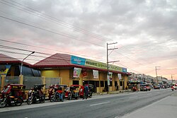
San Fernando City, officially the City of San Fernando, is a 3rd class component city and capital of the province of La Union, Philippines. According to the 2020 census, it has a population of 125,640 people.

<span class="mw-page-title-main">Binmaley</span> Municipality in Pangasinan, Philippines

Binmaley, officially the Municipality of Binmaley, is a 1st class municipality in the province of Pangasinan, Philippines. According to the 2020 census, it has a population of 86,881 people.

<span class="mw-page-title-main">Caba, La Union</span> Municipality in La Union, Philippines

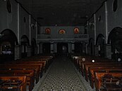
Caba, officially the Municipality of Caba, is a 4th class municipality in the province of La Union, Philippines. According to the 2020 census, it has a population of 23,119 people.

<span class="mw-page-title-main">Sison, Pangasinan</span> Municipality in Pangasinan, Philippines

Sison, officially the Municipality of Sison, is a 3rd class municipality in the province of Pangasinan, Philippines. The town's original name was Alava. According to the 2020 census, it has a population of 52,320 people.

<span class="mw-page-title-main">Villasis</span> Municipality in Pangasinan, Philippines

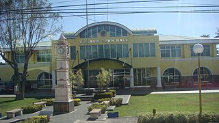
Villasis, officially the Municipality of Villasis, is a 1st class municipality in the province of Pangasinan, Philippines. According to the 2020 census, it has a population of 65,047 people.

<span class="mw-page-title-main">Agoo</span> Municipality in La Union, Philippines

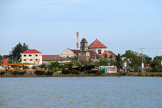
Agoo, officially the Municipality of Agoo, is a 1st class municipality in the province of La Union, Philippines. According to the 2020 census, it has a population of 66,028 people.

<span class="mw-page-title-main">Bacnotan</span> Municipality in La Union, Philippines

Bacnotan, officially the Municipality of Bacnotan, is a 1st class municipality in the province of La Union, Philippines. According to the 2020 census, it has a population of 44,388 people.

<span class="mw-page-title-main">Pugo, La Union</span> Municipality in La Union, Philippines

Pugo, officially the Municipality of Pugo, is a 5th class municipality in the province of La Union, Philippines. According to the 2020 census, it has a population of 19,337 people.

<span class="mw-page-title-main">Santo Tomas, La Union</span> Municipality in La Union, Philippines

Santo Tomas, officially the Municipality of Santo Tomas, is a 4th class municipality in the province of La Union, Philippines. According to the 2020 census, it has a population of 40,846 people.

<span class="mw-page-title-main">Alaminos, Pangasinan</span> Component city in Pangasinan, Philippines

Alaminos, officially the City of Alaminos, is a 4th class component city in the province of Pangasinan, Philippines, and is known for being the home of the Hundred Islands National Park, which is composed of 124 islands and is located off the coast of Barangay Lucap. According to the 2020 census, it has a population of 99,397 people. The city is named after Juan Alaminos y de Vivar, a former governor-general of the Philippines.

<span class="mw-page-title-main">Bani, Pangasinan</span> Municipality in Pangasinan, Philippines

Bani, officially the Municipality of Bani, is a 2nd class municipality in the province of Pangasinan, Philippines. According to the 2020 census, it has a population of 52,603 people.

<span class="mw-page-title-main">Bugallon</span> Municipality in Pangasinan, Philippines

Bugallon, officially the Municipality of Bugallon, is a 2nd class municipality in the province of Pangasinan, Philippines. According to the 2020 census, it has a population of 74,962 people.

<span class="mw-page-title-main">Manaoag</span> Municipality in Pangasinan, Philippines

Manaoag, officially the Municipality of Manaoag, is a 1st class municipality in the province of Pangasinan, Philippines. According to the 2020 census, it has a population of 76,045 people.

<span class="mw-page-title-main">Rosales, Pangasinan</span> Municipality in Pangasinan, Philippines

Rosales, officially the Municipality of Rosales, is a 1st class municipality in the province of Pangasinan, Philippines. According to the 2020 census, it has a population of 66,711 people.

<span class="mw-page-title-main">San Fabian, Pangasinan</span> Municipality in Pangasinan, Philippines

San Fabian, officially the Municipality of San Fabian, is a 1st class municipality in the province of Pangasinan, Philippines. According to the 2020 census, it has a population of 87,428 people.

<span class="mw-page-title-main">San Jacinto, Pangasinan</span> Municipality in Pangasinan, Philippines

San Jacinto, officially the Municipality of San Jacinto, is a 3rd class municipality in the province of Pangasinan, Philippines. According to the 2020 census, it has a population of 44,351 people.

<span class="mw-page-title-main">Santo Tomas, Pangasinan</span> Municipality in Pangasinan, Philippines

Santo Tomas, officially the Municipality of Santo Tomas, is a 5th class municipality in the province of Pangasinan, Philippines. According to the 2020 census, it has a population of 14,878 people.

<span class="mw-page-title-main">Umingan</span> Municipality in Pangasinan, Philippines

Umingan, officially the Municipality of Umingan, is a 1st class municipality in the province of Pangasinan, Philippines. According to the 2020 census, it has a population of 77,074 people.

References

  1. Municipality of Rosario | (DILG)
  2. "2015 Census of Population, Report No. 3 – Population, Land Area, and Population Density" (PDF). Philippine Statistics Authority. Quezon City, Philippines. August 2016. ISSN   0117-1453. Archived (PDF) from the original on May 25, 2021. Retrieved July 16, 2021.
  3. 1 2 3 Census of Population (2020). "Region I (Ilocos Region)". Total Population by Province, City, Municipality and Barangay. Philippine Statistics Authority . Retrieved 8 July 2021.
  4. "PSA Releases the 2018 Municipal and City Level Poverty Estimates". Philippine Statistics Authority. 15 December 2021. Retrieved 22 January 2022.
  5. 1 2 de los Reyes, Isabelo. (1887) Ilocandias.
  6. Demetrio, Francisco R., Ed. (1991) Encyclopedia of Philippine Folk Beliefs and Customs Volume II. Cagayan de Oro: Xavier University Press
  7. 189 Km – Flight distance between Manila and Rosario – La Union Philippines
  8. "Rosario: Average Temperatures and Rainfall". Meteoblue. Retrieved 26 April 2020.
  9. "Province: La Union". PSGC Interactive. Quezon City, Philippines: Philippine Statistics Authority . Retrieved 12 November 2016.
  10. Census of Population (2015). "Region I (Ilocos Region)". Total Population by Province, City, Municipality and Barangay. Philippine Statistics Authority . Retrieved 20 June 2016.
  11. Census of Population and Housing (2010). "Region I (Ilocos Region)". Total Population by Province, City, Municipality and Barangay. National Statistics Office . Retrieved 29 June 2016.
  12. Censuses of Population (1903–2007). "Region I (Ilocos Region)". Table 1. Population Enumerated in Various Censuses by Province/Highly Urbanized City: 1903 to 2007. National Statistics Office.
  13. "Province of La Union". Municipality Population Data. Local Water Utilities Administration Research Division. Retrieved 17 December 2016.
  14. "Poverty incidence (PI):". Philippine Statistics Authority. Retrieved December 28, 2020.
  15. "Estimation of Local Poverty in the Philippines" (PDF). Philippine Statistics Authority. 29 November 2005.
  16. "2003 City and Municipal Level Poverty Estimates" (PDF). Philippine Statistics Authority. 23 March 2009.
  17. "City and Municipal Level Poverty Estimates; 2006 and 2009" (PDF). Philippine Statistics Authority. 3 August 2012.
  18. "2012 Municipal and City Level Poverty Estimates" (PDF). Philippine Statistics Authority. 31 May 2016.
  19. "Municipal and City Level Small Area Poverty Estimates; 2009, 2012 and 2015". Philippine Statistics Authority. 10 July 2019.
  20. "PSA Releases the 2018 Municipal and City Level Poverty Estimates". Philippine Statistics Authority. 15 December 2021. Retrieved 22 January 2022.
  21. Local Government Units: Municipality of Rosario-Government - Province of La Union :: Official Website
  22. "2019 National and Local Elections" (PDF). Commission on Elections. Retrieved March 6, 2022.
  23. Local Government Units: Municipality of Rosario - Province of La Union :: Official Website
  24. "Diocese of San Fernando de La Union". Claretian Publications. Retrieved 28 September 2014.
  25. "Diocese of San Fernando de La Union". Catholic Hierarchy. Retrieved 28 September 2014.